Event discussion and analysis for Victoria and Tasmania, including day to day weather.
Forum rules
When posting photos, particularly in active breaking weather threads, please link to clickable photos to minimise download issues. For more information, see Posting Photo Guidelines for more information. Threads that are six weeks old or older will be Archived Here
hillybilly wrote: ↑Mon May 29, 2023 9:47 pm
Btw people tracking sea ice? 2 million kms below average atm. Crazy. Nothing like that seen in the records, ever. Doesn’t bode well for winter, though perhaps we will get luck in Oz.
Funny how we’ve bucked the trend so far this year while so many places are record warm. Even a few more record low mins yesterday in Queensland, though most at short run sites except Maryborough.
Most of the significant lack of sea ice around the Antarctic at present is the South Atlantic region and also due-South of New Zealand. East Antarctic sea-ice is close to normal which is what mainly affects our winters.
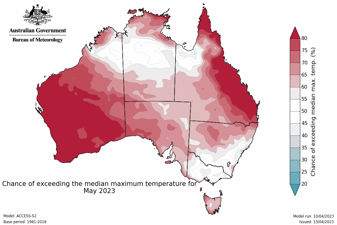
May 2023 is tracking a a fair colder than normal here, although the coming week looks very mild. Not too fussed given the rain and mild conditions are very useful for germinating winter crops.
A very mild night. A minimum of just 12.2c here, which is a fairly average summer night for us.
We're finishing the month on 85mm, so not a bad outcome considering the drying trend. Next month and the months ahead may be a bit of a different story, especially with the double whammy of El Nino and a positive IOD.
Really mild one here today with 19C. That’s getting up there for one day before winter. Rain finally got here about 3pm with a quick 8mm. Been a really dry month so very welcome. Hoping to get a few more mms before it clears tomorrow.
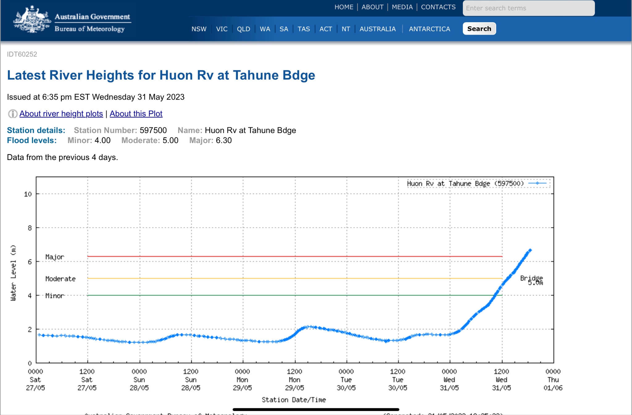
Big big falls over the southwest third of Tasmania. Classic laid back front with a really long fetch of moisture. Rained basically non stop and heavily in the upper Huon valley for about 36 hours. Based on the big rises in rivers must have been some really big falls. The Huon at Tahune which is a big wide river is a remarkable 2m above the bridge at that spot. The catchments have been burnt a few years back so probably run off a bit quickly than historically, but still remarkable.
hillybilly wrote: ↑Wed May 31, 2023 7:07 pm
Big big falls over the southwest third of Tasmania. Classic laid back front with a really long fetch of moisture. Rained basically non stop and heavily in the upper Huon valley for about 36 hours. Based on the big rises in rivers must have been some really big falls. The Huon at Tahune which is a big wide river is a remarkable 2m above the bridge at that spot.
Amazing. It's normally a big, beautiful river the Huon, but that is a serious flood. Rainfall obviously clocking up in the south-west.
Easy to forget for us 'north islanders' but just had a look at the warnings, and Tas really copping the brunt of the weather atm, with a low snow (to 700m) and other flood warnings/ watches.
Fitting start to winter cold wet and windy. Snow on the mountain falling down to about 400m. Temperature here near sea level of 5C.
Clearing slowly now. Potential big mild to warm and wet system next week. Looks like the snow season my start with mud and rain This is all linked to the trough over WA atm.
Just some light drizzle early this morning with the weak cool change.
May 2023 ended up 1 degC below average for both Min and Max means. A mild start to June (not ususual), and keeping an eye out for the Long Weekend which has the potential to deliver good rains across much of the State.
The Western Pacific ocean and Central Indian oceans are still quite warm which seems to be tempering the influence of the incoming El-Nino/Positive IOD.
May for me was really cold. Mean max was only 7.5° and I had 23 days with a max less than 10°. More like June than May.
75mm of rain with one day of snow falling and two frosts.
Home- "Shepherd's Bush" at Mt Macedon. 870m
Work- "Bolobek" at Macedon. 430m
Late top up for vic today, and for some parts of Tasmania. Weird system with a front caught in a col between two highs. These tend to be slow moving so while the showers are that impressive they take a while to move.
New thread time. Big warm low. Should give a great start to winter in the southeast. Widespread 20-60mm, with big falls on northern slopes of VIC and TAS.


 This is all linked to the trough over WA atm.