Yeah, noticed that too. EC still keen this morning but GFS isn't. Something to watch though.hillybilly wrote: ↑Wed Dec 05, 2018 6:46 pmPossible significant system later next week which EC is really keen on.I'm trying to work out how Ballarat temps of 14-32 Thursday, 20-34 on Friday, and 18-28 on Saturday, constitute a 'low intensity heatwave

Welcome New Members! We want to hear from you. Register, stop lurking and start posting!
VIC: Early Summer Blast of Heat, and storms - Dec 6-10
- StratoBendigo
- Supercell
- Reactions:
- Posts: 2810
- Joined: Fri Jan 02, 2015 2:18 pm
- Location: Kangaroo Flat
Re: VIC: Early Summer Blast of Heat, and storms - Dec 6-10
- wolfcat
- Cumulonumbus Calvas
- Reactions:
- Posts: 562
- Joined: Sun Mar 07, 2010 12:14 pm
- Location: Bentleigh East
- Contact:
Re: VIC: Early Summer Blast of Heat, and storms - Dec 6-10
"Well that escalated quickly..."
other places you will find me...
My blog...http://www.wolfcat.com.au/randomrants/
Flickr .. http://www.flickr.com/photos/wolfcat_aus/
Twitter... http://twitter.com/wolfcat
Redbubble... http://www.redbubble.com/people/wolfcat
My blog...http://www.wolfcat.com.au/randomrants/
Flickr .. http://www.flickr.com/photos/wolfcat_aus/
Twitter... http://twitter.com/wolfcat
Redbubble... http://www.redbubble.com/people/wolfcat
- wolfcat
- Cumulonumbus Calvas
- Reactions:
- Posts: 562
- Joined: Sun Mar 07, 2010 12:14 pm
- Location: Bentleigh East
- Contact:
Re: VIC: Early Summer Blast of Heat, and storms - Dec 6-10
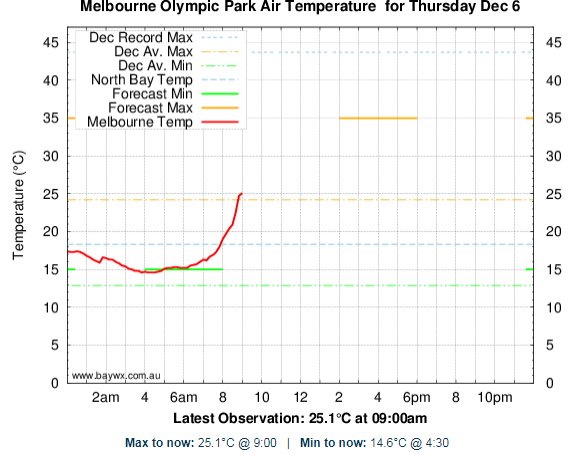
And 30.0c at 11:09am in the city already.
Opticast is now saying 39 for tomorrow as well.
Opticast is now saying 39 for tomorrow as well.
other places you will find me...
My blog...http://www.wolfcat.com.au/randomrants/
Flickr .. http://www.flickr.com/photos/wolfcat_aus/
Twitter... http://twitter.com/wolfcat
Redbubble... http://www.redbubble.com/people/wolfcat
My blog...http://www.wolfcat.com.au/randomrants/
Flickr .. http://www.flickr.com/photos/wolfcat_aus/
Twitter... http://twitter.com/wolfcat
Redbubble... http://www.redbubble.com/people/wolfcat
- QldTwister
- Cumulonimbus
- Reactions:
- Posts: 434
- Joined: Tue May 22, 2012 7:56 pm
- Location: Ashwood Vic
Re: VIC: Early Summer Blast of Heat, and storms - Dec 6-10
Great day out there and Hot one tomorrow
Sat through Tues Wed could be hot and stormy on and north of the ranges early next week lucky them
Mild SSE winds here for us i think with trough just to our N and E
More typical December pattern though with Heat and moisture building over the continent
Sat through Tues Wed could be hot and stormy on and north of the ranges early next week lucky them
Mild SSE winds here for us i think with trough just to our N and E
More typical December pattern though with Heat and moisture building over the continent
Bring on the heat and stroms
Re: VIC: Early Summer Blast of Heat, and storms - Dec 6-10
Some really dry air around Adelaide atm, 8-10% humidity and dew points down to -4c in some parts.
- stevco123
- Supercell
- Reactions:
- Posts: 2936
- Joined: Sat Aug 07, 2010 7:42 pm
- Location: Cranbourne 78m asl
Re: VIC: Early Summer Blast of Heat, and storms - Dec 6-10
Geez, didn't take long for the media to sensationalise normal summer heat, using word like "Unprecedented"in the article below.
Must be a VERY slow news day.
https://www.news.com.au/technology/envi ... 71732eeee2
Must be a VERY slow news day.
https://www.news.com.au/technology/envi ... 71732eeee2
https://www.weatherlink.com/bulletin/53 ... 76dd68e8bc: for current weather updated every 2 minutes
Re: VIC: Early Summer Blast of Heat, and storms - Dec 6-10
It is NewsCorp...stevco123 wrote: ↑Thu Dec 06, 2018 12:25 pm Geez, didn't take long for the media to sensationalise normal summer heat, using word like "Unprecedented"in the article below.
Must be a VERY slow news day.
https://www.news.com.au/technology/envi ... 71732eeee2
- Skywalker
- Supercell
- Reactions:
- Posts: 1872
- Joined: Sun Nov 29, 2009 10:03 am
- Location: Burnside Heights/Cowes (Home) & Sunshine West (Work)
Re: VIC: Early Summer Blast of Heat, and storms - Dec 6-10
Yep, obviously they have already forgotten what an unprecedented summer scorcher really is. Perhaps they need a trip down memory lane. Black Saturday anyone?stevco123 wrote: ↑Thu Dec 06, 2018 12:25 pm Geez, didn't take long for the media to sensationalise normal summer heat, using word like "Unprecedented"in the article below.
Must be a VERY slow news day.
https://www.news.com.au/technology/envi ... 71732eeee2
Caroline Springs, Melbourne's meteorological boredom zone.
-
hillybilly

- Site Admin/Moderator
- Reactions:
- Posts: 4989
- Joined: Thu Nov 26, 2009 7:26 am
- Location: Howden Tasmania, 25m above sea level
- Contact:
Re: VIC: Early Summer Blast of Heat, and storms - Dec 6-10
My gut feeling is this is about a once every couple of years event for Melbourne for December (nowadays). 40s used to be quite rare in December so if we get one, then it might pop up a bit higher.Skywalker wrote: ↑Thu Dec 06, 2018 2:26 pmYep, obviously they have already forgotten what an unprecedented summer scorcher really is. Perhaps they need a trip down memory lane. Black Saturday anyone?stevco123 wrote: ↑Thu Dec 06, 2018 12:25 pm Geez, didn't take long for the media to sensationalise normal summer heat, using word like "Unprecedented"in the article below.
Must be a VERY slow news day.
https://www.news.com.au/technology/envi ... 71732eeee2
I do wonder about the run of 35C at Mildura. A week is a long run in December. I can’t inagine that’s happened often before
Btw some extreme numbers showing up in northern Australia. 45.2C at Wyndham which is barely below their highest on record. Lots of near misses or records in other tropical sites. If that dives south there will be some serious heat
-
hillybilly
- Site Admin/Moderator
- Reactions:
- Posts: 4989
- Joined: Thu Nov 26, 2009 7:26 am
- Location: Howden Tasmania, 25m above sea level
- Contact:
Re: VIC: Early Summer Blast of Heat, and storms - Dec 6-10
Looks like a fire gone up near Ballarat on the radar 
Emergency warning out for area around Buninyong
Emergency warning out for area around Buninyong
Re: VIC: Early Summer Blast of Heat, and storms - Dec 6-10
I just had one of those Elvis air crane helicopters fly over heading up that way.hillybilly wrote: ↑Thu Dec 06, 2018 3:39 pm Looks like a fire gone up near Ballarat on the radar
Emergency warning out for area around Buninyong
-
hillybilly
- Site Admin/Moderator
- Reactions:
- Posts: 4989
- Joined: Thu Nov 26, 2009 7:26 am
- Location: Howden Tasmania, 25m above sea level
- Contact:
Re: VIC: Early Summer Blast of Heat, and storms - Dec 6-10
Progs rolling in are looking better for patchy rain trailing the change form late Saturday through Sunday. GFS3 and CMC both have quite widespread 10mm plus falls, and locally over 25mm. Meanwhile stinker tomorrow. Most spots on the flats are going to be close to 40C by the mid arvo. Not a nice day.
They are also picking up something big second half of next week. EC has been keen on this second system for a while, so seems to be firming
They are also picking up something big second half of next week. EC has been keen on this second system for a while, so seems to be firming
- stevco123
- Supercell
- Reactions:
- Posts: 2936
- Joined: Sat Aug 07, 2010 7:42 pm
- Location: Cranbourne 78m asl
Re: VIC: Early Summer Blast of Heat, and storms - Dec 6-10
hillybilly wrote: ↑Thu Dec 06, 2018 4:52 pm Progs rolling in are looking better for patchy rain trailing the change form late Saturday through Sunday. GFS3 and CMC both have quite widespread 10mm plus falls, and locally over 25mm. Meanwhile stinker tomorrow. Most spots on the flats are going to be close to 40C by the mid arvo. Not a nice day.
They are also picking up something big second half of next week. EC has been keen on this second system for a while, so seems to be firming
Late next week has me interested very much so
https://www.weatherlink.com/bulletin/53 ... 76dd68e8bc: for current weather updated every 2 minutes
- snowfall
- Supercell
- Reactions:
- Posts: 1287
- Joined: Mon Mar 20, 2017 7:39 pm
- Location: Gisborne South (349m asl)
Re: VIC: Early Summer Blast of Heat, and storms - Dec 6-10
32.6c as a maximum today. Hottest day in a long time. Still 31c, so it’s going to be a warm night.
-
Didjman

- Supercell
- Reactions:
- Posts: 2099
- Joined: Fri Sep 03, 2010 2:52 pm
- Location: Wallan, Vic 328m ASL
- Contact:
Re: VIC: Early Summer Blast of Heat, and storms - Dec 6-10
33.1 top here. Currently 30/12
Re: VIC: Early Summer Blast of Heat, and storms - Dec 6-10
Just on 37c for me today and currently on 30c.
-
hillybilly
- Site Admin/Moderator
- Reactions:
- Posts: 4989
- Joined: Thu Nov 26, 2009 7:26 am
- Location: Howden Tasmania, 25m above sea level
- Contact:
Re: VIC: Early Summer Blast of Heat, and storms - Dec 6-10
Min of 23C for us in FC. Going to be a stinker. Anticipate something around 34 or 35C for us which is about 40C equivalent at sea level.
Thankfully just one shocker in this sequence for us in the south, though the front is weak as and will take a day or two to clear through to the east/northeast. No relief for spots like Mildura and Albury till the second half of the weekend
Some showers developing around middle of the day Saturday. Still looks like we should get a few mms.
Progs going big for late next week. CMC and GFS have got widespread 25-75mm falls
-
Onetahuti

- Supercell
- Reactions:
- Posts: 2790
- Joined: Thu Mar 25, 2010 9:37 pm
- Location: Dandenong Nth.
Re: VIC: Early Summer Blast of Heat, and storms - Dec 6-10
Overnight min here was 27.4°C no complaints slept well.
- Gordon
- Supercell
- Reactions:
- Posts: 2890
- Joined: Thu Jun 17, 2010 10:01 am
- Location: Near Gordon, Vic. 620 m asl
Re: VIC: Early Summer Blast of Heat, and storms - Dec 6-10
Yes, both the weekend and next week looking quite a bit better on this morning's WATL runshillybilly wrote: ↑Fri Dec 07, 2018 4:36 am Some showers developing around middle of the day Saturday. Still looks like we should get a few mms.
Progs going big for late next week. CMC and GFS have got widespread 25-75mm falls
- Skywalker
- Supercell
- Reactions:
- Posts: 1872
- Joined: Sun Nov 29, 2009 10:03 am
- Location: Burnside Heights/Cowes (Home) & Sunshine West (Work)
Re: VIC: Early Summer Blast of Heat, and storms - Dec 6-10
Currently 35c here in the western desert on the way to a potential 40c. 
Caroline Springs, Melbourne's meteorological boredom zone.