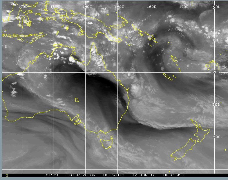
JAN 17th 2012. Pacific ocean.
Took a snap of this
upper low in the pacific ocean . It is centred around the solomon islands or thereabout
Just massive
Found the position interesting as it sits on top of the sub tropical jetstream and is residing in the monsoon trough region from what l can deduce from the 200mb windstream maps
Down under beneath the structured top layer( 200mb ) the low structure is weaker and less intense, and at surface level , not evident.
I couldn't find any sign of a surface low indicating the very large rising air mass is occurring from the mid levels at around 500mb
Also of note is the lack of the dynamic wind patterns that are often seen to spin lows up in the more southern latitudes.
I was wondering if this low is a massive heat low? ( induced by convection in the equatorial trough,rather than wind patterns?)
I am not sure of how the large upper low came to be?
What is amazing to contemplate is that 200mb is the upper air.
and this air mass is just exactly that , the top layer of the tropopause. Yet at 200mb,
this parcel is rising ..
THe static image really doesn't convey how good this looks
The animated loop looks sensational!! amazing satellite picture 

HERE
http://tropic.ssec.wisc.edu/real-time/a ... vjava.html" onclick="window.open(this.href);return false;


