
Welcome New Members! We want to hear from you. Register, stop lurking and start posting!
Victoria: Low Pressure System Cup Weekend 2010
Re: Victoria: Low Pressure System Cup Weekend 2010
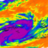
Showers moveing down from the North still! Convective as well very odd set up now that the surface low has moved South of us and were in W/WSW winds... Only thing I can put it down too is the mid levels are still unstable driven by the fact that cold air in the mid and upper levels is still well to our North West
- wolfcat
- Cumulonumbus Calvas
- Reactions:
- Posts: 562
- Joined: Sun Mar 07, 2010 12:14 pm
- Location: Bentleigh East
- Contact:
Re: Victoria: Low Pressure System Cup Weekend 2010
Just checked the gauge 63mm ( so another 20mm over night )
Time for a coffee then a trip into the hills me thinks
Time for a coffee then a trip into the hills me thinks
other places you will find me...
My blog...http://www.wolfcat.com.au/randomrants/
Flickr .. http://www.flickr.com/photos/wolfcat_aus/
Twitter... http://twitter.com/wolfcat
Redbubble... http://www.redbubble.com/people/wolfcat
My blog...http://www.wolfcat.com.au/randomrants/
Flickr .. http://www.flickr.com/photos/wolfcat_aus/
Twitter... http://twitter.com/wolfcat
Redbubble... http://www.redbubble.com/people/wolfcat
-
tizza

- Cumulonumbus Calvas
- Reactions:
- Posts: 728
- Joined: Wed Nov 25, 2009 6:48 pm
- Location: Dandenong North
- Contact:
Re: Victoria: Low Pressure System Cup Weekend 2010
I'm guestimating I've had around 58mm for this event, give or take.
Hey Ken you wouldn't have a rain gauge at home would you? I have nowhere to put one and we are so close, maybe 600-700m away, It would be pretty unusual to have much of a difference with a system like this one. Feel free to PM if you like.
Hey Ken you wouldn't have a rain gauge at home would you? I have nowhere to put one and we are so close, maybe 600-700m away, It would be pretty unusual to have much of a difference with a system like this one. Feel free to PM if you like.
- droughtbreaker
- Supercell
- Reactions:
- Posts: 2844
- Joined: Wed Nov 25, 2009 7:50 pm
- Location: Mount Macedon, VIC, 520m asl
Re: Victoria: Low Pressure System Cup Weekend 2010
One of the wettest year to dates of the last 35 years here as well, coming in around 4th. 1978, 1983 and 1995 were wetter and maybe a couple of other years that were close. Because we have always recorded to 4pm-6pm here it is hard to compare results as I don't know how many years in the past had overnight rain on the last day of the month like we did this year therefore spilling over to the next month (it's complicated I know  )
)
Whichever way you look at it though it would definitely be in the top 5 or 6 wettest year to dates since 1975. Should easily crack 1000mm for the year and could even be looking at 1100mm+ this year.
Haven't checked any of the local creeks yet. Maribyrnong catchment seems to be holding up extremely well at this point. Campaspe is flooding again at Redesdale so expect Eppalock to fill rapidly again. Jacksons creek has risen about a metre or so at Rosslynne I'm pretty sure, and still rising so Rosslynne Res level should rise rapidly as well
Last edited by droughtbreaker on Sun Oct 31, 2010 11:13 am, edited 1 time in total.
-
Blackee

- Site Admin/Moderator
- Reactions:
- Posts: 3859
- Joined: Tue Nov 24, 2009 8:57 pm
- Location: Elwood and Mansfield 370m
Re: Victoria: Low Pressure System Cup Weekend 2010
Did a quick tour from home to Mooroolbark, Lilydale, Wantirna, Box Hill and return.
Retarding basin near Billanook College filling nicely. Water over pedestrian bridge (Pics to come later!).
Dandenong Creek @ Wantirna Rd has burst banks and flowing very swiftly.
Sparks Reserve @ Box Hill has fared extremely well. A mass of water in the middle of the oval, but the overflow is below the bridge. Drain itself is 1ft from full submersion. I presume Gardiners Crk towards Toorak Road would be pretty high.
All in all, local areas have fared well. Not many trees down. Worst damage seen is probably potholes in Blackburn Road, nth of Eastern Freeway.
Mansfield 370m and Elwood
Re: Victoria: Low Pressure System Cup Weekend 2010
Yeah wind hasn't been to bad actually been good this moring since Dawn when I expected the worse of it
- Hamlan
- Storm Chaser
- Reactions:
- Posts: 449
- Joined: Tue Dec 22, 2009 11:05 pm
- Location: Northern suburbs
Re: Victoria: Low Pressure System Cup Weekend 2010
Damn! I missed itKen wrote:The 24hr GPATS imagery recorded a solitary cloud-to-ground lightning stroke in the Melbourne metro area this morning. Have circled the stroke in black to make it more visible:

-
Anthony Violi

- Supercell
- Reactions:
- Posts: 2652
- Joined: Mon Nov 23, 2009 9:03 pm
- Location: Lilydale
- Contact:
Re: Victoria: Low Pressure System Cup Weekend 2010
65.4mm and just starting to stop now, its starting to brighten up a bit bti still am shrouded with low cloud so cant get a visual yet on what the sky is doing.
Upper Yarra will go over this week or into the weekend, was there last week and its lapping at the spillway already. The most worring hing willbe thunderstorms any time in the near future, a serious downpour of 40mm in 30 minutes would cause extreme chaos.
Still not over with some showery days ahead before another significant system late next weekend.
Ken, i seen that solitary stroke at 4.10 roughly..
http://www.therealworldweatherforum.com" onclick="window.open(this.href);return false;
avweatherforecasts.com
avweatherforecasts.com
-
apocalypse

- Cumulonumbus Calvas
- Reactions:
- Posts: 761
- Joined: Tue Jan 19, 2010 6:17 pm
- Location: Wagga Wagga, NSW 189m asl
Re: Victoria: Low Pressure System Cup Weekend 2010
Received 27.3mm since yesterday morning, which brings my MTD to 178.8mm, just 3mm shy of the monthly record at the airport.
It has been a tremendous year here in terms of rainfall. Our YTD at the airport is currently 813.6mm, which is 143% of the average, and our wettest since 1974. Only need another 175mm between now and the end of the year to have our wettest year on record, and with all these major systems lately, it seems like a real possibility.
It has been a tremendous year here in terms of rainfall. Our YTD at the airport is currently 813.6mm, which is 143% of the average, and our wettest since 1974. Only need another 175mm between now and the end of the year to have our wettest year on record, and with all these major systems lately, it seems like a real possibility.
Nathan Morris
2013 Rainfall
Jan - 3.8mm
Feb - 27.0mm
Mar - 0.0mm
YTD - 30.8mm
2013 Rainfall
Jan - 3.8mm
Feb - 27.0mm
Mar - 0.0mm
YTD - 30.8mm
-
Tempest
- Cumulonimbus
- Reactions:
- Posts: 148
- Joined: Sat Aug 14, 2010 8:34 pm
- Location: Warragul North, Vic... 140m asl
Re: Victoria: Low Pressure System Cup Weekend 2010
Gardiners creek runs behind my place here in Ashwood. Checked half an hour ago and it was flowing fast but only up to the top of the concrete, which is about half way up the banks. Going by the flattened grass above that though, at some point over night it came pretty close (30-40cm) to the top edge. Only remember the creek flooding into our backyard once in the 40 odd years since my parents moved here.Sniper wrote:Did a quick tour from home to Mooroolbark, Lilydale, Wantirna, Box Hill and return.
I presume Gardiners Crk towards Toorak Road would be pretty high.
-
Blackee
- Site Admin/Moderator
- Reactions:
- Posts: 3859
- Joined: Tue Nov 24, 2009 8:57 pm
- Location: Elwood and Mansfield 370m
Re: Victoria: Low Pressure System Cup Weekend 2010
This has been Melbourne' wettest October since 1975.
Mansfield 370m and Elwood
-
Karl Lijnders

- Tornadic Supercell
- Reactions:
- Posts: 5771
- Joined: Sun Nov 22, 2009 11:17 pm
- Location: Knoxfield, Victoria
Re: Victoria: Low Pressure System Cup Weekend 2010
Certainly is Nathan. There is another correlation with 1974/1975....cyclical??
Anyway drizzly rain still falling here with 3mm since 9am taking me nearly to 86mm.
I suspect 10-20mm over the coming few days before clearing later in the week which will keep river and stream flows up.
Anyway drizzly rain still falling here with 3mm since 9am taking me nearly to 86mm.
I suspect 10-20mm over the coming few days before clearing later in the week which will keep river and stream flows up.
Former Owner - The Australian Weather Forum. Email me anytime - weatherman1000@hotmail.com
-
Blackee
- Site Admin/Moderator
- Reactions:
- Posts: 3859
- Joined: Tue Nov 24, 2009 8:57 pm
- Location: Elwood and Mansfield 370m
Re: Victoria: Low Pressure System Cup Weekend 2010
Thanks for the update Tempest.
I remember over 10 years ago when the old SE Fwy was partially under water when we had flash flooding.
Obviously flood mitigation and lower hourly rainfall rates have helped keep the creek within its banks.
I remember over 10 years ago when the old SE Fwy was partially under water when we had flash flooding.
Obviously flood mitigation and lower hourly rainfall rates have helped keep the creek within its banks.
Mansfield 370m and Elwood
-
Karl Lijnders
- Tornadic Supercell
- Reactions:
- Posts: 5771
- Joined: Sun Nov 22, 2009 11:17 pm
- Location: Knoxfield, Victoria
Re: Victoria: Low Pressure System Cup Weekend 2010
AWF Update at 11:30am.
Rainfall has eased rapidly across the state a surface low moves offshore the Central coast and takes most of the rain with it. In it's wake scattered showers and widespread drizzle remains over large parts of southern and mountain VIC with the odd heavier patch of rain amongst it.
An upper low over the W border is conitnuing to produce showers and isolated hail and thunder which will increase this afternoon over the NW.
Otherwise conditions returning to partly cloudy over the remainder of the inland and winds becoming light to moderate SW by the end of the day.
Widespread low scale river flooding is occurring over many areas of the state so refer to http://www.bom.gov.au/vic.
Melbourne Forecast for the remainder of Sunday.
Sunday: Showers and drizzle. Clouds decreasing over the coming hours. The slight chance of a thunderstorm over the far north this afternoon. Cooler with SW winds developing. 18C
Monday: A shower or two, mainly later. Sunny breaks. Light to moderate NW winds. 19C
This is the final update in this event.
-----------------------------------------------------------------------------------------------------------
Former Owner - The Australian Weather Forum. Email me anytime - weatherman1000@hotmail.com
- HarleyB
- Cumulonumbus Calvas
- Reactions:
- Posts: 839
- Joined: Sun Oct 10, 2010 9:39 pm
- Location: Wangaratta
Re: Victoria: Low Pressure System Cup Weekend 2010
That rain on the radar just south of here is heavier than what the radar is saying. Had 2mm in less than 5 minutes.
- Rhino
- Supercell
- Reactions:
- Posts: 1227
- Joined: Mon Nov 30, 2009 11:37 am
- Location: Carisbrook-Near Maryborough
Re: Victoria: Low Pressure System Cup Weekend 2010
39mm here for the event so 121mm for the month of Oct and this incredibly wet year just keeps rolling on, been averaging 116mm a month since august...Bring on a very wet November I say. 
Rhino.
Rhino.
Last edited by Rhino on Sun Oct 31, 2010 11:51 am, edited 1 time in total.
-
Onetahuti

- Supercell
- Reactions:
- Posts: 2792
- Joined: Thu Mar 25, 2010 9:37 pm
- Location: Dandenong Nth.
Re: Victoria: Low Pressure System Cup Weekend 2010
Thanks for the updates, the giving of a lot of your time and knowledge is greatly appreciatedKarl Lijnders wrote:AWF Update at 11:30am.
This is the final update in this event.
-----------------------------------------------------------------------------------------------------------
-
Karl Lijnders
- Tornadic Supercell
- Reactions:
- Posts: 5771
- Joined: Sun Nov 22, 2009 11:17 pm
- Location: Knoxfield, Victoria
Re: Victoria: Low Pressure System Cup Weekend 2010
My pleasure
Sun has come out briefly but ahead of another burst of showers. Hopefully it can drop 5mm in a quick burst!! Nearly 8mm at Mount Dandenong ontop of 75mm there to 9am and 7mm to 9am previously. So they should crack through 100mm from the event which is fantastic and will ensure wet wet wet conditions up there till December.
Quite a cold week coming up!! Might have to start looking towards the record for the longest stretch without a 30C soon for Melbourne.
Former Owner - The Australian Weather Forum. Email me anytime - weatherman1000@hotmail.com
-
Anthony Violi
- Supercell
- Reactions:
- Posts: 2652
- Joined: Mon Nov 23, 2009 9:03 pm
- Location: Lilydale
- Contact:
Re: Victoria: Low Pressure System Cup Weekend 2010
I think further showers will start to fire from the SW once the cold air decides to move closer, just meandering its way across Vic atm..
http://www.therealworldweatherforum.com" onclick="window.open(this.href);return false;
avweatherforecasts.com
avweatherforecasts.com
Re: Victoria: Low Pressure System Cup Weekend 2010
I think going from what were seeing we should score a 30c+ next Sunday or Monday karl.
We need at least another 8 weeks of less than 30c days to come anywhere close to the record, 2001 we didn't get a 30c til after Christmas.
This has been one of the best systems I have seen in a long time, great to see alot of the state getting a pounding! Pity Central & East Gippsland have missed out though there was some good rain there couple of weeks ago but I'm sure good rains there are only just around the corner again.