I don't think NSW can warn for Victoria and vice versa.norwester wrote:Its building here - interesting that NSW has a severe thunderstorm warning out for as far south as Wentworth. We are just over the river and no warnings yet!

Welcome New Members! We want to hear from you. Register, stop lurking and start posting!
Victoria: A humid thundery week - 13th-20th Feb 2011
Re: Another humid showery week: 13-20 Feb
-
Karl Lijnders

- Tornadic Supercell
- Reactions:
- Posts: 5771
- Joined: Sun Nov 22, 2009 11:17 pm
- Location: Knoxfield, Victoria
Re: Another humid showery week: 13-20 Feb
No it's different state based forecasters that do the warnings. They do communicate with one another.
I think there is a good chance of further severe storms in the NW this afternoon and scattered showers and storms over the remainder of the inland. Plenty of cj and cu over the northern, western and eastern skyline.
I think there will be plenty of convection to the north and west of the city today.
I think there is a good chance of further severe storms in the NW this afternoon and scattered showers and storms over the remainder of the inland. Plenty of cj and cu over the northern, western and eastern skyline.
I think there will be plenty of convection to the north and west of the city today.
Former Owner - The Australian Weather Forum. Email me anytime - weatherman1000@hotmail.com
- aussiestormfreak
- Cumulonumbus Calvas
- Reactions:
- Posts: 534
- Joined: Thu Feb 03, 2011 9:52 am
- Location: Melbourne, Corryong, Merimbula, and Fiji
- Contact:
Re: Another humid showery week: 13-20 Feb
Nothing interesting atm outside, just a bit of cirrus and fluffy fair-weather cumulus, otherwise gloriously warm and sunny! 
Up northwest, a totally different story... over the past hour or two, the Ouyen cell appears to have been 'swallowed' up by the Wentworth/Broken Hill/White Cliffs storm front!!
Just joking! In actual fact, the Ouyen cell is moving to the west, while the cell on the southwest end of the storm front I mentioned appears to be moving off the main line and heading southwest, merging with the Ouyen cell as it does so. The rest of the line appears to be moving east/northeast. The weather can do some very strange things, but that makes it all the more interesting!
Up northwest, a totally different story... over the past hour or two, the Ouyen cell appears to have been 'swallowed' up by the Wentworth/Broken Hill/White Cliffs storm front!!
Just joking!
-
Supercellimpact

- Supercell
- Reactions:
- Posts: 1238
- Joined: Thu Oct 07, 2010 8:39 pm
- Location: Bendigo
Re: Another humid showery week: 13-20 Feb
Alot of lighting up there atm, storms are moving SW, its a pity there not moving SE torwards here. No convection here just cirus cloud everywhere.
- Harley34
- Cumulonumbus Calvas
- Reactions:
- Posts: 580
- Joined: Sat Mar 06, 2010 1:08 pm
- Location: Ringwood East, Melbourne
Re: Another humid showery week: 13-20 Feb
Friday night/ Saturday looks be like a real wet and windy day.
Latest BOM 4 day chart shows a Low over Adelaide on Friday moving SE towards Melbourne. It also shows the Low winding up, could get very gusty.
http://www.bom.gov.au/fwo/IDG00074.gif? ... 5-03:42:14" onclick="window.open(this.href);return false;
Latest BOM 4 day chart shows a Low over Adelaide on Friday moving SE towards Melbourne. It also shows the Low winding up, could get very gusty.
http://www.bom.gov.au/fwo/IDG00074.gif? ... 5-03:42:14" onclick="window.open(this.href);return false;

Re: Another humid showery week: 13-20 Feb
Just home from work and a quick check of the radar and satellite doesn't fill me with too much hope of a storm around here this arvo or tonight. Thought as much, as the only convection I could see on the way home was out towards the SW and very distant.
- Gordon
- Supercell
- Reactions:
- Posts: 2908
- Joined: Thu Jun 17, 2010 10:01 am
- Location: Near Gordon, Vic. 620 m asl
Re: Another humid showery week: 13-20 Feb
Wow. If that holds, a 994 low so close to us and all this moisture is a recipe for a very serious event on Saturday.Harley34 wrote:Friday night/ Saturday looks be like a real wet and windy day.
Latest BOM 4 day chart shows a Low over Adelaide on Friday moving SE towards Melbourne. It also shows the Low winding up, could get very gusty.
- norfolk
- Supercell
- Reactions:
- Posts: 2024
- Joined: Thu Nov 26, 2009 7:03 pm
- Location: Caroline Springs, western Melbourne
- Contact:
Re: Another humid showery week: 13-20 Feb
This looks quite scary! Expect cold wet weather, just like that Feb 2007 event(was it 2007?)Harley34 wrote:Friday night/ Saturday looks be like a real wet and windy day.
Latest BOM 4 day chart shows a Low over Adelaide on Friday moving SE towards Melbourne. It also shows the Low winding up, could get very gusty.
http://www.bom.gov.au/fwo/IDG00074.gif? ... 5-03:42:14" onclick="window.open(this.href);return false;
No It was 2005! 138mm for the even and 167.4mm for the month. We will rival that this month!
- Jake Smethurst
- Supercell
- Reactions:
- Posts: 3583
- Joined: Mon Nov 23, 2009 8:49 pm
- Location: Cheltenham
Re: Another humid showery week: 13-20 Feb
Some very beefy thunderstorms across the northwest in the most moist atmosphere. Shame activity didnt really get going elsewhere as of yet.
Currently 30 degrees here with a DP of 18, max today is the current temp.
Currently 30 degrees here with a DP of 18, max today is the current temp.
Jake - Senior AWF Forecaster
Feel free to send me a private message if you have any questions.
Feel free to send me a private message if you have any questions.
-
AUS_Twisted

- Storm Chaser
- Reactions:
- Posts: 652
- Joined: Wed Nov 25, 2009 6:15 pm
- Location: Dandenong North, Melb
Re: Another humid showery week: 13-20 Feb
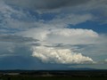
Theres a decent tower SW currently creating a anvil, nice build up behind it to.
-
Karl Lijnders
- Tornadic Supercell
- Reactions:
- Posts: 5771
- Joined: Sun Nov 22, 2009 11:17 pm
- Location: Knoxfield, Victoria
Re: Another humid showery week: 13-20 Feb
Cells from Cressy-Blackwood should be the main area for C areas this afternoon and evening. Activity to increase 5 fold tomorrow as the atmosphere responds to the trough moving into VIC. Currently sitting on the border.
Looking good for a couple of days of stormy weather and the weekend remains wet and windy.
Looking good for a couple of days of stormy weather and the weekend remains wet and windy.
Former Owner - The Australian Weather Forum. Email me anytime - weatherman1000@hotmail.com
- Jake Smethurst
- Supercell
- Reactions:
- Posts: 3583
- Joined: Mon Nov 23, 2009 8:49 pm
- Location: Cheltenham
Re: Another humid showery week: 13-20 Feb
Couple of cells have just got going locally. One to the northwest of Colac is to my NNE but seems to be moving WSW at this stage. Still rather convective, whether or not convection can become deep enough for further development is yet to be seen.
Jake - Senior AWF Forecaster
Feel free to send me a private message if you have any questions.
Feel free to send me a private message if you have any questions.
- HarleyB
- Cumulonumbus Calvas
- Reactions:
- Posts: 839
- Joined: Sun Oct 10, 2010 9:39 pm
- Location: Wangaratta
Re: Another humid showery week: 13-20 Feb
Just got interesting as soon as the cirrus layer moved a litle east in the last 30 minutes- hour. Substantial convection starting to the E, NE and N and now a small cell popped up S of Euroa. Could, with a little luck, be quite an interesting evening.
- norwester
- Cumulonimbus
- Reactions:
- Posts: 105
- Joined: Sat Feb 05, 2011 9:54 am
- Location: Merbein, Vic
Re: Another humid showery week: 13-20 Feb
Big nothing here in Mildura! Slipped past us so far with just a drop or two and the echo of distant thunder.Wind has shifted WSW/SW (from north) in the last hour or so and still 70-80% humidity.
Dry, dusty and hot - usually!
-
Petros

- Supercell
- Reactions:
- Posts: 2001
- Joined: Tue Dec 01, 2009 6:25 pm
- Location: Maffra, Gippsland, Vic
Re: Another humid showery week: 13-20 Feb
28C here today with a persitent easterly all day, mostly cloudy too.
- Gordon
- Supercell
- Reactions:
- Posts: 2908
- Joined: Thu Jun 17, 2010 10:01 am
- Location: Near Gordon, Vic. 620 m asl
Re: Another humid showery week: 13-20 Feb
Moderate little shower here moving directly east-west.
-
flatcam
- Cumulonimbus
- Reactions:
- Posts: 182
- Joined: Wed Jan 05, 2011 8:16 pm
- Location: Craigieburn, Victoria
Re: Another humid showery week: 13-20 Feb
There was a lot of activity outside before, but seems to have calmed down substantially in the last two hours.
Is is possible for Cragieburn (or surrounds) to be hit by a thunderstorm tonight? The activity seems to all be happening in the west judging by radar.
Cheers, Cam
Is is possible for Cragieburn (or surrounds) to be hit by a thunderstorm tonight? The activity seems to all be happening in the west judging by radar.
Cheers, Cam
Re: Another humid showery week: 13-20 Feb
2009 or 2008 David? I'm sure it was 2008 when we had a mild Feb coolish finished then 3 weeks of heat in March.
EC does look impressive but for heavy rain down here I also would like to see the low track bit further North than SW of us which would leave us in strong squally N winds and rain to a much lesser extent here, Northern slopes are proned to do well again in this set up. Still time for change as other models don't look anything like EC for Saturday including UK.
EC does look impressive but for heavy rain down here I also would like to see the low track bit further North than SW of us which would leave us in strong squally N winds and rain to a much lesser extent here, Northern slopes are proned to do well again in this set up. Still time for change as other models don't look anything like EC for Saturday including UK.
Re: Another humid showery week: 13-20 Feb
You just half answered your own question kiddo.flatcam wrote:Is is possible for Cragieburn (or surrounds) to be hit by a thunderstorm tonight? The activity seems to all be happening in the west judging by radar.
Check the satpic, check the obs, check the radar..
In other news, though sadly unrelated, I just happened to stumble across this website. http://www.wikihow.com/Use-You're-and-Your" onclick="window.open(this.href);return false;
-
flatcam
- Cumulonimbus
- Reactions:
- Posts: 182
- Joined: Wed Jan 05, 2011 8:16 pm
- Location: Craigieburn, Victoria
Re: Another humid showery week: 13-20 Feb
Thankyou. At the time of posting, some small cells were developing over in the eastern parts of the state, and I was merely hoping one could drift over or develop on top of us here.schitzengiggles wrote:You just half answered your own question kiddo.flatcam wrote:Is is possible for Cragieburn (or surrounds) to be hit by a thunderstorm tonight? The activity seems to all be happening in the west judging by radar.
Check the satpic, check the obs, check the radar..
In other news, though sadly unrelated, I just happened to stumble across this website. http://www.wikihow.com/Use-You're-and-Your" onclick="window.open(this.href);return false;
It looks like Friday could be the day for thunderstorms here.
Cheers, Cam