
Welcome New Members! We want to hear from you. Register, stop lurking and start posting!
Victoria: Troughy thundery humid rain event. Jan 9th -14th
- Jake Smethurst
- Supercell
- Reactions:
- Posts: 3583
- Joined: Mon Nov 23, 2009 8:49 pm
- Location: Cheltenham
Re: Victoria: Troughy thundery humid rain event. Jan 9th-15t
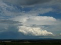
Some nice showers over the northeast at the moment, should be some high rainfall rates in them.
Jake - Senior AWF Forecaster
Feel free to send me a private message if you have any questions.
Feel free to send me a private message if you have any questions.
-
Blackee

- Site Admin/Moderator
- Reactions:
- Posts: 3859
- Joined: Tue Nov 24, 2009 8:57 pm
- Location: Elwood and Mansfield 370m
Re: Victoria: Troughy thundery humid rain event. Jan 9th-15t
Renewed Flood Watches are in place for:
Barwon, Hovells Creek and Otway Ranges
Greater Melbourne
Goulburn and Broken Basins
Campaspe, Loddon, Avoca and Wimmera Basins
A new Flood Watch is now in place for the Glenelg and Hopkins Basins
Flood warnings from this event are current for:
Avoca River
Loddon River
Wimmera River
Full details can be found in the specific warnings thread in this board, or via http://www.bom.gov.au" onclick="window.open(this.href);return false;
Mansfield 370m and Elwood
-
Blackee
- Site Admin/Moderator
- Reactions:
- Posts: 3859
- Joined: Tue Nov 24, 2009 8:57 pm
- Location: Elwood and Mansfield 370m
Re: Victoria: Troughy thundery humid rain event. Jan 9th-15t
Severe Weather Warning
for flash flooding
for people in the South West, North Central, Northern Country, Wimmera, Mallee, Central and North East forecast districts
Issued at 11:28 am EDT on Wednesday 12 January 2011.
Weather Situation
A broad slow moving trough is centred over western Victoria while a ridge of high pressure lies south of Tasmania. The two systems are producing a humid and unstable northeasterly flow across the state. The trough will strengthen on Wednesday and develop into a low pressure system over South Australia on Thursday. The low pressure system and accompanying low pressure trough will move across the State on Friday.
Shower and thunderstorm activity has the potential to produce flash flooding today, mainly over the northeast and central districts.
Heavy rain and isolated thunderstorms is forecast to redevelop over western districts during the early hours of Thursday morning. Flash flooding is a significant risk associated with this rainband.
In the 24 hours to 9am this morning the highest rainfall totals were in the west of the state with 161mm at Jeparit, 135mm at Mount William, 131mm at Rainbow, 104 mm at Dimboola, 101mm at Horsham. and quite a few other locations in the 75-100mm range.
The State Emergency Service advises that people should:
Don't drive, ride or walk through flood water.
Keep clear of creeks and storm drains.
The next warning will be issued by 5:00 pm EDT Wednesday.
Mansfield 370m and Elwood
-
stratospear

- Supercell
- Reactions:
- Posts: 1261
- Joined: Sat Dec 19, 2009 9:38 am
- Location: Usually Bendigo
Re: Victoria: Troughy thundery humid rain event. Jan 9th-15t
Very steamy outside. Everything is saturated and lawn has gone ballistic. Clouds moving in from NW and dropping convective showers.
Monsoonal moisture is sweeping over Vic right now and most models suggest another 60mm - 100mm to come this week for here. More expected in Wimmera which is not helpful to their current situation.
Monsoonal moisture is sweeping over Vic right now and most models suggest another 60mm - 100mm to come this week for here. More expected in Wimmera which is not helpful to their current situation.
Last edited by stratospear on Wed Jan 12, 2011 11:38 am, edited 1 time in total.
- Jake Smethurst
- Supercell
- Reactions:
- Posts: 3583
- Joined: Mon Nov 23, 2009 8:49 pm
- Location: Cheltenham
Re: Victoria: Troughy thundery humid rain event. Jan 9th-15t
Here is my thunderstorm chart for today!
Australian Weather Forum
Thunderstorm Forecast - Day 1 (Wednesday)
Issued 11:20 AM EDT 12/01/2011
A trough of low pressure exists across Victoria today, and is causing very unstable conditions. Latest data indicates strong instability over most of Victoria for this afternoon and evening, with general values of lifted index at -2 to -5, and the convective potential (CAPE) up to 1500. There has been a large inflow of moisture through the uppers overnight which will create prime conditions for thunderstorm development this afternoon and evening, and generally dew points across the state are mostly above 20 degrees. Shear is also looking healthy for today, with the 0-6KM data indicating about 30 knots. Scattered thunderstorms are likely to develop over much of Victoria this afternoon and evening, particularly within the 'likely' area mentioned below, and also in any clearer air that develops across the state. Despite no 'severe' area being defined on the chart below, flash flooding is the highest concern for today with the large amounts of moisture available, however damaging winds are also possible. Please note movement of thunderstorms today is expected to be towards the south to southeast. Also, some isolated thunderstorm acticity is currently being observed across the state.
Jake - Senior AWF Forecaster
Feel free to send me a private message if you have any questions.
Feel free to send me a private message if you have any questions.

Re: Victoria: Troughy thundery humid rain event. Jan 9th-15t
So much for the sun...belting down again.
-
Supercellimpact

- Supercell
- Reactions:
- Posts: 1238
- Joined: Thu Oct 07, 2010 8:39 pm
- Location: Bendigo
Re: Victoria: Troughy thundery humid rain event. Jan 9th-15t
The sun was out very briefly, now it's very dark and gloomy.
- cutofflow
- Cumulus
- Reactions:
- Posts: 95
- Joined: Sun Aug 29, 2010 8:29 pm
- Location: Near Maryborough - North central vic
Re: Victoria: Troughy thundery humid rain event. Jan 9th-15t
~122mm for the event.
Bet bet creek at 4.34m at 5.42am, we've had probably an inch since that time and it takes a while to flow through anyhow. My guess is about 5-6m currently, so thats the road cut at Eddington, Betly and possibly later Maryborough-Dunolly road. September 4 got to around ~7m AFAIK and it was cut off, 7m is a serious major flood.
Lower Loddon will have flood issues below Laanecoorie. Bet Bet, Burnt crk and McCallums crk/Deep crk all huge volumes of water in them. Upper Loddon above Cairn Curren have avoided major stream rises.
Avoca River doesnt have a decent gauge in its catchment area available but watch Archdale junction, could get to major flood with very heavy rain in the Pyrenees ranges last night/this morning.
Last edited by cutofflow on Wed Jan 12, 2011 11:56 am, edited 1 time in total.
- droughtbreaker
- Supercell
- Reactions:
- Posts: 2844
- Joined: Wed Nov 25, 2009 7:50 pm
- Location: Mount Macedon, VIC, 520m asl
Re: Victoria: Troughy thundery humid rain event. Jan 9th-15t
Precipitable water values are progged above 60mm with the rain band Thursday/Friday which is the same as what is progged for Darwin. Basically we are going to see a true tropical air mass. 100mm plus totals are very likely over a widespread area between now and Friday afternoon, and dare I say it, isolated 200mm totals are possible. 
Any large storms that develop today have the potential to dump 50-100mm in a very short time. This is a really serious situation we are in and requires the utmost vigilance from those at risk, i.e. in low lying areas near rivers or creeks, in any low spot, i.e. valleys, or in any area that may experience landslides. The Otways comes to mind as well as Alpine areas and even steep areas of the Dandenongs, Mount Macedon etc. are at some risk.
Any large storms that develop today have the potential to dump 50-100mm in a very short time. This is a really serious situation we are in and requires the utmost vigilance from those at risk, i.e. in low lying areas near rivers or creeks, in any low spot, i.e. valleys, or in any area that may experience landslides. The Otways comes to mind as well as Alpine areas and even steep areas of the Dandenongs, Mount Macedon etc. are at some risk.
- Gordon
- Supercell
- Reactions:
- Posts: 2909
- Joined: Thu Jun 17, 2010 10:01 am
- Location: Near Gordon, Vic. 620 m asl
Re: Victoria: Troughy thundery humid rain event. Jan 9th-15t
A further 20 mm since 9 am making 106 mm for the event. Water is starting to run across the paddocks now; much more heavy rain and I expect to see some local creeks beginning to spill.
-
Blackee
- Site Admin/Moderator
- Reactions:
- Posts: 3859
- Joined: Tue Nov 24, 2009 8:57 pm
- Location: Elwood and Mansfield 370m
Re: Victoria: Troughy thundery humid rain event. Jan 9th-15t
A very, very dangerous set-up Andrew.
Not everyone will cop extreme falls, but many places have and many more will over the next 2-3 days.
As DJ mentioned this morning (and I have stated the past day or so) Friday looks likely to be a ball burster.
Keep the obs coming thru, best form of communication!
Not everyone will cop extreme falls, but many places have and many more will over the next 2-3 days.
As DJ mentioned this morning (and I have stated the past day or so) Friday looks likely to be a ball burster.
Keep the obs coming thru, best form of communication!
Mansfield 370m and Elwood
- Jake Smethurst
- Supercell
- Reactions:
- Posts: 3583
- Joined: Mon Nov 23, 2009 8:49 pm
- Location: Cheltenham
Re: Victoria: Troughy thundery humid rain event. Jan 9th-15t
Worth a look at the aviation point-of-view as well for today. Here is the latest from the BoM.
AREA FORECAST 112300 TO 121100 AREA 30/32.
OVERVIEW:
RAIN AREAS SE OF YNRC/YSWG WITH HEAVY FALLS IN THE WEST, EXPECTED SE
OF WEBS/YWLP/YSWG 05Z AND E OF YJER/LVG/CAMUS BY 11Z. SCATTERED
SHOWERS ELSEWHERE. ISOLATED THUNDERSTORMS LAND BECOMING OCCASIONAL
ON/N DIVIDE AND SCATTERED SOUTHWARDS AFTER 02Z WITH LOCAL HEAVY FALLS
AND HAIL, LOW CLOUD WINDWARD SLOPES TILL 01Z, ALSO WITH PRECIPITATION
AND SEA/COAST. AREAS OF SEA FOG. SEVERE LOW LEVEL TURBULENCE SE OF
YCTY/YDLQ/YSWG EASING BY 01Z.
TURBULENCE:
SEV IN CB/TCU.
MOD CU/AC.
MOD SEA/COAST AND LEE OF RANGES BELOW 7000FT, OCNL SEV TURB/SHEAR SE
OF YCTY/YDLQ/YSWG TILL 01Z - CHECK SIGMET.
So certaintly a bumpy one if your coming in or leaving Tulla today!
Jake - Senior AWF Forecaster
Feel free to send me a private message if you have any questions.
Feel free to send me a private message if you have any questions.
-
thunderhead

- Cumulus
- Reactions:
- Posts: 55
- Joined: Mon Apr 12, 2010 7:52 pm
- Location: Camberwell East
- Contact:
Re: Victoria: Troughy thundery humid rain event. Jan 9th-15t
Thanks for the chart and the info PS. A big area to choose from today! BTW is there a handy guide for de-cyphering the locations in the BoM aviation info?
East Camberwell - storm free zone
-
stratospear
- Supercell
- Reactions:
- Posts: 1261
- Joined: Sat Dec 19, 2009 9:38 am
- Location: Usually Bendigo
Re: Victoria: Troughy thundery humid rain event. Jan 9th-15t
With 160mm at Jeparit, Lake Hindmarsh will get massive inflows. Anyone know if it's close to overflowing into Albacutya?
Re: Victoria: Troughy thundery humid rain event. Jan 9th-15t
63mm last night, the rain though mainly moderate just didn't stop, not a good night to sleep but pales big time to the horror going on in QLD.
After this, I hope to never see rain for at least a month.
After this, I hope to never see rain for at least a month.
-
Blackee
- Site Admin/Moderator
- Reactions:
- Posts: 3859
- Joined: Tue Nov 24, 2009 8:57 pm
- Location: Elwood and Mansfield 370m
Re: Victoria: Troughy thundery humid rain event. Jan 9th-15t
BIG Watch on activity developing around and N or Echuca.
IDV65758
Australian Government Bureau of Meteorology
Victoria Regional Office
THUNDERSTORM FORECAST
Issued at 12:21 pm Wednesday, 12 January 2011,
Valid until midnight on Wednesday, 12 January 2011.
A very humid and unstable airmass continues to reside over Victoria.
Thunderstorms are considered a chance anywhere across the state but are most
likely through central, southwestern and northeastern parts. With significant
amounts of moisture in the atmosphere there is the potential for heavy rainfall
from any storms, although with a low level jet over the state storms should be
relatively quickly moving. Flash flooding is still considered a risk, however,
especially if a series of successive storms moves over a given location.
Damaging wind gusts are also a risk with storms although large hail is
considered less of a risk. A severe weather warning for flash flooding is
current for the Mallee, Wimmera, Southwest, Northern Country, North Central,
Central and Northeast forecast districts.
- IDV65675.gif (17.54 KiB) Viewed 6564 times
Mansfield 370m and Elwood
- Rhino
- Supercell
- Reactions:
- Posts: 1227
- Joined: Mon Nov 30, 2009 11:37 am
- Location: Carisbrook-Near Maryborough
Re: Victoria: Troughy thundery humid rain event. Jan 9th-15t
Massive amount of water vapor moving SSE through the middle of Aus and W NSW coming this way, looking good for tommorow and possibly earlier.  Suns out here.
Rhino.
Rhino.
-
apocalypse

- Cumulonumbus Calvas
- Reactions:
- Posts: 761
- Joined: Tue Jan 19, 2010 6:17 pm
- Location: Wagga Wagga, NSW 189m asl
Re: Victoria: Troughy thundery humid rain event. Jan 9th-15t
From the Aviation section of their website.thunderhead wrote:Thanks for the chart and the info PS. A big area to choose from today! BTW is there a handy guide for de-cyphering the locations in the BoM aviation info?
http://reg.bom.gov.au/reguser/by_prod/a ... fo_All.PDF" onclick="window.open(this.href);return false;
Nathan Morris
2013 Rainfall
Jan - 3.8mm
Feb - 27.0mm
Mar - 0.0mm
YTD - 30.8mm
2013 Rainfall
Jan - 3.8mm
Feb - 27.0mm
Mar - 0.0mm
YTD - 30.8mm
- droughtbreaker
- Supercell
- Reactions:
- Posts: 2844
- Joined: Wed Nov 25, 2009 7:50 pm
- Location: Mount Macedon, VIC, 520m asl
Re: Victoria: Troughy thundery humid rain event. Jan 9th-15t
Patches of blue sky developing here and even a bit of sun just before. Most of the scud and low cloud is lifting between showers but redevelops after precipitation falls. Frequent heavy showers persisting and it will only get worse as the day goes on. My local creek here is a bit over half way up to the road and if we get the forecast rainfall between now and Friday it will probably flow over the road on Friday. I have only seen this happen on a few occasions previous and almost always after summer storms and flash flooding events.
The last time we got very severe flash flooding here was December 1999 and there were boulders crashing down the road towards the creek and the water was gushing about a foot deep over the road. That was after 50mm in about 15 minutes and then another 30mm in quick time soon after. I am not in an 'at risk' area though but the creeks around here can flood and damage roads etc.
I would be watching the Maribyrnong catchment today. Gisborne is very prone to flooding (that can be severe) from these sort of events and there have been occasions where a surge of floodwater has reached Maribyrnong, Flemington, Ascot Vale etc.
-
flatcam
- Cumulonimbus
- Reactions:
- Posts: 182
- Joined: Wed Jan 05, 2011 8:16 pm
- Location: Craigieburn, Victoria
Re: Victoria: Troughy thundery humid rain event. Jan 9th-15t
That Thunderstorm Forecast looks great! I'm right in the firing line there 
We actually haven't seen much rain for the event at all. Without a guage it's very hard to get an exact measurement of the rain but I'd probably guess around 10-20ml for the event.
There's some very dark skies around at the moment and wind has just amped up quite substantially. Hoping for a ripper storm to take some photos of!
Temp: 25.7
Dewpoint: 21.4
Gust: 26km/h
Humidity: 77% - Feels a lot more than that!
Cheers, Cam