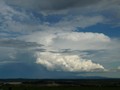
Although, it does look better than what it did before, so fingers crossed we get a storm or two out of this one. And that shear is awesome!

Welcome New Members! We want to hear from you. Register, stop lurking and start posting!
Vic: Unstable Warm Weather Sept 16th- 19th
-
apocalypse

- Cumulonumbus Calvas
- Reactions:
- Posts: 761
- Joined: Tue Jan 19, 2010 6:17 pm
- Location: Wagga Wagga, NSW 189m asl
Re: Vic: Unstable Warm Weather Sept 16th- 19th
I think GFS is WAY overestimating the moisture content, especially at the surface, which is making those LI and CAPE values seem so attractive. A look at a few soundings for Monday's -9 LI bullseye shows DP's at the surface of 17-18C! I'd love to see that! 
Although, it does look better than what it did before, so fingers crossed we get a storm or two out of this one. And that shear is awesome!
Although, it does look better than what it did before, so fingers crossed we get a storm or two out of this one. And that shear is awesome!
Nathan Morris
2013 Rainfall
Jan - 3.8mm
Feb - 27.0mm
Mar - 0.0mm
YTD - 30.8mm
2013 Rainfall
Jan - 3.8mm
Feb - 27.0mm
Mar - 0.0mm
YTD - 30.8mm
-
AUSSKY

- Storm Chaser
- Reactions:
- Posts: 538
- Joined: Wed Nov 25, 2009 11:59 pm
- Location: Trentham (700m ASL)
- Contact:
Re: Vic: Unstable Warm Weather Sept 16th- 19th
(cross posted from austpacwx...)
New window
Print all
Expand all
Collapse all
[austpacwx] Predicted warm spell SE Aus..(this weekend)
Inbox
X
austpacwx
X
ReplyReply
More|
Clyve Herbert to austpacwx
9:59 AM
Hi all.
I noted with interest the model predictions for high temps across SE Aus this weekend, some were for extreme heat. The advent of models offer a very big and too some extent accurate barometer for forecasting and I enjoy overlooking some of the predictions. I presume all model outlooks are 'quality checked' by humans with 'real analysis's. Back to the coming weekend it appears the extreme nature of this model forecast (heat) does not appear to be coming off, instead a rather patchy appearance of warm days intervened by fast moving cold fronts. I had a good look at warm pool generation across the NW of Aus and it never achieves the stupendous heat that occurred several years ago during the spring, although some of the heat is transported by the pre frontal NW 850 it is effectively mixed out as it approaches southeast Aus by the associated westerly shear at 850. It now appears that any higher temps may be achieved briefly on Monday ahead of an amplifying trough passing rather rapidly through SE Aus. best regards Clyve H
Australian Sky & Weather (AUSSKY)
Victoria - The State of Drizzle & Occasional Tornadoes
(1999 -2016)
Victoria - The State of Drizzle & Occasional Tornadoes
(1999 -2016)
- Jake Smethurst
- Supercell
- Reactions:
- Posts: 3583
- Joined: Mon Nov 23, 2009 8:49 pm
- Location: Cheltenham
Re: Vic: Unstable Warm Weather Sept 16th- 19th
Interesting next few days on the cards.
We have a bit of a trough system expected to pass through during tomorrow, however this should just bring some convective shower activity to parts of southern and southern central parts of Victoria. There is a little bit of an increase of moisture in the northeast of the state, however at this stage the risk of thunderstorms tomorrow is pretty much nil.
During Saturday it becomes a bit more interesting with a cold front expected to reach western districts during the afternoon and progress eastwards to reach the east at night. Should see shower and thunderstorm activity develop along this front in particular, with some strong winds possible in any thunderstorms that form. Its hard to tell if GFS is over-reacting with all the date evident, time will tell I guess, but Saturday looks like an okay day with the chance of a thunderstorm basically anywhere in the state, particularly along the front as I mentioned.
Sunday looks to become generally fine ahead of the next front on Monday.
Here is our thunderstorm forecast for the next two days, if you would like to see the map provided, please click on the link in my signature:
Thunderstorm Forecast - Day 1 (Friday)
Issued 11:00 PM EST 14/09/2011
Latest computer models released this evening are indicating that there could be an increase in moisture through parts of far northern Victoria on Friday, particularly along the central Murray region. The atmosphere is expected to become only slightly unstable, and the moisture profile does not look very healthy, therefore there is only the chance of an isolated thunderstorm marked in the region below.
Thunderstorm Forecast - Day 2 (Saturday)
Issued 11:00 PM EDT 14/09/2011
A cold front is expected to reach western Victoria during the early afternoon on Saturday, before progressing eastwards during the remainder of the afternoon to reach eastern districts at night. There is an increase of moisture through the state, particularly through the mid-levels of the atmosphere, and conditions are generally expected to be unstable. Lifted Index values are expected to reach down to -5 at some locations, with CAPE levels above 1000 at some spots. The main focus of attention will be for the development of isolated thunderstorms along the frontal system itself, particularly over the Wimmera region where the deepest instability is involved, however there is a chance across all areas. Damaging winds are a potential with the thunderstorms, mostly along and near the front.
Jake - Senior AWF Forecaster
Feel free to send me a private message if you have any questions.
Feel free to send me a private message if you have any questions.
- Pete
- Cumulonimbus
- Reactions:
- Posts: 470
- Joined: Mon May 30, 2011 9:02 pm
- Location: Albany, Western Australia
Re: Vic: Unstable Warm Weather Sept 16th- 19th
Just wondering Power Storm, are you an independent meteorologist? Do you get paid for your work?
- Jake Smethurst
- Supercell
- Reactions:
- Posts: 3583
- Joined: Mon Nov 23, 2009 8:49 pm
- Location: Cheltenham
Re: Vic: Unstable Warm Weather Sept 16th- 19th
Hi Pete.
Unfortunately I am not a meteorologist just yet. Hopefully I will be in a few more years. I am just about to finish year 12 at school. But one day, hopefully I am.
Unfortunately I am not a meteorologist just yet. Hopefully I will be in a few more years. I am just about to finish year 12 at school. But one day, hopefully I am.
Jake - Senior AWF Forecaster
Feel free to send me a private message if you have any questions.
Feel free to send me a private message if you have any questions.
-
Rivergirl

- Memorial
- Reactions:
- Posts: 3674
- Joined: Sun Nov 22, 2009 6:04 pm
- Location: Ferny Creek VIC
- Contact:
Re: Vic: Unstable Warm Weather Sept 16th- 19th
And you always do such a good job Power Storm! Thank you 
- Pete
- Cumulonimbus
- Reactions:
- Posts: 470
- Joined: Mon May 30, 2011 9:02 pm
- Location: Albany, Western Australia
Re: Vic: Unstable Warm Weather Sept 16th- 19th
You can't be much older than me then. I'm finishing year 11 this year, year 12 next year. I want to be a severe weather meteorologist eventually.Power Storm » Fri Sep 16, 2011 2:09 am wrote:Power Storm wrote:Hi Pete.
Unfortunately I am not a meteorologist just yet. Hopefully I will be in a few more years. I am just about to finish year 12 at school. But one day, hopefully I am.
-
stratospear

- Supercell
- Reactions:
- Posts: 1261
- Joined: Sat Dec 19, 2009 9:38 am
- Location: Usually Bendigo
Re: Vic: Unstable Warm Weather Sept 16th- 19th
00Z GFS run has LI of -9 to our NW tomorrow afternoon. Not sure about the RH levels the same model is throwing out though. Seem way too high IMO given that the dew point this afternoon has been around 5 degC (35% RH).
-
Supercellimpact

- Supercell
- Reactions:
- Posts: 1238
- Joined: Thu Oct 07, 2010 8:39 pm
- Location: Bendigo
Re: Vic: Unstable Warm Weather Sept 16th- 19th
Can some one tell me why gfs is progging such high instability? I just don t see why its so high .

Re: Vic: Unstable Warm Weather Sept 16th- 19th
I don't get it either. We struggle to get LI's that low at the peak of storm season.
The next few days are a real head scratcher for a novice like me.
The next few days are a real head scratcher for a novice like me.
- Rhino
- Supercell
- Reactions:
- Posts: 1227
- Joined: Mon Nov 30, 2009 11:37 am
- Location: Carisbrook-Near Maryborough
Re: Vic: Unstable Warm Weather Sept 16th- 19th
Starting to get semi-excited now about sat, although much will depend on how the day develops and moisture profile, but at least something to look forward too.GFS stormcast making the eyes pop out, but with some scepticism, here's hoping anyway. 
Rhino.
Rhino.
- droughtbreaker
- Supercell
- Reactions:
- Posts: 2844
- Joined: Wed Nov 25, 2009 7:50 pm
- Location: Mount Macedon, VIC, 520m asl
Re: Vic: Unstable Warm Weather Sept 16th- 19th
GFS likes to go overboard from time to time.
Tomorrow's front doesn't look all that exceptional to me to be honest, just a standard spring cold front. It all comes down to moisture levels. Models seem to be progging a small plume of moisture over most of VIC which could aid storm development but the general picture atm is a very dry one thanks to the rather depressing +ve PDO scenario we have found ourselves in yet again. Still, if the moisture is there I would expect a decent line of storms with the change, particularly over southern and mountain areas and a few showers and storms popping up in the north as well.
Models are not keen on rainfall for tomorrow and basically showing up very little, but this doesn't necessarily mean it will be a non event as it's still possible the models could be off by a little bit with some of the data. One big factor in our favour is the timing of the fronts which are set to arrive in central areas during peak heating time.
Monday sees a much more significant front, a really strong one with a large thermal gradient involved. I would definitely expect a line of storms and a period of rain with 5-10mm over mainly southern and mountain areas yet again.
BOM is a bit high with some of the forecast max temps, Tuesday and Friday in particular look a degree or two too high when compared to the model consensus.
- Jake Smethurst
- Supercell
- Reactions:
- Posts: 3583
- Joined: Mon Nov 23, 2009 8:49 pm
- Location: Cheltenham
Re: Vic: Unstable Warm Weather Sept 16th- 19th
Nothing much changed since my above post yesterday.
Still looking on track, but as mentioned by many people here, it is up to the moisture levels generally for thunderstorm development tomorrow. It is questionable with GFS keen. The cold front is still expected to reach western districts during the afternoon and progress eastwards to reach the east at night. Should see some shower and thunderstorm activity develop along this front in particular, with some strong winds possible in any thunderstorms that form. Still a risk of the odd storm ahead of the front too. It's a day to wait and watch in my opinion, it always gets tricky through transitional periods, let alone normal thunderstorm days.
Here is the thunderstorm forecasts i've just updated, for maps, click link in my signature:
Thunderstorm Forecast - Day 1 (Saturday)
Issued 11:00 PM EST 16/09/2011
A trough of low pressure is expected to reach western Victoria during the afternoon on Saturday, before progressing eastwards during the remainder of the afternoon to reach eastern districts at night. Moisture levels are expected to have increased overnight, particularly through the mid-levels of the atmosphere, however the levels of moisture remain questionable in terms of if it is sufficient enough to produce thunderstorms. Despite the questionability of the moisture levels, conditions are generally expected to be unstable. Lifted Index values are expected to reach down to -5 at some locations, with CAPE levels above 1000 at some spots. Forecast soundings also reveal a general spread of instability. The main focus of attention will be for the development of isolated thunderstorms along the frontal system itself thanks to forcing, particularly over the western ranges where the deepest instability is involved, however there is a chance across all areas with and east of the front. Damaging winds are a potential with the thunderstorms, mostly along and near the front.
Jake - Senior AWF Forecaster
Feel free to send me a private message if you have any questions.
Feel free to send me a private message if you have any questions.
- aussiestormfreak
- Cumulonumbus Calvas
- Reactions:
- Posts: 534
- Joined: Thu Feb 03, 2011 9:52 am
- Location: Melbourne, Corryong, Merimbula, and Fiji
- Contact:
Re: Vic: Unstable Warm Weather Sept 16th- 19th
Been busy brushing up on how to photograph lightning this evening, hopefully we'll get some nice thunderstorms tomorrow and again on Monday, even if it only amounts to blustery squall lines as the cold fronts move through, but yes the moisture factor is the real issue here. Either way, I'm ready
-
flatcam
- Cumulonimbus
- Reactions:
- Posts: 182
- Joined: Wed Jan 05, 2011 8:16 pm
- Location: Craigieburn, Victoria
Re: Vic: Unstable Warm Weather Sept 16th- 19th
Best of luck ASF! Hopefully you get something interesting to photograph!aussiestormfreak » Sat Sep 17, 2011 12:52 am wrote:aussiestormfreak wrote:Been busy brushing up on how to photograph lightning this evening, hopefully we'll get some nice thunderstorms tomorrow and again on Monday, even if it only amounts to blustery squall lines as the cold fronts move through, but yes the moisture factor is the real issue here. Either way, I'm ready
Really hoping for something here, but after checking the charts, I'm not sure about our chances. The front rolling through may produce something though. Does anyone know roughly what time the front should roll through the Melbourne area tomorrow ?
Best of luck to all!
Cheers, Cam
-
Anthony Violi

- Supercell
- Reactions:
- Posts: 2652
- Joined: Mon Nov 23, 2009 9:03 pm
- Location: Lilydale
- Contact:
Re: Vic: Unstable Warm Weather Sept 16th- 19th
All the models are getting worse, GFS is the worst of them, as they have all been updated recently.
Remember, model output rely on human input, so if we assume that man made global warming is real, that is the reason why the models produce such inaacurate forecasts. Short term are no different, since GFS has been updated its been even more unreliable.
This system lacks moisture, although we will still see some activity. The high instability progs are likely to be because the uppers are still cold, as to be expected at this stage of the year. I still believe that we are some weeks away from an increase an moisture across the interior to be advected into the west coast trough, which Ec is hinting is starting to get rolling in the coming weeks.
The one wildcard is the temp, 25 today and 27 Monday, which would help convection develop.
http://www.therealworldweatherforum.com" onclick="window.open(this.href);return false;
avweatherforecasts.com
avweatherforecasts.com
Re: Vic: Unstable Warm Weather Sept 16th- 19th
BoM only really seems interested in storms and showers down south for both today and Monday.
- Nick Sykes
- Cumulonimbus
- Reactions:
- Posts: 353
- Joined: Wed Nov 25, 2009 6:16 pm
- Location: Gungahlin, ACT
Re: Vic: Unstable Warm Weather Sept 16th- 19th
Big spread of temperatures across the suburbs today with the city still around 19c while Avavlon is already up to 25c, most other suburbs are around the 22c mark. I'm guessing this in part due to the fact there has been some cloud hanging over the northern end of town this morning and the SW has been clear. Could also be site related, I have noticed that Melbourne often struggles to get going temp wise on northerly wind days, often reading lower than other sites while at the same time Avalon always seems very warm.
Dewpoints are still relatively high, near 10 through the south of the state, though the bone dry NW winds have mixed out in Mildura with a DP of -9 and temp of 27. I expect the lower DP's will mix through much of the state as the NW winds come in from the NW, especially if we get good sunshine.
Nick
- I_Love_Storms
- Supercell
- Reactions:
- Posts: 2812
- Joined: Wed Dec 02, 2009 2:01 pm
- Location: Hawthorn
Re: Vic: Unstable Warm Weather Sept 16th- 19th
IMO dynamics not quite right today. May get some short lived small cells but temps not that high, lack of moisture and deep trough feature. Few more degrees above forecast would make it a bit more Interesting
Re: Vic: Unstable Warm Weather Sept 16th- 19th
30c in Adelaide, 31c in Mildura at the moment even Brissy is having a hot one 31c.