
Welcome New Members! We want to hear from you. Register, stop lurking and start posting!
Victoria: Cold Outbreak/Low Pressure. January 17-20 2010
- droughtbreaker
- Supercell
- Reactions:
- Posts: 2844
- Joined: Wed Nov 25, 2009 7:50 pm
- Location: Mount Macedon, VIC, 520m asl
Re: Vic - cut-off low for Sun-Mon 17-18 Jan 10
Second burst to that shower and light rain in between. Temp down to 11C with that. Maximum so far here is 13.5C
-
Instability

- Cumulonimbus
- Reactions:
- Posts: 290
- Joined: Thu Nov 26, 2009 6:26 am
- Location: Live in Burwood - Work in Dandenong South
Re: Vic - cut-off low for Sun-Mon 17-18 Jan 10
Not as surprised as I was - I even checked the underside of the gauge to make sure there was no hole in it :lol: The type of gauge I have is susceptible to under-reading when there is a bit of wind around though. I am thinking about getting another couple of gauges and setting them up in different spots of the garden to reduce this possibility.Sniper wrote:Yeah mate, some amazing numbers dotted around the place. The one that surprises me is Rog (Instability) with only 9mm. Burwood is normally wetter than most places.
Just receving a sun shower in CBD at the moment. Temps also up to, 17.5c.
It takes me to a whole 11mm for Jan so far, after a very respectable 70mm in December.
Rog.
- droughtbreaker
- Supercell
- Reactions:
- Posts: 2844
- Joined: Wed Nov 25, 2009 7:50 pm
- Location: Mount Macedon, VIC, 520m asl
Re: Victoria: Cold Outbreak/Low Pressure. January 17-20 2010
Well, sure it is disappointing for areas west of Melbourne and in west central VIC but it is hardly surprising. SW winds = dry in these areas and as DJ mentioned earlier in the thread it is just physics that determines this and has to be expected. In an average year we get a similar setup time and time again and we miss out here repeatedly but we make up for it here with the NW gales and cloud bands ahead of fronts in winter that deliver heavy rain here. Western suburbs will get frustrated time and time again thanks to geographic location and topography. Just the way it is.
At least we're getting a bit of a better go of it now. If we can get under a few heavy showers today here and get another 3mm or so I will be happy as that would be enough to keep things a bit damp and at least stop things from drying out too much.
At least we're getting a bit of a better go of it now. If we can get under a few heavy showers today here and get another 3mm or so I will be happy as that would be enough to keep things a bit damp and at least stop things from drying out too much.
-
Karl Lijnders

- Tornadic Supercell
- Reactions:
- Posts: 5771
- Joined: Sun Nov 22, 2009 11:17 pm
- Location: Knoxfield, Victoria
Re: Victoria: Cold Outbreak/Low Pressure. January 17-20 2010
Some large convection turning into summer time convection to my south and west. Not over for the east. How awesome if we can score another 10-20mm to 9am tomorrow!!
Nothing like a widespread 40-70mm event for the east. Which is what US had for a lot of the week leading into it.
Wonderful rainfall. Good to see your getting some Sean. Interesting to place your observation slightly further west of Anthony. Really backs up the stream pattern across the region.
Nothing like a widespread 40-70mm event for the east. Which is what US had for a lot of the week leading into it.
Wonderful rainfall. Good to see your getting some Sean. Interesting to place your observation slightly further west of Anthony. Really backs up the stream pattern across the region.
Former Owner - The Australian Weather Forum. Email me anytime - weatherman1000@hotmail.com
-
Petros

- Supercell
- Reactions:
- Posts: 2001
- Joined: Tue Dec 01, 2009 6:25 pm
- Location: Maffra, Gippsland, Vic
Re: Vic - cut-off low for Sun-Mon 17-18 Jan 10
Thanks Sniper - is this from the BOM? (looked but couldnt find it).Sniper wrote:Petros, latest BOM storm chart puts coastal areas east of Melbourne as "likely" for storms.
I would add the map, however I am having troubles with photobucket.
THUNDERSTORM FORECAST
Issued at 11:55 am Monday, 18 January 2010,
Valid until midnight on Monday, 18 January 2010.
As an upper trough passes over the eastern part of Victoria the associated
instability will provide the potential for isolated thunderstorm activity over
central and eastern Victoria. A low pressure system that will form near eastern
Bass Strait overnight will sweep a trough over Gippsland. Thunderstorm activity
will be more likely with this trough over Gippsland and Alpine areas. NOTE:
Localised damaging winds are possible with thunderstorm activity about the
Gippsland coastal plains.
Karl - any thoughts on the location of the low over the next 12 hrs? - latest chart shows it closer than most models progged 36 hrs ago!
Still just the odd brief shower passing over from the SW and hanging onto the hope of a coldie to pass over and bump our meagre 5.5mm tally northwards. I fear we are too much in the lee of Tassie to get significant rain unless the low can knuckle down and tighten up the isobars along the 90 mile beach.
- Jake Smethurst
- Supercell
- Reactions:
- Posts: 3583
- Joined: Mon Nov 23, 2009 8:49 pm
- Location: Cheltenham
Re: Victoria: Cold Outbreak/Low Pressure. January 17-20 2010
12mm to 9am this morning, a bit of a surprise! But good!! Showers have cleared here now to a partly cloudy afternoon and temperatures are fairly cool with the wind, but the sun feels great.
Petros, yeah that's where the chart was from, the Bureau of Meteorology, here is the map that Wes was talking about.
Australian Government Bureau of Meteorology
Victoria Regional Office
THUNDERSTORM FORECAST
Issued at 11:55 am Monday, 18 January 2010,
Valid until midnight on Monday, 18 January 2010.
As an upper trough passes over the eastern part of Victoria the associated instability will provide the potential for isolated thunderstorm activity over central and eastern Victoria. A low pressure system that will form near eastern Bass Strait overnight will sweep a trough over Gippsland. Thunderstorm activity will be more likely with this trough over Gippsland and Alpine areas. NOTE: Localised damaging winds are possible with thunderstorm activity about the Gippsland coastal plains.
Jake - Senior AWF Forecaster
Feel free to send me a private message if you have any questions.
Feel free to send me a private message if you have any questions.
- Twister
- Cumulonumbus Calvas
- Reactions:
- Posts: 914
- Joined: Sun Nov 29, 2009 10:47 pm
- Location: Brisbane Qld
Re: Victoria: Cold Outbreak/Low Pressure. January 17-20 2010
Very ture Norfolk, those that said it would be a dry system it is for there area. Those that said it would be wet it is in there area 20-40mm falls with easy another 20mm to come, SO jealous what a shame they are not state wide falls the State is starting to really need it in the W, NW, N, NC, NE.
Only East of Melb, Hills and W and S gippy and east gippy doing well, this is a nothing system for MUCH of the state but was always going to be.
Sw events only good for those N and E of the bay almost everyone else gets nothing :(
:(
Easy 20mm+ east of bay and NE of bay in next 24 hours Enjoy Good to here dams are going well to
Only East of Melb, Hills and W and S gippy and east gippy doing well, this is a nothing system for MUCH of the state but was always going to be.
Sw events only good for those N and E of the bay almost everyone else gets nothing
Easy 20mm+ east of bay and NE of bay in next 24 hours Enjoy Good to here dams are going well to
Now Living in Wet QLD
-
Petros
- Supercell
- Reactions:
- Posts: 2001
- Joined: Tue Dec 01, 2009 6:25 pm
- Location: Maffra, Gippsland, Vic
Re: Victoria: Cold Outbreak/Low Pressure. January 17-20 2010
Finally got a coldie here, a fairly weak cell drifted over us and strengthened enough to provide 5 or 6 close rumbles and 1.5mm rain to take us to 7mm since last evening.
Still CANNOT find that thunderstorm forecast/map on the BOM site - is it from within a paid area?
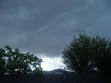
15.8C here and calm again, the odd muffled distant rumble as the weak cell drifts away to our NNE.
Heres a pathetic photo to our N.
Thanks for the help Robyn, forgot how to drive the clickable thumbnail generator thingy in Photobucket for a while.
Still CANNOT find that thunderstorm forecast/map on the BOM site - is it from within a paid area?
15.8C here and calm again, the odd muffled distant rumble as the weak cell drifts away to our NNE.
Heres a pathetic photo to our N.

Thanks for the help Robyn, forgot how to drive the clickable thumbnail generator thingy in Photobucket for a while.
Last edited by Petros on Mon Jan 18, 2010 2:21 pm, edited 2 times in total.
-
tizza

- Cumulonumbus Calvas
- Reactions:
- Posts: 728
- Joined: Wed Nov 25, 2009 6:48 pm
- Location: Dandenong North
- Contact:
Re: Victoria: Cold Outbreak/Low Pressure. January 17-20 2010
Yet another decent shower passing through, no squalls with this one but it's quite heavy and hail free
Hey Petros, go to photobucket and click on the IMG link next to the image, then once you're back in here just paste it in this box. I think it's ctrl V on a PC. That should help. Otherwise, back in photobucket control copy the link, ctrl C then come back in here and ctrl V should put the IMG link up for you.
Hey Petros, go to photobucket and click on the IMG link next to the image, then once you're back in here just paste it in this box. I think it's ctrl V on a PC. That should help. Otherwise, back in photobucket control copy the link, ctrl C then come back in here and ctrl V should put the IMG link up for you.
Last edited by tizza on Mon Jan 18, 2010 2:15 pm, edited 1 time in total.
Re: Victoria: Cold Outbreak/Low Pressure. January 17-20 2010
Yeah those who called the rain for their areas have got it and those who said it would do Jack  all for their areas and get diddley squat it has preety much come off that way too like Tony and Andrew and others predicted so everyone that did a forecast is right in their own ways. Like I said earlier was always going to be an Eastern Suburbs and some parts of Gippsland event. Anyway hope guys like Tony, Andrew, Sam, Dagget and even myself can see 5mm by the time this ends even though thats low still would be happy with that.
Glad to see the dams done okay should put the brakes on the water levels dropping which is always good in the middle of Summer.
Glad to see the dams done okay should put the brakes on the water levels dropping which is always good in the middle of Summer.
- Jake Smethurst
- Supercell
- Reactions:
- Posts: 3583
- Joined: Mon Nov 23, 2009 8:49 pm
- Location: Cheltenham
Re: Victoria: Cold Outbreak/Low Pressure. January 17-20 2010
Also Petros, the T'storm Charts come from the CFA internal pages from the BoM, needs password access.
Jake - Senior AWF Forecaster
Feel free to send me a private message if you have any questions.
Feel free to send me a private message if you have any questions.
-
Blackee

- Site Admin/Moderator
- Reactions:
- Posts: 3859
- Joined: Tue Nov 24, 2009 8:57 pm
- Location: Elwood and Mansfield 370m
Re: Victoria: Cold Outbreak/Low Pressure. January 17-20 2010
Severe Weather Warning
for damaging winds
for people in the West and South Gippsland and East Gippsland forecast districts.
Issued at 10:58 am EDT on Monday 18 January 2010.
Weather Situation
A cold airmass associated with an upper level trough will pass over eastern parts of Victoria today.
Localised damaging winds may be associated with shower or thunderstorm activity. Localised peak wind gusts of around 100 km/h are forecast for the West and South Gippsland and East Gippsland forecast districts. Coastal regions will be at most risk. Small hail is also possible with shower or thunderstorm activity.
Damaging winds averaging 40 km/h with peak gusts around 100 km/h are forecast for the West and South Gippsland and East Gippsland forecast districts.
Peak wind gust of 107km/hr was recorded at Wilson's Promontory this morning.
The State Emergency Service advises that people should:
People should not park or shelter under trees.
Secure or put away loose items around your house, yard and balcony.
Keep clear of fallen power lines.
Don't drive, ride or walk through flood water.
Keep clear of creeks and storm drains.
Beware of fallen trees or debris on the road.
For emergency help in floods and storms, ring your local SES Unit on 132 500.
The next warning will be issued by 5:00 pm EDT Monday.
Mansfield 370m and Elwood
-
Anthony Violi

- Supercell
- Reactions:
- Posts: 2652
- Joined: Mon Nov 23, 2009 9:03 pm
- Location: Lilydale
- Contact:
Re: Victoria: Cold Outbreak/Low Pressure. January 17-20 2010
What??? Am I missing something here? Everyone jumped off this quicker than an Indian with the runs once EC went walking. At best most said a bit in Gippsland but that's it. You guys all wrote it off just like all the models. 48.2mm here thanks very much, just like I thought it would.
http://www.therealworldweatherforum.com" onclick="window.open(this.href);return false;
avweatherforecasts.com
avweatherforecasts.com
-
Blackee
- Site Admin/Moderator
- Reactions:
- Posts: 3859
- Joined: Tue Nov 24, 2009 8:57 pm
- Location: Elwood and Mansfield 370m
Re: Victoria: Cold Outbreak/Low Pressure. January 17-20 2010
As you mentioned Petros, cell N of Briagolong is quite lightning active.
Mansfield 370m and Elwood
- Skywalker
- Supercell
- Reactions:
- Posts: 1875
- Joined: Sun Nov 29, 2009 10:03 am
- Location: Burnside Heights/Cowes (Home) & Sunshine West (Work)
Re: Victoria: Cold Outbreak/Low Pressure. January 17-20 2010
In the middle of a shower stream here at work, few more showers seem to be making there way through the western suburbs. I'm guessing we will get 5mm at the most from this system.
Caroline Springs, Melbourne's meteorological boredom zone.
-
Petros
- Supercell
- Reactions:
- Posts: 2001
- Joined: Tue Dec 01, 2009 6:25 pm
- Location: Maffra, Gippsland, Vic
Re: Victoria: Cold Outbreak/Low Pressure. January 17-20 2010
Thanks Tizza.
Yeah Sniper funny it arrive here as a std Cu blob like all the rest today, just decided to thicken overhead and become a small storm. It did provide a nice view of heavy rain shafts in its arseend as it drifted away to our NNE.
Now I fear we are under the influence of the lee of Tasmania. Unless the low can deepen and edge back along the Gippsland coastal area.
- droughtbreaker
- Supercell
- Reactions:
- Posts: 2844
- Joined: Wed Nov 25, 2009 7:50 pm
- Location: Mount Macedon, VIC, 520m asl
Re: Victoria: Cold Outbreak/Low Pressure. January 17-20 2010
I never wrote it off for east of Melbourne. Never at any stageAnthony Violi wrote:What??? Am I missing something here? Everyone jumped off this quicker than an Indian with the runs once EC went walking. At best most said a bit in Gippsland but that's it. You guys all wrote it off just like all the models. 48.2mm here thanks very much, just like I thought it would.
The initial model runs had a massive cold pool and associated major surface cut off right over the guts of the state and for many runs had 25mm plus for a lot of the state. GFS even had 50mm+ here at one stage when it had the cold pool and low retrograding west over the state. In the end all we have is a simple SW airflow in an unstable environment with the cold pool to our east. If it wasn't for the bay it would just all be coastal, (the big totals anyway).
If you haven't already noticed, John, Tony and myself do not live in the eastern suburbs of Melbourne or South Gippsland so if we wrote it off in our forecasts it was for our own areas. I don't generally make specific forecasts for other areas, if I do it's only in passing but I mentioned in almost every single one of my posts that the Dandenongs and east would get good rain. In the end it extended a bit further towards central Melbourne and the coastal areas did well which they usually do anyway. Especially around the Otways.
Re: Victoria: Cold Outbreak/Low Pressure. January 17-20 2010
Anthony check our forecasts and see who jumped off or not before you quickly jump in here and tell everyone whos right or wrong. Does it matter whos right or wrong anyway? Few people of late seem to want to take the glory for when they predict things in here.. Who Cares! who gets it right or wrong and who doesn't didn't know it was a competitive thing its starting to look and feel that way lately!
Most people wrote off the heatwave when I started the thread last week in here but could I care less if people agreed with me or not and those who jumped on the 11th hour NO. Weather is weather it will do whatever it wants its bigger than any indvidual in here thats for sure does it matter if Joe Blow or Dick Smith got it right don't want this forum to turn into Look at me look at me I got it right don't know if others agree but its starting to look that way lately. Its 1 thing to turn on the BOM and perhaps even saying you were right for your area but turning on other people in here cos "you think" they got it wrong in your eyes is only going to cause friction and tension in this forum. Last time I looked this is a forum for everyone not for indivuduals if people don't like me saying this ban me.
Most people wrote off the heatwave when I started the thread last week in here but could I care less if people agreed with me or not and those who jumped on the 11th hour NO. Weather is weather it will do whatever it wants its bigger than any indvidual in here thats for sure does it matter if Joe Blow or Dick Smith got it right don't want this forum to turn into Look at me look at me I got it right don't know if others agree but its starting to look that way lately. Its 1 thing to turn on the BOM and perhaps even saying you were right for your area but turning on other people in here cos "you think" they got it wrong in your eyes is only going to cause friction and tension in this forum. Last time I looked this is a forum for everyone not for indivuduals if people don't like me saying this ban me.
- droughtbreaker
- Supercell
- Reactions:
- Posts: 2844
- Joined: Wed Nov 25, 2009 7:50 pm
- Location: Mount Macedon, VIC, 520m asl
Re: Victoria: Cold Outbreak/Low Pressure. January 17-20 2010
Anyway, back on topic, and that is reporting what is happening with the weather and not having to defend myself for fine details of my my posts from days ago. 
I went for a drive east of here and encountered heavy rain off and on the whole way through Barringo, Cherokee, Kerrie and between Woodend and Romsey. Roads had surface water on them and gutters/drains were running. We missed out here, just about the only place in the district that did but now we are getting a decent shower here.
I went for a drive east of here and encountered heavy rain off and on the whole way through Barringo, Cherokee, Kerrie and between Woodend and Romsey. Roads had surface water on them and gutters/drains were running. We missed out here, just about the only place in the district that did but now we are getting a decent shower here.
- Skywalker
- Supercell
- Reactions:
- Posts: 1875
- Joined: Sun Nov 29, 2009 10:03 am
- Location: Burnside Heights/Cowes (Home) & Sunshine West (Work)
Re: Victoria: Cold Outbreak/Low Pressure. January 17-20 2010
Lots of showers streaming through the western suburbs now, however it's going to be very much a hit and miss.
Caroline Springs, Melbourne's meteorological boredom zone.