Page 2 of 3
Re: Spring weather roller coaster: September 17 to 24
Posted: Fri Sep 22, 2017 1:38 pm
by Gordon
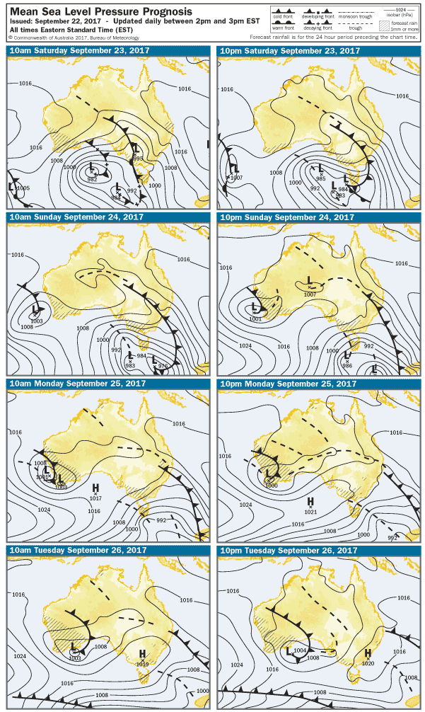
Not often you see a four day synoptic chart like this, in September, and don't end up with lots of rain, then snow... Hard to believe it won't deliver

Re: Spring weather roller coaster: September 17 to 24
Posted: Fri Sep 22, 2017 6:11 pm
by nafets
Agree with hillybilly. Looks way too dry at low levels for anything substantial rain wise/ large storms. The mid-teen dewpoint forecast at the surface is basically only at the surface, moisture is way too shallow as it dries substantially. Precipitable water around 20mm for most of the state which shows there isn't much moisture across most levels.
Thinking that while the north of the state sees the lowest LI Sat arvo, it will be high based and dry if anything, with western areas close to the front (higher LI than north) seeing a slightly higher risk. Would like to prove the forecasts wrong but unless we magically see some tropical moisture things won't be too wild tomorrow.
Re: Spring weather roller coaster: September 17 to 24
Posted: Fri Sep 22, 2017 7:52 pm
by Jake Smethurst
Would love to be proven wrong as well, but the moisture profile is just too horrid in my opinion. LI's may be okay but they are just one factor when it comes to thunderstorm development. There is a brief risk, no doubt, but it's very low and most storms if any that develop will be on the drier side. Otherwise tomorrow will just be warm and windy (especially ahead of and following the front).
Re: Spring weather roller coaster: September 17 to 24
Posted: Fri Sep 22, 2017 9:41 pm
by hillybilly
Cracked 20C here today. Hard to believe that six days ago we had snow showers

The kids even jumped in the pool after school (its up to nearly 15C and the spas 33C... quite amazing how much heat you can get out of black poly pipe). Still too cold for me

Tomorrow looks nasty. So lucky we've had a good wet few months as it's like that day in October 2015 when Lancefield had a bushfire
Nasty winds, really hot uppers and unstable. The very low levels don't get as hot as you might expect in the south which I assume is because of evaporation which is also why the soundings show that little bit of low level moisture.
Really couldn't rule out a run at the Vic September record in the north. The 38C contour gets very close to Mildura, but get cuts off by the trough. If it is delayed an hour or two would have to be a chance. NSW will likely get its hottest September day on record tomorrow (state average) and pretty likely today that OZ saw its hottest day. Hopefully the try hard La Niña gets cranking and takes the edge of the heat before summer proper hits
I'm expecting a dry front tomorrow here, but might squeeze out a mm or two. There is an early elevated warm front that comes through which will drop some virga, and then maybe a shower on the front. Looks quite showery on Sunday and Monday.
Re: Spring weather roller coaster: September 17 to 24
Posted: Sat Sep 23, 2017 5:06 am
by Australis(Shell3155)
Typical, fishing trip planned to SG'land,
And it's already blowing here, guess there is no rush to get there now.
The reports are all over the shop, but 2 days with 12c isn't what I wanted to see,
Nor the windy, windy possible shower possible rain.... grr..
Chuck in the bathers for today and the thermals for tomorrow..
Re: Spring weather roller coaster: September 17 to 24
Posted: Sat Sep 23, 2017 6:54 am
by hillybilly
Warm night up here, and already 20C. Winds gusting, and typical mid-level cloud band which ushers in the onset of rapid warm air advection. I'm guessing many people out today will see early cloud and think... it's not going to get warm

My experience is these early cloud bands usually usher in feral weather by the afternoon as they usually indicate a rapid pressure fall and strengthening northerlies.
Soundings are very warm today. Perisher is forecast to reach 17C which is about 1C above the previous record
If that air was to mix down proper most sites would see a new record high for today. We just don't quite get there with the front coming through too early, and a bit of cloud for most of the day.
Am thinking the places to watch for possible records are near the Murray and East Gippsland. Also, expect we will see some fires, even though much of Vic has seen pretty good rain the last couple of months.
Few storms back over SA on the wind change, so maybe something later (though thinking little rainwise).
Rain for Sunday/Monday should give things a bit of a drink, and still looks quite unstable.
Re: Spring weather roller coaster: September 17 to 24
Posted: Sat Sep 23, 2017 7:21 am
by StratoBendigo
Not much rain likely here. Conditions have got real dry and it's not looking all that promising in the weeks ahead. At least it'll be cooler.
Late-Sept 2008 was similar. We had several high-20s degC days that year and barely any rain. But quite a lot of frosts and cooler days in-between.
Re: Spring weather roller coaster: September 17 to 24
Posted: Sat Sep 23, 2017 7:47 am
by Tassiedave
Showers and scattered thunderstorms this morning in Northern Tasmania
Re: Spring weather roller coaster: September 17 to 24
Posted: Sat Sep 23, 2017 9:00 am
by Skywalker
Re: Spring weather roller coaster: September 17 to 24
Posted: Sat Sep 23, 2017 9:42 am
by Jake Smethurst
I like the wind, it’s adding at least some dynamic to an otherwise uneventful event.
Left for work early this morning. Very mild and a tad gusty but definitely happy the warmer weather has arrived, for now at least.
Good to see some storms there Tassie. Still looking quite dry if any develop here in Victoria. Southwest part of the state has the highest risk, generally low elsewhere.
Re: Spring weather roller coaster: September 17 to 24
Posted: Sat Sep 23, 2017 11:07 am
by Skywalker
Jake Smethurst wrote: ↑Sat Sep 23, 2017 9:42 am
I like the wind, it’s adding at least some dynamic to an otherwise uneventful event.
You would be about the only one I know who does Jake.
Personally I find it really annoying & destructive, especially out here on the flat basalt plans of the western suburbs. It's shocking.
Speaking of which, it has picked up quite substantially during the past hour, gusting about 50km/h with higher gusts.
Re: Spring weather roller coaster: September 17 to 24
Posted: Sat Sep 23, 2017 12:25 pm
by WeatherViewer
Temps already dropping south west of Melb, isn't that a little earlier than forecast?
Re: Spring weather roller coaster: September 17 to 24
Posted: Sat Sep 23, 2017 1:01 pm
by Dane
Not much wind here so far. indeed wind has gone to the south in the last hour and temp has dropped from 26 to 24 here.
Highest gust here so far was 10 knots - 18kph at 9.32am.
Re: Spring weather roller coaster: September 17 to 24
Posted: Sat Sep 23, 2017 1:06 pm
by stevco123
WeatherViewer wrote: ↑Sat Sep 23, 2017 12:25 pm
Temps already dropping south west of Melb, isn't that a little earlier than forecast?
That could well just be a seabreeze there.
Loving it down here. Nowhere near 30 as Dane just mentioned above. Sitting on a comfortable 24 here with cloud building and virga to my east.
Not very windy either compared to other places.
Microcliamte at work.
Re: Spring weather roller coaster: September 17 to 24
Posted: Sat Sep 23, 2017 1:30 pm
by WeatherViewer
Mallacoota 34.5C @ 1:20PM. Insane!!!
Re: Spring weather roller coaster: September 17 to 24
Posted: Sat Sep 23, 2017 1:50 pm
by WeatherViewer
I must report it has been a completely still and calm day this side of Melbourne. Hardly any wind.
Re: Spring weather roller coaster: September 17 to 24
Posted: Sat Sep 23, 2017 1:58 pm
by StratoBendigo
31 degC here. Yuck. Cooling down out West now.
Re: Spring weather roller coaster: September 17 to 24
Posted: Sat Sep 23, 2017 3:02 pm
by hillybilly
Crazy temperatures to our north. 37.7C at Mildura which is a new Victoria record. 40.5C at Wilcannia which is a new NSW record. Many long-term stations in NSW have broken long-term record by degrees. Not nice breaking records with such regularity.
Re: Spring weather roller coaster: September 17 to 24
Posted: Sat Sep 23, 2017 3:14 pm
by Dane
The hot gusty northerly came in here just after 2pm with gusts up to 28 knots - over 50kmh temperature then jumped from about 23 to close to 29c. Cool change not that far away i see Warnambool is now down to 14c.
Re: Spring weather roller coaster: September 17 to 24
Posted: Sat Sep 23, 2017 5:25 pm
by Horts
Awesome day here in Safety Beach, 25 and clear blue - 27 around 9am. Virtually no wind all day - turned now though.. absolutely howling!