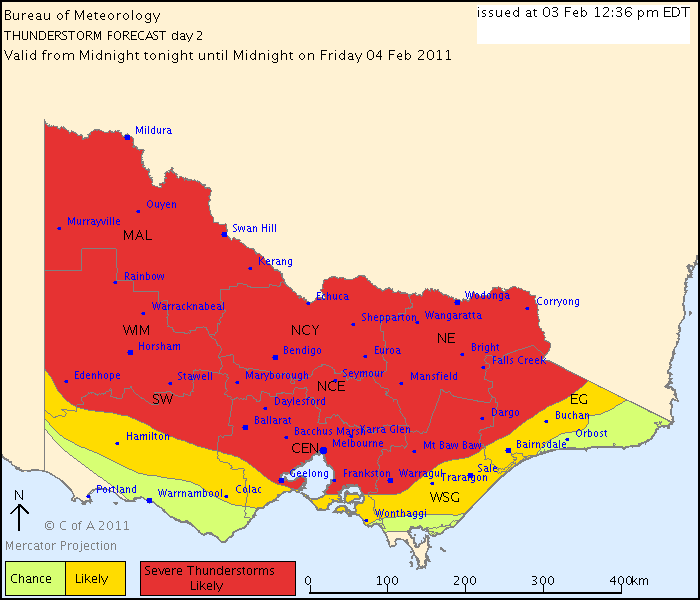
Australian Government Bureau of Meteorology
Victoria Regional Office
TOP PRIORITY FOR IMMEDIATE BROADCAST
SEVERE THUNDERSTORM WARNING
for FLASH FLOODING, LARGE HAILSTONES and DESTRUCTIVE WIND
For people in parts of the
Mallee and
Northern Country s.
Issued at 3:02 pm Thursday, 3 February 2011.
Severe thunderstorms are likely to produce very heavy rainfall, flash flooding,
large hailstones and destructive winds in the warning area over the next several
hours. Locations which may be affected include Swan Hill, Robinvale, Kerang and
Rochester.
The State Emergency Service advises that people should:
* Keep clear of fallen power lines.
* secure any loose objects in the vicinity of your home.
* keep away from creeks and drains.
* do not drive vehicles through flooded areas.
* stay indoors if possible.
* Avoid using the phone during the storm.
* if you are outside, avoid sheltering under trees
* listen to the radio for storm updates
* switch off your computer and electrical appliances
The next warning is due to be issued by 6:05 pm.
Warnings are also available through TV and Radio broadcasts, the Bureau's
website at
http://www.bom.gov.au" onclick="window.open(this.href);return false; or call 1300 659 217. The Bureau and State Emergency
Service would appreciate warnings being broadcast regularly.
Might be time for a drive