
Welcome New Members! We want to hear from you. Register, stop lurking and start posting!
Victoria: Rain/Storm event: 29th Nov - 5th Dec (Obs)
- Hamlan
- Storm Chaser
- Reactions:
- Posts: 449
- Joined: Tue Dec 22, 2009 11:05 pm
- Location: Northern suburbs
Re: Victoria: Rain/Storm event: 29th Nov - 5th Dec (Obs)
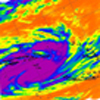
Awesome move on radar! the cell NE of Ararat has done an about face and turned real hard left!! wow.

Re: Victoria: Rain/Storm event: 29th Nov - 5th Dec (Obs)
Lol! Glad someone got on to the Kilmore storm. Looked good on radar earlier.
Re: Victoria: Rain/Storm event: 29th Nov - 5th Dec (Obs)
G'day
Is it just me or has it all died out today???
Cheers
Is it just me or has it all died out today???
Cheers
- droughtbreaker
- Supercell
- Reactions:
- Posts: 2844
- Joined: Wed Nov 25, 2009 7:50 pm
- Location: Mount Macedon, VIC, 520m asl
Re: Victoria: Rain/Storm event: 29th Nov - 5th Dec (Obs)
Well it's all fallen apart now. It looked really good for a while there but now I'm very skeptical.
- I_Love_Storms
- Supercell
- Reactions:
- Posts: 2812
- Joined: Wed Dec 02, 2009 2:01 pm
- Location: Hawthorn
Re: Victoria: Rain/Storm event: 29th Nov - 5th Dec (Obs)
Convection is done anywhere east of a line from Sheoaks to Broadford...otherwise west of this line still looks good. The southerlies have wrecked our chances down here today, BTW I no longer expect that line of storms later this evening. Monday afternoon is our next main day.
- weathergasm
- Cumulonimbus
- Reactions:
- Posts: 244
- Joined: Sun Feb 14, 2010 9:32 pm
- Location: Box Hill
Re: Victoria: Rain/Storm event: 29th Nov - 5th Dec (Obs)
It wasn't humid enough, there was no trigger and the wind didn't help the cause for the Melbourne metropolitan area.
But the next few days look promising trigger wise.
Edit: just got future reference, I think it's a great clue when one of the experts here say "this set up is perfect... there's just no trigger!"
Whenever this is said it's almost an iron-clad guarantee of no storms for Melbourne. Hahaha
But the next few days look promising trigger wise.
Edit: just got future reference, I think it's a great clue when one of the experts here say "this set up is perfect... there's just no trigger!"
Whenever this is said it's almost an iron-clad guarantee of no storms for Melbourne. Hahaha
- Jake Smethurst
- Supercell
- Reactions:
- Posts: 3583
- Joined: Mon Nov 23, 2009 8:49 pm
- Location: Cheltenham
Re: Victoria: Rain/Storm event: 29th Nov - 5th Dec (Obs)
My updated thunderstorm chart for today.
Thunderstorm Forecast - Day 1 (Saturday) Issued 4:30 PM EDT 4/12/2010
Scattered thunderstorms are currently occurring across western and eastern Victoria. For the rest of this afternoon, thunderstorm development or sustained thunderstorm activity remains likely over most areas on and north of the ranges. No thunderstorms are expected to form in the far northwest or across southern regions this afternoon. Severe thunderstorms are possible of the 'likely' area for the rest of today, however they are more likely over the Wimmera extending towards Bendigo for this afternoon, with damaging winds, large hailstones and flash flooding. A mass of thunderstorms are currently in this 'red' area and will continue to extend east to northeast.
Jake - Senior AWF Forecaster
Feel free to send me a private message if you have any questions.
Feel free to send me a private message if you have any questions.
- droughtbreaker
- Supercell
- Reactions:
- Posts: 2844
- Joined: Wed Nov 25, 2009 7:50 pm
- Location: Mount Macedon, VIC, 520m asl
Re: Victoria: Rain/Storm event: 29th Nov - 5th Dec (Obs)
It's anything but not humid enough. 30C/18C in the city at 2pm. Today never really presented as a big storm day but I thought the sea breeze convergence might have set something off. Grampians have a heap of activity so it is not completely inactive.
Re: Victoria: Rain/Storm event: 29th Nov - 5th Dec (Obs)
Cells moving NW Over the NE Mallee
- I_Love_Storms
- Supercell
- Reactions:
- Posts: 2812
- Joined: Wed Dec 02, 2009 2:01 pm
- Location: Hawthorn
Re: Victoria: Rain/Storm event: 29th Nov - 5th Dec (Obs)
It's going beserk in the grampians region
- Skywalker
- Supercell
- Reactions:
- Posts: 1876
- Joined: Sun Nov 29, 2009 10:03 am
- Location: Burnside Heights/Cowes (Home) & Sunshine West (Work)
Re: Victoria: Rain/Storm event: 29th Nov - 5th Dec (Obs)
Quite pleasant outside now with the southerly kicking in. Definately no chance of storms here again. Oh well, at least I got all the mowing done.
Caroline Springs, Melbourne's meteorological boredom zone.
- norfolk
- Supercell
- Reactions:
- Posts: 2024
- Joined: Thu Nov 26, 2009 7:03 pm
- Location: Caroline Springs, western Melbourne
- Contact:
Re: Victoria: Rain/Storm event: 29th Nov - 5th Dec (Obs)
Just goes to show that whenever there are chances for storms, you have to be at the right place at the right time. Couldnt call it a dud day, just that the storms were not in my area today!
- HarleyB
- Cumulonumbus Calvas
- Reactions:
- Posts: 839
- Joined: Sun Oct 10, 2010 9:39 pm
- Location: Wangaratta
Re: Victoria: Rain/Storm event: 29th Nov - 5th Dec (Obs)
Temp maxed out here at approx 28.4ºC today, just too cold given today's setup. The low level cloud that hung around here till 1pm really killed it for us today.
-
fireone

- Cumulus
- Reactions:
- Posts: 82
- Joined: Sat Oct 30, 2010 11:51 am
- Location: Alexandra Vic. 3714 (www.alexandraweather.org)
- Contact:
Re: Victoria: Rain/Storm event: 29th Nov - 5th Dec (Obs)
Feels like something has to give. Hot and humid and virtually calm.
Far west and east has quite bit of build up. Dew point been up most of day.
Uncomfortable . Feels like Singapore.
Far west and east has quite bit of build up. Dew point been up most of day.
Uncomfortable . Feels like Singapore.
FIREONE, Alexandra. { North Central } Vic.
- HarleyB
- Cumulonumbus Calvas
- Reactions:
- Posts: 839
- Joined: Sun Oct 10, 2010 9:39 pm
- Location: Wangaratta
Re: Victoria: Rain/Storm event: 29th Nov - 5th Dec (Obs)
Currently, there looks like more of a chance of something happening than it has all day, bar the Kilmore cell. A few huge towers, including to the SE and WNW. Strange, though not expecting anything really to come of it
- I_Love_Storms
- Supercell
- Reactions:
- Posts: 2812
- Joined: Wed Dec 02, 2009 2:01 pm
- Location: Hawthorn
Re: Victoria: Rain/Storm event: 29th Nov - 5th Dec (Obs)
MASSIVE BLACK CORE NEAR ARARAT!
-
Tempest
- Cumulonimbus
- Reactions:
- Posts: 148
- Joined: Sat Aug 14, 2010 8:34 pm
- Location: Warragul North, Vic... 140m asl
Re: Victoria: Rain/Storm event: 29th Nov - 5th Dec (Obs)
Are those storms in the West starting to finally move Eastward? Washing is dry and in now 
- I_Love_Storms
- Supercell
- Reactions:
- Posts: 2812
- Joined: Wed Dec 02, 2009 2:01 pm
- Location: Hawthorn
Re: Victoria: Rain/Storm event: 29th Nov - 5th Dec (Obs)
It does look like it...who knows what the weather will do...it will always throw up some surprises. Anything tonight would be an absolute bonus, would expect it to weaken before it gets anywhere near the city but some very severe stuff out there at the moment.Tempest wrote:Are those storms in the West starting to finally move Eastward? Washing is dry and in now
-
Supercellimpact

- Supercell
- Reactions:
- Posts: 1238
- Joined: Thu Oct 07, 2010 8:39 pm
- Location: Bendigo
Re: Victoria: Rain/Storm event: 29th Nov - 5th Dec (Obs)
Nice cell to the south , and that avil of the horsham storm is massive!!
- Jake Smethurst
- Supercell
- Reactions:
- Posts: 3583
- Joined: Mon Nov 23, 2009 8:49 pm
- Location: Cheltenham
Re: Victoria: Rain/Storm event: 29th Nov - 5th Dec (Obs)
AWF Severe Thunderstorm Advice
A severe thunderstorm is currently southwest of Ararat. This thunderstorm is currently moving east to northeast and is highly likely to produce large hailstones. Residents of Beaufort need to prepare to be possibly impacted upon by this thunderstorm during the next hour.
A severe thunderstorm is currently southwest of Ararat. This thunderstorm is currently moving east to northeast and is highly likely to produce large hailstones. Residents of Beaufort need to prepare to be possibly impacted upon by this thunderstorm during the next hour.
Jake - Senior AWF Forecaster
Feel free to send me a private message if you have any questions.
Feel free to send me a private message if you have any questions.