Convection starting to build up nicely to my NW N NE and E all moving in a NE direction. Started coming up from the SW but passed over and clear over that way now.
Edit: I'm in Ashwood ATM.

Welcome New Members! We want to hear from you. Register, stop lurking and start posting!
Victoria: Rain/Storm event: 29th Nov - 5th Dec (Obs)
- Rhino
- Supercell
- Reactions:
- Posts: 1227
- Joined: Mon Nov 30, 2009 11:37 am
- Location: Carisbrook-Near Maryborough
Re: Victoria: Rain/Storm event: 29th Nov - 5th Dec (Obs)
Wimmera starting to fire, can see big convection to my W-NW, and my god it's sticky and not a good day to be assembling an outdoor setting.  Might take the little bloke on a small chase later if things look sweet, cutoff time will be 4pm, after that it's beer o'clock.
Rhino.
Rhino.
- HarleyB
- Cumulonumbus Calvas
- Reactions:
- Posts: 839
- Joined: Sun Oct 10, 2010 9:39 pm
- Location: Wangaratta
Re: Victoria: Rain/Storm event: 29th Nov - 5th Dec (Obs)
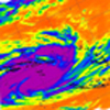
Absolutely massive tower to the west and I expect it to show up on radar soon, building by the second
- I_Love_Storms
- Supercell
- Reactions:
- Posts: 2812
- Joined: Wed Dec 02, 2009 2:01 pm
- Location: Hawthorn
Re: Victoria: Rain/Storm event: 29th Nov - 5th Dec (Obs)
I expect a line of storms to come in from the west and affect Melbourne around 8pm. Will be heavily lightning active too IMO.
Edit: Convection becoming higher over the eastern ranges. City now 30/18 with a trough over the top of it, ridiculous energy around no matter how warm the mid layers have become. The towers should shoot higher any second now.
Edit: Convection becoming higher over the eastern ranges. City now 30/18 with a trough over the top of it, ridiculous energy around no matter how warm the mid layers have become. The towers should shoot higher any second now.
Last edited by I_Love_Storms on Sat Dec 04, 2010 2:08 pm, edited 3 times in total.
-
Supercellimpact

- Supercell
- Reactions:
- Posts: 1238
- Joined: Thu Oct 07, 2010 8:39 pm
- Location: Bendigo
Re: Victoria: Rain/Storm event: 29th Nov - 5th Dec (Obs)
Cell south of swan hill now.
-
mick

- Supercell
- Reactions:
- Posts: 1453
- Joined: Mon Nov 30, 2009 6:45 pm
- Location: Mid North SA Baaaaaaaaaaaaaaa
Re: Victoria: Rain/Storm event: 29th Nov - 5th Dec (Obs)
The build up has begun here, plenty of convection just nth, should show on radar soon.
-
tizza

- Cumulonumbus Calvas
- Reactions:
- Posts: 728
- Joined: Wed Nov 25, 2009 6:48 pm
- Location: Dandenong North
- Contact:
Re: Victoria: Rain/Storm event: 29th Nov - 5th Dec (Obs)
a mixture of accas and cirrus here with low level convection, slowly starting to kick off, but I'm concerned that the swirling winds will mess with Melb's (CBD/Inner) chances for now. Hopefully things will change. Just hit 33c in the concrete jungle of Richmond, there's not a breath of wind here. Sweating bullets and have been told to shower
Last edited by tizza on Sat Dec 04, 2010 2:09 pm, edited 1 time in total.
Re: Victoria: Rain/Storm event: 29th Nov - 5th Dec (Obs)
Towers going up here aswell, 32/20!
Go the bombersss!
- I_Love_Storms
- Supercell
- Reactions:
- Posts: 2812
- Joined: Wed Dec 02, 2009 2:01 pm
- Location: Hawthorn
Re: Victoria: Rain/Storm event: 29th Nov - 5th Dec (Obs)
First lightning strike showing up on tracker just west of Horsham.
- Rhino
- Supercell
- Reactions:
- Posts: 1227
- Joined: Mon Nov 30, 2009 11:37 am
- Location: Carisbrook-Near Maryborough
Re: Victoria: Rain/Storm event: 29th Nov - 5th Dec (Obs)
Massive convection now to my W-NW, looks incredible.
Rhino.
Rhino.
-
Tempest
- Cumulonimbus
- Reactions:
- Posts: 148
- Joined: Sat Aug 14, 2010 8:34 pm
- Location: Warragul North, Vic... 140m asl
Re: Victoria: Rain/Storm event: 29th Nov - 5th Dec (Obs)
I_Love_Storms wrote:I expect a line of storms to come in from the west and affect Melbourne around 8pm. Will be heavily lightning active too IMO.
As soon as my washing dries

- Dane
- Supercell
- Reactions:
- Posts: 1662
- Joined: Thu Nov 26, 2009 9:51 am
- Location: Sebastopol 420m ASL
- Contact:
Re: Victoria: Rain/Storm event: 29th Nov - 5th Dec (Obs)
Storms now firing in the far east and west of the state. Some good towers going up to the distant north. Currently 30/15 here. Winds gone round to the SW here may be a bit of a sea breeze.
- droughtbreaker
- Supercell
- Reactions:
- Posts: 2844
- Joined: Wed Nov 25, 2009 7:50 pm
- Location: Mount Macedon, VIC, 520m asl
Re: Victoria: Rain/Storm event: 29th Nov - 5th Dec (Obs)
A lot happening here now, towers overhead etc. Will be very interesting to see what happens when the sea breeze kicks in and how far north any convergence line can make it.
EDIT: Huge tower just to the west of here going 100% vertical. Would almost expect a pileus cap to develop over the top of it, it is that sort of structure.
EDIT: Huge tower just to the west of here going 100% vertical. Would almost expect a pileus cap to develop over the top of it, it is that sort of structure.
-
Australis(Shell3155)

- Supercell
- Reactions:
- Posts: 3149
- Joined: Mon Nov 30, 2009 8:05 pm
- Location: FTG
- Contact:
Re: Victoria: Rain/Storm event: 29th Nov - 5th Dec (Obs)
Holy Reindeer,
its warm out there behind a mower, whipper snipper and a blower.. 31.8 c.
its warm out there behind a mower, whipper snipper and a blower.. 31.8 c.
- GregSorenson2
- Cumulus
- Reactions:
- Posts: 68
- Joined: Thu Sep 16, 2010 11:08 pm
Re: Victoria: Rain/Storm event: 29th Nov - 5th Dec (Obs)
Currently sitting between mildura and swanny having lunch on my way back to Canberra. 35ºC with dps i'd expect in the mid teens. Bank of Cu, can see the Swanny cell, not too fab, but tighter Culi-form. Will hang out further east, and might duck into Vic for a quick chase if anything catches my eye.

Re: Victoria: Rain/Storm event: 29th Nov - 5th Dec (Obs)
And we're off and running! 
Keeping an eye on that stuff near Kerang. Hopefully it makes it way down here.
Keeping an eye on that stuff near Kerang. Hopefully it makes it way down here.
Re: Victoria: Rain/Storm event: 29th Nov - 5th Dec (Obs)
will a seabreeze/ convergence line destroy storm chances or enchance them for melb?
- I_Love_Storms
- Supercell
- Reactions:
- Posts: 2812
- Joined: Wed Dec 02, 2009 2:01 pm
- Location: Hawthorn
Re: Victoria: Rain/Storm event: 29th Nov - 5th Dec (Obs)
Convergence lines will certainly enhance chances, if the seabreeze takes over though then convection will be destroyed. Doppler looks okay at the moment though, isn't showing up anything too worrying.James wrote:will a seabreeze/ convergence line destroy storm chances or enchance them for melb?
Edit: Big towers going up to my west.
- Jake Smethurst
- Supercell
- Reactions:
- Posts: 3583
- Joined: Mon Nov 23, 2009 8:49 pm
- Location: Cheltenham
Re: Victoria: Rain/Storm event: 29th Nov - 5th Dec (Obs)
Fantastic shower and thunderstorm activity currently over the eastern ranges and western parts of Victoria. I am not so sure on the line you think may occur ILS. Movement of thunderstorms is slow today and motion/steering is variable across the state. Some storms will go north, others SE, some NE, its all over the shop. But you never know. Melbourne is in with a fairly good chance this afternoon ... above 70%.
Convection all to my west and northwest currently. Some okay towers starting to show up.
Australian Government Bureau of Meteorology
Victoria Regional Office
TOP PRIORITY FOR IMMEDIATE BROADCAST
SEVERE THUNDERSTORM WARNING
for DAMAGING WIND, FLASH FLOODING and LARGE HAILSTONES
For people in the East Gippsland and parts of the Mallee, South West, Northern Country, North Central, North East, West and South Gippsland and Wimmera s.
Issued at 2:18 pm Saturday, 4 December 2010.
Severe thunderstorms are likely to produce damaging winds, very heavy rainfall, flash flooding and large hailstones in the warning area over the next several hours. Locations which may be affected include Orbost, Dargo, Buchan, Falls Creek, Mt Hotham, Omeo, Horsham, Stawell, Edenhope, Hamilton, Ararat and Kerang.
There is the risk of severe thunderstorms developing over the remainder of central and eastern Victoria over the next 1 to 2 hours.
Jake - Senior AWF Forecaster
Feel free to send me a private message if you have any questions.
Feel free to send me a private message if you have any questions.
