From 35 years of watching synoptic charts, and later on - satpics - any fronts travelling east across the Bight die before getting here. The fronts to watch are those that uncurl like an unwinding spring, and shoot up the west coast of Tassie! I also closely watch models etc, but for winter wx and the REAL cold pools, I have found the above to be the golden rule for Vic.
My 2 cents worth.
Peter

Welcome New Members! We want to hear from you. Register, stop lurking and start posting!
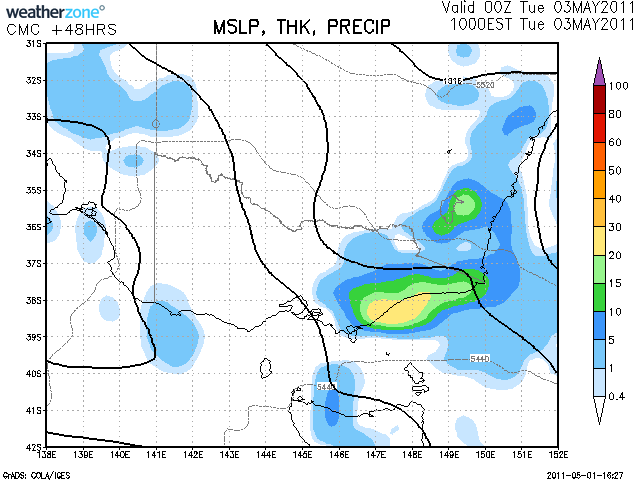
VIC - trough/cold front, then cold pool - 30/4 - 4/5 2011
- stevco123
- Supercell
- Reactions:
- Posts: 2944
- Joined: Sat Aug 07, 2010 7:42 pm
- Location: Cranbourne 78m asl
Re: VIC - trough/cold front, then cold pool - 30/4 - 4/5 201
Agreed Peter. It always gets to me when people say that its going to rain in a few days coz perth got a cold front yesterday for example. Our most intense cold fronts come from the south.
https://www.weatherlink.com/bulletin/53 ... 76dd68e8bc: for current weather updated every 2 minutes
-
Petros

- Supercell
- Reactions:
- Posts: 2001
- Joined: Tue Dec 01, 2009 6:25 pm
- Location: Maffra, Gippsland, Vic
Re: VIC - trough/cold front, then cold pool - 30/4 - 4/5 201
Latest satpic shows how near we are to a major system, great NW cloudband over us, cold pool to our SW. Unfortunately the pool hasnt much northward impetus. Stll the models did a good job sniffing this out a week ago eh?
Re: VIC - trough/cold front, then cold pool - 30/4 - 4/5 201
As I said Yesterday the BOM forecast is to rich and stick to it and going by the radar it looks to be on track that we will see very little out of this
- I_Love_Storms
- Supercell
- Reactions:
- Posts: 2812
- Joined: Wed Dec 02, 2009 2:01 pm
- Location: Hawthorn
Re: VIC - trough/cold front, then cold pool - 30/4 - 4/5 201
Probably don't need too much rain anyway. Looks pretty crap on radar but slow moving which is an advantage. Do expect the intensity to pick up a little as it crosses over the bay, with maybe a few speckled patches of darker blue - LOL. Pretty nice day outside though, airmass feels a little more moist today than the other days where the high totally dominated proceedings.
- droughtbreaker
- Supercell
- Reactions:
- Posts: 2844
- Joined: Wed Nov 25, 2009 7:50 pm
- Location: Mount Macedon, VIC, 520m asl
Re: VIC - trough/cold front, then cold pool - 30/4 - 4/5 201
I'm a bit perplexed with the BOM on this one. The guy at the BOM this morning on ABC (not going to name names) was adamant that the rain was coming for Melbourne by midday (this was at 11am) and it was a big solid band 'stretching back to Mildura'. Most of us on this forum have become well aware of how these rain bands associated with very weak systems can often break apart before getting to central areas. Why the BOM couldn't see this I have no idea. 
Anyway, I still reckon there will be 1-5mm across southern parts of the state tonight with the highest falls on the ranges. The models always had the rain this evening or overnight, there was never any interest in rainfall for central areas during the day.
Anyway, I still reckon there will be 1-5mm across southern parts of the state tonight with the highest falls on the ranges. The models always had the rain this evening or overnight, there was never any interest in rainfall for central areas during the day.
- stevco123
- Supercell
- Reactions:
- Posts: 2944
- Joined: Sat Aug 07, 2010 7:42 pm
- Location: Cranbourne 78m asl
Re: VIC - trough/cold front, then cold pool - 30/4 - 4/5 201
Looks to be slowly re building again on radar.
https://www.weatherlink.com/bulletin/53 ... 76dd68e8bc: for current weather updated every 2 minutes
Re: VIC - trough/cold front, then cold pool - 30/4 - 4/5 201
Terrible forecasting by the BOM in its lastest forecasts at 420pm IMO
-
Didjman

- Supercell
- Reactions:
- Posts: 2100
- Joined: Fri Sep 03, 2010 2:52 pm
- Location: Wallan, Vic 328m ASL
- Contact:
Re: VIC - trough/cold front, then cold pool - 30/4 - 4/5 201
My lower back has been suddenly quite stiff since mid morning! Season change very close!
Peter
Peter
-
Petros
- Supercell
- Reactions:
- Posts: 2001
- Joined: Tue Dec 01, 2009 6:25 pm
- Location: Maffra, Gippsland, Vic
Re: VIC - trough/cold front, then cold pool - 30/4 - 4/5 201
Baro back to 1018 hPa and we had a calm fine arvo (21C) after a cool heavily overcast morning that seemed to promise earlier-than-progged rain. Another great arvo for a hit of golf.
AccessR/G dont want a bar of it (Johnno I dont understand what you meant with your reference to BOM in previous post?), but CMC is keen on helping us out re the current dryness out this way.....
AccessR/G dont want a bar of it (Johnno I dont understand what you meant with your reference to BOM in previous post?), but CMC is keen on helping us out re the current dryness out this way.....
- droughtbreaker
- Supercell
- Reactions:
- Posts: 2844
- Joined: Wed Nov 25, 2009 7:50 pm
- Location: Mount Macedon, VIC, 520m asl
Re: VIC - trough/cold front, then cold pool - 30/4 - 4/5 201
I think what John is referring to is the 'areas of rain/rain at times' forecast for Melbourne when really it should be just 'patchy rain', or 'a little rain'. The former implies widespread falls and decent amounts whereas the latter more accurately describes the situation for tonight and tomorrow.
Seriously, some of the forecasting we get from the BOM these days is just diabolical. They are pretty good most of the time but are often severely challenged by relatively simple scenarios.
There is the chance of some more substantial rain over parts of Gippsland overnight and tomorrow as winds swing SE'ly from northerly. There is also the chance of some substantial showery or drizzly weather over west central parts tomorrow, but no widespread rainfall.
-
tizza

- Cumulonumbus Calvas
- Reactions:
- Posts: 728
- Joined: Wed Nov 25, 2009 6:48 pm
- Location: Dandenong North
- Contact:
Re: VIC - trough/cold front, then cold pool - 30/4 - 4/5 201
It is absolutely chucking it down here!!!!!!!!!
-
tizza
- Cumulonumbus Calvas
- Reactions:
- Posts: 728
- Joined: Wed Nov 25, 2009 6:48 pm
- Location: Dandenong North
- Contact:
Re: VIC - trough/cold front, then cold pool - 30/4 - 4/5 201
5mm in 5 minutes and still belting, all the gutters around the house are overflowing
-
Petros
- Supercell
- Reactions:
- Posts: 2001
- Joined: Tue Dec 01, 2009 6:25 pm
- Location: Maffra, Gippsland, Vic
Re: VIC - trough/cold front, then cold pool - 30/4 - 4/5 201
Unexpected bonus Tizza!, hope some of it makes it way over here before dawn. Calm and very mild out here atm.
- stevco123
- Supercell
- Reactions:
- Posts: 2944
- Joined: Sat Aug 07, 2010 7:42 pm
- Location: Cranbourne 78m asl
Re: VIC - trough/cold front, then cold pool - 30/4 - 4/5 201
Just confirming tizzas report, I have had a couple of heavy downpours with gutters overflowing. 8.2 mm so far tonight, so definitely rain at times for us here around this area. And looks like it is back building too.love it when that happens.
501 mm for the year. Well over half way for the average.
501 mm for the year. Well over half way for the average.
https://www.weatherlink.com/bulletin/53 ... 76dd68e8bc: for current weather updated every 2 minutes
-
tizza
- Cumulonumbus Calvas
- Reactions:
- Posts: 728
- Joined: Wed Nov 25, 2009 6:48 pm
- Location: Dandenong North
- Contact:
Re: VIC - trough/cold front, then cold pool - 30/4 - 4/5 201
6.5mm now, it stopped dead in its tracks. That was a very heavy shower, very tropical in nature too
- stevco123
- Supercell
- Reactions:
- Posts: 2944
- Joined: Sat Aug 07, 2010 7:42 pm
- Location: Cranbourne 78m asl
Re: VIC - trough/cold front, then cold pool - 30/4 - 4/5 201
Another band coming through soon for my area by the looks of things on the radar. The last band was underestimated by the radar, and I suspect it could well be one of those nights with intermittent heavy showers. Just have to wait and see.
https://www.weatherlink.com/bulletin/53 ... 76dd68e8bc: for current weather updated every 2 minutes
-
occluded

- Cumulonumbus Calvas
- Reactions:
- Posts: 611
- Joined: Tue May 04, 2010 3:26 pm
- Location: Mooroolbark 130m asl
Re: VIC - trough/cold front, then cold pool - 30/4 - 4/5 201
The lightest of light light rain this afternoon, not enough to bother the kids on the trampoline outside.
Gently raining now, enough to wet the ground but little more.
Gently raining now, enough to wet the ground but little more.
Re: VIC - trough/cold front, then cold pool - 30/4 - 4/5 201
Absolutely poured a few hours ago for a little while, was good to get some water on the ground.
fortius quo fidelius
- Gordon
- Supercell
- Reactions:
- Posts: 2908
- Joined: Thu Jun 17, 2010 10:01 am
- Location: Near Gordon, Vic. 620 m asl
Re: VIC - trough/cold front, then cold pool - 30/4 - 4/5 201
Although we had a few drops from midday onward, significant rain only started here around 5 pm; crept up to 8 mm at last count. I agree the radar is underestimating this one, a function of fine droplets but very dense?