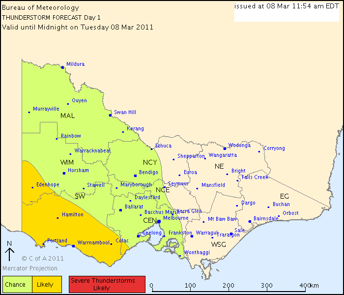
Australian Government Bureau of Meteorology
Victoria Regional Office
THUNDERSTORM FORECAST
Issued at 11:54 am Tuesday, 8 March 2011,
Valid until midnight on Tuesday, 8 March 2011.
Middle level instability combined with favourable upper level flow provide the chance of isolated thunderstorm activity across the northern part of the region shown. As thunderstorm activity may be slow moving in this region, there is a slight chance of flash flooding. Across the southern part, a surface trough will provide enhanced upmotion that makes the chance of thunderstorms in this region more likely. There is a chance that the direction of motion may line up with the orientation of the trough from later this afternoon, enhanced showers or thunderstorms may move over the same region providing a chance of flash flooding over this region.