Welcome New Members! We want to hear from you. Register, stop lurking and start posting!
Victoria: Troughy thundery humid rain event. Jan 9th -14th
Re: Victoria: Troughy thundery humid rain event. Jan 9th-15t
wow this is insane...another big downpour....backyard is struggling to get the water away....the rain rate must be massive....
-
flatcam
- Cumulonimbus
- Reactions:
- Posts: 182
- Joined: Wed Jan 05, 2011 8:16 pm
- Location: Craigieburn, Victoria
Re: Victoria: Troughy thundery humid rain event. Jan 9th-15t
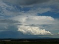
Definately some storm clouds developing to our North and North East. Looking good! 
Cheers, Cam
Cheers, Cam
- Rhino
- Supercell
- Reactions:
- Posts: 1227
- Joined: Mon Nov 30, 2009 11:37 am
- Location: Carisbrook-Near Maryborough
Re: Victoria: Troughy thundery humid rain event. Jan 9th-15t
Another line of possible storms developing alligned N-S to the west of Ballarat, could give metro areas a nice thump if it develops more on it's nth edge. Suns still out here and starting to get that "feel" about it. 
Rhino.
Rhino.
- Lily
- Supercell
- Reactions:
- Posts: 4014
- Joined: Wed Nov 25, 2009 10:29 pm
- Location: Rowville/Lysterfield
Re: Victoria: Troughy thundery humid rain event. Jan 9th-15t
11.8mm since midnight, total to just over 15mm. Sun's been out a reasonable amount this afternoon and getting pretty breezy. 29C/22DP/64%RH.
Eildon Fire Tower on 23.8mm since 9am.
Eildon Fire Tower on 23.8mm since 9am.
- HarleyB
- Cumulonumbus Calvas
- Reactions:
- Posts: 839
- Joined: Sun Oct 10, 2010 9:39 pm
- Location: Wangaratta
Re: Victoria: Troughy thundery humid rain event. Jan 9th-15t
Stupid rain. It broke up just before it got here and went around us. Temp 25.6°C, DP 23.1°C, Humidity 87%
-
Karl Lijnders

- Tornadic Supercell
- Reactions:
- Posts: 5771
- Joined: Sun Nov 22, 2009 11:17 pm
- Location: Knoxfield, Victoria
Re: Victoria: Troughy thundery humid rain event. Jan 9th-15t
I have just conferred with home and 20mm has fallen there for the event, much the same as One in Dandenong so that makes sense being SSW of Scoresby.
Not the huge and unbelieveable falls in the NW! Oh my!
Well not so dry afterall for January. I wonder if February will be dry!!?
Not the huge and unbelieveable falls in the NW! Oh my!
Well not so dry afterall for January. I wonder if February will be dry!!?
Former Owner - The Australian Weather Forum. Email me anytime - weatherman1000@hotmail.com
-
Australis(Shell3155)

- Supercell
- Reactions:
- Posts: 3162
- Joined: Mon Nov 30, 2009 8:05 pm
- Location: FTG
- Contact:
Re: Victoria: Troughy thundery humid rain event. Jan 9th-15t
Homes built right on river bank, river banks are like large Nature Stips then a road and then flash homes.Sniper wrote:From 3AW on twitter
UPDATE: @DenisWalter3AW says 12 homes in town of Nattimuk have had to be evacuated. Some Horsham homes being sand-bagged.
Possibly need more than sang bags if it does flood.
Other homes (units) have been recently built on the old sheep yards, really low lying area not all that far from the river either.
-
AUSSKY

- Storm Chaser
- Reactions:
- Posts: 538
- Joined: Wed Nov 25, 2009 11:59 pm
- Location: Trentham (700m ASL)
- Contact:
Re: Victoria: Troughy thundery humid rain event. Jan 9th-15t
Rhino wrote:Another line of possible storms developing alligned N-S to the west of Ballarat, could give metro areas a nice thump if it develops more on it's nth edge. Suns still out here and starting to get that "feel" about it.
Rhino.
Forming on one of the arms of the deepening low to our southwest...note the shear has changed direction today...Jane
Australian Sky & Weather (AUSSKY)
Victoria - The State of Drizzle & Occasional Tornadoes
(1999 -2016)
Victoria - The State of Drizzle & Occasional Tornadoes
(1999 -2016)
- solcampbell
- Cumulus
- Reactions:
- Posts: 58
- Joined: Tue Dec 07, 2010 6:29 pm
- Location: Grovedale, Geelong
Re: Victoria: Troughy thundery humid rain event. Jan 9th-15t
Just home from work and hoping that it strengthens on the southern edge as well to give us a bit of a showRhino wrote:Another line of possible storms developing alligned N-S to the west of Ballarat, could give metro areas a nice thump if it develops more on it's nth edge. Suns still out here and starting to get that "feel" about it.
Rhino.
- cutofflow
- Cumulus
- Reactions:
- Posts: 95
- Joined: Sun Aug 29, 2010 8:29 pm
- Location: Near Maryborough - North central vic
Re: Victoria: Troughy thundery humid rain event. Jan 9th-15t
Im not so familier with the wimmera river but the bulk of the water is still well upstream sitting at Glynwylln so sandbagging is precaution unless localised flooding
http://www.bom.gov.au/fwo/IDV67206/IDV6 ... .plt.shtml" onclick="window.open(this.href);return false;
All eyes will be on Glenorchy later today to see if this is going to be a major flood.
http://www.bom.gov.au/fwo/IDV67206/IDV6 ... .plt.shtml" onclick="window.open(this.href);return false;
http://www.bom.gov.au/fwo/IDV67206/IDV6 ... .plt.shtml" onclick="window.open(this.href);return false;
All eyes will be on Glenorchy later today to see if this is going to be a major flood.
http://www.bom.gov.au/fwo/IDV67206/IDV6 ... .plt.shtml" onclick="window.open(this.href);return false;
Re: Victoria: Troughy thundery humid rain event. Jan 9th-15t
Dennis Walter on 3AW announced 20 mins ago that BOM will be holding a press conferance @ 330pm
- SC.
- Cumulonimbus
- Reactions:
- Posts: 346
- Joined: Wed Nov 25, 2009 5:57 pm
- Location: Wheelers Hill
- Contact:
Re: Victoria: Troughy thundery humid rain event. Jan 9th-15t
20mm is what I got here as well. Just 28C DP is 21.6CKarl Lijnders wrote:I have just conferred with home and 20mm has fallen there for the event, much the same as One in Dandenong so that makes sense being SSW of Scoresby.
- samueliza
- Cumulonimbus
- Reactions:
- Posts: 161
- Joined: Mon Nov 30, 2009 10:05 pm
- Location: Point Cook- or somewhere in Northern or Western Victoria!!!
Re: Victoria: Troughy thundery humid rain event. Jan 9th-15t
I heard that too! He said they have increased the predicted rainfall totals for VIC? Anyone got any further details?johnno wrote:Dennis Walter on 3AW announced 20 mins ago that BOM will be holding a press conferance @ 330pm
- HarleyB
- Cumulonumbus Calvas
- Reactions:
- Posts: 839
- Joined: Sun Oct 10, 2010 9:39 pm
- Location: Wangaratta
Re: Victoria: Troughy thundery humid rain event. Jan 9th-15t
Is there any way to hear the press conference?johnno wrote:Dennis Walter on 3AW announced 20 mins ago that BOM will be holding a press conferance @ 330pm
Re: Victoria: Troughy thundery humid rain event. Jan 9th-15t
I assume it's on the radio and not tv.HarleyB wrote:Is there any way to hear the press conference?johnno wrote:Dennis Walter on 3AW announced 20 mins ago that BOM will be holding a press conferance @ 330pm
http://www.3aw.com.au/" onclick="window.open(this.href);return false; streaming is just on the right side
- HarleyB
- Cumulonumbus Calvas
- Reactions:
- Posts: 839
- Joined: Sun Oct 10, 2010 9:39 pm
- Location: Wangaratta
Re: Victoria: Troughy thundery humid rain event. Jan 9th-15t
Thankyou
That band is fairly heavy, sounds like it isnt but it is adding up quickly
That band is fairly heavy, sounds like it isnt but it is adding up quickly
-
Anthony Violi

- Supercell
- Reactions:
- Posts: 2652
- Joined: Mon Nov 23, 2009 9:03 pm
- Location: Lilydale
- Contact:
Re: Victoria: Troughy thundery humid rain event. Jan 9th-15t
Looks like its lining up the catchments finally through the Yarra Valley. Sky is dark with black bases and can see the tops of the storms to the north. Still back building slightly but the flow is now NNW so the Eastern half of Melbourne looks like it now gets its turn.
http://www.therealworldweatherforum.com" onclick="window.open(this.href);return false;
avweatherforecasts.com
avweatherforecasts.com
-
karenamelia

- Cumulus
- Reactions:
- Posts: 22
- Joined: Mon Jan 04, 2010 8:19 am
- Location: Horsham Victoria
- Contact:
Re: Victoria: Troughy thundery humid rain event. Jan 9th-15t
The sand bagging is on Burnt Creek it comes into the edge of the city My friend is sandbagging now Shes out Williams Road
After 4 inches last night 100+ mils Its no wonder the creeks are bursting the banks Natimuk is flooded too Evacuations are happening now
After 4 inches last night 100+ mils Its no wonder the creeks are bursting the banks Natimuk is flooded too Evacuations are happening now
karen in Horsham Vic
Re: Victoria: Troughy thundery humid rain event. Jan 9th-15t
Up to 25.5mm for the week, a little less then I thought we would of had so far, amazing falls in the west many records will of broken.
- SC.
- Cumulonimbus
- Reactions:
- Posts: 346
- Joined: Wed Nov 25, 2009 5:57 pm
- Location: Wheelers Hill
- Contact:
Re: Victoria: Troughy thundery humid rain event. Jan 9th-15t
Got thunder and rain here now.