Welcome New Members! We want to hear from you. Register, stop lurking and start posting!
Victoria: Rain/Storm event: 29th Nov - 5th Dec (Obs)
Re: Victoria: Rain/Storm event: 29th Nov - 5th Dec (Obs)
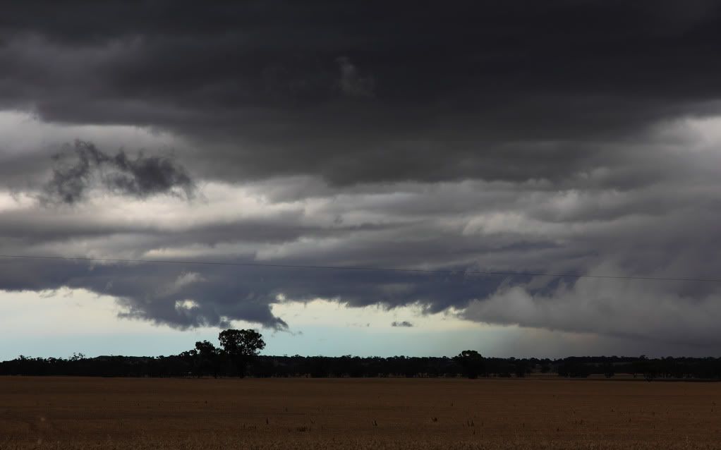
Got a visual on that one Anthony, it's shrinking sadly.
-
Petros

- Supercell
- Reactions:
- Posts: 2005
- Joined: Tue Dec 01, 2009 6:25 pm
- Location: Maffra, Gippsland, Vic
Re: Victoria: Rain/Storm event: 29th Nov - 5th Dec (Images)
Great snaps violet... gotta say that I'm not a great fan of the "tricked up" photos though.
Re: Victoria: Rain/Storm event: 29th Nov - 5th Dec (Obs)
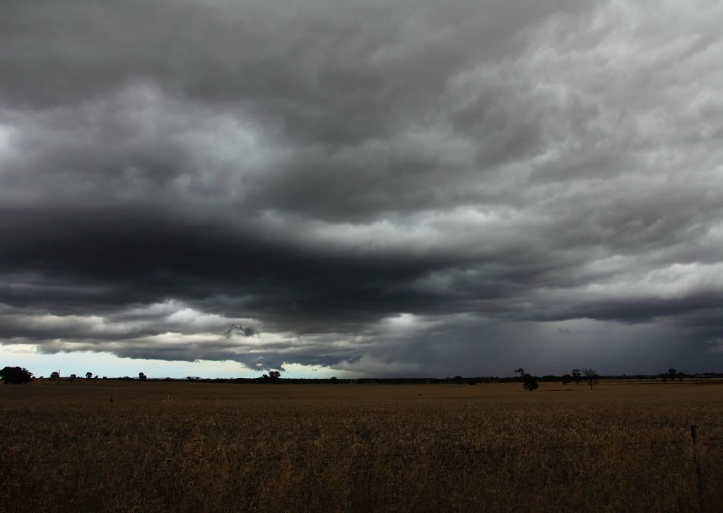
Rain band seems to be moving in a south/south westerly direction and seems to have flattened out to a rather big rainband
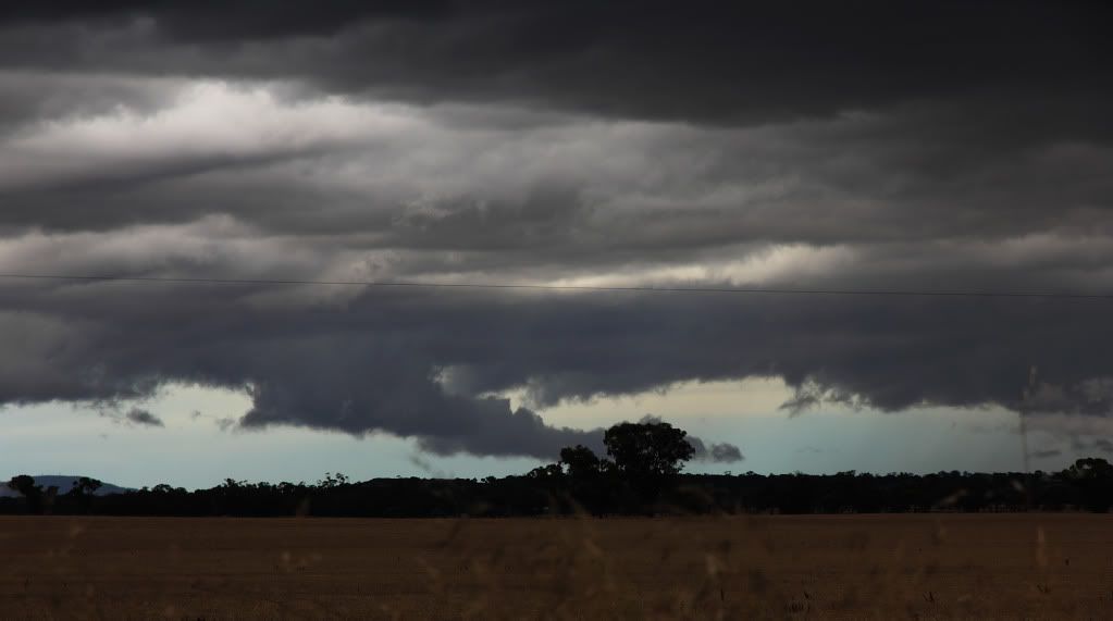
EDIT: Rain seems to be moving away from me, sorry folks nothing to see here, (Waves hand) Move Along (Stops Waving Hand)
EDIT: Rain seems to be moving away from me, sorry folks nothing to see here, (Waves hand) Move Along (Stops Waving Hand)
Re: Victoria: Rain/Storm event: 29th Nov - 5th Dec (Images)
The only tricked up one is the outflow one infront of the railway line.
Here's much the same shot, without the adjustments to white balance / contrast / fill light which will show you how the camera captured it, which was very much contrary to what my eyes were telling me.

Here's much the same shot, without the adjustments to white balance / contrast / fill light which will show you how the camera captured it, which was very much contrary to what my eyes were telling me.
-
daviescr

- Supercell
- Reactions:
- Posts: 1394
- Joined: Wed Dec 02, 2009 5:40 pm
- Location: Warranwood, Vic
Re: Victoria: Rain/Storm event: 29th Nov - 5th Dec (Images)
Nice images Ryan, love the railroad pic - gee you're getting good mate!
Sorry Petros - not really fussed if a picture is 'tricked up' or not - it's the final oooh factor that makes it for me
Sorry Petros - not really fussed if a picture is 'tricked up' or not - it's the final oooh factor that makes it for me

Re: Victoria: Rain/Storm event: 29th Nov - 5th Dec (Images)
Great shot mate! Lovely shelf cloud there.
Gotta get down the coast myself during storm season sometime. Plenty of stunning landscapes to work with.
Gotta get down the coast myself during storm season sometime. Plenty of stunning landscapes to work with.
Re: Victoria: Rain/Storm event: 29th Nov - 5th Dec (Images)
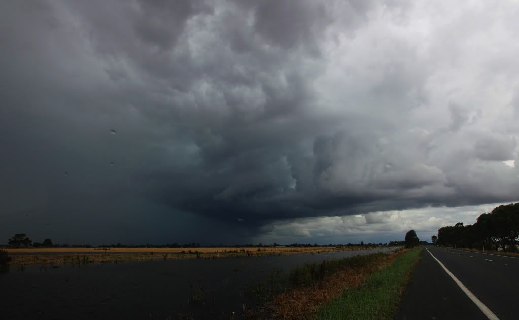
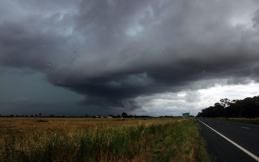
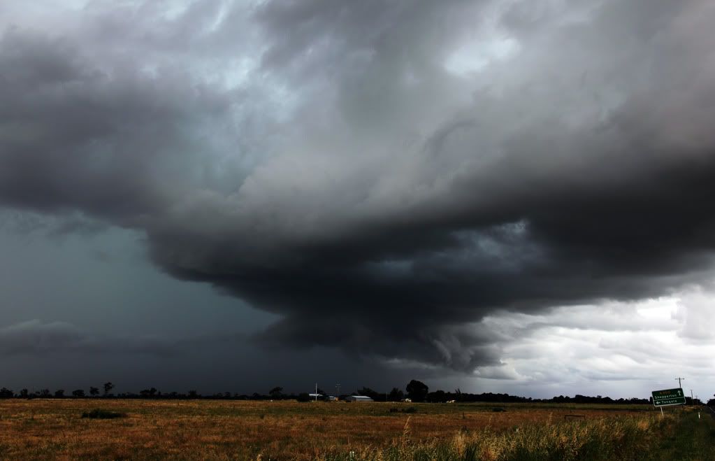
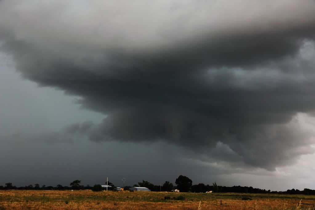
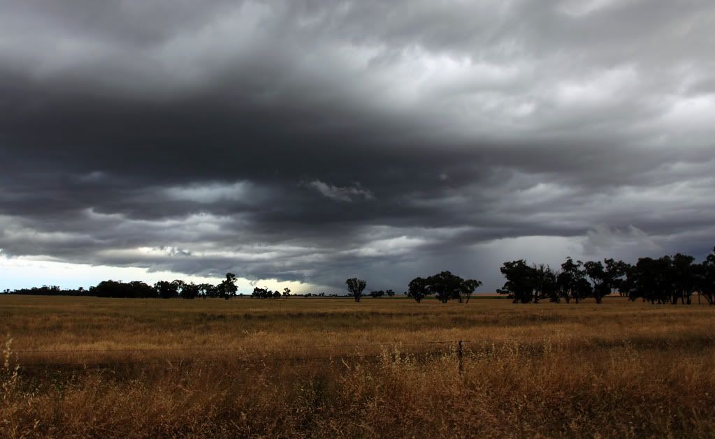
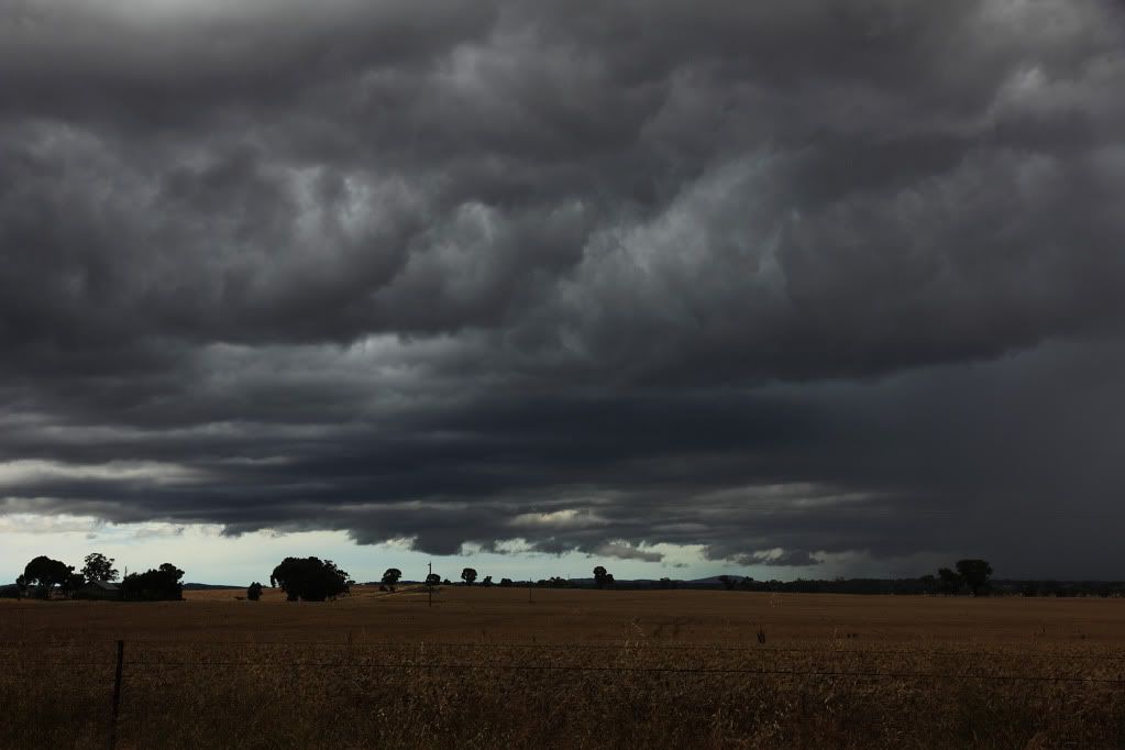
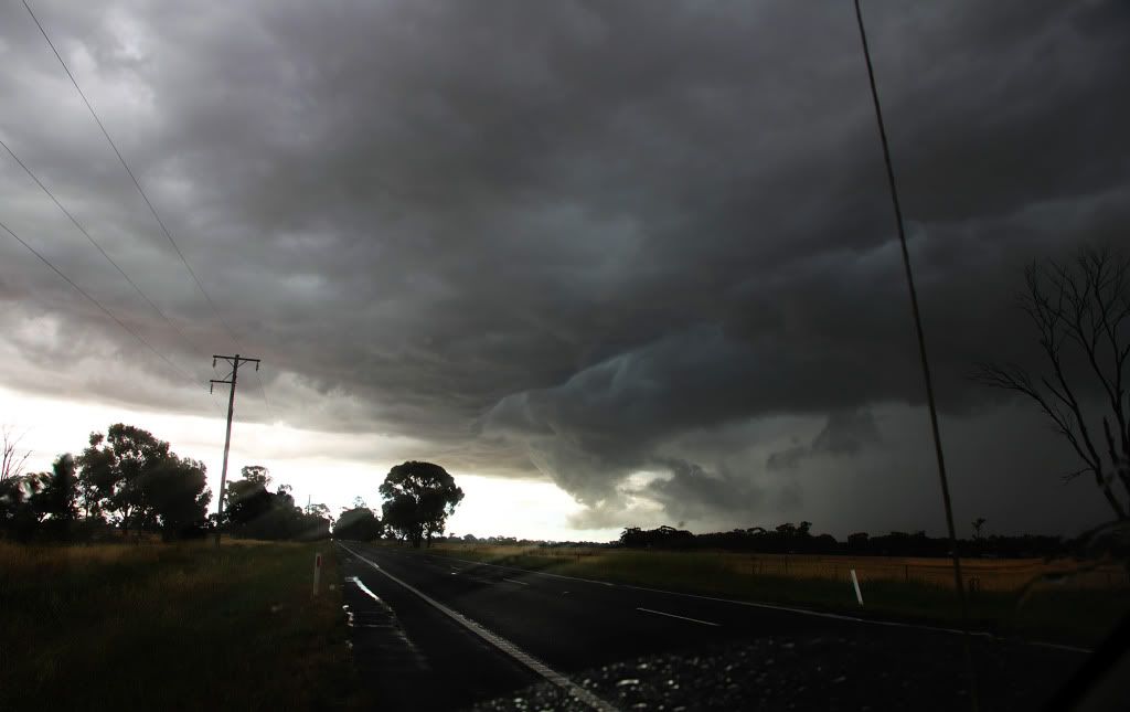
Finally sorted through some of my images, well one day anyway - these are all from Thursday 2nd, when all the action kicked off.
First few from the storm that originated out of NSW in the morning. I caught it just north of Corop. Thanks to Rikki for the advice about heading that way! This storm was rumbling like you wouldn't believe, continuous thunder. The inflow band and updraft base in the pics is what really caught my eye tho...
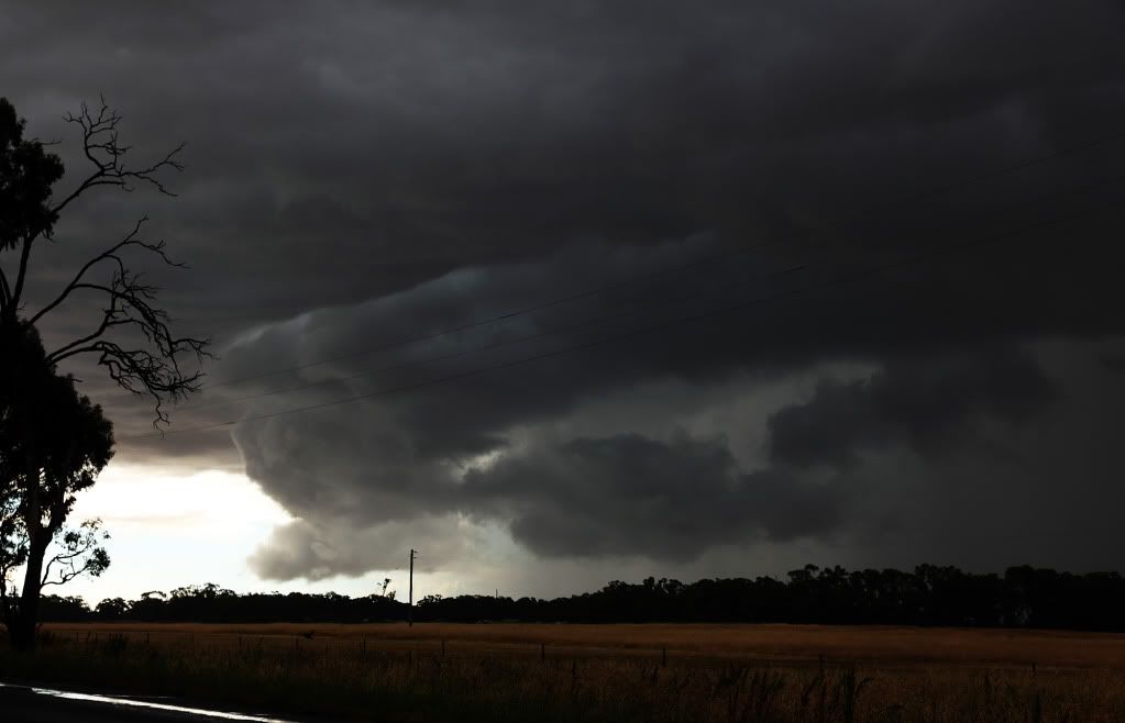
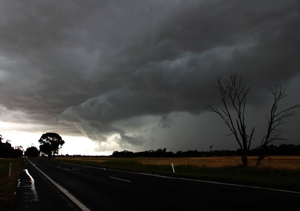
And the rest are from a storm I caught later in the day between Marong and Leichhardt. Didn't look that exciting at first...
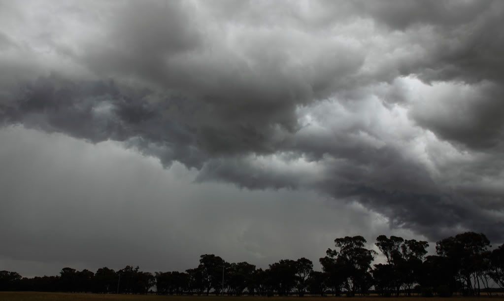
Although their were some interesting lowerings. Wall cloud, inflow? I dunno, probably neither, but it was interesting to watch....
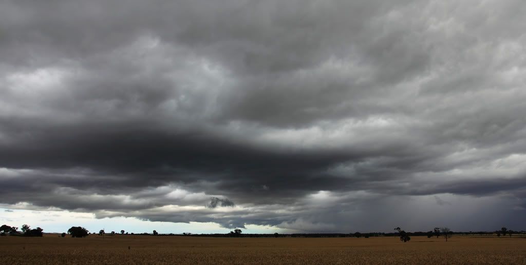
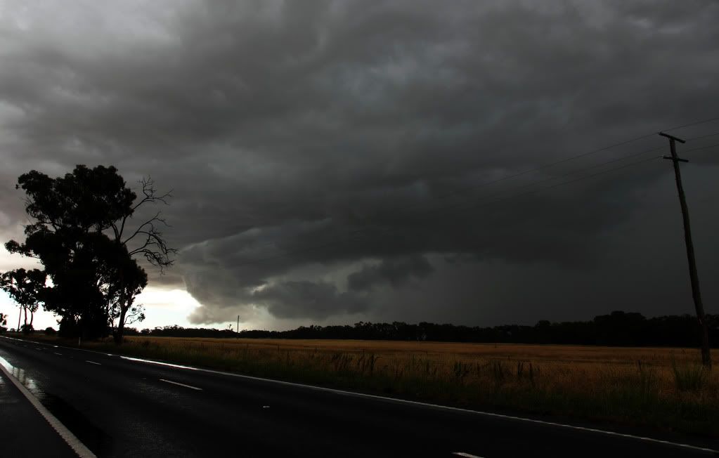
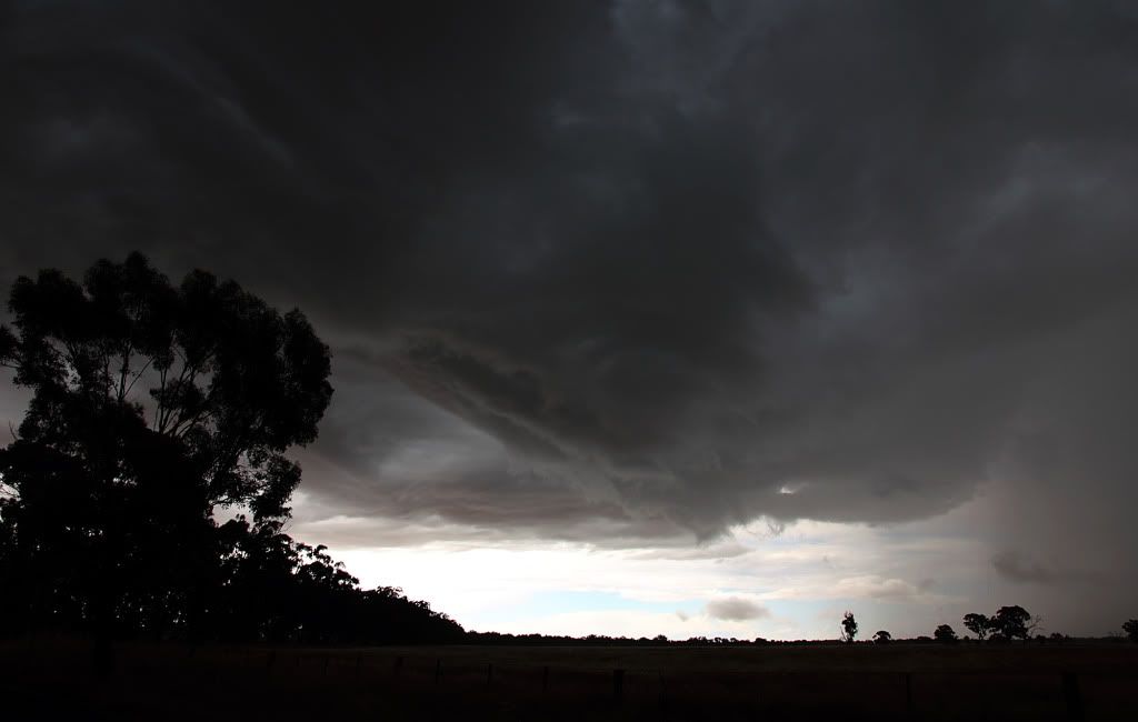
Rain started falling on me after a while in this spot, so darted around a bit more to try get a better view and was eventually greeted by this which stopped me dead in my tracks...
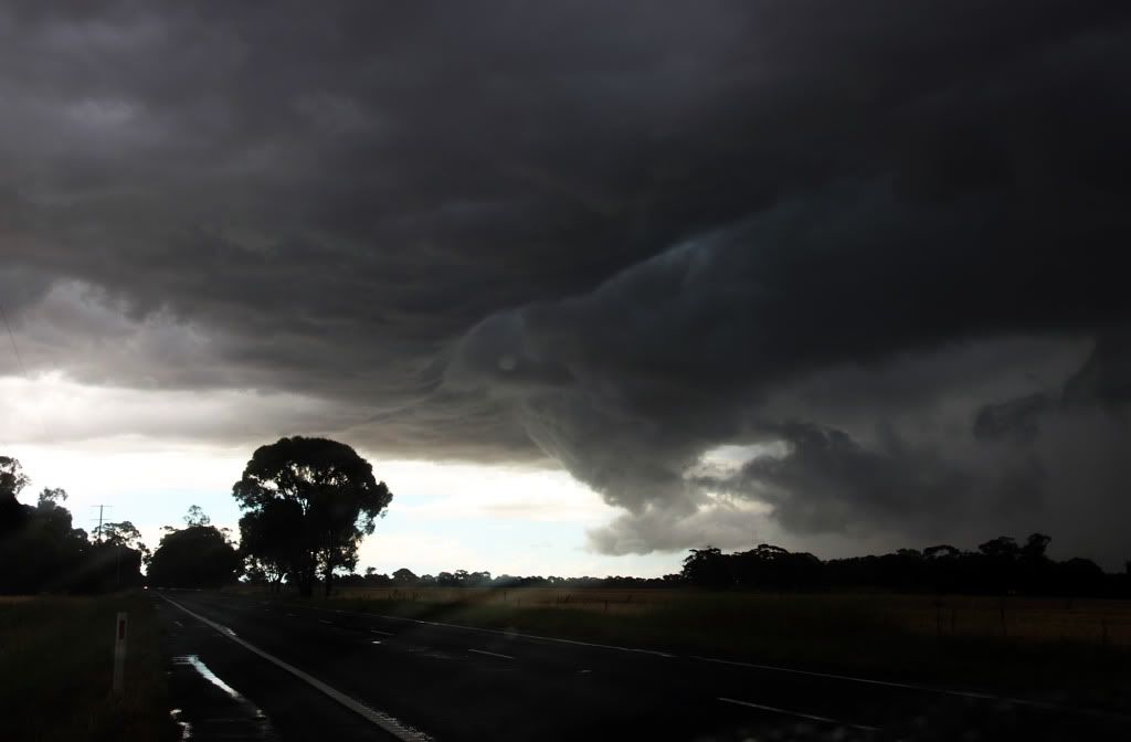
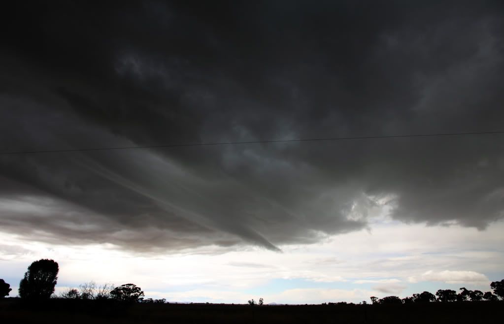
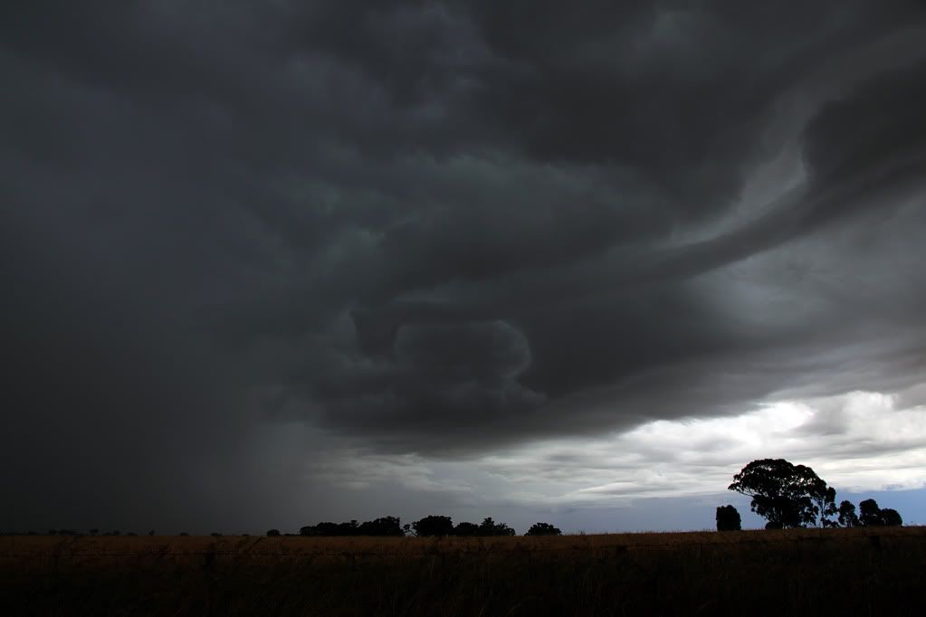
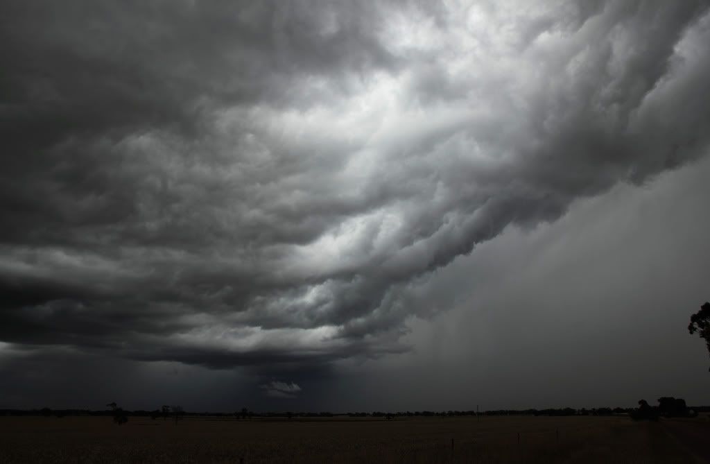
And then the storm as it moved away towards Bendigo...
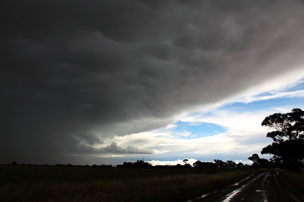
An awesome day. Little did I know it was going to get even better on Friday. Will have those pics in a day or two when I've had time to sort them out.
First few from the storm that originated out of NSW in the morning. I caught it just north of Corop. Thanks to Rikki for the advice about heading that way! This storm was rumbling like you wouldn't believe, continuous thunder. The inflow band and updraft base in the pics is what really caught my eye tho...
And the rest are from a storm I caught later in the day between Marong and Leichhardt. Didn't look that exciting at first...
Although their were some interesting lowerings. Wall cloud, inflow? I dunno, probably neither, but it was interesting to watch....
Rain started falling on me after a while in this spot, so darted around a bit more to try get a better view and was eventually greeted by this which stopped me dead in my tracks...
And then the storm as it moved away towards Bendigo...
An awesome day. Little did I know it was going to get even better on Friday. Will have those pics in a day or two when I've had time to sort them out.
-
AUSSKY

- Storm Chaser
- Reactions:
- Posts: 538
- Joined: Wed Nov 25, 2009 11:59 pm
- Location: Trentham (700m ASL)
- Contact:
Re: Victoria: Rain/Storm event: 29th Nov - 5th Dec (Obs)
Hi all......Great day out for the Trentham stormchasers, some bloody unbelievable downpours and a mammoth downburst near Ararat....Got under a strong pulse storm near Glenlyon and was absolutely astounded by a flash flood rolling stones off the nearby paddocks...the entire downhill part of the road just east of Glenlyon was a conveyor of stones rolled along by floodwater...never seen anything like it before....We chased to Newstead and captured a nice flanking line near Mt Franklin and then into 2cm hail. Called into Maryborough for tucker and nearly threw up when a bloke tried to charge me $6.85 for a chicken sanger !!!...but the best was yet to come as we drove southeast of Ararat and came across a lot of damage caused by straight line winds from a downburst ex the Beaufort storm...what an interesting day..all these severe storms and no shear just great slow moving pulsing monsters....best regards Clyve H and Jane O....
PS: lots more to come


PS: lots more to come
Australian Sky & Weather (AUSSKY)
Victoria - The State of Drizzle & Occasional Tornadoes
(1999 -2016)
Victoria - The State of Drizzle & Occasional Tornadoes
(1999 -2016)
-
Karl Lijnders

- Tornadic Supercell
- Reactions:
- Posts: 5771
- Joined: Sun Nov 22, 2009 11:17 pm
- Location: Knoxfield, Victoria
Re: Victoria: Rain/Storm event: 29th Nov - 5th Dec (Obs)
Brilliant chasing as always guys. Rocking it home!! Love it!
Nice to have some postive pages on this page to round out the afternoon. Thanks everyone for contributing.
I expect a better day tomorrow for the western half of VIC.
Nice to have some postive pages on this page to round out the afternoon. Thanks everyone for contributing.
I expect a better day tomorrow for the western half of VIC.
Former Owner - The Australian Weather Forum. Email me anytime - weatherman1000@hotmail.com
- Twister
- Cumulonumbus Calvas
- Reactions:
- Posts: 914
- Joined: Sun Nov 29, 2009 10:47 pm
- Location: Brisbane Qld
Re: Victoria: Rain/Storm event: 29th Nov - 5th Dec (Obs)
Interesting drive home today few weak cells in NW Vic then about 7pm some heavy showers and few Thunderstorms with some nice bolts all moving to SW
Another 2mm at home after the huge storm here yesterday though the rainfall gradient from that storm is VERY impressive
Airport 53mm
Home 5kms NE of Air port 15mm
Town 8km NE of air port 4mm
Light show was nuts with bolts every second for about half hour i missed an unreal show
Have had 90mm in last 10 days and another 40mm is looking good next few days.
Looks like HUGE storms on Tuesday get excited
Now Living in Wet QLD
- ShaneEEEE
- Cumulus
- Reactions:
- Posts: 50
- Joined: Sat Jan 02, 2010 2:30 pm
- Location: Lara, Victoria, Australia
Re: Victoria: Rain/Storm event: 29th Nov - 5th Dec (Images)
Hi All,
Awesome pics from all. I thought I would share one more from the 4th. A pan of the Minyip storm:

I have linked it to my gallery on my website which is under construction, so hopefully it works as planned.
Still going through all the 352 images taken on that day, so will be putting more up but storms every day is slowing this process down lol. Also have a few hours of video to go through.
Awesome pics from all. I thought I would share one more from the 4th. A pan of the Minyip storm:
I have linked it to my gallery on my website which is under construction, so hopefully it works as planned.
Still going through all the 352 images taken on that day, so will be putting more up but storms every day is slowing this process down lol. Also have a few hours of video to go through.
-
Karl Lijnders
- Tornadic Supercell
- Reactions:
- Posts: 5771
- Joined: Sun Nov 22, 2009 11:17 pm
- Location: Knoxfield, Victoria
Re: Victoria: Rain/Storm event: 29th Nov - 5th Dec (Images)
Very nice shots everyone. Soxy that is simply amazing!!!! 
Former Owner - The Australian Weather Forum. Email me anytime - weatherman1000@hotmail.com
-
AUS_Twisted

- Storm Chaser
- Reactions:
- Posts: 652
- Joined: Wed Nov 25, 2009 6:15 pm
- Location: Dandenong North, Melb
Re: Victoria: Rain/Storm event: 29th Nov - 5th Dec (Obs)
Very nice Jane and Clyve.
I drove down that same road with all the rocks all over the place with some rivers going down it, it looked like someone had lost there load spread down the road but could see how it was all pushed out from the sides from the heavy flowing water.
Got back not long ago which I ended up at Hamilton, I did not really plan to go chasing today as the far SW was the main target for storms but that changed quickly when I saw those big towers/anvils go up a lot closer west so decided to go check them out as I liked all the clear air around them. Was a good day chasing even though some of the country I went through is not ideal for it, there was some really nice views to see and lots of water around the place which could make for great photos in the right area.
Will post more later.
- Hamlan
- Storm Chaser
- Reactions:
- Posts: 449
- Joined: Tue Dec 22, 2009 11:05 pm
- Location: Northern suburbs
Re: Victoria: Rain/Storm event: 29th Nov - 5th Dec (Obs)
Haha I too ended up in Hamilton!!! what are the chances of a chaser convergence there.
After getting on to the atomic bomb updrafts near Kyneton at lunchtime (boy were they impressive) and seeing a large and briefly organised cell south of Malmsbury I was fortunate enough later and after lots of driving to get onto a gorgeous supercell near Lake Bolac!
Yes I know, on a day with poor shear it seems a long bow, however this cell near Lake Bolac was incredible with a persistent rotating updraft and I think classic supercell structure as I drove straight at it west from near north of Skipton in perfect chase country I had unobscured views as this structured machine pulled up low scud into funnels and tried repeatedly to condense down! This storm was truly a beauty with updraft clearly seperated from precip, long low level inflow, blue sky contrast, big elongated anvil mammatus and serious funnel action. Finally, the storm transitioned into a more LP structure where the rotating updraft was more revealed. In true LP style when it gave up the ghost it did it real quickly
  Photos and video look fantastic on quick review.
As I said in the stormchasing thread, I cant believe my last 10 or so days of chasing
Wed 24th Nov - LP corkscrewing storm (the pretzel!) in the southwest (cant confirm if the updraft was rotating long enough for supercell status or not)
Fri 26th Nov - Craigieburn supercell and then the Wallen convergence (close to tornadoing, no confirmation)
Tues 30th Nov - remnants of the strong deviant (left mover) cell from Flowerdale, with small funnels
Thurs 2nd Dec - Gisborne/Melton supercell timelapse from formation of the base (wow!)
Fri 3rd Dec - Elmore to Heathcote entire supercell lifecycle and boy did it want to tornado early and persistently!
Sat 4th Dec - nice organised storm near Heathcote
Sun 5th Dec - Kyneton severe and organised storm and then my days highlight, a gorgeous (perhaps classic with transition to LP) supercell near Lake Bolac which blew me away!
Brad.
After getting on to the atomic bomb updrafts near Kyneton at lunchtime (boy were they impressive) and seeing a large and briefly organised cell south of Malmsbury I was fortunate enough later and after lots of driving to get onto a gorgeous supercell near Lake Bolac!
Yes I know, on a day with poor shear it seems a long bow, however this cell near Lake Bolac was incredible with a persistent rotating updraft and I think classic supercell structure as I drove straight at it west from near north of Skipton in perfect chase country
As I said in the stormchasing thread, I cant believe my last 10 or so days of chasing
Wed 24th Nov - LP corkscrewing storm (the pretzel!) in the southwest (cant confirm if the updraft was rotating long enough for supercell status or not)
Fri 26th Nov - Craigieburn supercell and then the Wallen convergence (close to tornadoing, no confirmation)
Tues 30th Nov - remnants of the strong deviant (left mover) cell from Flowerdale, with small funnels
Thurs 2nd Dec - Gisborne/Melton supercell timelapse from formation of the base (wow!)
Fri 3rd Dec - Elmore to Heathcote entire supercell lifecycle and boy did it want to tornado early and persistently!
Sat 4th Dec - nice organised storm near Heathcote
Sun 5th Dec - Kyneton severe and organised storm and then my days highlight, a gorgeous (perhaps classic with transition to LP) supercell near Lake Bolac which blew me away!
Brad.
-
AUS_Twisted
- Storm Chaser
- Reactions:
- Posts: 652
- Joined: Wed Nov 25, 2009 6:15 pm
- Location: Dandenong North, Melb
Re: Victoria: Rain/Storm event: 29th Nov - 5th Dec (Obs)
Sounds very good Brad, I ended up down further SW to late but I stopped a few times SE of the Grampians for the lovely views.
This is my fav shot of the day taken at 6:24 PM, would really love to have a view like that again but with the CG closer lol. Will post more tomorrow or whenever I go through them properly.

This is my fav shot of the day taken at 6:24 PM, would really love to have a view like that again but with the CG closer lol. Will post more tomorrow or whenever I go through them properly.
-
Australis(Shell3155)

- Supercell
- Reactions:
- Posts: 3162
- Joined: Mon Nov 30, 2009 8:05 pm
- Location: FTG
- Contact:
Re: Victoria: Rain/Storm event: 29th Nov - 5th Dec (Obs)
I think you all should put in for a Helicopter, save hours on all the driving you do.
Brad you would nearly need new tyres in that 10 days.
In Janes pics someone had the wrong seasons winter clothes on.
16.4c @ 5am
Brad you would nearly need new tyres in that 10 days.
In Janes pics someone had the wrong seasons winter clothes on.
16.4c @ 5am
-
Australis(Shell3155)
- Supercell
- Reactions:
- Posts: 3162
- Joined: Mon Nov 30, 2009 8:05 pm
- Location: FTG
- Contact:
Re: Victoria: Rain/Storm event: 29th Nov - 5th Dec (Images)
Soxy.. Good One.
Shane E.. link work fine.
Shane E.. link work fine.
- Microburst
- Cumulus
- Reactions:
- Posts: 32
- Joined: Wed Nov 24, 2010 4:31 pm
- Location: Horsham
Re: Victoria: Rain/Storm event: 29th Nov - 5th Dec (Obs)
6mm here in Horsham thunder to our west already this morning just wondering when this is likely to drift our way, if things are the same as yesterday then it won't make it here, only chance is if it developes to our NE again. The radar in SE SA indicated some sort of change in movement of cells, but not sure when if at all the direction will move. Hope someone can help
-
Karl Lijnders
- Tornadic Supercell
- Reactions:
- Posts: 5771
- Joined: Sun Nov 22, 2009 11:17 pm
- Location: Knoxfield, Victoria
Re: Victoria: Rain/Storm event: 29th Nov - 5th Dec (Obs)
The shower and thunderstorm activity will develop during the late morning and early afternoon over the region Microburst and tend to train over the region from the NNE with locally heavy falls developing much as you had to your west overnight.
Should see 25-50mm.
Should see 25-50mm.
Former Owner - The Australian Weather Forum. Email me anytime - weatherman1000@hotmail.com