Welcome New Members! We want to hear from you. Register, stop lurking and start posting!
Victoria: Low pressure system. March 4th-10th 2010
- Madmel
- Cumulonimbus
- Reactions:
- Posts: 182
- Joined: Thu Nov 26, 2009 3:19 pm
- Location: Tarneit & Williamstown Vic
Re: Victoria: Low pressure system. March 4th-??? 2010
Possibly! Just had a look outside and the ants are pretty much evacuating here. I have never seen them swarm outs of their nests like this!!!!
-
Anthony Violi

- Supercell
- Reactions:
- Posts: 2652
- Joined: Mon Nov 23, 2009 9:03 pm
- Location: Lilydale
- Contact:
Re: Victoria: Low pressure system. March 4th-??? 2010
Report CG lightning to the NE from here.
Major shelf, convection and corkscrew updraught and rapidly developing flanking line as the complex heads into SW winds over S Central VIC. Could see some interesting phenomena in our region.
Looking fantastic for the E suburbs and all of Melbourne. Pencilling in 50mm.
Karl @AV's
Mel, the ants are going bonkers out here!!
http://www.therealworldweatherforum.com" onclick="window.open(this.href);return false;
avweatherforecasts.com
avweatherforecasts.com
- norfolk
- Supercell
- Reactions:
- Posts: 2024
- Joined: Thu Nov 26, 2009 7:03 pm
- Location: Caroline Springs, western Melbourne
- Contact:
Re: Victoria: Low pressure system. March 4th-??? 2010
also the wind has started to pick up here, which I think is a sure sign we will get something! But then I am in no doubt!
-
Duckey

- Cumulonimbus
- Reactions:
- Posts: 283
- Joined: Sun Mar 07, 2010 3:39 pm
- Location: Live: Croydon Work: Burwood
Re: Victoria: Low pressure system. March 4th-??? 2010
Hi everyone, I'm new as well although have been following this forum with great interest for a while!
I'm in Croydon North, we missed all the hail etc yesterday but was just on the back deck - looking VERY blue-black to the north and ominous. Still muggy here but gone very still.
Just looking at the radar, looks like the Shep supercell is merging with the Mansfield rain band - can anyone tell me what effect that may possibly have on the storm?
Thanks!
Duckey
Storm Nerd!!
- weathergasm
- Cumulonimbus
- Reactions:
- Posts: 244
- Joined: Sun Feb 14, 2010 9:32 pm
- Location: Box Hill
Re: Victoria: Low pressure system. March 4th-??? 2010
Don't mean to be a negative nancy or anything buuuuuut there is also the possibility that the pivot could very well ensure these storms miss Melbourne just to the west. A lot could happen between Seymour and the CBD.
- Scott Lawrance
- Cumulus
- Reactions:
- Posts: 84
- Joined: Thu Nov 26, 2009 9:13 am
- Location: Yea Victoria
- Contact:
Re: Victoria: Low pressure system. March 4th-??? 2010
Gosh - that storm is heading straight for us. Do you think I should get the car in the hay shed - does it have hail in it you think?
The Ghin Ghin Farmstore & Cafe
www.ghinghin.com.au
www.ghinghin.com.au
Re: Victoria: Low pressure system. March 4th-??? 2010
Just heard thunder. Gonna get my camera ready incase.norfolk wrote:getting dark here, the rain at least will be here very soon. Thunder and lightning in this or just rain?
-
Anthony Violi
- Supercell
- Reactions:
- Posts: 2652
- Joined: Mon Nov 23, 2009 9:03 pm
- Location: Lilydale
- Contact:
Re: Victoria: Low pressure system. March 4th-??? 2010
Hi Duckey,
Welcome to the forum. The nett affect will be - eastern suburbs will get slammed. I think another 50mm overnight. The fact we have SSW winds over south central areas will cause convergence which will regenerate convection locally causing the thunderstorms to increase.
Thunder here. Greenage to the NW.
Everyone this is my advice. PUT YOUR CARS UNDER COVER AND PLACE OLD TOWELS OVER THE WINDSCREEN AND BACK WINDOWS.
Karl @ AV's
http://www.therealworldweatherforum.com" onclick="window.open(this.href);return false;
avweatherforecasts.com
avweatherforecasts.com
-
Duckey
- Cumulonimbus
- Reactions:
- Posts: 283
- Joined: Sun Mar 07, 2010 3:39 pm
- Location: Live: Croydon Work: Burwood
Re: Victoria: Low pressure system. March 4th-??? 2010
Scott, after what happened in Melb yesterday, I wouldn't be taking any chances! Get the car under cover!!Scott Lawrance wrote:Gosh - that storm is heading straight for us. Do you think I should get the car in the hay shed - does it have hail in it you think?
Storm Nerd!!
Re: Victoria: Low pressure system. March 4th-??? 2010
Oh man look at that red core now! A bit of brown in it aswell now.
- Scott Lawrance
- Cumulus
- Reactions:
- Posts: 84
- Joined: Thu Nov 26, 2009 9:13 am
- Location: Yea Victoria
- Contact:
Re: Victoria: Low pressure system. March 4th-??? 2010
I hear you - doing it now!
The Ghin Ghin Farmstore & Cafe
www.ghinghin.com.au
www.ghinghin.com.au
- Jake Smethurst
- Supercell
- Reactions:
- Posts: 3583
- Joined: Mon Nov 23, 2009 8:49 pm
- Location: Cheltenham
Re: Victoria: Low pressure system. March 4th-??? 2010
Australian Government Bureau of Meteorology
Victoria Regional Office
TOP PRIORITY FOR IMMEDIATE BROADCAST
SEVERE THUNDERSTORM WARNING
for DAMAGING WIND, FLASH FLOODING and LARGE HAILSTONES
For people in the Northern Country, Northeast, North Central, Central and parts of the Western and Alpine Forecast Districts.
Issued at 5:14 pm Sunday, 7 March 2010.
Severe thunderstorms are likely to produce damaging winds, very heavy rainfall, flash flooding and large hailstones in the warning area over the next several hours. Locations which may be affected include Ballarat, Bendigo, Shepparton, Seymour, Maryborough, Geelong, Melbourne, Wodonga and Wangaratta.
Large hail of 3-4cm has been reported at Numurkah from a thunderstorm at around 4:30pm.
Flash flooding has been reported as a result of a thunderstorm in Shepparton at around 4:30pm.
36mm of rain was recorded in 30 minutes at Murchison.
The State Emergency Service advises that people should:
* Keep clear of fallen power lines.
* secure any loose objects in the vicinity of your home.
* keep away from creeks and drains.
* do not drive vehicles through flooded areas.
* stay indoors if possible.
* Avoid using the phone during the storm.
* if you are outside, avoid sheltering under trees
* listen to the radio for storm updates
* switch off your computer and electrical appliances
The next warning is due to be issued by 8:15 pm.
If severe thunderstorms develop in the Melbourne Area, a more detailed Severe Thunderstorm Warning will be issued to people in this area.
Jake - Senior AWF Forecaster
Feel free to send me a private message if you have any questions.
Feel free to send me a private message if you have any questions.
-
Anthony Violi
- Supercell
- Reactions:
- Posts: 2652
- Joined: Mon Nov 23, 2009 9:03 pm
- Location: Lilydale
- Contact:
Re: Victoria: Low pressure system. March 4th-??? 2010
This is insane!!! Lightning not far away and thunderstorms merging in with the main cells...i keep repeating myself....ONE FOR THE AGES!!!
http://www.therealworldweatherforum.com" onclick="window.open(this.href);return false;
avweatherforecasts.com
avweatherforecasts.com
Re: Victoria: Low pressure system. March 4th-??? 2010
Lol nice work AV, you got it correct right from the start.Anthony Violi wrote:This is insane!!! Lightning not far away and thunderstorms merging in with the main cells...i keep repeating myself....ONE FOR THE AGES!!!
-
Leasy

- Cumulonimbus
- Reactions:
- Posts: 216
- Joined: Wed Nov 25, 2009 6:50 pm
- Location: London, United Kingdom
Re: Victoria: Low pressure system. March 4th-??? 2010
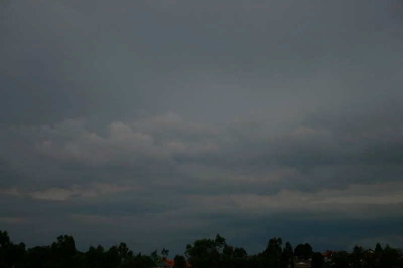
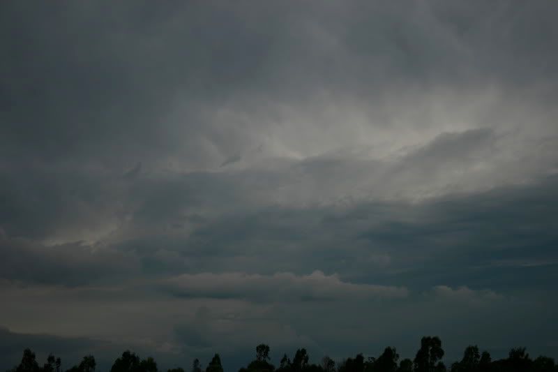
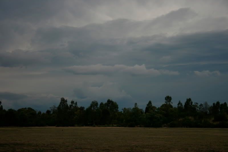
A couple of shots taken 15 minutes ago looking to the north - looks very unstable! A southerly wind has whipped up, quite strong but nice and refreshing due to the stinking humidity out there.
Taken at the park near my place in Mill Park...
Taken at the park near my place in Mill Park...
-
Duckey
- Cumulonimbus
- Reactions:
- Posts: 283
- Joined: Sun Mar 07, 2010 3:39 pm
- Location: Live: Croydon Work: Burwood
Re: Victoria: Low pressure system. March 4th-??? 2010
Lol just gave myself a heart attack! Went to pull up the front canvas blind and found a huntsman hiding under there....freaked me out....don't they like to hide away when it's going to rain? We hardley ever get them at our place, no trees around the house. Now have to go and convice the hubby to shoo it away and not let it inside.
VERY dark outside now and think I heard a rumble.....
VERY dark outside now and think I heard a rumble.....
Storm Nerd!!
Re: Victoria: Low pressure system. March 4th-??? 2010
Light rain now. Nothing big to report on yet.
- Madmel
- Cumulonimbus
- Reactions:
- Posts: 182
- Joined: Thu Nov 26, 2009 3:19 pm
- Location: Tarneit & Williamstown Vic
Re: Victoria: Low pressure system. March 4th-??? 2010
Wow if this thing hits hard as predicted I may have to turn of the computer again. Had very close call yesterday with a massive close strike in the area. Ill we prolly be outside trying to take pics LOL
-
mick

- Supercell
- Reactions:
- Posts: 1453
- Joined: Mon Nov 30, 2009 6:45 pm
- Location: Mid North SA Baaaaaaaaaaaaaaa
Re: Victoria: Low pressure system. March 4th-??? 2010
Massive inflow from the east here.