Starting to appear on a number of forecast models is the presence of a LWT and associated cold fronts and possible deep low pressure system over South Eastern Australia.
Potentially some good falls of rain and snow in the mix, and it may last for a while well beyond June 10th...

Welcome New Members! We want to hear from you. Register, stop lurking and start posting!
Strong Cold Front & Low: 7th - 10th June
- StratoBendigo
- Supercell
- Reactions:
- Posts: 2809
- Joined: Fri Jan 02, 2015 2:18 pm
- Location: Kangaroo Flat
-
hillybilly

- Site Admin/Moderator
- Reactions:
- Posts: 4979
- Joined: Thu Nov 26, 2009 7:26 am
- Location: Howden Tasmania, 25m above sea level
- Contact:
Re: Strong Cold Front & Low: 7th - 10th June
EC is getting very excited. Huge low, starts cold then wraps in some milder Tasman Sea air. Still too far out to be confident about details.
Meanwhile a couple of weak troughs this week. Might see a few mms to get winter started.
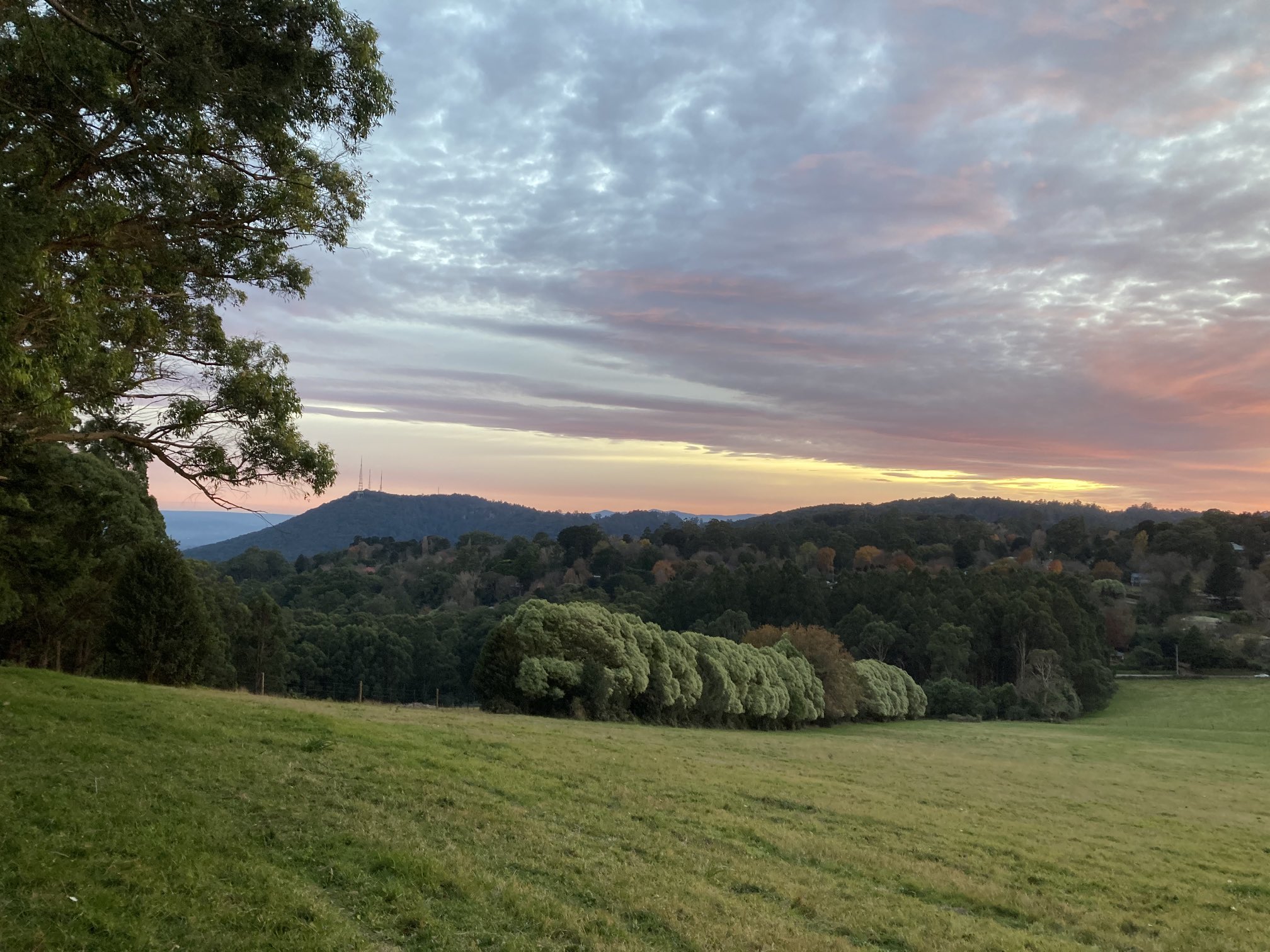
Oh… And here is a photo of the first sunrise of winter. Nice day here and quite mild, though a bit blustery.
Meanwhile a couple of weak troughs this week. Might see a few mms to get winter started.
Oh… And here is a photo of the first sunrise of winter. Nice day here and quite mild, though a bit blustery.
- Tassiedave
- Supercell
- Reactions:
- Posts: 1098
- Joined: Thu Nov 11, 2010 11:09 am
- Location: Grindelwald Tasmania
Re: Strong Cold Front & Low: 7th - 10th June
Hobart May stats Average Max Temp 15.7 degrees Long Term avge 14.5 Rainfall 12.6mm Average is 47.0 mm
Launceston May stats Average Max Temp 16.1 degrees Long Term avge 15.8 Rainfall 52.0mm Average is 65.0 mm
Launceston May stats Average Max Temp 16.1 degrees Long Term avge 15.8 Rainfall 52.0mm Average is 65.0 mm
Re: Strong Cold Front & Low: 7th - 10th June
Ended up with 88mm here for May with the average being about 40mm.
- Gordon
- Supercell
- Reactions:
- Posts: 2888
- Joined: Thu Jun 17, 2010 10:01 am
- Location: Near Gordon, Vic. 620 m asl
Re: Strong Cold Front & Low: 7th - 10th June
Looking like a monster system on latest GFS and ACCESS too - might be a case of, 'be careful what we wish for'.hillybilly wrote: ↑Tue Jun 01, 2021 6:51 pm EC is getting very excited. Huge low, starts cold then wraps in some milder Tasman Sea air. Still too far out to be confident about details.
(PS: Beautiful pic.)
- Derwent
- Cumulonimbus
- Reactions:
- Posts: 119
- Joined: Tue Jul 09, 2019 10:44 am
- Location: Huonville Tasmania
Re: Strong Cold Front & Low: 7th - 10th June
Hopefully Hobart will get some decent rain.
Talking to the green keepers at the Richmond course ( near Hobart airport) and they are still pouring plenty of water into the course to stop it going brown and hard.
Talking to the green keepers at the Richmond course ( near Hobart airport) and they are still pouring plenty of water into the course to stop it going brown and hard.
- StratoBendigo
- Supercell
- Reactions:
- Posts: 2809
- Joined: Fri Jan 02, 2015 2:18 pm
- Location: Kangaroo Flat
Re: Strong Cold Front & Low: 7th - 10th June
GFS has scaled things down but EC is very bullish for next week. A lot will depend on how the Low forms and where it tracks.
Another of those 5-80mm possibilities.
Another of those 5-80mm possibilities.
- Derwent
- Cumulonimbus
- Reactions:
- Posts: 119
- Joined: Tue Jul 09, 2019 10:44 am
- Location: Huonville Tasmania
Re: Strong Cold Front & Low: 7th - 10th June
On the way to another sunny warm Spring day in Hobart currently 14c and rising .
Re: Strong Cold Front & Low: 7th - 10th June
LOL "bullish". I am screen shotting EC as one of the all time fun forecasts for us. Yes they are flakes.
- CaptureEC.PNG (22.05 KiB) Viewed 7961 times
- Gordon
- Supercell
- Reactions:
- Posts: 2888
- Joined: Thu Jun 17, 2010 10:01 am
- Location: Near Gordon, Vic. 620 m asl
Re: Strong Cold Front & Low: 7th - 10th June
BOM certainly bullish https://www.weatherzone.com.au/news/bom ... ter/534233 for 'cold power' element. Unusual for them to acknowledge exceptional weather this far out.
ACCESS & GFS still looking impressive too for the system as a whole, i.e. a huge low over most of SE Australia. Detail is the question.
ACCESS & GFS still looking impressive too for the system as a whole, i.e. a huge low over most of SE Australia. Detail is the question.
- Sean
- Supercell
- Reactions:
- Posts: 1000
- Joined: Mon Feb 27, 2012 6:35 pm
- Location: Patterson Lakes - SE Melb
Re: Strong Cold Front & Low: 7th - 10th June
The charts look very enticing right now, but I refuse to get excited 
-
hillybilly
- Site Admin/Moderator
- Reactions:
- Posts: 4979
- Joined: Thu Nov 26, 2009 7:26 am
- Location: Howden Tasmania, 25m above sea level
- Contact:
Re: Strong Cold Front & Low: 7th - 10th June
Bit of an underwhelming in between system this one. A few mms tonight in the north, mainly spits in south. Really mild for winter with mid to high teens. 13C here which is pretty warm for us in June.
Next week look very hopeful. Big system. Chilly at first but warms with a warm wrap around which usually means lots of rain through eastern parts. Snow further north, potentially reaching southern Queensland Gone a bit under the radar how dry it’s been for parts of Vic last few months. Spots in the Wimmera and Mallee just had their driest Feb to May on record Hope this one delivers.
Next week look very hopeful. Big system. Chilly at first but warms with a warm wrap around which usually means lots of rain through eastern parts. Snow further north, potentially reaching southern Queensland
- QldTwister
- Cumulonimbus
- Reactions:
- Posts: 432
- Joined: Tue May 22, 2012 7:56 pm
- Location: Ashwood Vic
Re: Strong Cold Front & Low: 7th - 10th June
Def not under the radar, they are really struggling up there just everyone mostly cares about their local area
Yeah hopefully big soak for many that have missed out next week but such a big low any wobbles will make all the difference between 50mm and 5mm
Big week of model watching to come hopefully a big soak for many
Yeah hopefully big soak for many that have missed out next week but such a big low any wobbles will make all the difference between 50mm and 5mm
Big week of model watching to come hopefully a big soak for many
Bring on the heat and stroms
- Sean
- Supercell
- Reactions:
- Posts: 1000
- Joined: Mon Feb 27, 2012 6:35 pm
- Location: Patterson Lakes - SE Melb
Re: Strong Cold Front & Low: 7th - 10th June
BOM and weatherzone getting on board now.
EC has wiggled a bit and now has Melbourne in direct line of heavy rainfall (heaping snow in alpine areas, meanwhile).
Of course, it's going to a wiggle a lot more. Still a week out.
EC has wiggled a bit and now has Melbourne in direct line of heavy rainfall (heaping snow in alpine areas, meanwhile).
Of course, it's going to a wiggle a lot more. Still a week out.
-
hillybilly
- Site Admin/Moderator
- Reactions:
- Posts: 4979
- Joined: Thu Nov 26, 2009 7:26 am
- Location: Howden Tasmania, 25m above sea level
- Contact:
Re: Strong Cold Front & Low: 7th - 10th June
0.6mm in the gauge. Better falls in the north as expected.
Winds go swly tomorrow with more showers in the south. Next week holding, and if anything looking better. Could be a big snow producer in the alps.
Winds go swly tomorrow with more showers in the south. Next week holding, and if anything looking better. Could be a big snow producer in the alps.
- Tassiedave
- Supercell
- Reactions:
- Posts: 1098
- Joined: Thu Nov 11, 2010 11:09 am
- Location: Grindelwald Tasmania
Re: Strong Cold Front & Low: 7th - 10th June
Latest GFS looks very good for Tassie! We need it
- StratoBendigo
- Supercell
- Reactions:
- Posts: 2809
- Joined: Fri Jan 02, 2015 2:18 pm
- Location: Kangaroo Flat
Re: Strong Cold Front & Low: 7th - 10th June
13mm overnight. Quite a surprise.
I hope the Wimmera and Mallee get something next week. They keep missing out.
I hope the Wimmera and Mallee get something next week. They keep missing out.
- stevco123
- Supercell
- Reactions:
- Posts: 2936
- Joined: Sat Aug 07, 2010 7:42 pm
- Location: Cranbourne 78m asl
Re: Strong Cold Front & Low: 7th - 10th June
At least they got a little yesterday i supposeStratoBendigo wrote: ↑Thu Jun 03, 2021 7:34 am 13mm overnight. Quite a surprise.
I hope the Wimmera and Mallee get something next week. They keep missing out.
https://www.weatherlink.com/bulletin/53 ... 76dd68e8bc: for current weather updated every 2 minutes
Re: Strong Cold Front & Low: 7th - 10th June
3.2mm here overnight.