
Welcome New Members! We want to hear from you. Register, stop lurking and start posting!
Last gasp Warmth and Cut-off Low to start May 2021
- StratoBendigo
- Supercell
- Reactions:
- Posts: 2809
- Joined: Fri Jan 02, 2015 2:18 pm
- Location: Kangaroo Flat
Last gasp Warmth and Cut-off Low to start May 2021
The first weekend of May looks quite warm (up to mid-20s) before a cut-off Low develops over the State with potential for good Autumn rainfall. EC suggests it may hang around for several days. Something to keep an eye on.
- Gordon
- Supercell
- Reactions:
- Posts: 2889
- Joined: Thu Jun 17, 2010 10:01 am
- Location: Near Gordon, Vic. 620 m asl
Re: Last gasp Warmth and Cut-off Low to start May 2021
A wee bit more warmth would be nice after an unusually cold few weeks of April - we're now running half a degree below average despite a warm first week of the month.
Rain would be handy too - although we've managed to scrape together 10mm over the last week, we're still just 32.5mm mtd, which will nearly be it, versus 51.5mm average. (YTD is still comfortably ahead thanks to a wet Jan and March)
PS: WATL looking good for this system.
Rain would be handy too - although we've managed to scrape together 10mm over the last week, we're still just 32.5mm mtd, which will nearly be it, versus 51.5mm average. (YTD is still comfortably ahead thanks to a wet Jan and March)
PS: WATL looking good for this system.
- StratoBendigo
- Supercell
- Reactions:
- Posts: 2809
- Joined: Fri Jan 02, 2015 2:18 pm
- Location: Kangaroo Flat
Re: Last gasp Warmth and Cut-off Low to start May 2021
We're on 7mm MTD. Very lean for April but our big January and March downpours are keeping us above-average YTD (180mm so far in 2021).
00z GFS is looking the goods for next week, especially for Southern and Eastern Vic.
00z GFS is looking the goods for next week, especially for Southern and Eastern Vic.
- Gordon
- Supercell
- Reactions:
- Posts: 2889
- Joined: Thu Jun 17, 2010 10:01 am
- Location: Near Gordon, Vic. 620 m asl
Re: Last gasp Warmth and Cut-off Low to start May 2021
Just like that, GFS and EC have dumped this system for the time being, but if anything it's better on WATL this morning 
Edit: GFS back on with the 18Z run.
Edit: GFS back on with the 18Z run.
- Derwent
- Cumulonimbus
- Reactions:
- Posts: 119
- Joined: Tue Jul 09, 2019 10:44 am
- Location: Huonville Tasmania
Re: Last gasp Warmth and Cut-off Low to start May 2021
I wouldn’t be placing any bets about the last gasp of warmth just yet. It just keeps coming back to bite the last 10 years . Will only take another large High and it will be back .
-
hillybilly

- Site Admin/Moderator
- Reactions:
- Posts: 4984
- Joined: Thu Nov 26, 2009 7:26 am
- Location: Howden Tasmania, 25m above sea level
- Contact:
Re: Last gasp Warmth and Cut-off Low to start May 2021
Progs tending to look a bit better for Vic. Complex system and slow moving so rain gradients will be tight and details will matter a lot. Currently looks like west central up to the Wimmera and East Gippsland and best inline for substantial falls. EC is currently showing very heavy falls into the the Gippsland hills.
Meanwhile, very warm Saturday, and Sunday in the north and east. Could well see a 30C pop up.
Meanwhile, very warm Saturday, and Sunday in the north and east. Could well see a 30C pop up.
- StratoBendigo
- Supercell
- Reactions:
- Posts: 2809
- Joined: Fri Jan 02, 2015 2:18 pm
- Location: Kangaroo Flat
Re: Last gasp Warmth and Cut-off Low to start May 2021
EC and CMA for the win on Tuesday. But so much uncertainty and looks quite messy.
-
Petros

- Supercell
- Reactions:
- Posts: 2001
- Joined: Tue Dec 01, 2009 6:25 pm
- Location: Maffra, Gippsland, Vic
Re: Last gasp Warmth and Cut-off Low to start May 2021
Going by the latest model runs available to me, ....looks like a chance of a cut-off low forming on the Murray central Nth Vic next Tuesday?
That could create 2-3inches of rain into Gippsland.
....finally something to watch for a change. After a good start to the year, only a half an inch of rain for April in Gippy. We have reverted to dry as a crisp. But great for the seasonal forest fire burns.
That could create 2-3inches of rain into Gippsland.
....finally something to watch for a change. After a good start to the year, only a half an inch of rain for April in Gippy. We have reverted to dry as a crisp. But great for the seasonal forest fire burns.
-
hillybilly
- Site Admin/Moderator
- Reactions:
- Posts: 4984
- Joined: Thu Nov 26, 2009 7:26 am
- Location: Howden Tasmania, 25m above sea level
- Contact:
Re: Last gasp Warmth and Cut-off Low to start May 2021
Progs are too jumpy. Now focusing more on NSW, but northern and eastern Vic may do ok. It’s very complex with a deep upper trough amplifying and upslide developing (basically strong warm air advection). Where that happens is where the low will form.
Meanwhile, a few warm days ahead.
Meanwhile, a few warm days ahead.
- Tassiedave
- Supercell
- Reactions:
- Posts: 1098
- Joined: Thu Nov 11, 2010 11:09 am
- Location: Grindelwald Tasmania
Re: Last gasp Warmth and Cut-off Low to start May 2021
GFS has jumped right off...
-
hillybilly
- Site Admin/Moderator
- Reactions:
- Posts: 4984
- Joined: Thu Nov 26, 2009 7:26 am
- Location: Howden Tasmania, 25m above sea level
- Contact:
Re: Last gasp Warmth and Cut-off Low to start May 2021
Cant keep up with the model jumps. Each run is different. EC off and now back on with lots for the west and east but not much inbetween. GFS widespread good falls. CMC good falls expect near the coast.
Take your pick
Will be a warm one today, and warm start to Sunday. Showers and storms through the arvo into the evening on Sunday. Think watching the radar will be the go... Rainbands for Monday, and slow moving. Could focus north, south, east or west.
Take your pick
Will be a warm one today, and warm start to Sunday. Showers and storms through the arvo into the evening on Sunday. Think watching the radar will be the go... Rainbands for Monday, and slow moving. Could focus north, south, east or west.
- Derwent
- Cumulonimbus
- Reactions:
- Posts: 119
- Joined: Tue Jul 09, 2019 10:44 am
- Location: Huonville Tasmania
Re: Last gasp Warmth and Cut-off Low to start May 2021
Going to be very warm day down in Hobart, the fireball in the sky looking more like January.
D81360A4-7DAC-4EA7-A9E3-69B020805635.jpeg
D81360A4-7DAC-4EA7-A9E3-69B020805635.jpeg
- weathergasm
- Cumulonimbus
- Reactions:
- Posts: 244
- Joined: Sun Feb 14, 2010 9:32 pm
- Location: Box Hill
Re: Last gasp Warmth and Cut-off Low to start May 2021
Relative upgrade from the BOM this afternoon, talking up chance of storms for tomorrow afternoon, with slightly increased rain totals for the following two or three days.
- StratoBendigo
- Supercell
- Reactions:
- Posts: 2809
- Joined: Fri Jan 02, 2015 2:18 pm
- Location: Kangaroo Flat
Re: Last gasp Warmth and Cut-off Low to start May 2021
OCF Ensemble has definitely upgraded. Might be more like 20mm-ish here which would be great.
-
hillybilly
- Site Admin/Moderator
- Reactions:
- Posts: 4984
- Joined: Thu Nov 26, 2009 7:26 am
- Location: Howden Tasmania, 25m above sea level
- Contact:
Re: Last gasp Warmth and Cut-off Low to start May 2021
27.4C at Mildura and 26.2C at Avalon the warmest for Vic and metro yesterday. Didn’t really feel like the first of May Today could go a degree or two higher. Odd shower moving in and maybe a rumble. It is quite unstable, with steep lapse rates through the middle atmosphere, but surface heating is always an issue this close to the solstice.
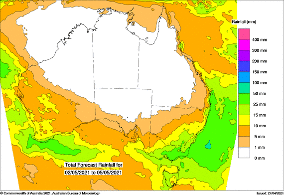
Quite an upgrade across all the models for Monday and Tuesday with the low developing further south not far from Gabo Island. West central and Gippsland looking the best atm. Not so got for those in the cropping regions with the Mallee and Wimmera looking like being too far northwest.
The upper trough is quite cold so could get some significant snow in the alps. Looks like a Dinner Plain, Baw Baw and Thredbo favouring system, though temps a bit marginal at times so not sure how well it will accumulate. Will feel quite wintery in southern areas Monday and Tuesday with gusty southerlies setting in and a cold rain.
- StratoBendigo
- Supercell
- Reactions:
- Posts: 2809
- Joined: Fri Jan 02, 2015 2:18 pm
- Location: Kangaroo Flat
Re: Last gasp Warmth and Cut-off Low to start May 2021
Just for comparison, May 1990 saw temps as high as 28c at Walpeup. Also a 28.1c at Melb in May 2002. (28.9c in Ouyen).
Mildura will get close to that today.
Mildura will get close to that today.
- stevco123
- Supercell
- Reactions:
- Posts: 2936
- Joined: Sat Aug 07, 2010 7:42 pm
- Location: Cranbourne 78m asl
Re: Last gasp Warmth and Cut-off Low to start May 2021
Side topic slightly, but that 28 degree in 2002 for Melbourne is almost definitely inaccurate. I don't consider temperatures recorded at the old Melbourne site from about 2000 until the new station set up. All those temps are questionable as the area was artificially warmer than other areas (the very reason why the station was moved to Melbourne Olympic Park).StratoBendigo wrote: ↑Sun May 02, 2021 8:49 am Just for comparison, May 1990 saw temps as high as 28c at Walpeup. Also a 28.1c at Melb in May 2002. (28.9c in Ouyen).
Mildura will get close to that today.
https://www.weatherlink.com/bulletin/53 ... 76dd68e8bc: for current weather updated every 2 minutes
- QldTwister
- Cumulonimbus
- Reactions:
- Posts: 434
- Joined: Tue May 22, 2012 7:56 pm
- Location: Ashwood Vic
Re: Last gasp Warmth and Cut-off Low to start May 2021
LOVE, LOVE, LOVING this weather just magic for May so nice spend all day outside everyone happy getting out and about how can you not love this weather house fully open its great. 
Messy week some will do well, others will miss out will be cold and wet too
Fun few days of watching Sat and radar sadly areas that really really need it look to miss out but hopefully not.
If you looking for active weather next 2 weeks should provide it
Interesting times ahead
Get out there and enjoy the warmth this will be it
Bring on the heat and stroms
- StratoBendigo
- Supercell
- Reactions:
- Posts: 2809
- Joined: Fri Jan 02, 2015 2:18 pm
- Location: Kangaroo Flat
Re: Last gasp Warmth and Cut-off Low to start May 2021
A bit of Cu has popped up just West of here. Maybe a storm in the mix this afternoon?
EC has edged totals up to 13mm for this week. GFS still not very interested in much.
EC has edged totals up to 13mm for this week. GFS still not very interested in much.
-
Didjman

- Supercell
- Reactions:
- Posts: 2099
- Joined: Fri Sep 03, 2010 2:52 pm
- Location: Wallan, Vic 328m ASL
- Contact:
Re: Last gasp Warmth and Cut-off Low to start May 2021
A line is developing on Satpic and radar from King Island to Swan Hill. There is a lot of Lightning around KI, some west of Wederburn and some west of Daylesford. Moving SE.StratoBendigo wrote: ↑Sun May 02, 2021 2:05 pm A bit of Cu has popped up just West of here. Maybe a storm in the mix this afternoon?