The WA cyclone looks to have a similar track to TC Hazel in 1979. That one left quite a mess.
In not expecting anything more than 1 mm here.

Welcome New Members! We want to hear from you. Register, stop lurking and start posting!
Series of front with possible cold outbreak: April 8-12
- StratoBendigo
- Supercell
- Reactions:
- Posts: 2809
- Joined: Fri Jan 02, 2015 2:18 pm
- Location: Kangaroo Flat
-
hillybilly

- Site Admin/Moderator
- Reactions:
- Posts: 4979
- Joined: Thu Nov 26, 2009 7:26 am
- Location: Howden Tasmania, 25m above sea level
- Contact:
Re: Series of front with possible cold outbreak: April 8-12
Turned showery here with fog drifting in over the trees. Icy 48 hours coming up. Hope a bit spills over into the north, though looks pretty hit and miss once you cross the divide. Just 7.6C for a min and another mm in the gauge here since yesterday.
Substantial snow producer coming up. Thinking Lake Mt and Baw Baw should see a solid cover by this time tomorrow.
Btw also a huge wave event. Significant waves forecast to exceed 11m just off the Victorian coast. This Victorian record appears to be about 12m, though such things are not well observed. Puts this one up there with big historical wave events. The tides are low this weekend which will take the edge off thing. Anyone on the coast be interested to see photos from a safe spot. I’d usually make a dash to Walkerville, but instead will be heading to Marysville as snow calls
Hazel looks like the best analogue for this cyclone, but that low ran inland. This one looks particular unusual in running a speed into the coast near Geraldton. It then take a wierd pause and drifts south before darting inland. Perth is lucky going off the current Progs as it gets remarkably close to Perth, but swings east just before
-
hillybilly
- Site Admin/Moderator
- Reactions:
- Posts: 4979
- Joined: Thu Nov 26, 2009 7:26 am
- Location: Howden Tasmania, 25m above sea level
- Contact:
Re: Series of front with possible cold outbreak: April 8-12
Just had a cracking coldies pass just south of here. Couple of crack booms, gusty winds and bit of hail. Just on 4mm for the day. Missed the best of it so far with 5-15mm to the south of me.
Expecting lots of showers to set up over the bay as the night goes on.
First snow falling in the alps.
Expecting lots of showers to set up over the bay as the night goes on.
First snow falling in the alps.
Re: Series of front with possible cold outbreak: April 8-12
Unremarkable max of 14.1 here today. Encouraging radar and satellite though.
-
Onetahuti

- Supercell
- Reactions:
- Posts: 2790
- Joined: Thu Mar 25, 2010 9:37 pm
- Location: Dandenong Nth.
Re: Series of front with possible cold outbreak: April 8-12
Patchy to your south, Melbourne Water site at Rowville has had 4.8 mm since 9 a.m. I am about 2 km south of it and have had 13.2 mm so far. One short lived torrential fall between 6 and 7 pm gave me 6mm it had only 2mm, also had a short heavy fall during the afternoon.hillybilly wrote: ↑Sat Apr 10, 2021 6:49 pm Just on 4mm for the day. Missed the best of it so far with 5-15mm to the south of me.
Expecting lots of showers to set up over the bay as the night goes on.
- snowfall
- Supercell
- Reactions:
- Posts: 1283
- Joined: Mon Mar 20, 2017 7:39 pm
- Location: Gisborne South (349m asl)
Re: Series of front with possible cold outbreak: April 8-12
9.8mm here today. We had a few showers during the day followed by a long period of rain this evening, with the occasional heavy burst. Didn’t see any hail but I heard a rumble of distant thunder this evening. Currently 5c, so a chilly one for sure. Interesting watching the temp gradually fall as the day went on. A nice blast of mini-winter weather!
- Macedonian
- Supercell
- Reactions:
- Posts: 2330
- Joined: Mon Dec 21, 2009 10:44 pm
- Location: Mount Macedon Vic at 870m above sea level
Re: Series of front with possible cold outbreak: April 8-12
Can't quite believe it but I have been having snow flurries over the last hour and a half. Top temp of 9.8C today and currently 2C now.
Home- "Shepherd's Bush" at Mt Macedon. 870m
Work- "Bolobek" at Macedon. 430m
Work- "Bolobek" at Macedon. 430m
-
Australis(Shell3155)

- Supercell
- Reactions:
- Posts: 3146
- Joined: Mon Nov 30, 2009 8:05 pm
- Location: FTG
- Contact:
Re: Series of front with possible cold outbreak: April 8-12
Scoresby station noting 5mm
My guess is a fair amount more for here..
yellow on radar with a driveway river flowing..
I’ll be checking the dog bowl at daylight..
one flash of lightening
Edit.. kaboom.. massive
Edit #2.. Hail
My guess is a fair amount more for here..
yellow on radar with a driveway river flowing..
I’ll be checking the dog bowl at daylight..
one flash of lightening
Edit.. kaboom.. massive
Edit #2.. Hail
-
Australis(Shell3155)
- Supercell
- Reactions:
- Posts: 3146
- Joined: Mon Nov 30, 2009 8:05 pm
- Location: FTG
- Contact:
Re: Series of front with possible cold outbreak: April 8-12
Ferny crk 34
Scoresby 17
More to come with red.
Great day for first game back of kids footy,
50 game banner may not make it to run through..
Scoresby 17
More to come with red.
Great day for first game back of kids footy,
50 game banner may not make it to run through..
-
hillybilly
- Site Admin/Moderator
- Reactions:
- Posts: 4979
- Joined: Thu Nov 26, 2009 7:26 am
- Location: Howden Tasmania, 25m above sea level
- Contact:
Re: Series of front with possible cold outbreak: April 8-12
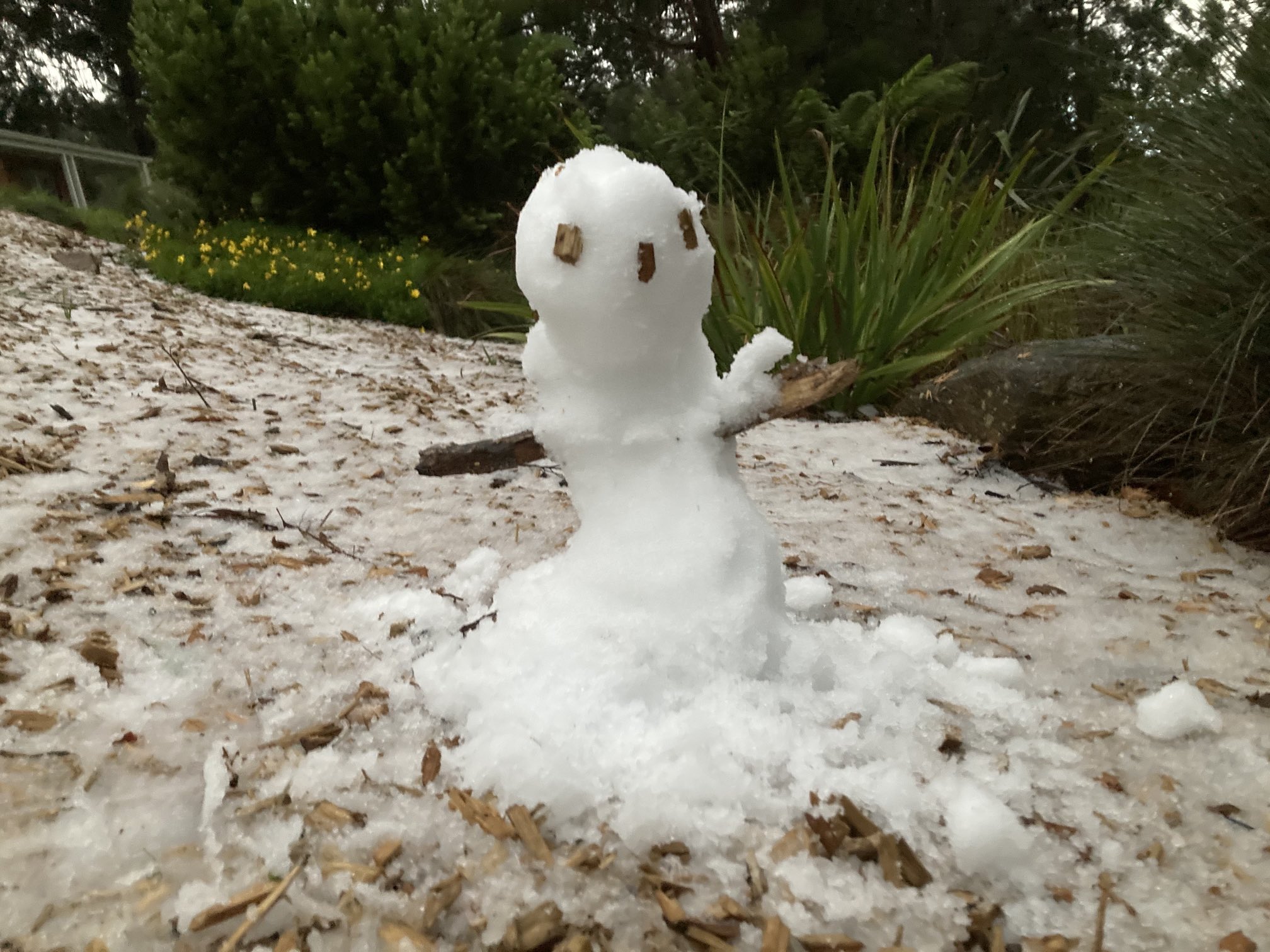
The garden this morning. Had melted a bit, so must have been deep. The funnel on the AWS was about 2/3rds full. Temp dipped to 1.8C which is cold enough for snow, so very probable we had some flakes. I went out during one of the heavy showers just before and did seem to be some flakes mixed in with the graupel. Lots of rumbles too.
Shame we can’t take the trend off some of these events. Drop a degree and this would have been a remarkable settling snow event up here in mid April
Over 40mm here, but a lot still to melt Garden is awash.

Shame we can’t take the trend off some of these events. Drop a degree and this would have been a remarkable settling snow event up here in mid April
Over 40mm here, but a lot still to melt
-
Australis(Shell3155)
- Supercell
- Reactions:
- Posts: 3146
- Joined: Mon Nov 30, 2009 8:05 pm
- Location: FTG
- Contact:
Re: Series of front with possible cold outbreak: April 8-12
New plastic states 35mm
WZ says Ferny crk on 52
WZ says Ferny crk on 52
-
hillybilly
- Site Admin/Moderator
- Reactions:
- Posts: 4979
- Joined: Thu Nov 26, 2009 7:26 am
- Location: Howden Tasmania, 25m above sea level
- Contact:
Re: Series of front with possible cold outbreak: April 8-12
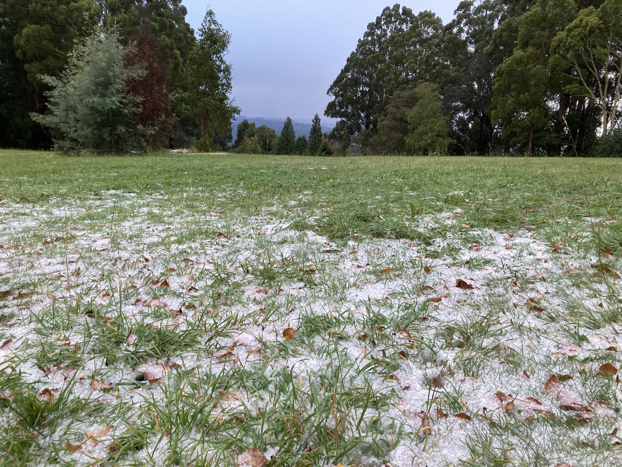
Snowed heavy here just on 7am. Looking back through my obs, coldest here for April since 1995. Gauge now over 50mm with more melt to come.
Few photos from Ferny Creek and Olinda.

Few photos from Ferny Creek and Olinda.
- Gordon
- Supercell
- Reactions:
- Posts: 2888
- Joined: Thu Jun 17, 2010 10:01 am
- Location: Near Gordon, Vic. 620 m asl
Re: Series of front with possible cold outbreak: April 8-12
Fantastic! Blobs of snow in the rain here last night but nothing settled. 11mm overnight makes it 17.5mm for the dates, so way more than expected already.
Bitterly cold now at 3C with a stiff southerly.
Bitterly cold now at 3C with a stiff southerly.
-
Onetahuti
- Supercell
- Reactions:
- Posts: 2790
- Joined: Thu Mar 25, 2010 9:37 pm
- Location: Dandenong Nth.
Re: Series of front with possible cold outbreak: April 8-12
Certainly beat the forecast rainfall, since 9am yesterday have had 44mm which add to the 10 mm I had here on Friday morning. Everything SOAKING!
Re: Series of front with possible cold outbreak: April 8-12
3.0mm here since this time yesterday, which is more than EC had forecast, brief hail around 1030 last night. Minimum of 2.8 degrees. Bright sun, windy and 7 atm.
-
Didjman

- Supercell
- Reactions:
- Posts: 2099
- Joined: Fri Sep 03, 2010 2:52 pm
- Location: Wallan, Vic 328m ASL
- Contact:
Re: Series of front with possible cold outbreak: April 8-12
5mm yesterday here. Nothing today yet. Intermittent sun, wind to 26k and 8c currently.
-
occluded

- Cumulonumbus Calvas
- Reactions:
- Posts: 611
- Joined: Tue May 04, 2010 3:26 pm
- Location: Mooroolbark 130m asl
Re: Series of front with possible cold outbreak: April 8-12
Some heavy rain and a few good hail showers here at our new place in Mooroolbark, over 25mm on the nearest AWS.
Cold and wet enough for the dog to only venture outside briefly . The retarding basin across the road is now a duck pond. Quite the change from a few days ago.
Cold and wet enough for the dog to only venture outside briefly
-
Australis(Shell3155)
- Supercell
- Reactions:
- Posts: 3146
- Joined: Mon Nov 30, 2009 8:05 pm
- Location: FTG
- Contact:

Re: Series of front with possible cold outbreak: April 8-12
Had another 24.25mm since last post to 8am this morning here in Warragul, was a wet wild one last night with frequent heavy rain/hail showers.
Another 3mm from heavy showers which seem to keep rolling through every hour. Feels like it’s trying to clear, but radar still colourful.
Approx 36mm for the event.
Another 3mm from heavy showers which seem to keep rolling through every hour. Feels like it’s trying to clear, but radar still colourful.
Approx 36mm for the event.
- StratoBendigo
- Supercell
- Reactions:
- Posts: 2809
- Joined: Fri Jan 02, 2015 2:18 pm
- Location: Kangaroo Flat
Re: Series of front with possible cold outbreak: April 8-12
1mm for the event here. Just lots of wind. 14c atm after a 5c start.