
but no more...
Now I have a dedicated GPS for the camera... ( My gps count inc my wifes phone is now, 5
After a quick play it grabbed my location in under a minute ( when its last location was China ), elevation seems to take a few min to settle down... but more reports on that later...
Here is my Solmeta Geotagger Pro mounted on my D90 (Click for bigger )
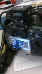
and as you can see in the image, the Nikon shows the geodata when you look at the image.... my work flow just got a lot shorter.

