Movement of showers is quite random, with lots of convergence boundaries at play.

Welcome New Members! We want to hear from you. Register, stop lurking and start posting!
Finally a storm outbreak first week of the New Year??
-
hillybilly

- Site Admin/Moderator
- Reactions:
- Posts: 4986
- Joined: Thu Nov 26, 2009 7:26 am
- Location: Howden Tasmania, 25m above sea level
- Contact:
Re: Finally a storm outbreak first week of the New Year??
Been under redeveloping showers here and now up to 7mm. Watching the development around Kinglake which is moving/developing southwest 
Movement of showers is quite random, with lots of convergence boundaries at play.
Movement of showers is quite random, with lots of convergence boundaries at play.
Re: Finally a storm outbreak first week of the New Year??
Last hour and a half sky has looked remarkably stable compared to the period after the SE wind arrived .
Re: Finally a storm outbreak first week of the New Year??
I'm over waiting for these "Storms" ....not sure anything will happen here overnight, something just not right anymore
- snowfall
- Supercell
- Reactions:
- Posts: 1286
- Joined: Mon Mar 20, 2017 7:39 pm
- Location: Gisborne South (349m asl)
Re: Finally a storm outbreak first week of the New Year??
Just 0.4mm here today, with a brief shower. I watched the storms develop overhead this afternoon, only to start dropping rain just to our east as they headed across to Melbourne. Shame they couldn’t have formed just a little further west! It was always going to be a hit and miss scenario though. Lots of rain further west currently, but it appears to be weakening now and struggling to move much further east. This should change as the trough starts moving over the next 24 hours, but I suspect that timing will be crucial for the amount of rainfall depending on how much solar heating occurs before the trough passes through, plus some fairly significant rainfall gradients as we have already seen.
A very humid 25c here today before the wind change. Currently 17c with a DP of 15.2c. There was quite a strong northerly wind this morning, followed by a breezy southeasterly this afternoon, but dead calm right now. Despite the lack of rain here, the sky has been amazing to watch - very tropical looking.
A very humid 25c here today before the wind change. Currently 17c with a DP of 15.2c. There was quite a strong northerly wind this morning, followed by a breezy southeasterly this afternoon, but dead calm right now. Despite the lack of rain here, the sky has been amazing to watch - very tropical looking.
-
chasersaddict76

- Cumulus
- Reactions:
- Posts: 83
- Joined: Wed Jul 10, 2019 8:36 pm
- Location: Bendigo
Re: Finally a storm outbreak first week of the New Year??
The trough axis is moving very strong seem pushing humid out Eastward
- Sean
- Supercell
- Reactions:
- Posts: 1000
- Joined: Mon Feb 27, 2012 6:35 pm
- Location: Patterson Lakes - SE Melb
Re: Finally a storm outbreak first week of the New Year??
Trough has been clinging to the west for the last couple of days unfortunately, then wizzes past tomorrow, meaning that timing will be off. Hopefully it decides to spurn the models and plant itself in central areas so we can make the most of daytime heat.
What an abysmal storm season for SE Melbourne.... waste of La Niña.
What an abysmal storm season for SE Melbourne....
- stevco123
- Supercell
- Reactions:
- Posts: 2936
- Joined: Sat Aug 07, 2010 7:42 pm
- Location: Cranbourne 78m asl
Re: Finally a storm outbreak first week of the New Year??
La Niña has always been more of a northern NSW, Qld event. We are just lucky to get some remnants of it. 2011 was an outlierSean wrote: ↑Sat Jan 02, 2021 9:43 pm Trough has been clinging to the west for the last couple of days unfortunately, then wizzes past tomorrow, meaning that timing will be off. Hopefully it decides to spurn the models and plant itself in central areas so we can make the most of daytime heat.
What an abysmal storm season for SE Melbourne....
https://www.weatherlink.com/bulletin/53 ... 76dd68e8bc: for current weather updated every 2 minutes
-
hillybilly
- Site Admin/Moderator
- Reactions:
- Posts: 4986
- Joined: Thu Nov 26, 2009 7:26 am
- Location: Howden Tasmania, 25m above sea level
- Contact:
Re: Finally a storm outbreak first week of the New Year??
Yep, you nailed in Sean. System starts to get captured by the westerlies as an upper trough that was back in the bight yesterday moves over the surface trough. The associated jet which has caused the rain and and storms to explode this morning, also drags the system away. The trough actually develops a small low to the southeast of Melbourne for Monday with Progs showing a weak wrap around band into southern areas, so a shot for more rain on Monday and Tuesday in southern areas.Sean wrote: ↑Sat Jan 02, 2021 9:43 pm Trough has been clinging to the west for the last couple of days unfortunately, then wizzes past tomorrow, meaning that timing will be off. Hopefully it decides to spurn the models and plant itself in central areas so we can make the most of daytime heat.
What an abysmal storm season for SE Melbourne....
Today brings rain and storms, which clear east. Unfortunately for northern parts, the focus is now more south. The window for heavy falls is narrowing, but with high precip water values it will pour down under any cells. We nearly doubled our total this morning in about ten minutes with a peak rainfall rate of 100mm/hr (event now just shy of 12mm here).
Re: Finally a storm outbreak first week of the New Year??
Still not a drop here since Thursday 1mm fog fest. Should get a few mm with trough as it passes in the next hour or two (unless it stalls again and becomes gigantic ha ha) then fingers crossed for accumulations in a SE airflow over next day or so. Still very light NNE wind here, its SSE in Trentham.
-
Didjman

- Supercell
- Reactions:
- Posts: 2099
- Joined: Fri Sep 03, 2010 2:52 pm
- Location: Wallan, Vic 328m ASL
- Contact:
Re: Finally a storm outbreak first week of the New Year??
4.8mm here so far this morning.
Edit: 8.2mm in the manual gauge for the event so far.
Edit: 8.2mm in the manual gauge for the event so far.
- StratoBendigo
- Supercell
- Reactions:
- Posts: 2809
- Joined: Fri Jan 02, 2015 2:18 pm
- Location: Kangaroo Flat
Re: Finally a storm outbreak first week of the New Year??
Managed to get 4mm yesterday, but everything looks too far south today. Another big fail for us. It's turning out to be a drier than normal summer.
Re: Finally a storm outbreak first week of the New Year??
A nice 25mm this morning with plenty of thunder too, clearing now though.
-
hillybilly
- Site Admin/Moderator
- Reactions:
- Posts: 4986
- Joined: Thu Nov 26, 2009 7:26 am
- Location: Howden Tasmania, 25m above sea level
- Contact:
Re: Finally a storm outbreak first week of the New Year??
Scored 14mm to 9am, and 5mm since. Almost a pass on this system. Keeps the fire risk down and freshens up the garden.
Band approaching is not wide, but has intense fall rates under cells. Could be worth another 5 or 30mm depending on whether you pick a hole or not.
Band approaching is not wide, but has intense fall rates under cells. Could be worth another 5 or 30mm depending on whether you pick a hole or not.
Re: Finally a storm outbreak first week of the New Year??
Wind shifted, thunder and so far about 20 drops. Concrete still dry.
Edit: Pouring now
Edit: Pouring now
Last edited by Mike on Sun Jan 03, 2021 9:40 am, edited 1 time in total.
- stevco123
- Supercell
- Reactions:
- Posts: 2936
- Joined: Sat Aug 07, 2010 7:42 pm
- Location: Cranbourne 78m asl
Re: Finally a storm outbreak first week of the New Year??
Around 2mm for the event so far. That's about what i expected from the beginning as the system didn't look right for this area
https://www.weatherlink.com/bulletin/53 ... 76dd68e8bc: for current weather updated every 2 minutes
- Gordon
- Supercell
- Reactions:
- Posts: 2889
- Joined: Thu Jun 17, 2010 10:01 am
- Location: Near Gordon, Vic. 620 m asl
Re: Finally a storm outbreak first week of the New Year??
Finally scored something decent, just catching the edge of last night's system, plus a direct hit from this morning's band to give us 25mm to 9am; 27mm for the event.
I'll call that a pass . Anything from here on is a bonus.
I'll call that a pass
Re: Finally a storm outbreak first week of the New Year??
2.2mm and bright sunshine atm.
- Dane
- Supercell
- Reactions:
- Posts: 1661
- Joined: Thu Nov 26, 2009 9:51 am
- Location: Sebastopol 420m ASL
- Contact:
Re: Finally a storm outbreak first week of the New Year??
Had a bit of Thunder between 7.30pm and 8pm last night but just a few not very loud rumbles.
Good news that steady rain followed and a bit more early this morning.
18.5mm's at my place (Sebastopol) but much heavier at Ballarat Airport about 10 kms to my NNW.
They had 40.6mm's up to 9am which means they have already exceeded the Monthly average of 39.7mm's.
Unfortunately the trough has moved East of here so not much more rain for me I think.
Still not a bad start to 2021.
- snowfall
- Supercell
- Reactions:
- Posts: 1286
- Joined: Mon Mar 20, 2017 7:39 pm
- Location: Gisborne South (349m asl)
Re: Finally a storm outbreak first week of the New Year??
A fair amount of thunder and lightning this morning. Dropped 17mm here but has now cleared and the sun is out. Still hearing the odd distant rumble as it heads east, but unfortunately, the band is also becoming patchier according to the latest radar. In the end, the positioning of the trough wasn't quite in our favour for the kind of falls that were projected even a few days ago, but the weather ultimately does its own thing!
Currently a westerly breeze and 16c. Looks like the low is already forming.
Currently a westerly breeze and 16c. Looks like the low is already forming.
- Gordon
- Supercell
- Reactions:
- Posts: 2889
- Joined: Thu Jun 17, 2010 10:01 am
- Location: Near Gordon, Vic. 620 m asl
Re: Finally a storm outbreak first week of the New Year??
Good to hear you got a nice drop Dane & Snowfall.
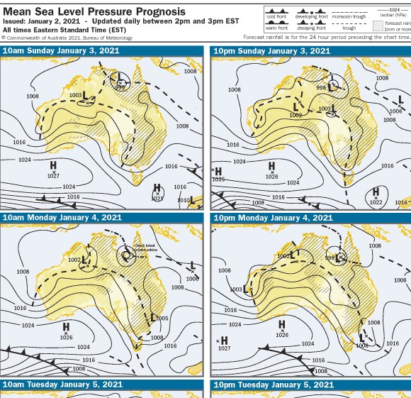
Yet the actual 5am chart today has it already out to the east. Does anyone know if the trough line is swinging back and forth (seems unlikely) or was yesterday's forecast chart way off?
Latest radar rotation does seem to suggest a low forming east of Cape Otway?
I'm struggling to get my head around this. Yesterday afternoon's forecast chart had the trough not reaching central til 10pm:
Yet the actual 5am chart today has it already out to the east. Does anyone know if the trough line is swinging back and forth (seems unlikely) or was yesterday's forecast chart way off?
Latest radar rotation does seem to suggest a low forming east of Cape Otway?