Tradie friend that is building houses in Botanic Ridge (2km from here) swears black and blue he saw snowflakes at around 11am with the soft hail. Here's my video of that time, from my backyard. Make up your own mind haha. I'm not convinced fully:
Temp at that time was 2 degrees

Welcome New Members! We want to hear from you. Register, stop lurking and start posting!
Cold outbreak 3 August - ?
- stevco123
- Supercell
- Reactions:
- Posts: 2937
- Joined: Sat Aug 07, 2010 7:42 pm
- Location: Cranbourne 78m asl
Re: Cold outbreak 3 August - ?
https://www.weatherlink.com/bulletin/53 ... 76dd68e8bc: for current weather updated every 2 minutes
- Macedonian
- Supercell
- Reactions:
- Posts: 2330
- Joined: Mon Dec 21, 2009 10:44 pm
- Location: Mount Macedon Vic at 870m above sea level
Re: Cold outbreak 3 August - ?
Absolutely blizzarding down now. Everything is going white.
Right on zero degrees.
Right on zero degrees.
Home- "Shepherd's Bush" at Mt Macedon. 870m
Work- "Bolobek" at Macedon. 430m
Work- "Bolobek" at Macedon. 430m
- BringOnTheCoolChange
- Cumulonimbus
- Reactions:
- Posts: 216
- Joined: Fri Jul 18, 2014 9:27 pm
- Location: East Warburton, Victoria, asl 232m
Re: Cold outbreak 3 August - ?
3.5c just now in Warburton, and had what I believe was a sleet shower, maybe someone knows, it was little white stuff like hail, but it wasnt landing like normal hail, it was splatting on the windscreen like snow, the white stuff separating apart as it landed on the window. Looked like slush on the windscreen.
Perhaps someone else might know.

Perhaps someone else might know.
-
hillybilly

- Site Admin/Moderator
- Reactions:
- Posts: 5003
- Joined: Thu Nov 26, 2009 7:26 am
- Location: Howden Tasmania, 25m above sea level
- Contact:
Re: Cold outbreak 3 August - ?
Sounds like graupel. We've had a couple of heavy graupel showers this arvo, including just one now which has covered everything white again. Graupel is like fluffy hail, and tends to dance in the wind and sounds like rice when it falls through gum trees.BringOnTheCoolChange wrote: ↑Tue Aug 04, 2020 5:13 pm 3.5c just now in Warburton, and had what I believe was a sleet shower, maybe someone knows, it was little white stuff like hail, but it wasnt landing like normal hail, it was splatting on the windscreen like snow, the white stuff separating apart as it landed on the window. Looked like slush on the windscreen.
Perhaps someone else might know.
Back to snow here again after that shower, and our temperature is 1C. Going to be a cold showery night so could accumulate with colder air now moving in for another shot of cold. It will warm up tomorrow morning, so quite possible it will all get washed away. My rain gauge is chockers with frozen precip so no idea how much we've had - would guess about 10-15mm all up, but need to wait til it all melts. Briefly reached a max of 3.8C here, but most of the day it was 2C or less. That's getting close to a record for here (though the records aren't very long).
Basically the radar gives you a good idea. If you have lighter echos much more likely to be low level and warm cloud processes. Cop a yellow or lighter blue and the clouds will be deeper and more likely to contain snow. You can also use the IR satellite imagery which often has a scale.Thanks for the info, Which site do you use to get info for cloud temps?
-
Didjman

- Supercell
- Reactions:
- Posts: 2100
- Joined: Fri Sep 03, 2010 2:52 pm
- Location: Wallan, Vic 328m ASL
- Contact:
Re: Cold outbreak 3 August - ?
On IR satpics, the whiter something is, the colder it is. As a rule of thumb.hillybilly wrote: ↑Tue Aug 04, 2020 5:20 pm You can also use the IR satellite imagery which often has a scale.
-
Didjman
- Supercell
- Reactions:
- Posts: 2100
- Joined: Fri Sep 03, 2010 2:52 pm
- Location: Wallan, Vic 328m ASL
- Contact:
Re: Cold outbreak 3 August - ?
Also, a circulation is developing near King Island, can be seen on satloop. Bit off topic, but how is this weather to blow away some of the Covid Blues!! Has given me a pickup!
- stevco123
- Supercell
- Reactions:
- Posts: 2937
- Joined: Sat Aug 07, 2010 7:42 pm
- Location: Cranbourne 78m asl
Re: Cold outbreak 3 August - ?
Temperature back to 3.4 now. Has dropped considerably in the last 30 minutes or so, without precipitation.
4.3 down the road at ballam park (frankston), for comparison)
4.3 down the road at ballam park (frankston), for comparison)
https://www.weatherlink.com/bulletin/53 ... 76dd68e8bc: for current weather updated every 2 minutes
- Sean
- Supercell
- Reactions:
- Posts: 1000
- Joined: Mon Feb 27, 2012 6:35 pm
- Location: Patterson Lakes - SE Melb
Re: Cold outbreak 3 August - ?
With showers inbound it could well start snowing in odd places, depending on how far the temp drops with them.
- stevco123
- Supercell
- Reactions:
- Posts: 2937
- Joined: Sat Aug 07, 2010 7:42 pm
- Location: Cranbourne 78m asl
Re: Cold outbreak 3 August - ?
Yes but is the air mass still as cold as this morning?
https://www.weatherlink.com/bulletin/53 ... 76dd68e8bc: for current weather updated every 2 minutes
- snowfall
- Supercell
- Reactions:
- Posts: 1290
- Joined: Mon Mar 20, 2017 7:39 pm
- Location: Gisborne South (349m asl)
Re: Cold outbreak 3 August - ?
Some chunky looking showers on their way currently. What is remarkable is that it was snowing heavily here during the middle of the day, when we would normally hit peak warmth. Goes to show just how cold this airmass is. Currently 3.3c here and dropping, so hopefully any showers to come will turn to snow again. Would love to see it settle properly on the ground, but that might be asking a bit too much!
- BringOnTheCoolChange
- Cumulonimbus
- Reactions:
- Posts: 216
- Joined: Fri Jul 18, 2014 9:27 pm
- Location: East Warburton, Victoria, asl 232m
Re: Cold outbreak 3 August - ?
Yep the midday temps in some areas were amazingly cold, sea level snow could have been possible, if things happened at the right time.stevco123 wrote: ↑Tue Aug 04, 2020 3:40 pmYep. see what i mean haha. Although it definitely can't be ruled out that in that wave this morning there was some small flakes mixed in. Some of the drops in amongst the graupel were "suspicious"
Still a notable event. My hourly temps for the day are quite remarkable for where we are on planet Earth:
8am - 3.5
9am- 4.3
10am- 4.6
11am - 2.6
12pm - 3.4
1pm - 5.7
2pm - 6.8
3pm - 6.8
Maximum was 7.8, settling back to around 6 now.
- Tassiedave
- Supercell
- Reactions:
- Posts: 1101
- Joined: Thu Nov 11, 2010 11:09 am
- Location: Grindelwald Tasmania
Re: Cold outbreak 3 August - ?
Extensive Snow in Tasmania today. Midlands highway between Launceston and Hobart closed. Snow is settling in the higher suburbs of Launceston which is once in a lifetime event.
-
Australis(Shell3155)

- Supercell
- Reactions:
- Posts: 3147
- Joined: Mon Nov 30, 2009 8:05 pm
- Location: FTG
- Contact:
Re: Cold outbreak 3 August - ?
grapel followed by about 30 seconds of a real snow fall.
was exciting.. bit more would have been fun..
was exciting.. bit more would have been fun..
- stevco123
- Supercell
- Reactions:
- Posts: 2937
- Joined: Sat Aug 07, 2010 7:42 pm
- Location: Cranbourne 78m asl
Re: Cold outbreak 3 August - ?
Just came back from Woolworths, car temp showing 3.0 degrees still with frequent showers constantly containing small bits of ice.
Will be a cold night. Not holding hope of sea level snow tonight, but hey... it's 2020. What a year it's been
Will be a cold night. Not holding hope of sea level snow tonight, but hey... it's 2020. What a year it's been
https://www.weatherlink.com/bulletin/53 ... 76dd68e8bc: for current weather updated every 2 minutes
- BringOnTheCoolChange
- Cumulonimbus
- Reactions:
- Posts: 216
- Joined: Fri Jul 18, 2014 9:27 pm
- Location: East Warburton, Victoria, asl 232m
Re: Cold outbreak 3 August - ?
The snow trail on the mountain behind the redwood forest. 5:22pm today.

Re: Cold outbreak 3 August - ?
Wow, 3.9 degrees in Scoresby, 2.6 in Moorabbin! Just a couple of degrees off snow, so close and yet so far. We had some graupel-like hail and some sleet-like rain, about as good as we can manage. My parents reported fleeting snow at 250m in the Dandenongs
Re: Cold outbreak 3 August - ?
I shot a little video of the snow shower as it came through. Currently 3.5 c and wet in Mansfield 330m.Australis(Shell3155) wrote: ↑Tue Aug 04, 2020 7:56 pm grapel followed by about 30 seconds of a real snow fall.
was exciting.. bit more would have been fun..
-
hillybilly
- Site Admin/Moderator
- Reactions:
- Posts: 5003
- Joined: Thu Nov 26, 2009 7:26 am
- Location: Howden Tasmania, 25m above sea level
- Contact:
Re: Cold outbreak 3 August - ?
It will snow to around 2.5C. Snowflakes will start out below zero so take a while to warm, and they cool from evaporation and melting. If the air is very dry, it can theoretically snow to about 7C, those these conditions only really occur in alpine deserts/dry plateaus like in the US. Heard reports of snow settling to The Basin, so would be consistent with flakes to about 100m or a tad lower.
-
hillybilly
- Site Admin/Moderator
- Reactions:
- Posts: 5003
- Joined: Thu Nov 26, 2009 7:26 am
- Location: Howden Tasmania, 25m above sea level
- Contact:
Re: Cold outbreak 3 August - ?
Wow... just had the best snow storm here in at least 12 years. Even got a boom of thunder  Just torrential puckage with flakes 50 cent size. 5-8cm on the grass, and our temperature down to -0.2C which is our first sub zero here since August 2008. Now hoping it lasts til morning. Warm air will push in, so comes down to the timing and whether we retain a low level inversion.
Here some photos. Shame it is dark, but you get an idea
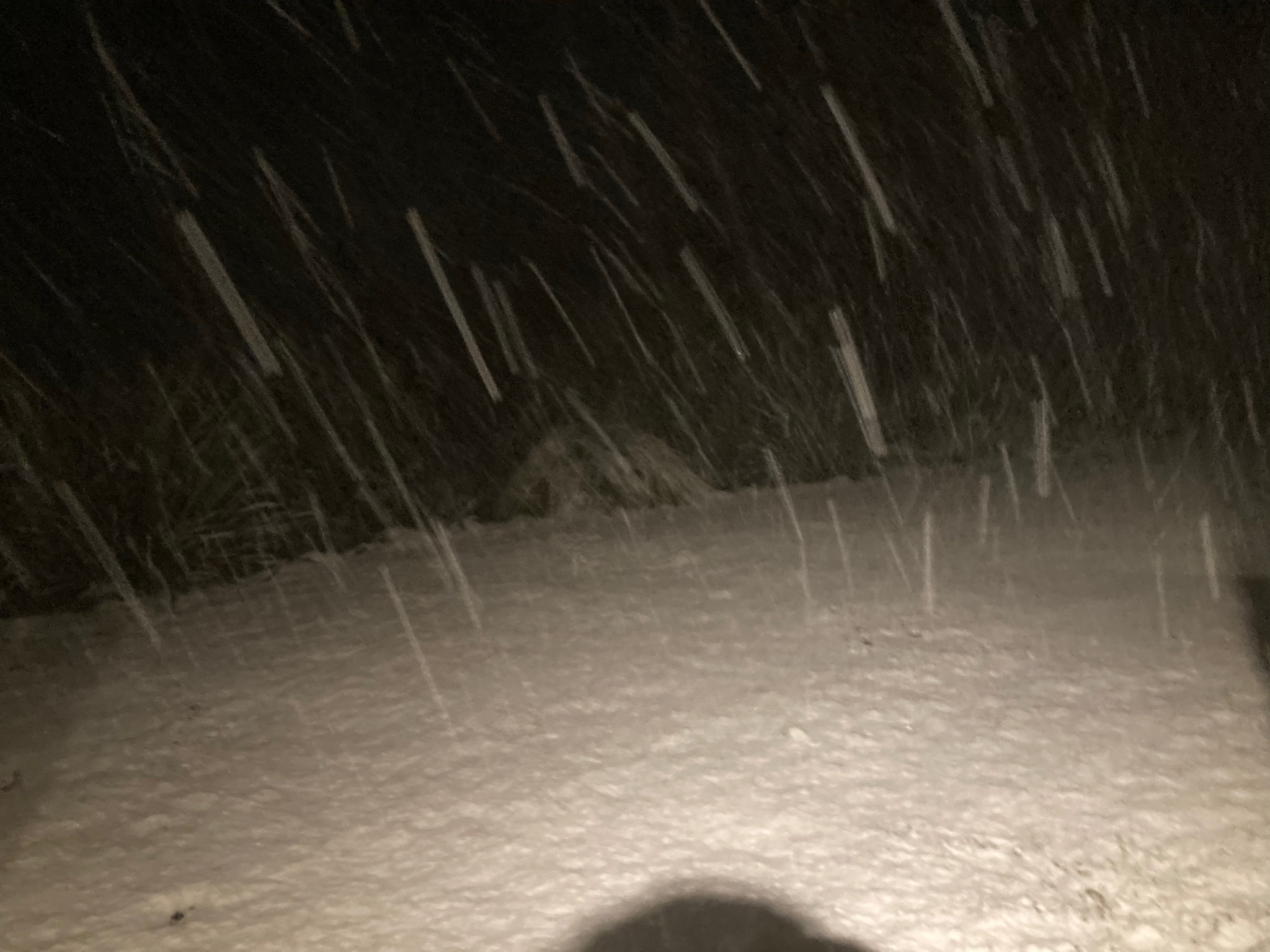
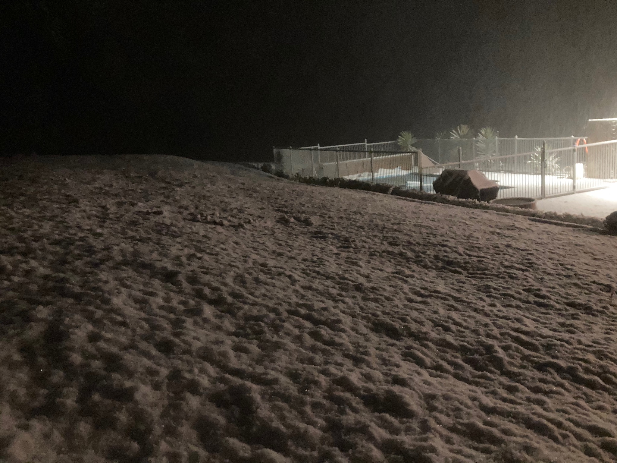
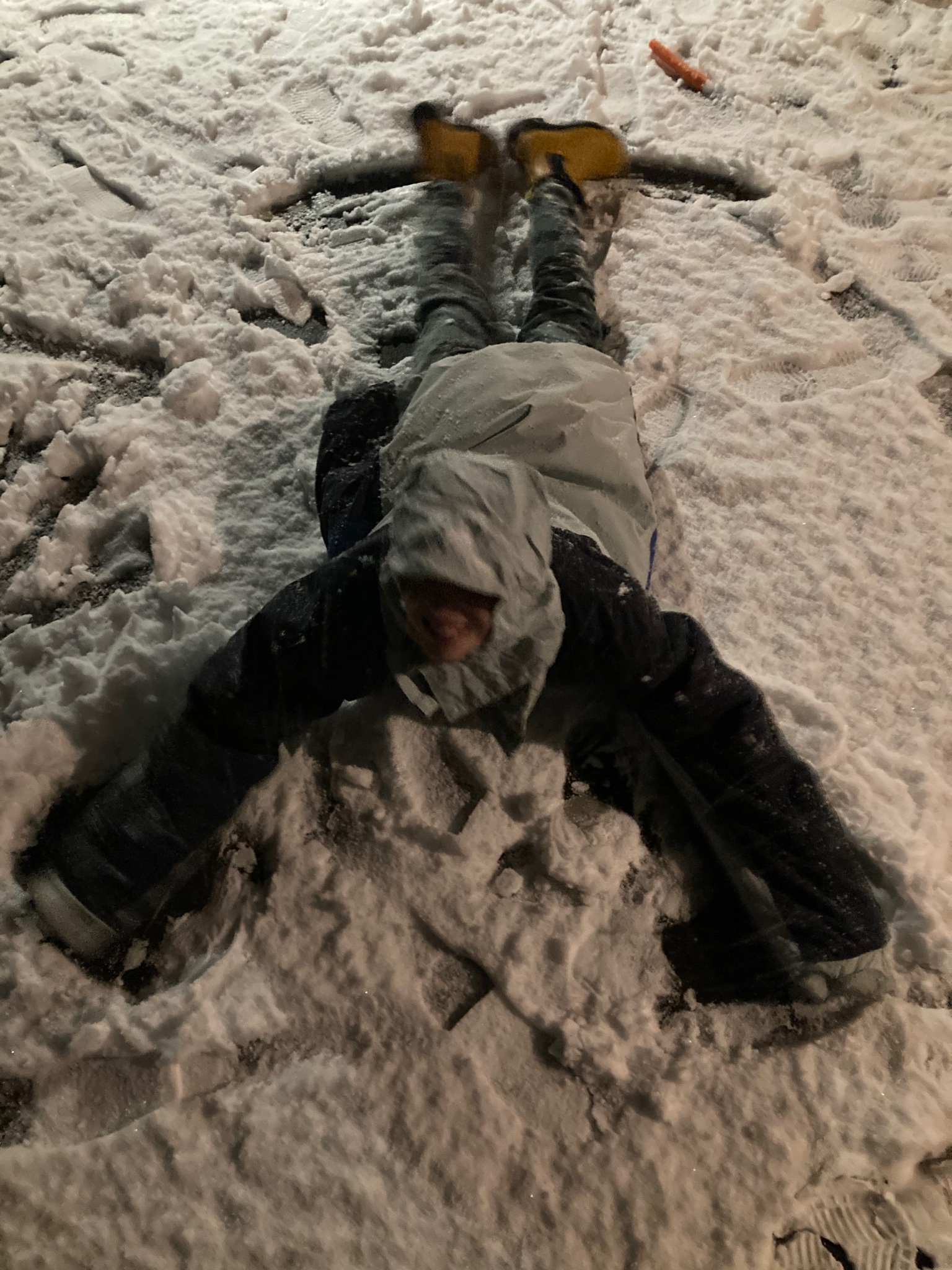
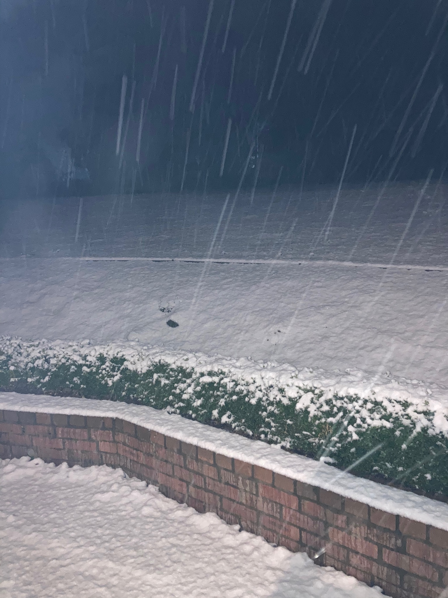
Here some photos. Shame it is dark, but you get an idea
- BringOnTheCoolChange
- Cumulonimbus
- Reactions:
- Posts: 216
- Joined: Fri Jul 18, 2014 9:27 pm
- Location: East Warburton, Victoria, asl 232m
Re: Cold outbreak 3 August - ?
Wow that is pretty impressive hillybilly, no white here on the ground at 230m asl East Warby. I don't get up early enough to see the full story though. At least there is still a bit of snow to look at on the surrounding mountains, but that's pretty much every decent 800m-900m event, considering most surrounding mountains are 900m - to over 1200m+
There was reports of snow in Mansfield, Noojee, Buxton, Marysville and even Traralgon South though. Lucky people. Lol!
There was reports of snow in Mansfield, Noojee, Buxton, Marysville and even Traralgon South though. Lucky people. Lol!