Looks like a protracted period of warm and humid weather, along with potentially heavy rain from Thursday onwards as tropical moisture streams in from the Northeast.
EC is ramping it up on Thursday. NSW and Qld look to get the bulk of the rain which is great, and a good chance of some of it ending up in Vic as well.
Extended GFS quite bullish beyond the above dates too.

Welcome New Members! We want to hear from you. Register, stop lurking and start posting!
Vic - Humid & Potential for Rain: Feb 5-20, 2020
- StratoBendigo
- Supercell
- Reactions:
- Posts: 2817
- Joined: Fri Jan 02, 2015 2:18 pm
- Location: Kangaroo Flat
- Sean
- Supercell
- Reactions:
- Posts: 1000
- Joined: Mon Feb 27, 2012 6:35 pm
- Location: Patterson Lakes - SE Melb
Re: Vic - Humid & Potential for Rain: Feb 5-12, 2020
It’s looking a lot better today. Fairly interesting week ahead (insane up north), with showers and storms a possibility most days.
- weathergasm
- Cumulonimbus
- Reactions:
- Posts: 244
- Joined: Sun Feb 14, 2010 9:32 pm
- Location: Box Hill
Re: Vic - Humid & Potential for Rain: Feb 5-12, 2020
For much of coastal NSW this event is pretty much locked in, but for us Victorians it is a much more uncertain event (looking at the synoptics). Curious to see how this one pans out but it looks like east and northeast parts of the state are in with the best shot at this stage.
-
hillybilly

- Site Admin/Moderator
- Reactions:
- Posts: 4999
- Joined: Thu Nov 26, 2009 7:26 am
- Location: Howden Tasmania, 25m above sea level
- Contact:
Re: Vic - Humid & Potential for Rain: Feb 5-12, 2020
EC and CMC have upgraded a lot on the latest run with heavy falls in the east into central areas and multiple days of showers and storms. Heavy to very heavy falls in NSW and Queensland, potentially topping 500mm  Could cause substantial areas in the burn scar areas.
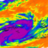
I struggle to think of such a long live blocking event with very humid easterly flow into a trough for 14 days give or take. A deep tropical depression or TC also looks like moving down into the Tasman Sea which will bring down some deep tropical moisture and push big swells onto the NSW coast.
EDIT> looking at EC it’s got widespread though scattered showers and storms today and tomorrow. Falls are patchy, but locally heavy. Cells make it into the Melbourne metro area, so might be a chance. Best of it near and north of the ranges.
-
Didjman

- Supercell
- Reactions:
- Posts: 2100
- Joined: Fri Sep 03, 2010 2:52 pm
- Location: Wallan, Vic 328m ASL
- Contact:
Re: Vic - Humid & Potential for Rain: Feb 5-12, 2020
When I got home yesterday, there were Currawongs wolf whistling. That usually is a sign of a significant weather change. Also, these birds hang only around here in the cooler months! I haven't heard them for months either. Very interesting.
Re: Vic - Humid & Potential for Rain: Feb 5-12, 2020
wow, storms firing in victoria already...
Re: Vic - Humid & Potential for Rain: Feb 5-12, 2020
Yes they wolf whistling is more pronounced around here this morning, , but unlike yours, have not left us this year, been hanging around all summer
Re: Vic - Humid & Potential for Rain: Feb 5-12, 2020
Woke up this morning checked outside looked nice and clear.. Got in the shower.. Boom. What the heck was that anyhow.. After checking the radar seen a tiny little blob above us. Bucketed down in Nagambie good 15 - 20mm havnt checked the gauge yet as I left to work.
Re: Vic - Humid & Potential for Rain: Feb 5-12, 2020
whats the bet now i have put plants undercover that it all evaporates before it gets down this far? 
Re: Vic - Humid & Potential for Rain: Feb 5-12, 2020
Mangalore Weather Station reporting 31mm since 8am
- StratoBendigo
- Supercell
- Reactions:
- Posts: 2817
- Joined: Fri Jan 02, 2015 2:18 pm
- Location: Kangaroo Flat
Re: Vic - Humid & Potential for Rain: Feb 5-12, 2020
Going to be very hit or miss today. Could be 40mm or 0mm.
It'll be this way for another week with this tropical setup. As for this morning - the anti-rain forcefield is working well again here.
It'll be this way for another week with this tropical setup. As for this morning - the anti-rain forcefield is working well again here.
- Jake Smethurst
- Supercell
- Reactions:
- Posts: 3583
- Joined: Mon Nov 23, 2009 8:49 pm
- Location: Cheltenham
Re: Vic - Humid & Potential for Rain: Feb 5-12, 2020
The nature of these types of events I'm afraid Strato ... but it is promising to see storms develop so early.
They'll be very slow moving all day so if one can manage to get underneath, flash flooding risk is high.
This is our map we put out yesterday (we'll have another update around midday).

Not surprised!
This is our map we put out yesterday (we'll have another update around midday).
Jake - Senior AWF Forecaster
Feel free to send me a private message if you have any questions.
Feel free to send me a private message if you have any questions.
-
Australis(Shell3155)

- Supercell
- Reactions:
- Posts: 3147
- Joined: Mon Nov 30, 2009 8:05 pm
- Location: FTG
- Contact:
Re: Vic - Humid & Potential for Rain: Feb 5-12, 2020
Didjman, yes noted currawongs yesterday, but after 2 wedge tailed eagles  hanging around a few times in the day, kinda made them insignificant...
Strato.. your turn will come, just think of all the weeds that didn’t grow..
 hanging around a few times in the day, kinda made them insignificant...
 Strato.. your turn will come, just think of all the weeds that didn’t grow..
-
Didjman
- Supercell
- Reactions:
- Posts: 2100
- Joined: Fri Sep 03, 2010 2:52 pm
- Location: Wallan, Vic 328m ASL
- Contact:
Re: Vic - Humid & Potential for Rain: Feb 5-12, 2020
My Aws is showing 24c 62% humidity in Wallan
- Jake Smethurst
- Supercell
- Reactions:
- Posts: 3583
- Joined: Mon Nov 23, 2009 8:49 pm
- Location: Cheltenham
Re: Vic - Humid & Potential for Rain: Feb 5-12, 2020
Our updated chart for today - little change. Click for bigger.

Jake - Senior AWF Forecaster
Feel free to send me a private message if you have any questions.
Feel free to send me a private message if you have any questions.
Re: Vic - Humid & Potential for Rain: Feb 5-12, 2020
I'm not holding my breath for this one...be pleasantly surprised though if anything does occur in this area
-
Tempest
- Cumulonimbus
- Reactions:
- Posts: 148
- Joined: Sat Aug 14, 2010 8:34 pm
- Location: Warragul North, Vic... 140m asl
Re: Vic - Humid & Potential for Rain: Feb 5-12, 2020
Yep, we had Currawongs here yesterday too for the first time in a while. They had a lovely feast in my pear tree
High country is getting a good soaking under those stationary storms atm. Looks like something brewing a bit closer over the Baw Baws now too.
- StratoBendigo
- Supercell
- Reactions:
- Posts: 2817
- Joined: Fri Jan 02, 2015 2:18 pm
- Location: Kangaroo Flat
Re: Vic - Humid & Potential for Rain: Feb 5-12, 2020
Some decent convection occurring here right now. Very rapid development....
http://auswebcams.com/#gallery-20
http://auswebcams.com/#gallery-20
Re: Vic - Humid & Potential for Rain: Feb 5-12, 2020
A lot of convection around here too with a cell developing just to the nw of here above Ballan.
Edit: booming thunder now
Edit: booming thunder now

-
Didjman
- Supercell
- Reactions:
- Posts: 2100
- Joined: Fri Sep 03, 2010 2:52 pm
- Location: Wallan, Vic 328m ASL
- Contact:
Re: Vic - Humid & Potential for Rain: Feb 5-12, 2020
That cell Adam looks very impressive from Tullamarine!!