The waters are so warm off the NW and there's prospect of a cyclone, so it's starting to get a little interesting. If the monsoon trough does develop like they're thinking it will, a lot of moisture may start pooling and very quickly.
Adding to the the mix is the slight break down in the high pressure ridge, which seemed to cut Victoria off from much of the moisture last summer.
No point getting too excited. There's a very good chance the dry will go on and on, as it's done so for 8 years, but all the ingredients are there for it to end with a bang. Just have to wait and see
If we have another failed monsoon season, this country is even more f*cked than it is already. Hundreds of millions of animals dead, millions of hectares of forest burnt, failed crops all over the place. This is one of the most devastating summers on record, and this is on the back of a devastating summer last year! Give us a break.
Interestingly, the rate of the +IOD's break down makes me wonder if a strong reversal is possible. Who knows these days
With SAM and IOD neutral, things are looking promising! Fingers crossed. We need cyclonic rain (spread out though and without the wind) to put out the fires.
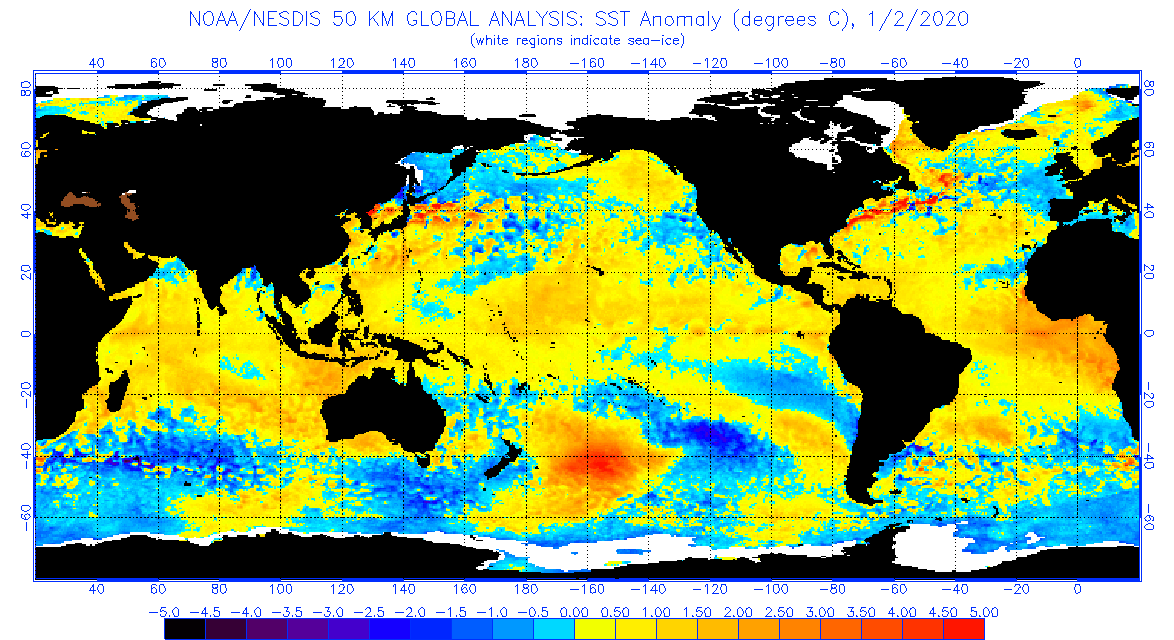
Finally the oceans have cooled around Tahiti and the some big positive SOI numbers can be put on the board. Almost a hint of -neg pdo like ssts in northern hemisphere. I still dont like our chances of a La nina till 2021 when solar cycle gets going. But with heat up north theres a chance. https://www.ospo.noaa.gov/data/sst/anom ... 2.2020.gif
The next week or so is likely to see exceptionally heavy rain over more-or-less all of Western Australia, particularly inland areas. This is good news in terms of putting a lid on the extreme temps that have afflicted the continent in the past couple of months. That said, the Simpson Desert will remain stinking hot for a while.
I'm seeing some parallels between this summer and 1994/5. i.e. A hot and dry December due to a strong Spring +ve IOD, but some big incursions of tropical moisture into January. Anyone else remember the flooded Rod Laver Arena at the Aust Open in January 1995?
Question is, will something wring it out over places that need it? I was a bit young to remember that event at Rod Laver, but that cyclone has brought with it a massive incursion of tropical moisture over northern regions...
If it were a regular year/summer I would think, ok, the monsoon is arriving, but the extremity of anomalies and drivers lately makes me wonder if extreme rainfall in southern regions is a chance. Having said that though, while we have some of the warmest waters in the world sitting to the NW of us at the moment, the anomaly is only moderate: http://www.bom.gov.au/products/IDYOC062 ... maly.shtml - which hints more at average type weather than extrememe type weather, where rain is concerned anyway.
My biggest concern is that a belt of high pressure will form as the monsoon trough descends. Victoria has been subject to this over and over again. The only regularity we seem to have these days is a snap drought once a year!
 ).
).