Page 3 of 4
Re: Jan 9 to 13 Warm to Hot with a thundery trough and change
Posted: Fri Jan 12, 2018 7:36 pm
by hillybilly
Steady rain here which has pushed us to 5.5mm. Pretty slow going this system... Keeps looking like it might clear, then more builds. Am thinking we will see showers thickening as the swly deepens the next few hours. So hopefully double figures by morning.
Well it does pay to look beyond the eastern side of Melbourne occasionally HB.
Yeah, and been one of those six week periods with some quite stunning rainfall gradients. December’s rainfall went from near 10mm to near 300mm as you went across central areas. Pretty crazy gradient that one.

Re: Jan 9 to 13 Warm to Hot with a thundery trough and change
Posted: Fri Jan 12, 2018 7:38 pm
by stevco123
Very happy with the almost 15mm. Could double that tomorrow easily.
Sorry you got so little HB and Gordon.
HB I'm sure you'll beat me and any other place tomorrow within half an hour haha

Re: Jan 9 to 13 Warm to Hot with a thundery trough and change
Posted: Fri Jan 12, 2018 7:44 pm
by Onetahuti
9.5mm so far. Garden has had a good drink, tanks now full again. Happy with all that.
Welcome Amandagural.

Re: Jan 9 to 13 Warm to Hot with a thundery trough and change
Posted: Fri Jan 12, 2018 7:52 pm
by Skywalker
hillybilly wrote: ↑Fri Jan 12, 2018 7:36 pm
Yeah, and been one of those six week periods with some quite stunning rainfall gradients. December’s rainfall went from near 10mm to near 300mm as you went across central areas. Pretty crazy gradient that one.
Sure is a pretty crazy gradient. I'm one of the few who have properties located on either side of the bay so I notice it more. Really hope it changes somewhat soon.
Still coming down here, should clear in about half an hour or so.
Re: Jan 9 to 13 Warm to Hot with a thundery trough and change
Posted: Fri Jan 12, 2018 10:24 pm
by StratoBendigo
Next to nothing here. Not unexpected really.
Tomorrow afternoon looks decidedly chilly for Mid-January here. 06z GFS has us on 15c at 4pm.... Brrrrr!
Then over 40c on Thursday. Rollercoaster weather.
Re: Jan 9 to 13 Warm to Hot with a thundery trough and change
Posted: Sat Jan 13, 2018 5:40 am
by hillybilly
Next to nothing here. Not unexpected really.
Pretty unlucky for Bendigo. Looks to have gone north, south, east and west. Maybe the odd shower will slip north of the divide today.
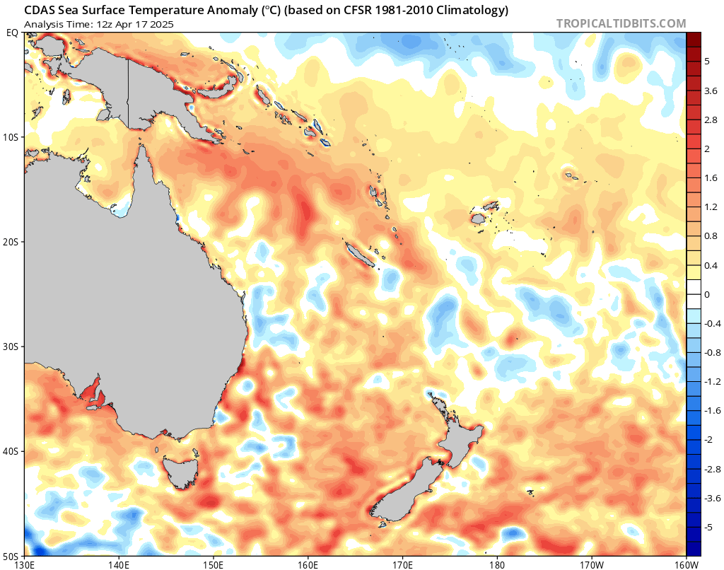
2mm more here overnight so 8.2mm now. Today looks wet and windy from about noon, and becoming quite chilly for southern and eastern areas. Be interesting how this system interacts with the really warm Bass Strait and Bay. We should see some intense coldies during the arvo into the evening. Hoping for 20mm or more to give things a good drink. Thinking the city through northeast burbs could be a bit of a surprise here with the flow going southerly tonight, which should really focus the showers out there.
Does look marginal to me for snow in the alps. Thinking the very top of spots like Baw Baw will see the odd flurry, but the 850Ts are pretty marginal with the precip, staying mainly around 2C until tomorrow by when much the precip will be through.
Btw check out the current SSTs which should boost showers today. I’m struggling to count the contours

Re: Jan 9 to 13 Warm to Hot with a thundery trough and change
Posted: Sat Jan 13, 2018 7:30 am
by JasmineStorm
Only scored 1mm up here but yesterday's system was always a east of Melbourne set up. I see a coldies sparking already in Bass Strait with the next system. Will be interesting to see how much gets over the divide this evening.
There is a fairly decent polar injection into today's system at 500 hPa which launches as far north as southern Queensland causing a major low in the Tasman over that warm soupy water.
Re: Jan 9 to 13 Warm to Hot with a thundery trough and change
Posted: Sat Jan 13, 2018 8:05 am
by Didjman
J.S, we tripled your tally with 3mm lol.
Re: Jan 9 to 13 Warm to Hot with a thundery trough and change
Posted: Sat Jan 13, 2018 9:21 am
by Dane
13.3mm's here up to 9am not too bad.
Feeling pretty chilly outside currently 15c here.
Hoping for a bit more during the day before it
warms later in the week,
Re: Jan 9 to 13 Warm to Hot with a thundery trough and change
Posted: Sat Jan 13, 2018 10:55 am
by Wilko
hillybilly wrote: ↑Sat Jan 13, 2018 5:40 am
Next to nothing here. Not unexpected really.
Pretty unlucky for Bendigo. Looks to have gone north, south, east and west. Maybe the odd shower will slip north of the divide today.
2mm more here overnight so 8.2mm now. Today looks wet and windy from about noon, and becoming quite chilly for southern and eastern areas. Be interesting how this system interacts with the really warm Bass Strait and Bay. We should see some intense coldies during the arvo into the evening. Hoping for 20mm or more to give things a good drink. Thinking the city through northeast burbs could be a bit of a surprise here with the flow going southerly tonight, which should really focus the showers out there.
Does look marginal to me for snow in the alps. Thinking the very top of spots like Baw Baw will see the odd flurry, but the 850Ts are pretty marginal with the precip, staying mainly around 2C until tomorrow by when much the precip will be through.
Btw check out the current SSTs which should boost showers today. I’m struggling to count the contours
I can testify to that
Unbelievably warm in the water down at Torquay yesterday
Must have been 20c
Re: Jan 9 to 13 Warm to Hot with a thundery trough and change
Posted: Sat Jan 13, 2018 12:57 pm
by Gordon
Starting to rain here - if you didn't know any better, looking at the radar, you'd think we were in for something half-decent.
Won't get to check the gauge until tomorrow afternoon, so time will tell!
Re: Jan 9 to 13 Warm to Hot with a thundery trough and change
Posted: Sat Jan 13, 2018 1:28 pm
by Skywalker
Currently at Wonthaggi here. Everything going north & south of us. Meanwhile the showers have arrived back on the island.
Re: Jan 9 to 13 Warm to Hot with a thundery trough and change
Posted: Sat Jan 13, 2018 2:06 pm
by JasmineStorm
Skywalker wrote: ↑Sat Jan 13, 2018 1:28 pm
Currently at Wonthaggi here. Everything going north & south of us. Meanwhile the showers have arrived back on the island.
Certainly an active sparking radar near you in the last hour or so
Re: Jan 9 to 13 Warm to Hot with a thundery trough and change
Posted: Sat Jan 13, 2018 3:54 pm
by hillybilly
Steady drizzly type rain here most the arvo. Slowly adding up, but only slowly

Just passed 2mm, so 10.4mm for the event.
Couple of embed cells in the frontal band so hoping they boost things for people

Totals starting to add up nicely in the Otways and South Gippsland with a few spots nearing 50mm now. Otways have been really dry so good to see for them.
Not very confident about totals next 24 hours as the showers have been stubbornly disorganised and tending to run over the same spots.
Re: Jan 9 to 13 Warm to Hot with a thundery trough and change
Posted: Sat Jan 13, 2018 4:57 pm
by stevco123
Can hear some rumbles getting closer. And dark clouds as well. Radar confirms it.
Hoping it doesn't break down like the last 10 lots of showers today.

Re: Jan 9 to 13 Warm to Hot with a thundery trough and change
Posted: Sat Jan 13, 2018 5:31 pm
by Wilko
Gee just had a squall come thru
Lasted 5 seconds but was extremely dangerous
Re: Jan 9 to 13 Warm to Hot with a thundery trough and change
Posted: Sat Jan 13, 2018 6:20 pm
by hillybilly
SWly just pushed through with that band. Had a brief burst of heavy rain and a five or so rumbles, so now on 6.2mm for the day. Wind got gusty, but nothing too out of the remarkable. City doing well, rapidly approaching 10mm.
Next shower lining the city and burbs up

Re: Jan 9 to 13 Warm to Hot with a thundery trough and change
Posted: Sat Jan 13, 2018 7:44 pm
by Didjman
5.8mm to add to the 3mm overnite - with more showers on the way.
Re: Jan 9 to 13 Warm to Hot with a thundery trough and change
Posted: Sat Jan 13, 2018 9:22 pm
by stevco123
Very impressed with about 25mm yesyerday and today on total.
Very wintery out there. Not unusual for January but still...
Currently 11.9 degrees after hovering at 15 for about 4 hours this afternoon.
Re: Jan 9 to 13 Warm to Hot with a thundery trough and change
Posted: Sun Jan 14, 2018 6:45 am
by hillybilly
10mm in the gauge this morning so about 18mm for the event. There a sneaky front for tomorrow morning so could add a couple more. Was thinking 20mm is a pass for this one here, so might just sneak there

Bumper system for the city and northeast burbs, Otways and a fair bit of Gippsland. Lots of 20-40mm falls and a few spot over 50mm with a bit more to come. Mid summmer events are so important for reducing fire risk, given the plants a drink etc so fantastic to see.
Very wintery out there. Not unusual for January but still...
Got the wood fire going here with 8C. Kind of weather we get a couple of times in most Jan/Feb, and comes in handy for burning those branches which fall off the trees on the hot days. Saw some video of snow on Ben Lomond yesterday. Baw Baw might have seen the odd wet flurry, but the other mountains in Vic seem to have got cold after the precip cleared out.
I did find the media pretty frustrating yesterday... Whinge whinge whinge because it rained and was mild

It’s like we all would prefer to live ar Oodnadatta. They went on how it wasn’t like summer. Just last Saturday it was 42C which is about 16C above average, and yesterday was 21C which is 5C below average. By my calculations yesterday’s temperature were way more normal than a week before