One of those marginally interesting events with a warm then hot day followed by a front. Could be a few showers and possible storm Wednesday into Thursday, though system overall looks fairly moisture starved.
More significant heat in a week.

Welcome New Members! We want to hear from you. Register, stop lurking and start posting!
Victoria - Becoming hot then a change: December 12-14 2017
-
hillybilly

- Site Admin/Moderator
- Reactions:
- Posts: 4989
- Joined: Thu Nov 26, 2009 7:26 am
- Location: Howden Tasmania, 25m above sea level
- Contact:
- JasmineStorm
- Supercell
- Reactions:
- Posts: 1870
- Joined: Thu Sep 22, 2016 9:40 pm
- Location: Kyneton 527 ASL
Re: Becoming hot then a change: December 12-14
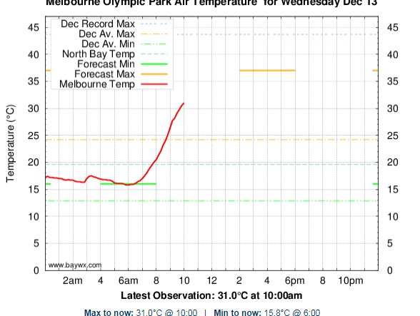
Looks like the hottest day of summer so far on Wednesday.
Definitely something interesting showing up storm wise for early next week if EC is to be believed
http://www.theaustralianweatherforum.co ... 20#p103216
Definitely something interesting showing up storm wise for early next week if EC is to be believed
http://www.theaustralianweatherforum.co ... 20#p103216
-
Australis(Shell3155)

- Supercell
- Reactions:
- Posts: 3146
- Joined: Mon Nov 30, 2009 8:05 pm
- Location: FTG
- Contact:
Re: Becoming hot then a change: December 12-14
Black Cockies on the move saw flock of 6 Sunday @ Arbouretum and could hear them again today, can only hope.
-
hillybilly
- Site Admin/Moderator
- Reactions:
- Posts: 4989
- Joined: Thu Nov 26, 2009 7:26 am
- Location: Howden Tasmania, 25m above sea level
- Contact:
Re: Becoming hot then a change: December 12-14
Nice day here today with a max of 22C. Nasty uppers for tomorrow with the 850Ts in the mid 20s in the northwest, and low 20s in the south. Thankfully we got all that rain last week.
Gotta be a chance for a 40C in the metro area and low 40s in the northwest.
Weak mostly dry front coming through on Thursday so only one stinker.
Gotta be a chance for a 40C in the metro area and low 40s in the northwest.
Weak mostly dry front coming through on Thursday so only one stinker.
- wolfcat
- Cumulonumbus Calvas
- Reactions:
- Posts: 562
- Joined: Sun Mar 07, 2010 12:14 pm
- Location: Bentleigh East
- Contact:
Re: Becoming hot then a change: December 12-14
Sure did warm up fast this morning.
other places you will find me...
My blog...http://www.wolfcat.com.au/randomrants/
Flickr .. http://www.flickr.com/photos/wolfcat_aus/
Twitter... http://twitter.com/wolfcat
Redbubble... http://www.redbubble.com/people/wolfcat
My blog...http://www.wolfcat.com.au/randomrants/
Flickr .. http://www.flickr.com/photos/wolfcat_aus/
Twitter... http://twitter.com/wolfcat
Redbubble... http://www.redbubble.com/people/wolfcat
- flyfisher
- Cumulonimbus
- Reactions:
- Posts: 250
- Joined: Wed Jul 18, 2012 1:39 pm
- Location: Belgrave
- Contact:
Re: Becoming hot then a change: December 12-14
What is going on with the Indian ocean - it just keeps on getting cooler and cooler when it should have broken down by now. Looks like it's suppressing tropical activity in NW Australia. At the same time we have a high that orientated along with a low in the coral sea that means winds are parallel to the coast.
So no much moisture is getting into the continent right now producing clear baking conditions that are being drawn south. Just an ugly setup like I have seen over the last few summers. Complete opposite to the last few weeks.
I hope it changes soon.
So no much moisture is getting into the continent right now producing clear baking conditions that are being drawn south. Just an ugly setup like I have seen over the last few summers. Complete opposite to the last few weeks.
I hope it changes soon.
- JasmineStorm
- Supercell
- Reactions:
- Posts: 1870
- Joined: Thu Sep 22, 2016 9:40 pm
- Location: Kyneton 527 ASL
Re: Becoming hot then a change: December 12-14
The first to 40c for the summer has been won by Longerenong at 12.40pm, beat Walpeup by 15 minutes 
- JasmineStorm
- Supercell
- Reactions:
- Posts: 1870
- Joined: Thu Sep 22, 2016 9:40 pm
- Location: Kyneton 527 ASL
Re: Becoming hot then a change: December 12-14
Just had a quick look and the walker cell is anchored above the equator at the moment. IMO it's going to take a few weeks to head south, so central OZ is just going to keep getting hotter and hotter with the storms here or there. The current set up would give some potential to near 50c in certain spots by early January. One to watch in Victoria if a big north westerly swings down the middle.flyfisher wrote: ↑Wed Dec 13, 2017 11:54 am What is going on with the Indian ocean - it just keeps on getting cooler and cooler when it should have broken down by now. Looks like it's suppressing tropical activity in NW Australia. At the same time we have a high that orientated along with a low in the coral sea that means winds are parallel to the coast.
So no much moisture is getting into the continent right now producing clear baking conditions that are being drawn south. Just an ugly setup like I have seen over the last few summers. Complete opposite to the last few weeks.
I hope it changes soon.
- Attachments
-
- Walker cell Dec 13 2017.jpg (172.79 KiB) Viewed 9889 times
- WeatherViewer
- Cumulonimbus
- Reactions:
- Posts: 388
- Joined: Fri Oct 19, 2012 5:57 pm
- Location: Truganina
Re: Becoming hot then a change: December 12-14
Avalon has cracked 40C for central areas today!
- wolfcat
- Cumulonumbus Calvas
- Reactions:
- Posts: 562
- Joined: Sun Mar 07, 2010 12:14 pm
- Location: Bentleigh East
- Contact:
Re: Becoming hot then a change: December 12-14
39.7c 04:30pm at Avalon makes it there hottest day this year, beating 17/1/17 on 39.6, with still an hour or so before the temp could top out.
other places you will find me...
My blog...http://www.wolfcat.com.au/randomrants/
Flickr .. http://www.flickr.com/photos/wolfcat_aus/
Twitter... http://twitter.com/wolfcat
Redbubble... http://www.redbubble.com/people/wolfcat
My blog...http://www.wolfcat.com.au/randomrants/
Flickr .. http://www.flickr.com/photos/wolfcat_aus/
Twitter... http://twitter.com/wolfcat
Redbubble... http://www.redbubble.com/people/wolfcat
Re: Becoming hot then a change: December 12-14
Certainly this next stretch until Christmas is looking very warm indeed! Looks like next Monday could be a spike day with 39 already forecast for Melbourne. Early predictions are suggesting a very hot Christmas period as well!! Are we heading into an El Nino pattern??
It looks as though the rain over the past few weeks hasn't done much around my area. JS, i drove into Kyneton this morning from Lancefield and it's looking very, very dry. Could be an interesting summer ahead!?
It looks as though the rain over the past few weeks hasn't done much around my area. JS, i drove into Kyneton this morning from Lancefield and it's looking very, very dry. Could be an interesting summer ahead!?
-
hillybilly
- Site Admin/Moderator
- Reactions:
- Posts: 4989
- Joined: Thu Nov 26, 2009 7:26 am
- Location: Howden Tasmania, 25m above sea level
- Contact:
Re: Becoming hot then a change: December 12-14
Nasty day out there. Hot, dry and windy. So lucky we got the rain earlier in the month. Even with that, a lot of fires have broken out which isn't a good sign 
It is surpisingly uncommon (or at least used to be) to get to 43C this side of January in Victoria. We only get to 43C in December in about 1 in 5 years (we fell just short today, but have another chance on Monday and Tuesday).
It is surpisingly uncommon (or at least used to be) to get to 43C this side of January in Victoria. We only get to 43C in December in about 1 in 5 years (we fell just short today, but have another chance on Monday and Tuesday).
- JasmineStorm
- Supercell
- Reactions:
- Posts: 1870
- Joined: Thu Sep 22, 2016 9:40 pm
- Location: Kyneton 527 ASL
Re: Victoria - Becoming hot then a change: December 12-14 2017
36c here today, still not far off that now.
Frankston was 29.1 at 7.17pm then the wind wobbled NNE and it went to 35.8c 7.38pm
@macca, yes grassland is drying quickly now around here. Might be a nasty January with the late growth from the early December rain.
Frankston was 29.1 at 7.17pm then the wind wobbled NNE and it went to 35.8c 7.38pm
@macca, yes grassland is drying quickly now around here. Might be a nasty January with the late growth from the early December rain.
-
typhoon29

- Cumulonumbus Calvas
- Reactions:
- Posts: 510
- Joined: Fri Jan 01, 2010 11:05 pm
- Location: Ballarat (Mitchell Park)
- Contact:
Re: Victoria - Becoming hot then a change: December 12-14 2017
Nice typical summers day here today; 34. No humid warmth; dry! Wind change came through around 8pm.
Ballarat, Home of the Anti-Thunderstorm Shield!
-
hillybilly
- Site Admin/Moderator
- Reactions:
- Posts: 4989
- Joined: Thu Nov 26, 2009 7:26 am
- Location: Howden Tasmania, 25m above sea level
- Contact:
Re: Victoria - Becoming hot then a change: December 12-14 2017
Winds getting gusty here now with the front closing in. Maybe a mm tonight if we are lucky. No moisture for this system to tap.
Another hot thread for the weekend into next week.
Another hot thread for the weekend into next week.
-
hillybilly
- Site Admin/Moderator
- Reactions:
- Posts: 4989
- Joined: Thu Nov 26, 2009 7:26 am
- Location: Howden Tasmania, 25m above sea level
- Contact:
Re: Victoria - Becoming hot then a change: December 12-14 2017
Font has pushed through with a puff of a southerly in Ferny Creek and a mid level cloud deck. Suddenly feels like summer
Looks like a few days of nothing weather to come. Perhaps a storm about the far east and northeast ranges, and a little fog in the early mornings in the south.
Looks like a few days of nothing weather to come. Perhaps a storm about the far east and northeast ranges, and a little fog in the early mornings in the south.
- stevco123
- Supercell
- Reactions:
- Posts: 2936
- Joined: Sat Aug 07, 2010 7:42 pm
- Location: Cranbourne 78m asl
Re: Victoria - Becoming hot then a change: December 12-14 2017
Can't really see it being higher than about 31-33 on Monday and about 30 on Tuesday. (for now)
Very depressing morning temperature-wise. Can't wait for the wind to swing to the south in a few hours.
Very depressing morning temperature-wise. Can't wait for the wind to swing to the south in a few hours.
https://www.weatherlink.com/bulletin/53 ... 76dd68e8bc: for current weather updated every 2 minutes
- Tassiedave
- Supercell
- Reactions:
- Posts: 1099
- Joined: Thu Nov 11, 2010 11:09 am
- Location: Grindelwald Tasmania
Re: Victoria - Becoming hot then a change: December 12-14 2017
East Coast of Tasmania surprisingly warm today with 30 degrees at St Helens.
- Dane
- Supercell
- Reactions:
- Posts: 1661
- Joined: Thu Nov 26, 2009 9:51 am
- Location: Sebastopol 420m ASL
- Contact:
Re: Victoria - Becoming hot then a change: December 12-14 2017
Reached 36.4c at my place in Cranbourne yesterday. Surprisingly the Hottest day this year.
Have to go back to March 2016 to find a Hotter day.
Have to go back to March 2016 to find a Hotter day.
-
typhoon29
- Cumulonumbus Calvas
- Reactions:
- Posts: 510
- Joined: Fri Jan 01, 2010 11:05 pm
- Location: Ballarat (Mitchell Park)
- Contact:
Re: Victoria - Becoming hot then a change: December 12-14 2017
I love St Helens! Started off murky here then fine and sunny this avo. The next 7 days seem a bit all over the place??Tassiedave wrote: ↑Thu Dec 14, 2017 1:44 pm East Coast of Tasmania surprisingly warm today with 30 degrees at St Helens.
Ballarat, Home of the Anti-Thunderstorm Shield!