Welcome New Members! We want to hear from you. Register, stop lurking and start posting!

Hot and thundery - Tropical moisture feed - Jan 4 to 14 2015

Archived Weather Events since 2009.
If you have any valuable content to add to any locked thread, please PM board moderator.
s
stevco123
Supercell
Reactions:
Posts: 2936
Joined: Sat Aug 07, 2010 7:42 pm
Location: Cranbourne 78m asl

Re: Warm/hot and thundery: Jan 4 to 10

Post by stevco123 »

wolfcat » Wed Jan 07, 2015 11:01 am wrote:
wolfcat wrote:And the BoM have officially switched off the LaTrobe St weather station as of today.
Pretty sure it was done yesterday. But anyway. .. the name of those clouds i mention above is Altocumulus Castellanus.

Caused by a lifting of a large air mass followed by condensation with instability. May point to thunderstorm development later in the day.

That's straight out of a weather book.
https://www.weatherlink.com/bulletin/53 ... 76dd68e8bc: for current weather updated every 2 minutes
w
wolfcat
Cumulonumbus Calvas
Reactions:
Posts: 562
Joined: Sun Mar 07, 2010 12:14 pm
Location: Bentleigh East
Contact:

Re: Warm/hot and thundery: Jan 4 to 10

Post by wolfcat »

Hardly anything 40 minutes ago... then this

Image

5 min later "phat" rain drops in the city already.
B
BigBen
Cumulonimbus
Reactions:
Posts: 135
Joined: Tue Dec 08, 2009 10:16 am
Location: Glen Huntly (home) Richmond (work)

Re: Warm/hot and thundery: Jan 4 to 10

Post by BigBen »

Heavy raindrops here in Richmond, radar was clear 30 minutes ago, this has just popped up out of nowhere.
B
BigBen
Cumulonimbus
Reactions:
Posts: 135
Joined: Tue Dec 08, 2009 10:16 am
Location: Glen Huntly (home) Richmond (work)

Re: Warm/hot and thundery: Jan 4 to 10

Post by BigBen »

And a roll of thunder, woohoo.
I
I_Love_Storms
Supercell
Reactions:
Posts: 2812
Joined: Wed Dec 02, 2009 2:01 pm
Location: Hawthorn

Re: Warm/hot and thundery: Jan 4 to 10

Post by I_Love_Storms »

Bucketing down!
B
BigBen
Cumulonimbus
Reactions:
Posts: 135
Joined: Tue Dec 08, 2009 10:16 am
Location: Glen Huntly (home) Richmond (work)

Re: Warm/hot and thundery: Jan 4 to 10

Post by BigBen »

Rain stops and then 1 really loud crack of thunder and it's gone. wonder what else today will bring, that was a nice surprise.

Wait round 2 just starting :-)
s
stevco123
Supercell
Reactions:
Posts: 2936
Joined: Sat Aug 07, 2010 7:42 pm
Location: Cranbourne 78m asl

Re: Warm/hot and thundery: Jan 4 to 10

Post by stevco123 »

Vary rarely have i seen a storm develop in the city first before anywhere else
https://www.weatherlink.com/bulletin/53 ... 76dd68e8bc: for current weather updated every 2 minutes
I
I_Love_Storms
Supercell
Reactions:
Posts: 2812
Joined: Wed Dec 02, 2009 2:01 pm
Location: Hawthorn

Re: Warm/hot and thundery: Jan 4 to 10

Post by I_Love_Storms »

What a wonderful entree to what seems to be a cracker of an event coming up! BTW we should change the end date to Jan 11 :D
W
WeatherViewer
Cumulonimbus
Reactions:
Posts: 388
Joined: Fri Oct 19, 2012 5:57 pm
Location: Truganina

Re: Warm/hot and thundery: Jan 4 to 10

Post by WeatherViewer »

I_Love_Storms » Wed Jan 07, 2015 2:05 pm wrote:
I_Love_Storms wrote:What a wonderful entree to what seems to be a cracker of an event coming up! BTW we should change the end date to Jan 11 :D
Indeed, exciting stuff. Glad I'm here at work in the City where that cell just formed. Bring it on!
T
Tassiedave
Supercell
Reactions:
Posts: 1099
Joined: Thu Nov 11, 2010 11:09 am
Location: Grindelwald Tasmania

Re: Warm/hot and thundery: Jan 4 to 10

Post by Tassiedave »

The latest BOM 4 day chart positions a deep LOW in the Great Australian Bight by Sunday.
D
Dane
Supercell
Reactions:
Posts: 1661
Joined: Thu Nov 26, 2009 9:51 am
Location: Sebastopol 420m ASL
Contact:

Re: Warm/hot and thundery: Jan 4 to 10

Post by Dane »

Pulse storm in the city. Nothing here currently 36.7 Dp 17.
In these conditions though a storm could just develop above your head with little warning.
Love it
w
wolfcat
Cumulonumbus Calvas
Reactions:
Posts: 562
Joined: Sun Mar 07, 2010 12:14 pm
Location: Bentleigh East
Contact:

Re: Warm/hot and thundery: Jan 4 to 10

Post by wolfcat »

Great shots from Eureka Tower...

Both shot in the same minute of the storm cell that popped up over the CBD.


Image
User avatar
Onetahuti
Supercell
Reactions:
Posts: 2790
Joined: Thu Mar 25, 2010 9:37 pm
Location: Dandenong Nth.

Re: Warm/hot and thundery: Jan 4 to 10

Post by Onetahuti »

Plenty of rumbles to my north, do not think it is from the cell that went through the CBD, that is still a bit too far north but I could be mistaken. No rain just heat, currently 37.9°C

By way of interest I have a friend living in Nova Scotia Canada, his current temperature is -13.7°C.
H
Harley34
Cumulonumbus Calvas
Reactions:
Posts: 580
Joined: Sat Mar 06, 2010 1:08 pm
Location: Ringwood East, Melbourne

Re: Warm/hot and thundery: Jan 4 to 10

Post by Harley34 »

I haven't posted a reply on here in aaagggeees, but this up and coming situation looks good and has me interested. Tropical moisture, decent trough lines with NE and E influences and now apparently a low feeling from E to W to be in the bight early next week? That's cool...

http://www.bom.gov.au/australia/charts/4day_col.shtml" onclick="window.open(this.href);return false; - check that out...

Lastly, a thunderstorm over my mate's house near Balwyn was unexpected and very early. Clear to Cloudy very quickly. Lots of humidity and heat today, resulting in thermal convection, thunder, lightning and slow moving heavy rain. I hope this system pulls off...dams are looking good, but we still need some rain...
I
I_Love_Storms
Supercell
Reactions:
Posts: 2812
Joined: Wed Dec 02, 2009 2:01 pm
Location: Hawthorn

Re: Warm/hot and thundery: Jan 4 to 10

Post by I_Love_Storms »

TOP PRIORITY FOR IMMEDIATE BROADCAST


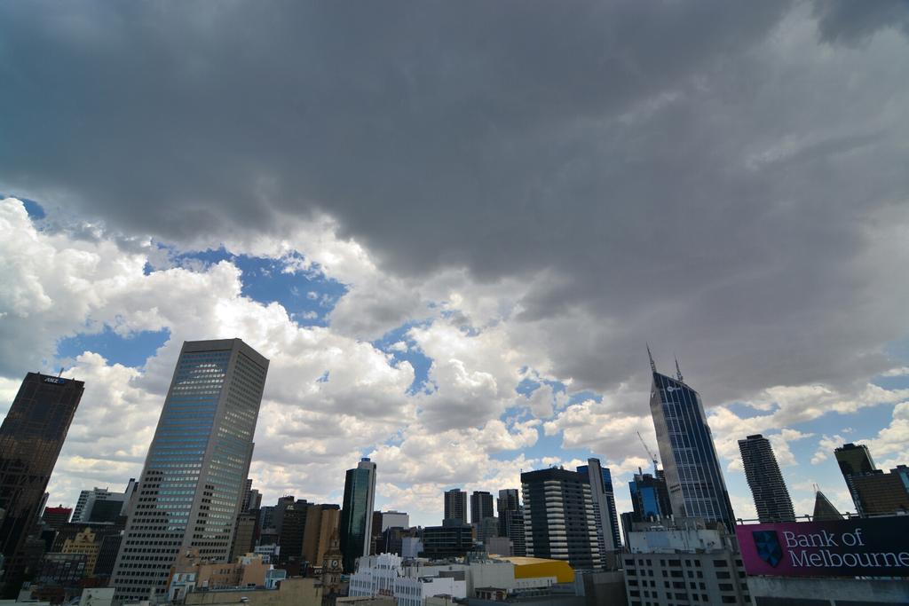
SEVERE THUNDERSTORM WARNING - MELBOURNE AREA

for HEAVY RAINFALL

For people in parts of the
Inner East,
Outer East and
Geelong and Bellarine Peninsula Local Warning Areas.
Issued at 2:36 pm Wednesday, 7 January 2015.
The Bureau of Meteorology warns that, at 2:35 pm, severe thunderstorms were detected on weather radar near Ringwood, Vermont, Moriac and the area east of Marysville. They are forecast to affect Geelong City, Lilydale and Scoresby by 3:05 pm and Ocean Grove, the area east of Lilydale and the area east of Mt Dandenong by 3:35 pm.
Heavy rainfall that may lead to flash flooding is likely.
The State Emergency Service advises that people should:
* keep away from creeks and drains.
* do not drive vehicles through flooded areas.
* stay indoors if possible.
* Avoid using the phone during the storm.
* if you are outside, avoid sheltering under trees
* listen to the radio for storm updates
* switch off your computer and electrical appliances
The next warning is due to be issued by 3:40 pm.
A more general severe thunderstorm warning is also current for the Central, East Gippsland, North East, West and South Gippsland and parts of the North Central districts.
Warnings are also available through TV and Radio broadcasts, the Bureau's website at http://www.bom.gov.au" onclick="window.open(this.href);return false; or call 1300 659 217. The Bureau and State Emergency Service would appreciate warnings being broadcast regularly.
Last edited by I_Love_Storms on Wed Jan 07, 2015 4:23 pm, edited 1 time in total.
S
Skywalker
Supercell
Reactions:
Posts: 1872
Joined: Sun Nov 29, 2009 10:03 am
Location: Burnside Heights/Cowes (Home) & Sunshine West (Work)

Re: Warm/hot and thundery: Jan 4 to 10

Post by Skywalker »

The local storm shield is in force again here, absolutely nothing! :x
Caroline Springs, Melbourne's meteorological boredom zone.
User avatar
occluded
Cumulonumbus Calvas
Reactions:
Posts: 611
Joined: Tue May 04, 2010 3:26 pm
Location: Mooroolbark 130m asl

Re: Warm/hot and thundery: Jan 4 to 10

Post by occluded »

Watching this unfold from sunny and mild San Francisco where it was about 13 and beautifully sunny today (that is... yesterday).

Over 100 storm jobs reported in the Nunawading/Vermont area in a fairly concentrated area, plenty of activity showing up on emergencyvic.info.
User avatar
Australis(Shell3155)
Supercell
Reactions:
Posts: 3146
Joined: Mon Nov 30, 2009 8:05 pm
Location: FTG
Contact:

Re: Warm/hot and thundery: Jan 4 to 10

Post by Australis(Shell3155) »

was a bit shocked with the thunder at 2pm. Lightening was amazing, but missed most of the heavy rain while grocery shopping..
sounds like stage 3 now @ 3.46pm.
User avatar
Onetahuti
Supercell
Reactions:
Posts: 2790
Joined: Thu Mar 25, 2010 9:37 pm
Location: Dandenong Nth.

Re: Warm/hot and thundery: Jan 4 to 10

Post by Onetahuti »

Plenty of noise but not a drop of rain, went out to make sure the rain gauge was empty which it wasn't but now is, the veg garden looked a very sorry sight.
W
WeatherViewer
Cumulonimbus
Reactions:
Posts: 388
Joined: Fri Oct 19, 2012 5:57 pm
Location: Truganina

Re: Warm/hot and thundery: Jan 4 to 10

Post by WeatherViewer »

hillybilly » Wed Jan 07, 2015 3:58 pm wrote:
hillybilly wrote:Deluge down here in Dockland about half an hour ago. Multiple flangs. Notice the new site got 18mm, much of it in the one cloud burst. Crazy that it was ~37C before hand, and the Ap with 0mm has seen 40C.

Back home, had 1mm :( Two storms died on our door step, and one currently just dipped down under us - site about 3km west has had 12mm and one 2km to our south has had 6mm. Still more coming, hopefully.

Don't think I can recall a day like today before in Melbourne :?:
Very crazy indeed, it was unreal here on St Kilda Road in the City where I work heavy torrential downpours.

Back home in Wyndham Vale not a single drop either and the local weather station which is very accurate, is current sitting at 43.5°C in a NNW. Not to forget Wyndham Vale is more inland than Werribee and we tend to be a few degrees warmer in Summer, and slightly cooler at night due to the open grass lands. The house will be an oven when I get home, and the A/C is on the wall in the lounge... Might camp out there tonight.
Locked