Thought I'd get in first with this one.
Front to cross Victoria tommorow with another weak one on Friday. At this point expecting 1-5mm here.

Welcome New Members! We want to hear from you. Register, stop lurking and start posting!
Cold Fronts 18/7/12 - 22/7/12
- Skywalker
- Supercell
- Reactions:
- Posts: 1871
- Joined: Sun Nov 29, 2009 10:03 am
- Location: Burnside Heights/Cowes (Home) & Sunshine West (Work)
Cold Fronts 18/7/12 - 22/7/12
Caroline Springs, Melbourne's meteorological boredom zone.
-
Karl Lijnders

- Tornadic Supercell
- Reactions:
- Posts: 5771
- Joined: Sun Nov 22, 2009 11:17 pm
- Location: Knoxfield, Victoria
Re: Cold Fronts 18/7/12 - 22/7/12
Hi Skywalker,
Yeah 1-5mm out in the western suburbs and up to 10mm locally in the east is fair. Some afternoon convection with hail and thunder is possible too.
A period of rain in the morning along the front but should be some sunny breaks come lunchtime.
Will be cold too with the warmth of today not returning till Sunday
Former Owner - The Australian Weather Forum. Email me anytime - weatherman1000@hotmail.com
Re: Cold Fronts 18/7/12 - 22/7/12
The front doesnt look so bad, 5mm already at mt gambier. Do you think it will slip down south of Victoria?
Go the bombersss!
-
Karl Lijnders
- Tornadic Supercell
- Reactions:
- Posts: 5771
- Joined: Sun Nov 22, 2009 11:17 pm
- Location: Knoxfield, Victoria
Re: Cold Fronts 18/7/12 - 22/7/12
Most likely slow down in the coming 12 hours and weaken over the state. Should see the cold air develop a band of follow up rain through SW Victoria tonight and that could see local falls of 5-10mm.
Cold air looking good for a period of showery weather tomorrow afternoon but nothing more than 5mm.
Cold air looking good for a period of showery weather tomorrow afternoon but nothing more than 5mm.
Former Owner - The Australian Weather Forum. Email me anytime - weatherman1000@hotmail.com
-
crikey

- Supercell
- Reactions:
- Posts: 1314
- Joined: Mon Feb 07, 2011 8:02 pm
- Location: tweed shire NSW and nDUNOLLY.. Nth Central district VIC
- Contact:
Re: Cold Fronts 18/7/12 - 22/7/12
Yeah. I see on national radar the wind change and cloud front has arrived near mt gambier and s/west VIC
http://www.bom.gov.au/products/national ... loop.shtml" onclick="window.open(this.href);return false;
It is actually not that cold on the wind change line and hoping it is nice and cold behind so we may have some snow top up on the ski fields
It is actually colder on inland SA than on the front line of the coming wind change at 10pm tonight
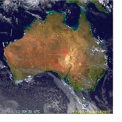
On the sat pic the cold looks quite a way behind?
http://www.bom.gov.au/sa/observations/saall.shtml" onclick="window.open(this.href);return false;
We have had an annoying Nth/Nth westerly all day here today on the flat pastoral plains. Just settled down tonight.
Wondering if that shower/rain band arriving will be strong enough to push into central country Vic.
More often than not we get little to nothing from those fronts in Dunolly a few hundred km's from the coast ,unless the fronts are super strong
Mt gambier has already had 6mm
Looks like that front will come through tonight or early tomorrow morning for us here
http://www.bom.gov.au/products/national ... loop.shtml" onclick="window.open(this.href);return false;
It is actually not that cold on the wind change line and hoping it is nice and cold behind so we may have some snow top up on the ski fields
It is actually colder on inland SA than on the front line of the coming wind change at 10pm tonight
On the sat pic the cold looks quite a way behind?
http://www.bom.gov.au/sa/observations/saall.shtml" onclick="window.open(this.href);return false;
We have had an annoying Nth/Nth westerly all day here today on the flat pastoral plains. Just settled down tonight.
Wondering if that shower/rain band arriving will be strong enough to push into central country Vic.
More often than not we get little to nothing from those fronts in Dunolly a few hundred km's from the coast ,unless the fronts are super strong
Mt gambier has already had 6mm
Looks like that front will come through tonight or early tomorrow morning for us here
-
Karl Lijnders
- Tornadic Supercell
- Reactions:
- Posts: 5771
- Joined: Sun Nov 22, 2009 11:17 pm
- Location: Knoxfield, Victoria
Re: Cold Fronts 18/7/12 - 22/7/12
Yeah that front has arrived in Central areas this morning with a marked drop in temps and a band of rain. 4mm here and widespread 2-5mm through the south with spot falls of 10mm in the SW.
Should see the showers increase across the southwest this morning and extend to Central areas during the day but ease rapidly tonight as a ridge moves in.
Very cold tomorrow morning with widespread frost.
Some snowfalls about the Alpine Areas too, only to 1100m
Should see the showers increase across the southwest this morning and extend to Central areas during the day but ease rapidly tonight as a ridge moves in.
Very cold tomorrow morning with widespread frost.
Some snowfalls about the Alpine Areas too, only to 1100m
Former Owner - The Australian Weather Forum. Email me anytime - weatherman1000@hotmail.com
-
stratospear

- Supercell
- Reactions:
- Posts: 1261
- Joined: Sat Dec 19, 2009 9:38 am
- Location: Usually Bendigo
Re: Cold Fronts 18/7/12 - 22/7/12
A complete joke of a cold front if the Melbourne CBD AWS is to be believed - Only midday and already 14.5 degC with sunny skies. Cape Otway seems to be the only place in the state that's experiencing it (8.4 degC & 2.4mm).
It's been 4 years (August 2008) since we've had a decent SWly cold front. Still waiting...
It's been 4 years (August 2008) since we've had a decent SWly cold front. Still waiting...
- I_Love_Storms
- Supercell
- Reactions:
- Posts: 2812
- Joined: Wed Dec 02, 2009 2:01 pm
- Location: Hawthorn
Re: Cold Fronts 18/7/12 - 22/7/12
Upper levels are quite cold. Some of the cloud tops are pretty high and some decent convection around with convective showers with possible small hail moving through western suburbs
-
stratospear
- Supercell
- Reactions:
- Posts: 1261
- Joined: Sat Dec 19, 2009 9:38 am
- Location: Usually Bendigo
Re: Cold Fronts 18/7/12 - 22/7/12
Maximum temp so far at Melb CBD - 15.0degC
Maximum temp so far at Essendon & Avalon Airports - 13.4degC
Says it all really!
Maximum temp so far at Essendon & Avalon Airports - 13.4degC
Says it all really!
-
daviescr

- Supercell
- Reactions:
- Posts: 1394
- Joined: Wed Dec 02, 2009 5:40 pm
- Location: Warranwood, Vic
Re: Cold Fronts 18/7/12 - 22/7/12
Just had a brief hail shower here, less than pea sized. Lovely looking clouds to the south west of my place, will try and get a pic up if my busted knee lets me move
- Monbulkian
- Cumulonimbus
- Reactions:
- Posts: 192
- Joined: Thu Nov 11, 2010 9:42 pm
- Location: Monbulk
Re: Cold Fronts 18/7/12 - 22/7/12
Rain and small hail here in monbulk too
-
Didjman

- Supercell
- Reactions:
- Posts: 2099
- Joined: Fri Sep 03, 2010 2:52 pm
- Location: Wallan, Vic 328m ASL
- Contact:
Re: Cold Fronts 18/7/12 - 22/7/12
Some very good looking coldies passing nth and sth of us here. I have a few pics myself.
Peter
Peter
- Skywalker
- Supercell
- Reactions:
- Posts: 1871
- Joined: Sun Nov 29, 2009 10:03 am
- Location: Burnside Heights/Cowes (Home) & Sunshine West (Work)
Re: Cold Fronts 18/7/12 - 22/7/12
Spotted a nice looking rain curtain just west of work as I was on my lunch break. Unfortunately no hope of taking pictures as I was driving.
Another line of showers on it's way from the south west.
Another line of showers on it's way from the south west.
Caroline Springs, Melbourne's meteorological boredom zone.
-
BigTom

- Cumulus
- Reactions:
- Posts: 84
- Joined: Tue May 22, 2012 9:01 pm
- Location: Caroline Springs, Victoria
Re: Cold Fronts 18/7/12 - 22/7/12
12.1C here at the moment with a dew point of -2.5C !!! Slot of dry air? No rain here today..
-
stratospear
- Supercell
- Reactions:
- Posts: 1261
- Joined: Sat Dec 19, 2009 9:38 am
- Location: Usually Bendigo
Re: Cold Fronts 18/7/12 - 22/7/12
Could be some frost around tomorrow morning if the cloud stays away.BigTom wrote:12.1C here at the moment with a dew point of -2.5C !!! Slot of dry air? No rain here today..
- Geoff
- Supercell
- Reactions:
- Posts: 2538
- Joined: Tue Jul 05, 2011 9:46 pm
- Location: Olinda VIC (470m ASL)
Re: Cold Fronts 18/7/12 - 22/7/12
Yep, I was caught out in that one, up the top of a big stepladder with a big hedgetrimmer in my hands!Monbulkian wrote:Rain and small hail here in monbulk too
(Memo to self: carry camera in pocket when at work on days like this!!!)
AWF Rainfall Details - Monthly rainfall stats. Please post your totals here at the end of each month, thank you –
http://www.theaustralianweatherforum.co ... &start=180
http://www.theaustralianweatherforum.co ... &start=180
-
93ben
- Site Admin
- Reactions:
- Posts: 603
- Joined: Tue Dec 27, 2011 12:28 am
- Location: Templestowe, Victoria
- Contact:

Re: Cold Fronts 18/7/12 - 22/7/12
No hail here today only just a couple of morning drops and that was about it.
Anyway from watching the news the other night they say we're up for a dry summer with below average rainfall.

Please no, I want storms not back to when we had drought and there was nothing to look forward to but the hot heat. This map from the BOM just puts us under bushfire risk and I'm pretty sure most of the vegetation burnt out in the Black Saturday Bushfires has recovered. It would be a shame to see another bushfire like this one.
Anyway from watching the news the other night they say we're up for a dry summer with below average rainfall.
Please no, I want storms not back to when we had drought and there was nothing to look forward to but the hot heat. This map from the BOM just puts us under bushfire risk and I'm pretty sure most of the vegetation burnt out in the Black Saturday Bushfires has recovered. It would be a shame to see another bushfire like this one.
- Geoff
- Supercell
- Reactions:
- Posts: 2538
- Joined: Tue Jul 05, 2011 9:46 pm
- Location: Olinda VIC (470m ASL)
Re: Cold Fronts 18/7/12 - 22/7/12
I'll let Anthony reply to that one 93ben. 
AWF Rainfall Details - Monthly rainfall stats. Please post your totals here at the end of each month, thank you –
http://www.theaustralianweatherforum.co ... &start=180
http://www.theaustralianweatherforum.co ... &start=180
Re: Cold Fronts 18/7/12 - 22/7/12
Another 3mm rain here this afternoon up to 78.5mm for the month.Our well at house has just started to run over first time in the last 10years. A lot of spings here are running like little rivers.
-
Anthony Violi

- Supercell
- Reactions:
- Posts: 2652
- Joined: Mon Nov 23, 2009 9:03 pm
- Location: Lilydale
- Contact:
Re: Cold Fronts 18/7/12 - 22/7/12
Never seen such horsesh1t Geoff....the last 36 has been wrong, this one will be no exception.
The Bom are practicing cretins all of them. Just remember when we get a massive flood in a couple of months the diatribe on that graph. Or the cold snap....ATM we have a bizzare pattern going on, and make no mistake it will plunge back into winter without a care in the world of some nonsensical graph. Models have no clue, neither do the fools who print these graphs, anyone who claims that we will see an el niño or deficient rainfall because of it is so deluded they have grown two extra arms...
The Bom are practicing cretins all of them. Just remember when we get a massive flood in a couple of months the diatribe on that graph. Or the cold snap....ATM we have a bizzare pattern going on, and make no mistake it will plunge back into winter without a care in the world of some nonsensical graph. Models have no clue, neither do the fools who print these graphs, anyone who claims that we will see an el niño or deficient rainfall because of it is so deluded they have grown two extra arms...
http://www.therealworldweatherforum.com" onclick="window.open(this.href);return false;
avweatherforecasts.com
avweatherforecasts.com