
Welcome New Members! We want to hear from you. Register, stop lurking and start posting!
Extended warm spell and becoming humid - Feb 6 to 24
Re: Extended warm spell and becoming humid - Feb 6 to 15
Yep just checked the radar its moving in !!!! its massive, i have photos can i put them up directly through the forum or through flickr?!  the clouds are moving WSW here and picking up speed
Go the bombersss!
-
Tempest
- Cumulonimbus
- Reactions:
- Posts: 148
- Joined: Sat Aug 14, 2010 8:34 pm
- Location: Warragul North, Vic... 140m asl
Re: Extended warm spell and becoming humid - Feb 6 to 15
Splitting into two monsters now :O
-
Tempest
- Cumulonimbus
- Reactions:
- Posts: 148
- Joined: Sat Aug 14, 2010 8:34 pm
- Location: Warragul North, Vic... 140m asl
Re: Extended warm spell and becoming humid - Feb 6 to 15
Stefan you need to post them on Flickr first.
Re: Extended warm spell and becoming humid - Feb 6 to 15
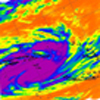
http://www.bom.gov.au/products/IDV65752.shtml" onclick="window.open(this.href);return false;
SEVERE THUNDERSTORM WARNING - MELBOURNE AREA
for DAMAGING WIND, HEAVY RAINFALL and LARGE HAILSTONES
For people in parts of the
Northern Local Warning Area.
Issued at 7:42 pm Friday, 15 February 2013.
The Bureau of Meteorology warns that, at 7:40 pm, severe thunderstorms were detected on weather radar near Whittlesea and the area west of Whittlesea. These thunderstorms are moving towards the southwest. They are forecast to affect Epping by 8:10 pm and Broadmeadows, Craigieburn and Greensborough by 8:40 pm.
Damaging winds, heavy rainfall that may lead to flash flooding and large hailstones are likely.
The State Emergency Service advises that people should:
* Keep clear of fallen power lines.
* secure any loose objects in the vicinity of your home.
* keep away from creeks and drains.
* do not drive vehicles through flooded areas.
* stay indoors if possible.
* Avoid using the phone during the storm.
* if you are outside, avoid sheltering under trees
* listen to the radio for storm updates
* switch off your computer and electrical appliances
The next warning is due to be issued by 8:45 pm.
A more general severe thunderstorm warning is also current for parts of the Central, South West, North Central and Wimmera districts.
Warnings are also available through TV and Radio broadcasts, the Bureau's website at http://www.bom.gov.au" onclick="window.open(this.href);return false; or call 1300 659 217. The Bureau and State Emergency Service would appreciate warnings being broadcast regularly.
^severe thunderstorm warning
Go the bombersss!
Re: Extended warm spell and becoming humid - Feb 6 to 15
wow hope we get some night time lightning!!
looks to be slightly coming this way more so than earlier today too
just heard a rumble of thunder....where was that from!!?
looks to be slightly coming this way more so than earlier today too
just heard a rumble of thunder....where was that from!!?
-
mick

- Supercell
- Reactions:
- Posts: 1453
- Joined: Mon Nov 30, 2009 6:45 pm
- Location: Mid North SA Baaaaaaaaaaaaaaa
Re: Extended warm spell and becoming humid - Feb 6 to 15
Looking toward Yan Yean from carrum 10 minutes ago, it all just collapsed from my view since then.
- 004 [800x600].jpg (51.03 KiB) Viewed 6720 times
- Rhino
- Supercell
- Reactions:
- Posts: 1227
- Joined: Mon Nov 30, 2009 11:37 am
- Location: Carisbrook-Near Maryborough
Re: Extended warm spell and becoming humid - Feb 6 to 15
Gosh I love the BOM's optimism in regards of movement on that map, almost due south. I'd be thinking more W or slightly SW movement looking at steering atm, unless it turns into a left mover . I would say look out sunbury and melton. Nice looking storm though and hope it reaches the burbs.
Rhino.
Rhino.
Last edited by Rhino on Fri Feb 15, 2013 8:16 pm, edited 1 time in total.
Re: Extended warm spell and becoming humid - Feb 6 to 15
I can hear thunder now, distant lightening. Ill upload a photo later!
Go the bombersss!
Re: Extended warm spell and becoming humid - Feb 6 to 15
Once again some strange storm directions happening but I guess after early yesterday mornings storms can't say I'm surprised at all, I did notice earlier on today how many different directions there were of the winds, no doubt fueling development, btw that facebook photo is nice.
-
mick
- Supercell
- Reactions:
- Posts: 1453
- Joined: Mon Nov 30, 2009 6:45 pm
- Location: Mid North SA Baaaaaaaaaaaaaaa
Re: Extended warm spell and becoming humid - Feb 6 to 15
Changed its mind, its looking angrier now, when the s/e wind hits it it will follow boms path I reckon.
Going to be a spectacular sunset for some.
- k 045 [800x600].jpg (36.41 KiB) Viewed 7067 times
Last edited by mick on Fri Feb 15, 2013 8:22 pm, edited 1 time in total.
-
Didjman

- Supercell
- Reactions:
- Posts: 2099
- Joined: Fri Sep 03, 2010 2:52 pm
- Location: Wallan, Vic 328m ASL
- Contact:
Re: Extended warm spell and becoming humid - Feb 6 to 15
Watched that Kilmore cell develop from here at work. It rapidly grew beneath the anvil plume from the Macedon storm, and quickly developed a western hdg. saw some awesome strikes, but being at work, couldnt photograph:(
It is only now dying 100klms to the west, and 4HOURS later!! Had a triangle black core between Kilmore and Lancefield at one point. It also backbuilt to the east for an hour. At around 4pm, another cell develloped east of Broadford, and motored over here b4 dying(or being overwhelmed by the Kilmore cell). Soz, no pics as at work. Recorded 6mm with flash flooding in around 15mins.
Peter
Re: Extended warm spell and becoming humid - Feb 6 to 15
Storm is definitely closer and thunder is getting louder, alright this isnt represented by the radar which has it staling. SE winds here still
Go the bombersss!
-
Tempest
- Cumulonimbus
- Reactions:
- Posts: 148
- Joined: Sat Aug 14, 2010 8:34 pm
- Location: Warragul North, Vic... 140m asl
Re: Extended warm spell and becoming humid - Feb 6 to 15
Looks like its dying a fast death on radar...
-
mick
- Supercell
- Reactions:
- Posts: 1453
- Joined: Mon Nov 30, 2009 6:45 pm
- Location: Mid North SA Baaaaaaaaaaaaaaa
Re: Extended warm spell and becoming humid - Feb 6 to 15
There goes the hook now.
Re: Extended warm spell and becoming humid - Feb 6 to 15
So much for that excitement haha! Decaying now..
Go the bombersss!
- rikjpool
- Storm Chaser
- Reactions:
- Posts: 989
- Joined: Thu Nov 26, 2009 1:46 pm
- Location: Home: North Bendigo-just behind Lake Weeroona, Vic. Work: 1.5Km SE from Bendigo AWS
Re: Extended warm spell and becoming humid - Feb 6 to 15
Shared with permission.
This is the cell that started out at Kilmore and had the black core for some amount of frames. This is taken just East of Kynton by Jenelle Ambrose.

You can find Jenelle and more of her pics here...
https://www.facebook.com/jenelle.ambrose" onclick="window.open(this.href);return false;
This is the cell that started out at Kilmore and had the black core for some amount of frames. This is taken just East of Kynton by Jenelle Ambrose.
You can find Jenelle and more of her pics here...
https://www.facebook.com/jenelle.ambrose" onclick="window.open(this.href);return false;
I live in a world where I dont see to believe, but I believe to see...
Re: Extended warm spell and becoming humid - Feb 6 to 15
Awesome photo, is that a funnel!? Looks like it haha but i doubt it is ..
Go the bombersss!
-
93ben
- Site Admin
- Reactions:
- Posts: 603
- Joined: Tue Dec 27, 2011 12:28 am
- Location: Templestowe, Victoria
- Contact:

Re: Extended warm spell and becoming humid - Feb 6 to 15
Wow you saw exactly what I saw...mick » Fri Feb 15, 2013 8:21 pm wrote:mick wrote:Going to be a spectacular sunset for some.

I was just outside taking photos of the sunset in the clouds at my place in Templestowe and all of a sudden, I notice greenage (hail) in the clouds and then lightning flashing. It's like the storm is just starting up over my house! lol
- Rhino
- Supercell
- Reactions:
- Posts: 1227
- Joined: Mon Nov 30, 2009 11:37 am
- Location: Carisbrook-Near Maryborough
Re: Extended warm spell and becoming humid - Feb 6 to 15
5.5mm here yesterday, 16mm over the last 48hrs so happy with that. The backyard looking greener already, amazing what some natural rain, and especially storm rain, will do overnight what town water can't  . See what today brings.
Rhino.
Rhino.
-
occluded

- Cumulonumbus Calvas
- Reactions:
- Posts: 611
- Joined: Tue May 04, 2010 3:26 pm
- Location: Mooroolbark 130m asl
Re: Extended warm spell and becoming humid - Feb 6 to 15
Spent a good hour or so watching that Whittlesea storm cloud to the north as I rode home along the trail through Heidelberg, looked impressive. I was willing it to move south but no dice. Got my hopes up again when the STW came through but dashed again, just died almost on our doorstep.
0mm so far for this event. 22.3/15.9 here this morning.
Maybe today it will be a case of 'third day' lucky, who knows.
0mm so far for this event. 22.3/15.9 here this morning.
Maybe today it will be a case of 'third day' lucky, who knows.