
Welcome New Members! We want to hear from you. Register, stop lurking and start posting!
Victoria - Storms 22nd to 29th
-
Supercellimpact

- Supercell
- Reactions:
- Posts: 1238
- Joined: Thu Oct 07, 2010 8:39 pm
- Location: Bendigo
Victoria - Storms 22nd to 29th
With storms firing, and pics and reports maybe coming in the days ahead, here is and thread for it. 
Last edited by Supercellimpact on Tue Nov 23, 2010 1:13 pm, edited 1 time in total.
- Harley34
- Cumulonumbus Calvas
- Reactions:
- Posts: 580
- Joined: Sat Mar 06, 2010 1:08 pm
- Location: Ringwood East, Melbourne
Re: Victoria - Storms 22nd to 27th
Mate, it's looking great from Thursday, all the way until Tuesday at this stage.
I'd suggest changing the date to the 29th or 30th.
Stormcast's latest run looks pretty epic for Sunday afternoon.
I'd suggest changing the date to the 29th or 30th.
Stormcast's latest run looks pretty epic for Sunday afternoon.
- Hamlan
- Storm Chaser
- Reactions:
- Posts: 449
- Joined: Tue Dec 22, 2009 11:05 pm
- Location: Northern suburbs
Re: Victoria - Storms 22nd to 29th
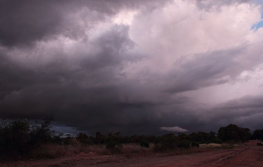
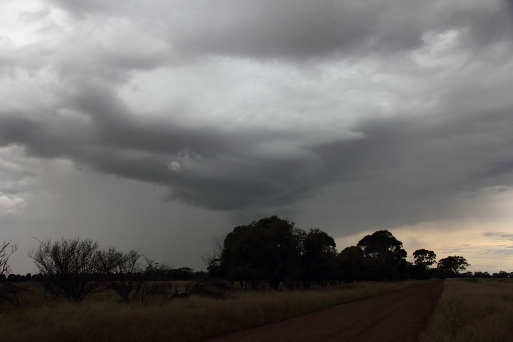
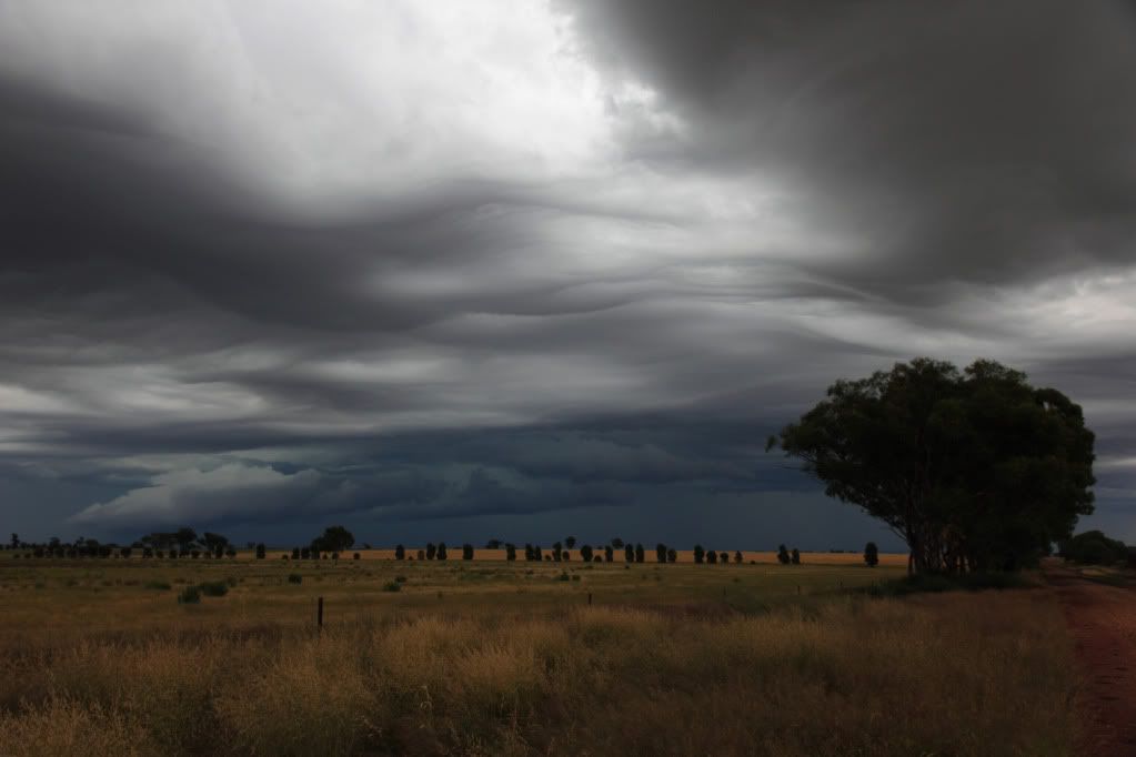
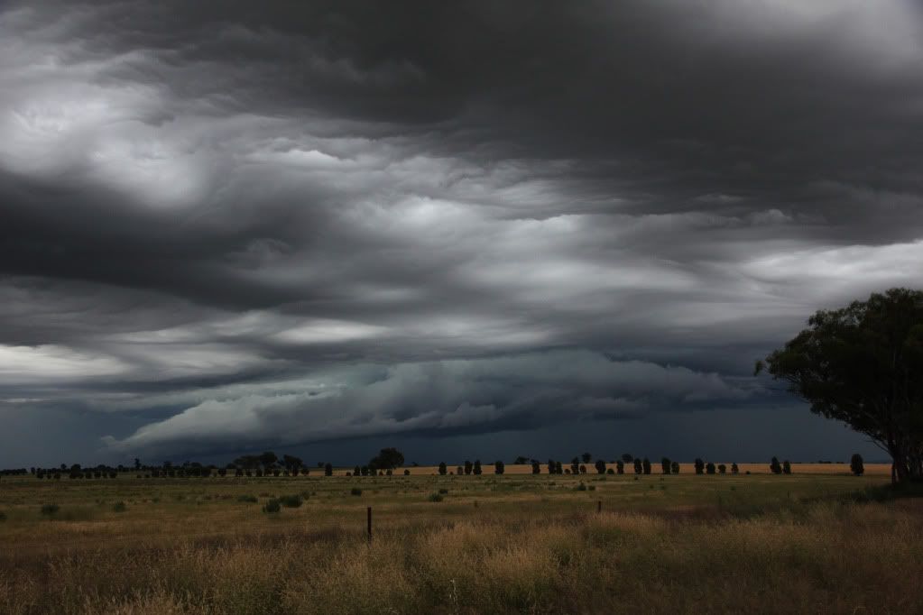
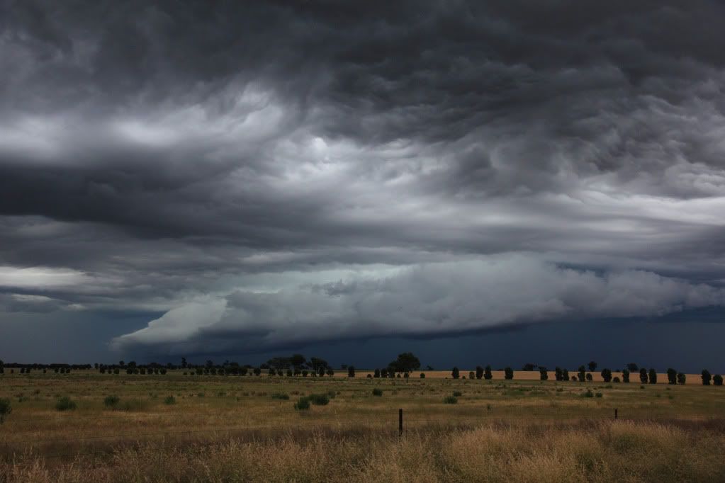
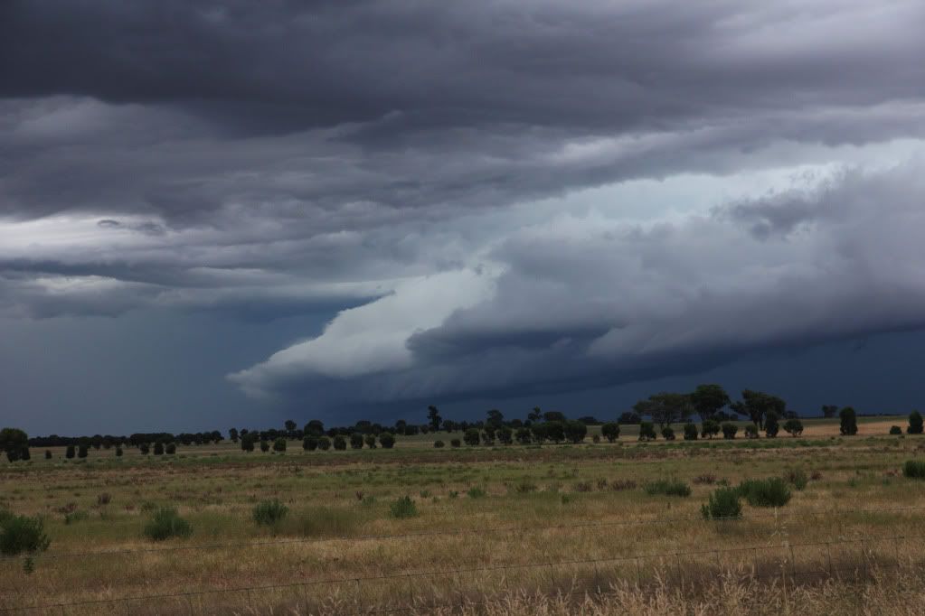
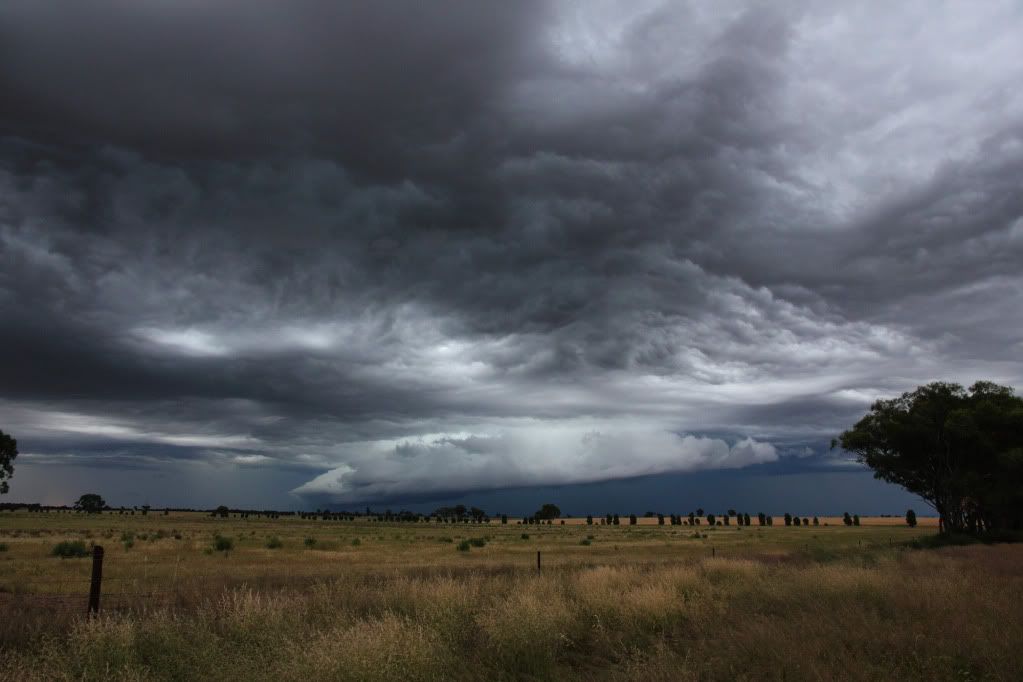
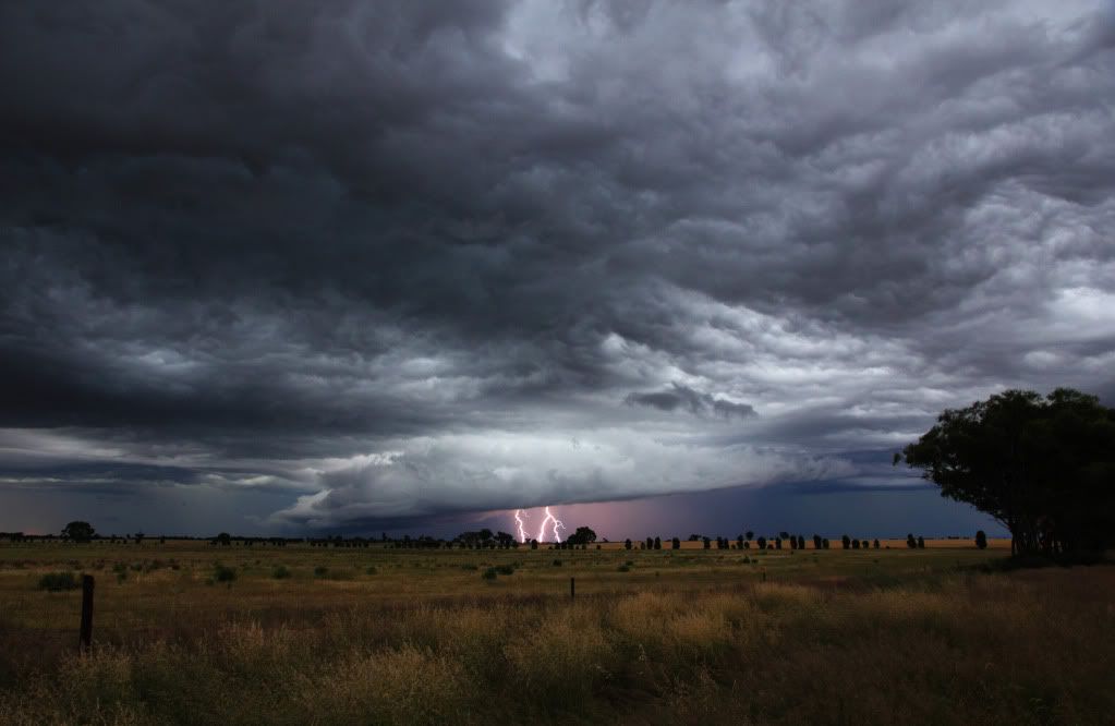
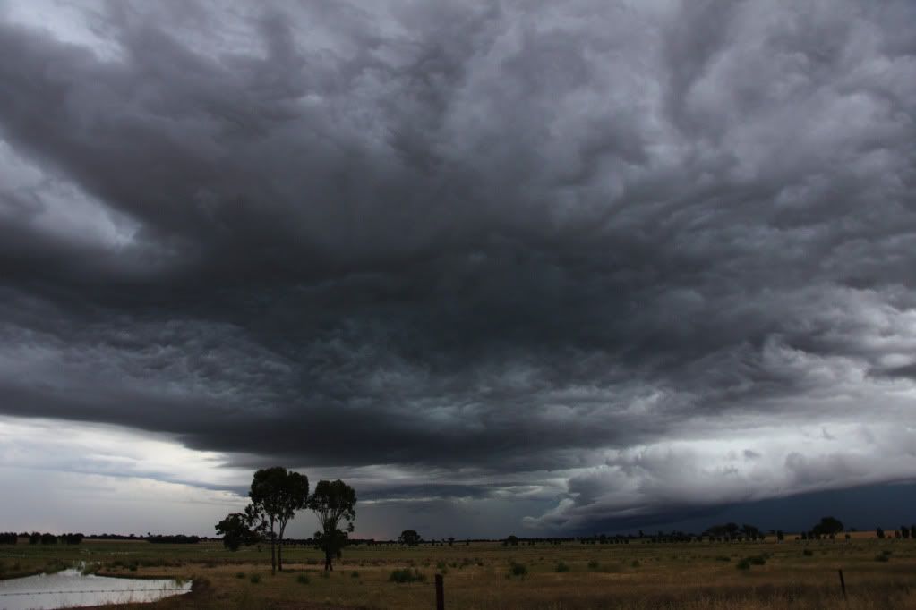
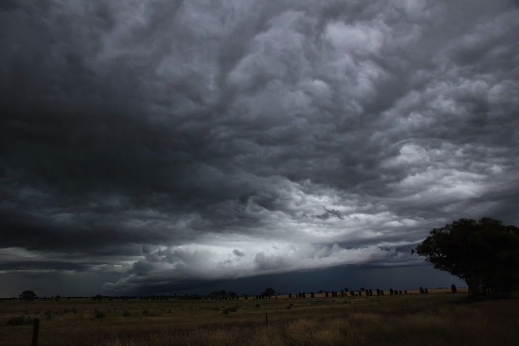
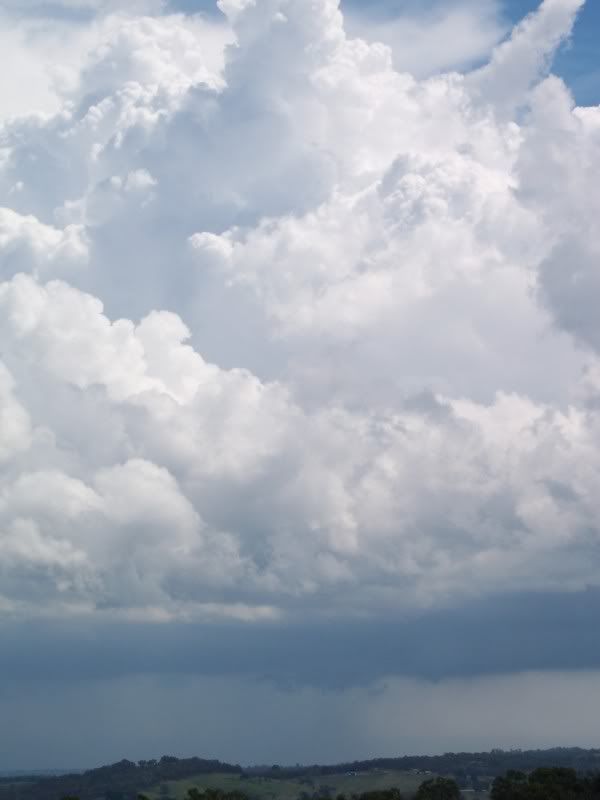
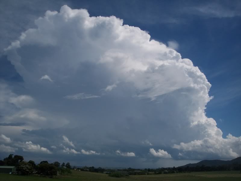
Chased the south west today. Scored a couple of early high based storms exhibiting rotation near Chatsworth, one which developed a weak wall cloud. Then later on I was treated to a strong and very low structured cell just south of the Grampians and SE of Cavendish. It made my jaw drop as I caught a glimpse through trees and then as I emerged into a clearing but I wish I hadve got there 5mins earlier. Got pics and vid of it but it was on the decline then  But, I was then able to watch as several new cells developed in its wake with the Grampians nearby (pretty cool scene!) including some interesting low scud interaction and then a beautiful structured and persistent LP (was it a supercell that is a question?) storm. It's debateable whether it was a supercell but I guess it may well have been as I watched it rotating for at least 15mins with barber pole corkscrew updraft and multiple inflow points. I'm not sure how long it was rotating but it was borderline supercell by definition.
Brad


Brad


Re: Victoria - Storms 22nd to 29th
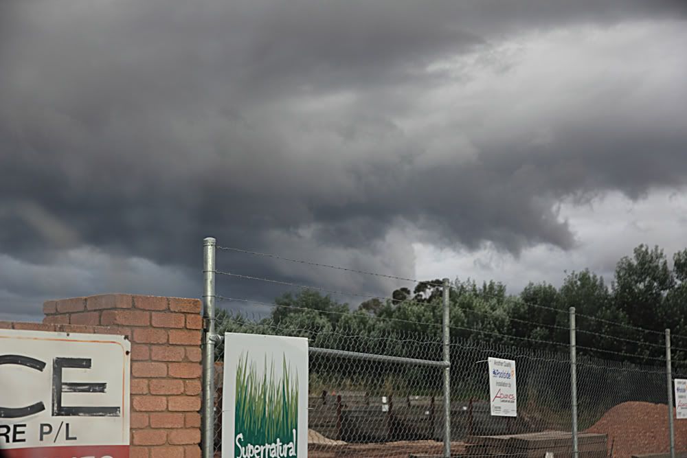
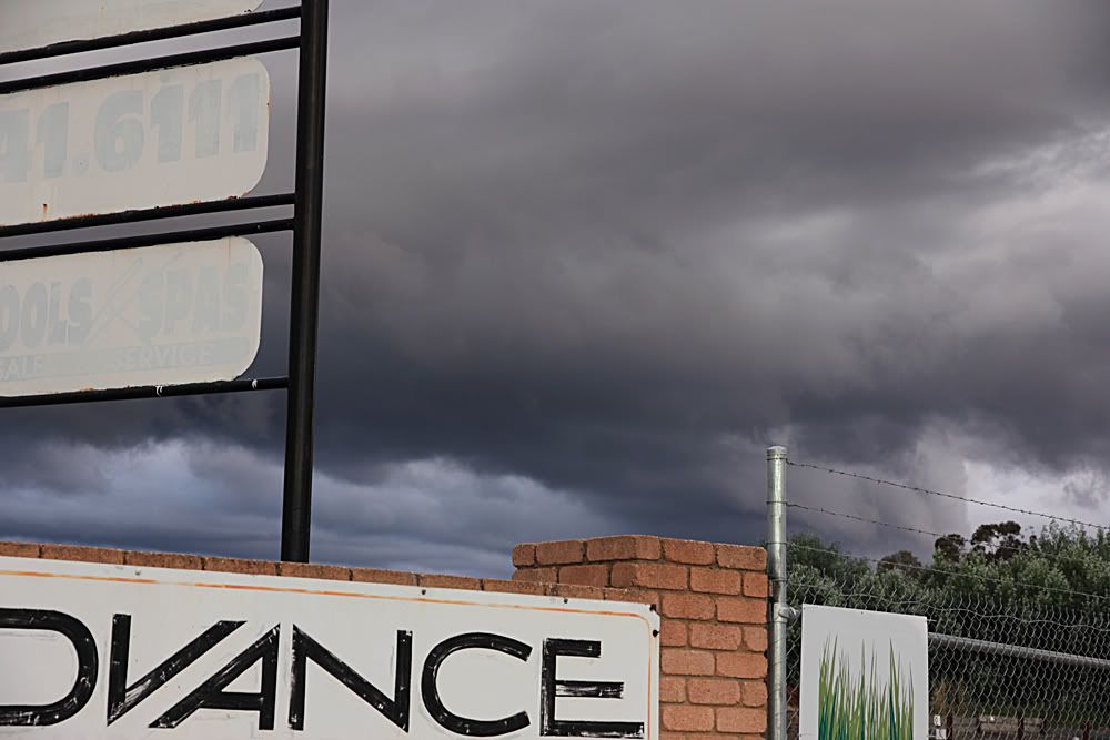
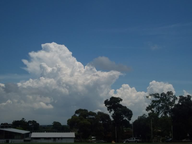
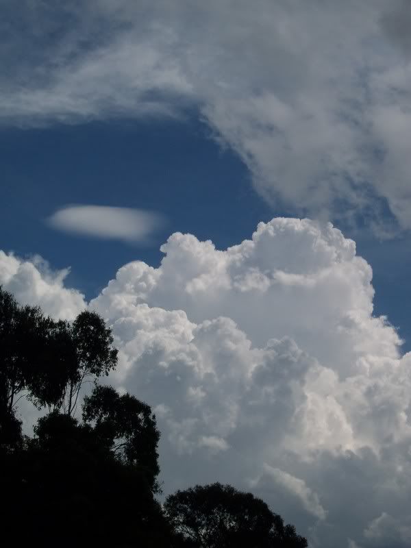
Pics from a quick chase around the industrial areas of Bendigo (Strathdale area)...
First couple from the backyard of some nice towers...
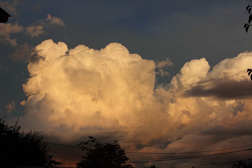
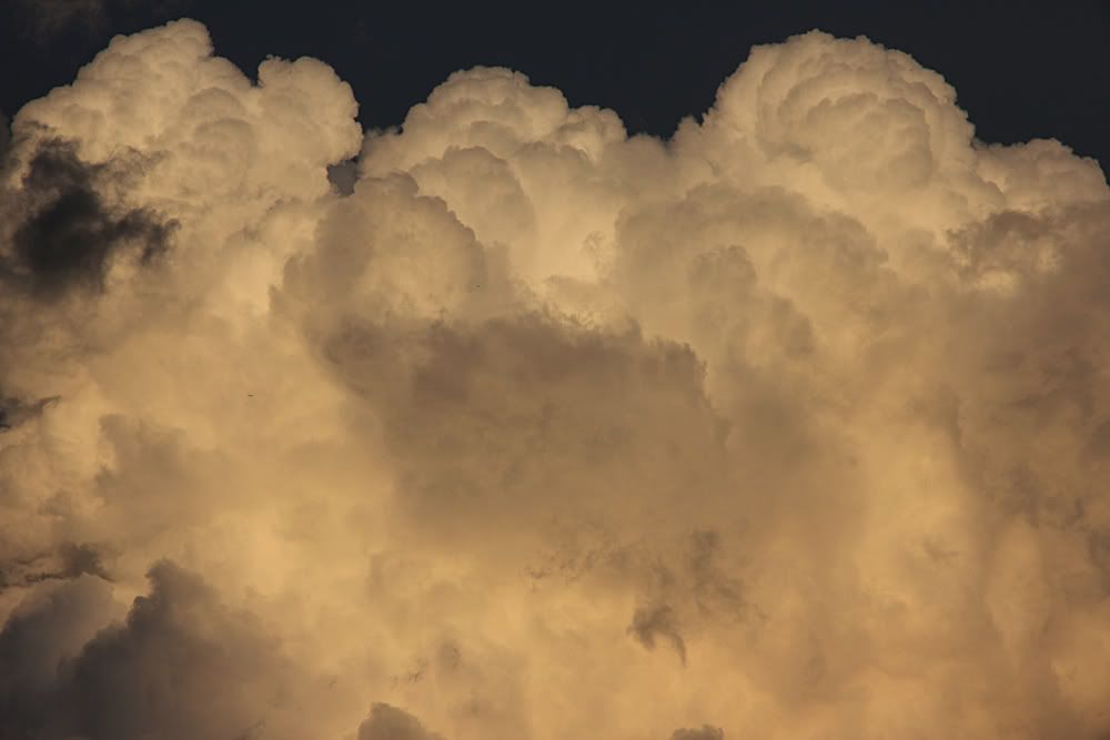
This was enough evidence to convince me to go for a drive to see what was happening. Whilst this wasn't some incredible severe storm or anything, there certainly was some nice structure and ground hugging cloud around that made the chase, albeit a short one, quite enjoyable.
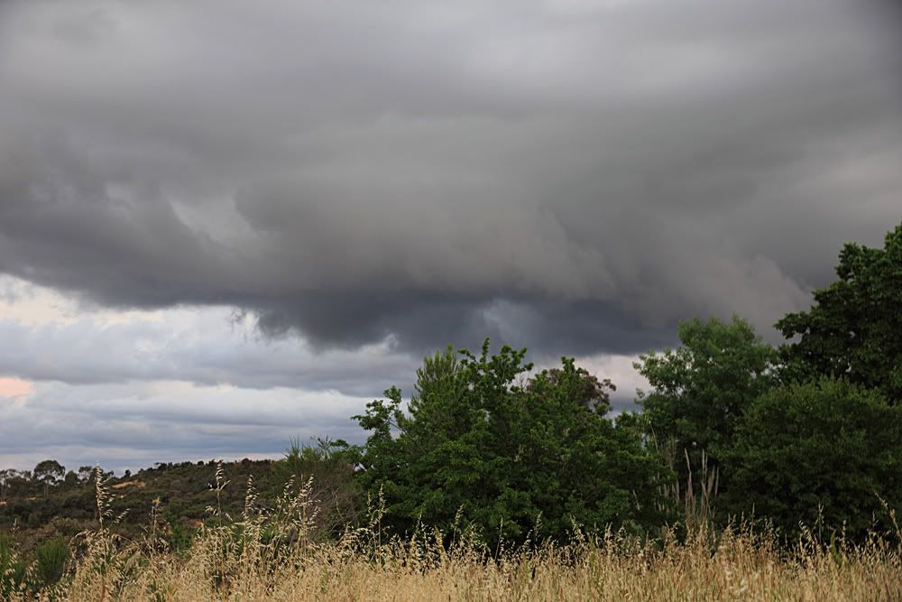
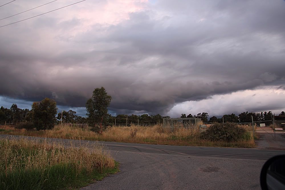
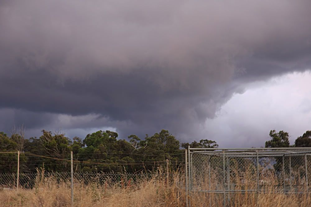
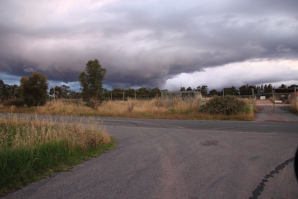
Nice tower lit up by the evening sun...
Light was gone by this point, so I headed home. Caught a few flashes while I was walking the dog, which was a nice bonus.
First couple from the backyard of some nice towers...
This was enough evidence to convince me to go for a drive to see what was happening. Whilst this wasn't some incredible severe storm or anything, there certainly was some nice structure and ground hugging cloud around that made the chase, albeit a short one, quite enjoyable.
Nice tower lit up by the evening sun...
Light was gone by this point, so I headed home. Caught a few flashes while I was walking the dog, which was a nice bonus.
- Hamlan
- Storm Chaser
- Reactions:
- Posts: 449
- Joined: Tue Dec 22, 2009 11:05 pm
- Location: Northern suburbs
Re: Victoria - Storms 22nd to 29th
Nice Greg, always a bonus to get a shot with the tower and the cloud base visible together! I see you mention Strathdale and 'quick chase' so I assume you live close to there. My sis-inlaw lives in Kennington near the old orphanage and im up there from time to time and have stayed there overnight before or after chases sometimes. You also mentioned lightning but I cant recall, have you tried shooting lightning?
- Hamlan
- Storm Chaser
- Reactions:
- Posts: 449
- Joined: Tue Dec 22, 2009 11:05 pm
- Location: Northern suburbs
Re: Victoria - Storms 22nd to 29th
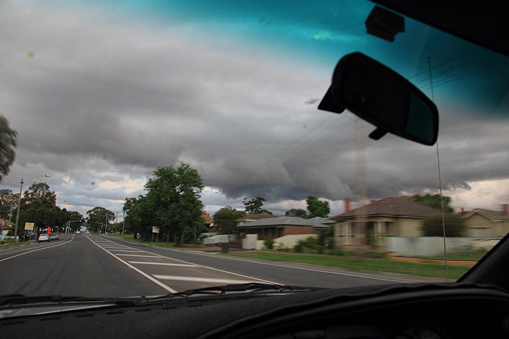
As an entree to the day's storms I watched from work as the storm that exploded over the inner NW suburbs, slowly made its way over the CBD leading to white out conditions and reportedlyt flash flooding in Ascot Vale and Sth Melb. The first two pics show that storm from the 26th floor of my building. Later in the day I drove north to chase!
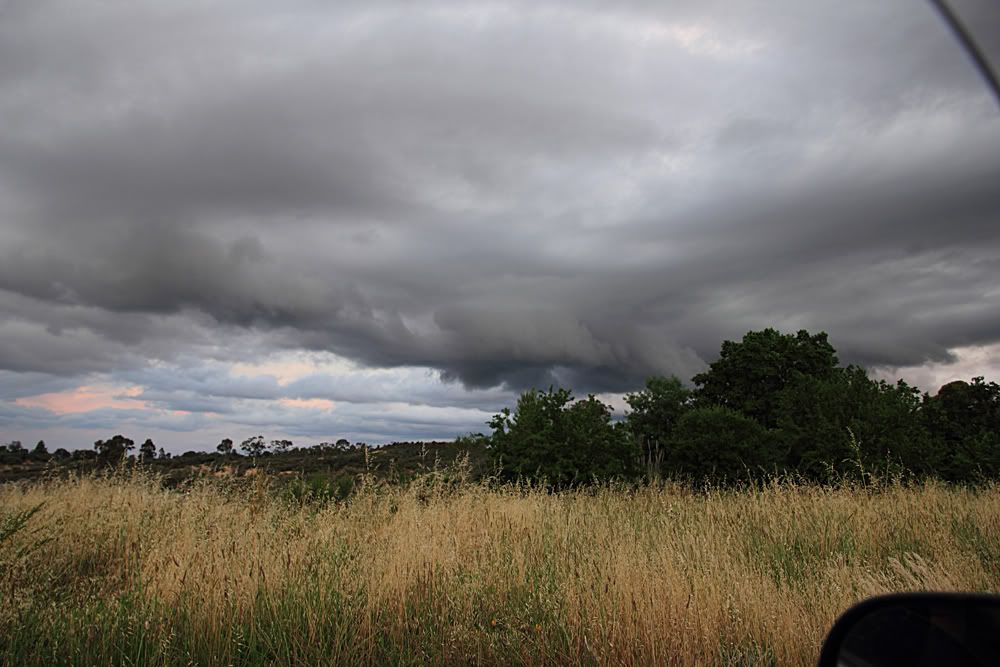
I chased north of Melbourne on Friday evening and scored firstly a structured cell at Craigieburn that exhibited storm scale rotation with curved banding and inflow bands and interesting base features. I stopped at Donnybrook and watched for an hour. It was moving somewhat northerly, I assume on a boundary as opposed to many other cells that were moving SE. This cell weakened before strengthening again although, as a smaller cell but beautiful to watch and capture. It produced a strong wall cloud and more curved structure that appeared to be due to stormscale rotation and was slow moving. I could see (also on radar) that a new cell was heading south from the Kilmore direction and was on a collision course in front of me so I waited. When the two cells began to interact a very low and strong wall cloud formed NW of Wallan and got my attention. The pics (and my timelapse) tell the story. Yet another impressive wall cloud with funnels behind a bloody hill. This was certainly potentially tornadic but I dont know if it touched down. The southern cell won the battle and the area of circulation moved back northward toward Kilmore so I moved north. While in transit towards Kilmore I could see that the storm base (I thought it was a wall cloud at the time) was now much lower and much bigger as can be seen in the pics and was looking very ominous if it was producing a tornado. Of course there is a hill in the way but when I finally got a view there was a wall cloud and it was still rotating with needle funnels doing their thing and a nice low level inflow tail. Rain got me at this stage and I turned my attention to lightning. I got up close to some of the brightest CG's I've ever seen and at f8 I blew out one of my shots - I reckon f14 wouldve been ok! Another great chase.


I chased north of Melbourne on Friday evening and scored firstly a structured cell at Craigieburn that exhibited storm scale rotation with curved banding and inflow bands and interesting base features. I stopped at Donnybrook and watched for an hour. It was moving somewhat northerly, I assume on a boundary as opposed to many other cells that were moving SE. This cell weakened before strengthening again although, as a smaller cell but beautiful to watch and capture. It produced a strong wall cloud and more curved structure that appeared to be due to stormscale rotation and was slow moving. I could see (also on radar) that a new cell was heading south from the Kilmore direction and was on a collision course in front of me so I waited. When the two cells began to interact a very low and strong wall cloud formed NW of Wallan and got my attention. The pics (and my timelapse) tell the story. Yet another impressive wall cloud with funnels behind a bloody hill. This was certainly potentially tornadic but I dont know if it touched down. The southern cell won the battle and the area of circulation moved back northward toward Kilmore so I moved north. While in transit towards Kilmore I could see that the storm base (I thought it was a wall cloud at the time) was now much lower and much bigger as can be seen in the pics and was looking very ominous if it was producing a tornado. Of course there is a hill in the way but when I finally got a view there was a wall cloud and it was still rotating with needle funnels doing their thing and a nice low level inflow tail. Rain got me at this stage and I turned my attention to lightning. I got up close to some of the brightest CG's I've ever seen and at f8 I blew out one of my shots - I reckon f14 wouldve been ok! Another great chase.


-
Blackee

- Site Admin/Moderator
- Reactions:
- Posts: 3859
- Joined: Tue Nov 24, 2009 8:57 pm
- Location: Elwood and Mansfield 370m
Re: Victoria - Storms 22nd to 29th
Ah Brad, you've done it again!
Brilliant captures and good report.
Brilliant captures and good report.
Mansfield 370m and Elwood
Re: Victoria - Storms 22nd to 29th
There is an alligator head in that 5th last pic! He's about to eat the lightning, haha
But yeah, good work Brad! You have some knack for hunting out those low hanging clouds and that lightning shot with the alligator is very nice!. I see you have the video camera set up on the dash too, when are we gonna see some clips???
But yeah, good work Brad! You have some knack for hunting out those low hanging clouds and that lightning shot with the alligator is very nice!. I see you have the video camera set up on the dash too, when are we gonna see some clips???
Re: Victoria - Storms 22nd to 29th
Mr Munchy the Alligator has been spotted.Meso wrote:There is an alligator head in that 5th last pic! He's about to eat the lightning, haha

-
AUSSKY

- Storm Chaser
- Reactions:
- Posts: 538
- Joined: Wed Nov 25, 2009 11:59 pm
- Location: Trentham (700m ASL)
- Contact:
Re: Victoria - Storms 22nd to 29th
3 days chases so far - loving this weather!!!
Thursday 25th November - dragonflies and flash floods
http://www.stormchasers.au.com/25_11_10.htm

Friday 26th November - locusts and severe pulse storms
http://www.stormchasers.au.com/26_11_10.htm

Saturday 27th November - flash floods and tornadic tattoos
http://www.stormchasers.au.com/27_11_10.htm

Thursday 25th November - dragonflies and flash floods
http://www.stormchasers.au.com/25_11_10.htm
Friday 26th November - locusts and severe pulse storms
http://www.stormchasers.au.com/26_11_10.htm
Saturday 27th November - flash floods and tornadic tattoos
http://www.stormchasers.au.com/27_11_10.htm
Australian Sky & Weather (AUSSKY)
Victoria - The State of Drizzle & Occasional Tornadoes
(1999 -2016)
Victoria - The State of Drizzle & Occasional Tornadoes
(1999 -2016)
Re: Victoria - Storms 22nd to 29th
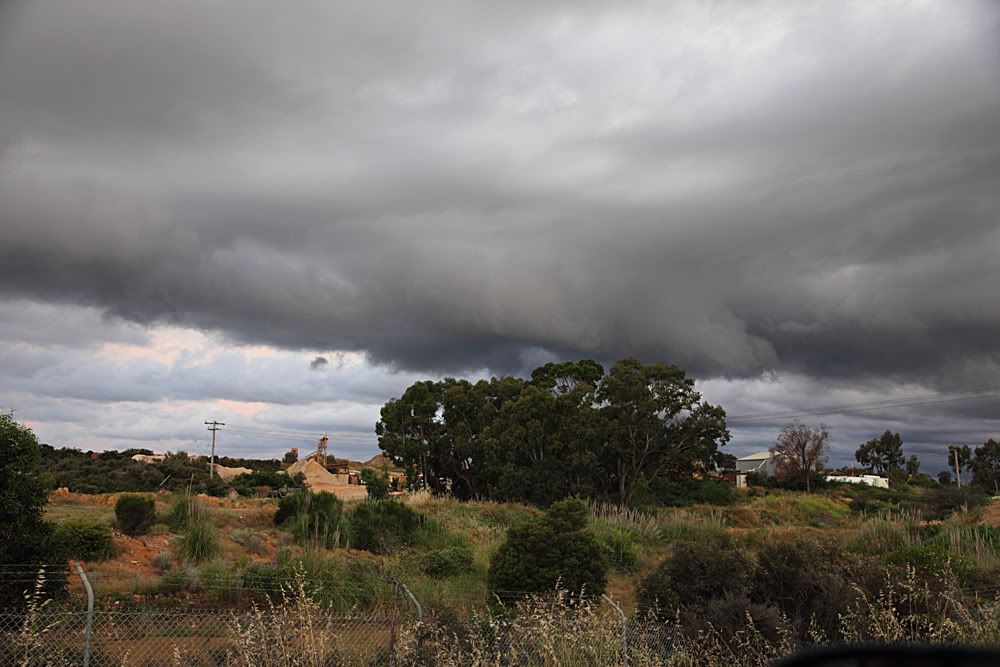
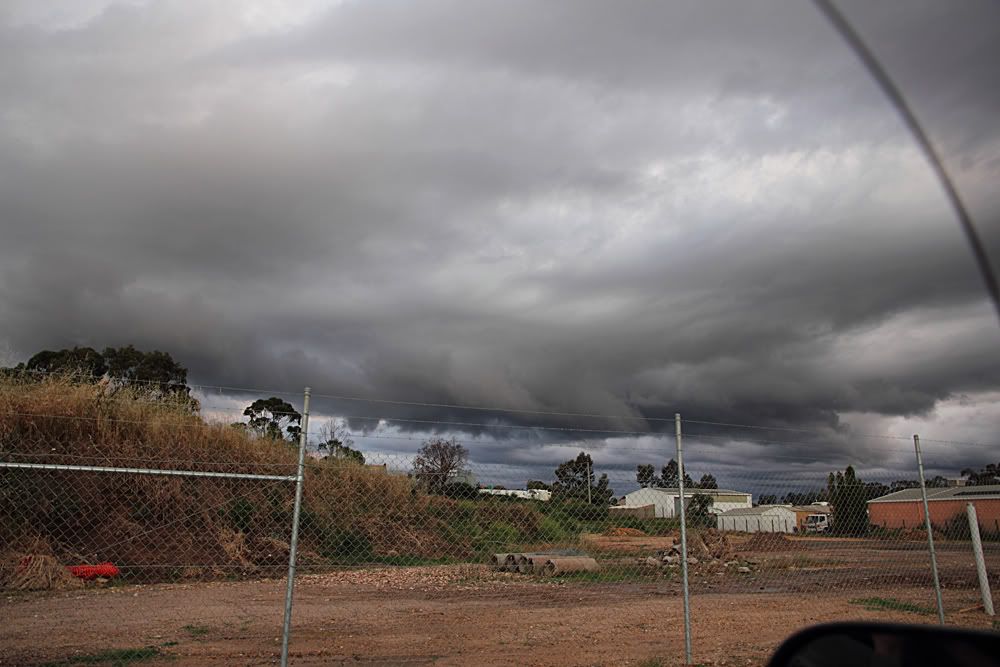
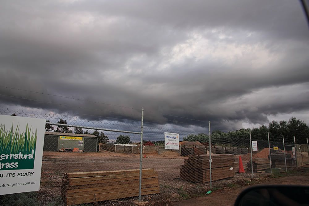
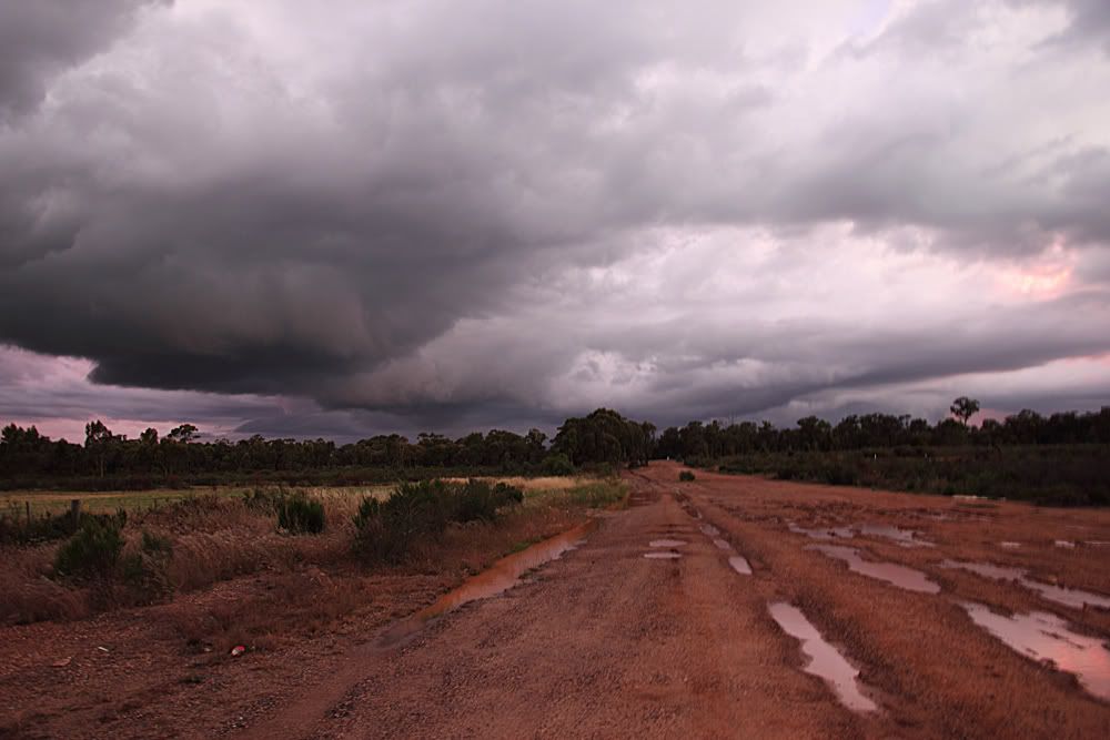
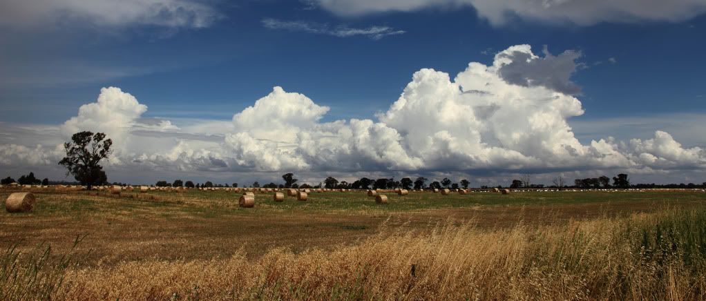
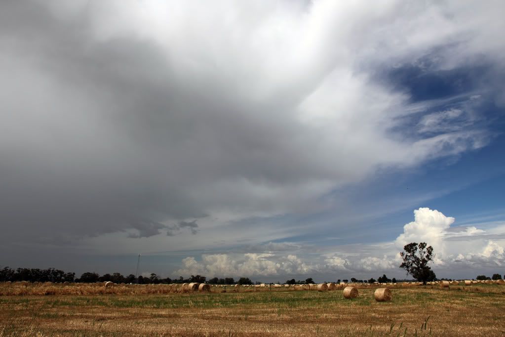
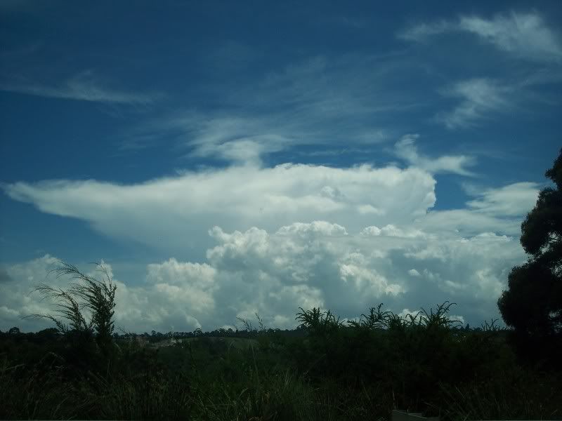
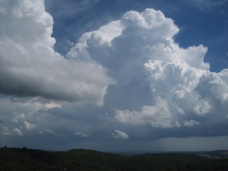
Here's the rest of my shots from yesterdays storms. First few are around the Rushworth area. Mainly just convection, distance cells and anvils. Excuse the splatterings on the windscreen in one of the shots. Damn locusts were out in great numbers yesterday!
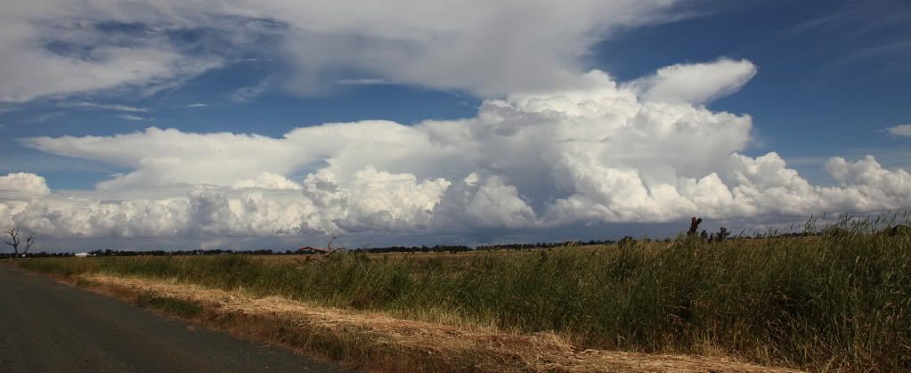
Then the storm I intercepted later that evening...
First shot is of a weird dome like cloud with striations looking back to the east, dunno what caused it?
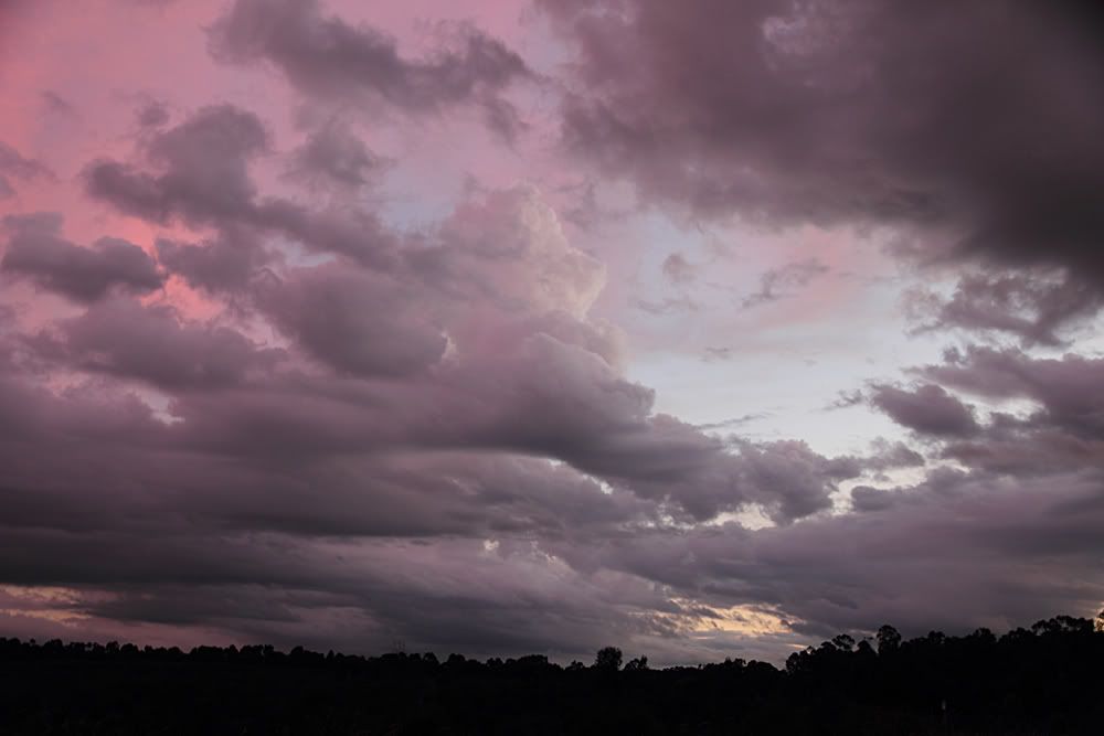
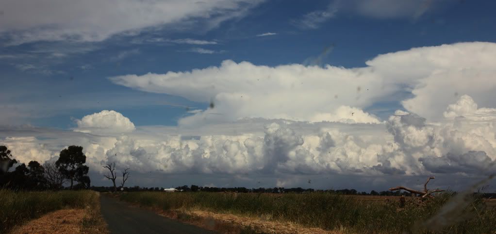
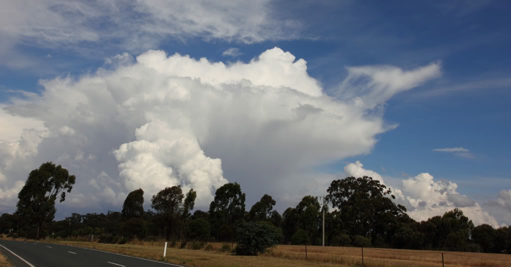
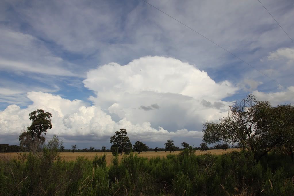
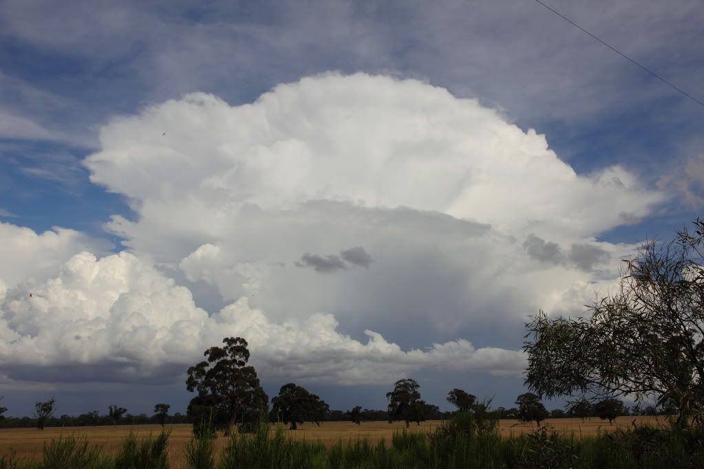
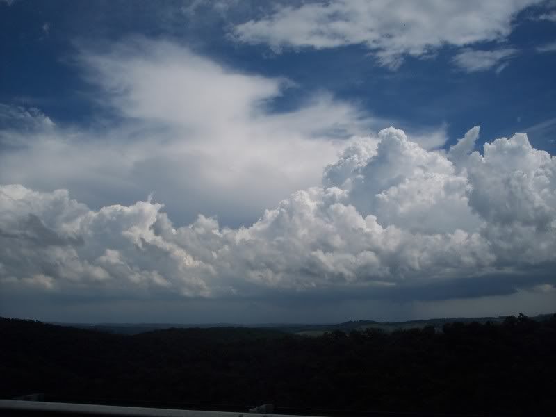
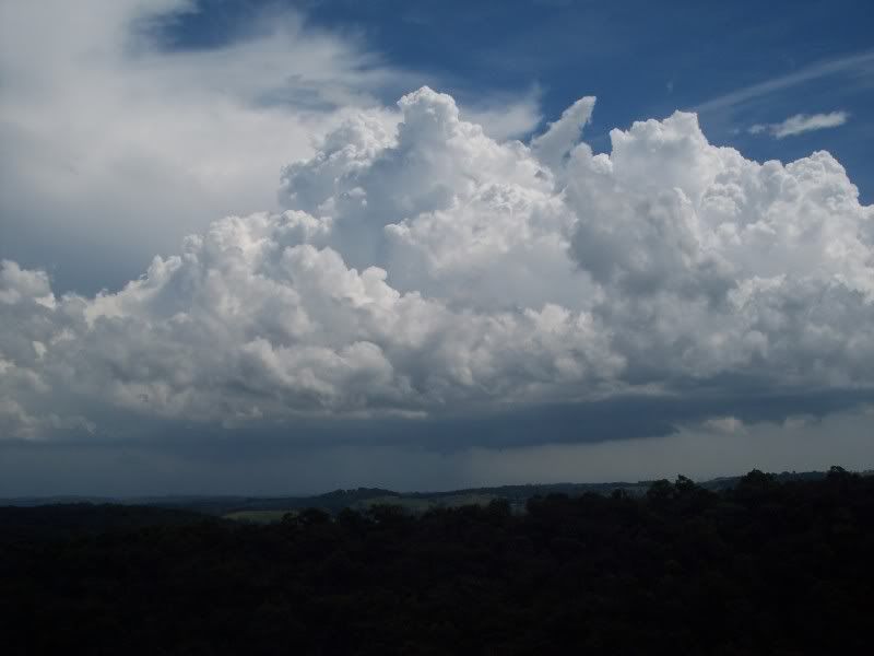
Next few as the main course arrived. Was a joy to watch as we'd positioned ourselves perfectly for a change and could just sit back and watch as the structure of the storm slowly revealed itself. The waves in the mid levels clouds were very nice too...bordering on mammatus, but not quite.
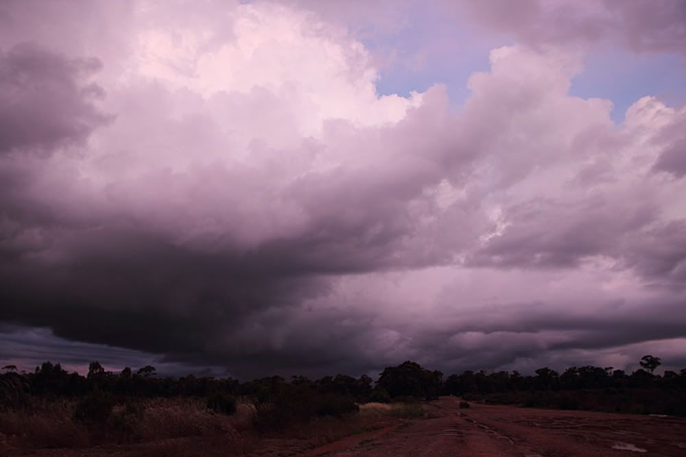
After a good 30-40 mins the storm had finally made it to where we were located and it all got a little messy...
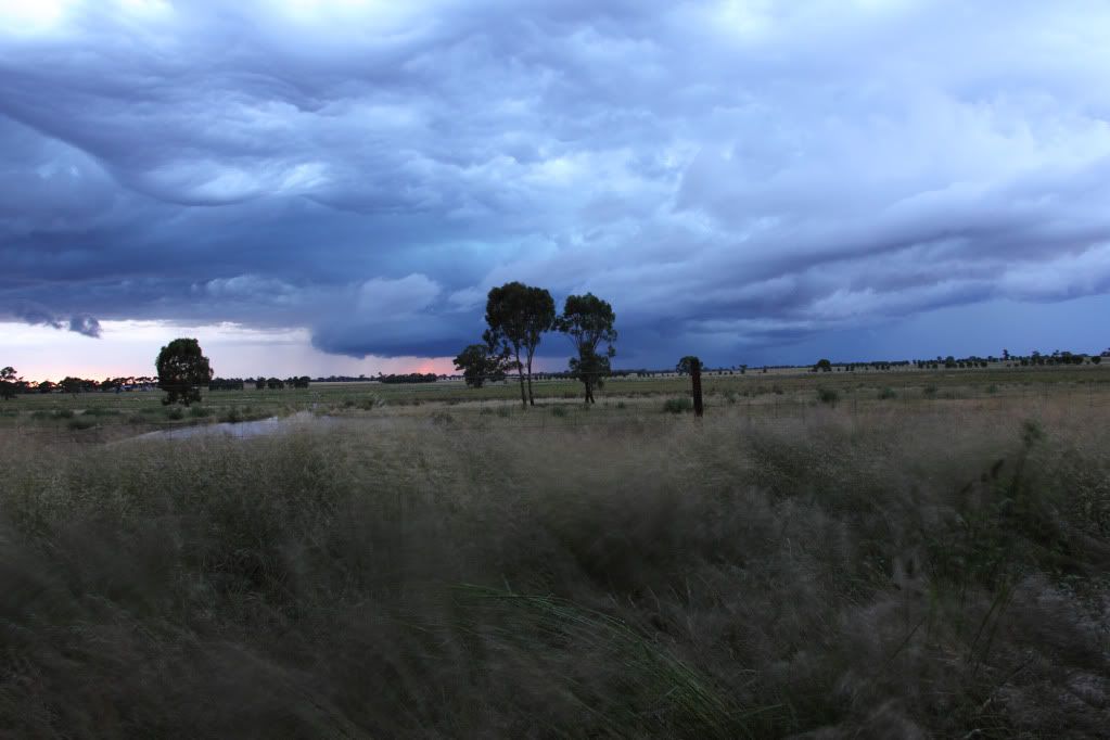
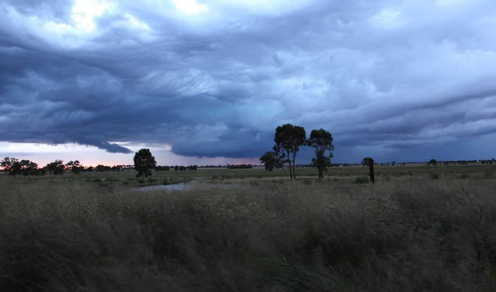
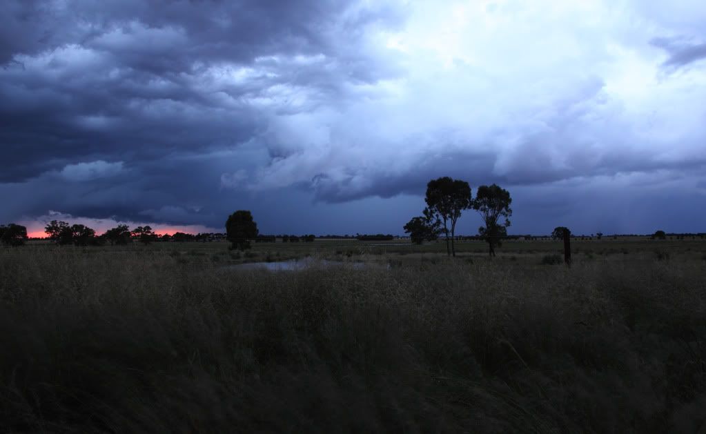
So in the end, a very nice storm to watch roll in across the open paddocks. I will definitely be marking the location down for future reference. Shot some video too which I'll try find the time to edit together and post here.
Then the storm I intercepted later that evening...
First shot is of a weird dome like cloud with striations looking back to the east, dunno what caused it?
Next few as the main course arrived. Was a joy to watch as we'd positioned ourselves perfectly for a change and could just sit back and watch as the structure of the storm slowly revealed itself. The waves in the mid levels clouds were very nice too...bordering on mammatus, but not quite.
After a good 30-40 mins the storm had finally made it to where we were located and it all got a little messy...
So in the end, a very nice storm to watch roll in across the open paddocks. I will definitely be marking the location down for future reference. Shot some video too which I'll try find the time to edit together and post here.
Last edited by Meso on Sat Nov 27, 2010 11:51 pm, edited 3 times in total.
Re: Victoria - Storms 22nd to 29th
Lol, Ryan. Nice work! 
- Hamlan
- Storm Chaser
- Reactions:
- Posts: 449
- Joined: Tue Dec 22, 2009 11:05 pm
- Location: Northern suburbs
Re: Victoria - Storms 22nd to 29th
Im almost crying with laughter here - Ryan and Greg, you've both cracked me up and I almost woke the kids!
On a serious note, I think it's safe to say Victorian chasers are nailing this season! Good to see so many people getting out and experiencing the best our storms have to offer and what better year to be doing the hard yards. We really are getting value for money thats for sure.
Snipes - thanks for the comments, appreciated. What an awesome storm season (even the whole year actually) it's been.
Greg - re the video camera I have been filming every Aussie chase this season and in conjunction with John plan to produce a 2010 DVD including all the Aussie and US chases we've done and there's a lot . Havent got the time to do anything with the footage now but rest assured if and when we get an unobscured tornado I will have the incentive to post some video of it 
Re your pics, love the anvils in the early shots and then wow on the main show - that mustve been a great experience to sit back and watch that storm, im jealous. Nothing better than being able to relax and take it all in. Fantastic. Love the pics, the colours and the drama. I had a similar time yesterday where I sat for an hour on the Hume at Donnybrook and watched it all unfold. Doesnt happen too often but great when it does.
Ryan - thanks for the heads up phonecall last night. Pity the barrage didnt persist for even longer. After it died off I went north to Seymour and intercepted the last hurrah up there. Saw some nice crawlers (incl the one I got through the windshield) but there was too much rain to get out of the car.
Jane - nice pics, particularly the Inglewood cell and 'funnel'. It certainly was a dynamic arvo and evening. After what I saw and was also told by John (regarding the BoM identifying rotation in a cell near Gisborne earlier, I think it was) Im not surprised to read your observations that another cell may have been briefly tornadic. Not bad for a relatively low shear environment!
Brad.
On a serious note, I think it's safe to say Victorian chasers are nailing this season! Good to see so many people getting out and experiencing the best our storms have to offer and what better year to be doing the hard yards. We really are getting value for money thats for sure.
Snipes - thanks for the comments, appreciated. What an awesome storm season (even the whole year actually) it's been.
Greg - re the video camera I have been filming every Aussie chase this season and in conjunction with John plan to produce a 2010 DVD including all the Aussie and US chases we've done and there's a lot
Re your pics, love the anvils in the early shots and then wow on the main show - that mustve been a great experience to sit back and watch that storm, im jealous. Nothing better than being able to relax and take it all in. Fantastic. Love the pics, the colours and the drama. I had a similar time yesterday where I sat for an hour on the Hume at Donnybrook and watched it all unfold. Doesnt happen too often but great when it does.
Ryan - thanks for the heads up phonecall last night. Pity the barrage didnt persist for even longer. After it died off I went north to Seymour and intercepted the last hurrah up there. Saw some nice crawlers (incl the one I got through the windshield) but there was too much rain to get out of the car.
Jane - nice pics, particularly the Inglewood cell and 'funnel'. It certainly was a dynamic arvo and evening. After what I saw and was also told by John (regarding the BoM identifying rotation in a cell near Gisborne earlier, I think it was) Im not surprised to read your observations that another cell may have been briefly tornadic. Not bad for a relatively low shear environment!
Brad.
-
Karl Lijnders

- Tornadic Supercell
- Reactions:
- Posts: 5771
- Joined: Sun Nov 22, 2009 11:17 pm
- Location: Knoxfield, Victoria
Re: Victoria - Storms 22nd to 29th
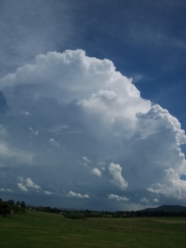
Storm chase from yesterday....
This was the Melbourne AP cell as it developed to maturity...From Ferntree Gully.
This was taken in Lilydale as the cell developed into a full blown thunderstorm over the NW suburbs. It dominated the environment
I travelled to Sugarloaf and this was taken on the dam wall. My favourite place in this type of seabreeze convergence.
This core was the one that dumped 20-40mm over the Footscray region.
The fresh convection that then spawned the new and severe multicell over the inner eastern suburbs and then went on to pound the SE/E suburbs.
The full blown cell over my area and areas towards Ringwood which copped around 40mm yesterday afternoon.
This had three lowerings on it and a lovely rainfoot and hail shaft.
Not a bad afternoon yesterday!!
Former Owner - The Australian Weather Forum. Email me anytime - weatherman1000@hotmail.com
-
AUS_Twisted

- Storm Chaser
- Reactions:
- Posts: 652
- Joined: Wed Nov 25, 2009 6:15 pm
- Location: Dandenong North, Melb
Re: Victoria - Storms 22nd to 29th
Great job Brad, Jane, Clyve, Meso and Karl. Really looking forward to see what unfolds over the next 3 - 4 months.
I ended up going just passed Calder Park on the 26th, was a also a bit of a test on the car which didn't go the best as it looks like theres a radiator leek as was slowly losing water and temps were within normal the whole time so I didn't go to far which I would of gone further if it was ok.
Some pics NW of Calder Park looking at the cell over the city area and new development going up not to far off.


Took this later on after being at the servo for a good hour. I believe this was the SE side of the main complex which went over central areas, was a lot of CG's not far off when I was following/backtracking this multi cell until the southerly pushed further north and killed off the south side of these cells so decided to go home as I did not want to go any further with the car.

Was a great day watching these cells go up in some clear air, though was frustrated I couldn't do what I really wanted to do in the end but still worth while.
I ended up going just passed Calder Park on the 26th, was a also a bit of a test on the car which didn't go the best as it looks like theres a radiator leek as was slowly losing water and temps were within normal the whole time so I didn't go to far which I would of gone further if it was ok.
Some pics NW of Calder Park looking at the cell over the city area and new development going up not to far off.
Took this later on after being at the servo for a good hour. I believe this was the SE side of the main complex which went over central areas, was a lot of CG's not far off when I was following/backtracking this multi cell until the southerly pushed further north and killed off the south side of these cells so decided to go home as I did not want to go any further with the car.
Was a great day watching these cells go up in some clear air, though was frustrated I couldn't do what I really wanted to do in the end but still worth while.
Re: Victoria - Storms 22nd to 29th
Ah cool, I often see you guys mention video in your posts, but haven't seen any yet. That explains it. Reserve me a copy.Hamlan wrote:Greg - re the video camera I have been filming every Aussie chase this season and in conjunction with John plan to produce a 2010 DVD including all the Aussie and US chases we've done and there's a lot
-
daviescr

- Supercell
- Reactions:
- Posts: 1394
- Joined: Wed Dec 02, 2009 5:40 pm
- Location: Warranwood, Vic
Re: Victoria - Storms 22nd to 29th
Greg, just wanted to add to all the plaudits for that photo. As Ryan and many others have said - perhaps the best pic I have seen on this site - definitely in my top three. I know it was a lucky shot, but hey, who cares!