Welcome New Members! We want to hear from you. Register, stop lurking and start posting!

Becoming hot ahead of a change with possible rain and storms: February 10-14

Event discussion and analysis for Victoria and Tasmania, including day to day weather.
Forum rules
When posting photos, particularly in active breaking weather threads, please link to clickable photos to minimise download issues. For more information, see Posting Photo Guidelines for more information. Threads that are six weeks old or older will be Archived Here
S
Skywalker
Supercell
Reactions:
Posts: 1871
Joined: Sun Nov 29, 2009 10:03 am
Location: Burnside Heights/Cowes (Home) & Sunshine West (Work)

Becoming hot ahead of a change with possible rain and storms: February 10-14

Post by Skywalker »

That was fun! :D
All over now.

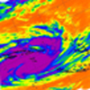
Wow, check out that black core over Oakleigh!! :o :sccary: :sccary:
Caroline Springs, Melbourne's meteorological boredom zone.
s
snowfall
Supercell
Reactions:
Posts: 1286
Joined: Mon Mar 20, 2017 7:39 pm
Location: Gisborne South (349m asl)

Becoming hot ahead of a change with possible rain and storms: February 10-14

Post by snowfall »

Incredible pic of the storm there stevco.

Had a direct hit here. The wind was insane. We're lucky to have escaped any major damage, as I have never seen wind like that here before. 7.4 mmm from heavy, mostly sideways rain. It was all over in about half an hour.

Now it's calm and 21c after hitting a max earlier of 35.9c. Another line of storms is developing out west, but it currently looks a bit weaker and patchier than the one just passed.
W
Wilko
Supercell
Reactions:
Posts: 1492
Joined: Wed Aug 11, 2010 12:08 pm
Location: Moorabbin & Highett, Vic

Becoming hot ahead of a change with possible rain and storms: February 10-14

Post by Wilko »

Wow black core bullseye here
20 mm in 20 mins
Glad that is over tbh :o
M
Macedonian
Supercell
Reactions:
Posts: 2330
Joined: Mon Dec 21, 2009 10:44 pm
Location: Mount Macedon Vic at 870m above sea level

Becoming hot ahead of a change with possible rain and storms: February 10-14

Post by Macedonian »

A lovely 10mm at Mt Macedon.
Home- "Shepherd's Bush" at Mt Macedon. 870m
Work- "Bolobek" at Macedon. 430m
User avatar
93ben
Site Admin
Reactions:
Posts: 603
Joined: Tue Dec 27, 2011 12:28 am
Location: Templestowe, Victoria
Contact:

Becoming hot ahead of a change with possible rain and storms: February 10-14

Post by 93ben »


crazy photos coming out of transmission towers being squashed to the ground!
L
Lara_Hunter
Cumulus
Reactions:
Posts: 77
Joined: Tue Dec 15, 2009 10:03 am
Location: Lara

Becoming hot ahead of a change with possible rain and storms: February 10-14

Post by Lara_Hunter »

Not good here in Lara. I’ve lost part of my roof and there is widespread damage. Wind was over 120kms. In addition to the roof, my veggie patch is cactus, tomatoes got destroyed. Seen a few pics of entire sheds blown away and trees over a few homes
User avatar
Pengaz
Cumulonimbus
Reactions:
Posts: 341
Joined: Tue Dec 15, 2009 10:04 pm
Location: Warragul

Becoming hot ahead of a change with possible rain and storms: February 10-14

Post by Pengaz »

Brutal storm through here just after 4pm. I’ll never forget the noise, constant rumbling thunder and roaring wind. Didn’t get a chance to get a pic before it hit due to work, but some of the wind squalls were right up there with the strongest I’ve felt. The straight line winds felt microburst-like.

14mm in very quick time. Power went off twice but came back quickly, not so lucky for those on the other side of town where power was out for over 3 hours.

Some posts on social media with impressive pics of the front coming through the Warragul/drouin area: https://www.facebook.com/share/tFgVjJhp ... tid=ox5AEW
G
Gordon
Supercell
Reactions:
Posts: 2889
Joined: Thu Jun 17, 2010 10:01 am
Location: Near Gordon, Vic. 620 m asl

Becoming hot ahead of a change with possible rain and storms: February 10-14

Post by Gordon »

Just got power back after losing it at 2.30pm. Storms were spectacular here but evidently nothing compared to some locations! 'Normal' strong wind, a brief bit of hail, and 7mm of rain.
S
StratoBendigo
Supercell
Reactions:
Posts: 2809
Joined: Fri Jan 02, 2015 2:18 pm
Location: Kangaroo Flat

Becoming hot ahead of a change with possible rain and storms: February 10-14

Post by StratoBendigo »

Any chance the 500 kV towers going down near Lara was due to a tornado? Quite extreme damage tbh.
s
stevco123
Supercell
Reactions:
Posts: 2936
Joined: Sat Aug 07, 2010 7:42 pm
Location: Cranbourne 78m asl

Becoming hot ahead of a change with possible rain and storms: February 10-14

Post by stevco123 »

StratoBendigo wrote: Tue Feb 13, 2024 9:32 pm Any chance the 500 kV towers going down near Lara was due to a tornado? Quite extreme damage tbh.
I was thinking the same thing, and trying to get observations but data is scarce thanks to our vast empty country. Could be a very strong microburst. Hopefully someone is in the area assessing the damage to try and ascertain what caused those 6 towers to literally bend over, and trees to snap like sticks. Several photos online of the damage and a couple of what looks like a strong microburst from that area. The damage is similar to what we have in Cranbourne and several other areas of Melbourne, but on a much small scale compared ro Lara
https://www.weatherlink.com/bulletin/53 ... 76dd68e8bc: for current weather updated every 2 minutes
User avatar
hillybilly
Site Admin/Moderator
Reactions:
Posts: 4986
Joined: Thu Nov 26, 2009 7:26 am
Location: Howden Tasmania, 25m above sea level
Contact:

Becoming hot ahead of a change with possible rain and storms: February 10-14

Post by hillybilly »

Was in Canberra yesterday. Crazy storms with big delays in the air. Coming into Hobart late we ran into squalls and missed our landing and had to go around. Two hours late in the end :(

Max of 25C for us in Howden with a welcome 4mm of rain. No drought breaker, but tops the tanks up a touch and freshens the garden. Heavy falls in the southwest corner as expected. As for Victoria. Jeepers. Those storms were crazy. So much damage. Be interesting to hear what the final wind estimates are, but I’d assume design specs for towers are somewhere around 200km/hr. Then the fires :o

Max temps close to expected. Stinker. Such a strange summer with positive SAM driving humid rainy weather the first half, then flipping to more classical El Niño summer weather for the second half. Almost the reverse of what you’d expect based on history.
G
Gordon
Supercell
Reactions:
Posts: 2889
Joined: Thu Jun 17, 2010 10:01 am
Location: Near Gordon, Vic. 620 m asl

Becoming hot ahead of a change with possible rain and storms: February 10-14

Post by Gordon »

A bit of drizzle and 8C now - what a contrast with yesterday!
User avatar
Didjman
Supercell
Reactions:
Posts: 2099
Joined: Fri Sep 03, 2010 2:52 pm
Location: Wallan, Vic 328m ASL
Contact:

Becoming hot ahead of a change with possible rain and storms: February 10-14

Post by Didjman »

Here it all went around us and kicked up 10 gears to the south. Only 4 mm here with max wind to 35klm
Q
QldTwister
Cumulonimbus
Reactions:
Posts: 434
Joined: Tue May 22, 2012 7:56 pm
Location: Ashwood Vic

Becoming hot ahead of a change with possible rain and storms: February 10-14

Post by QldTwister »

Awesome 3 days of heat low mid 30s then high 30s yesterday beach has being great last 3 days, so nice, summer has returned for a few days about time :D :D :D :D :D

Yesterday omg the storms WOW the first one dropped hail on us at Chealsa beach was amazing 2cm or so some decent size ones then the 2nd one the line of storms was like a hurricane so much damage unreal guster white out condtions just nuts lots of close lightning too flash flooding pea hail and widespread damage.

The damage though next level on springvale road around Mulgrave Claytron Oakligh all huge messes and 500k without power I lost power for 18 hours. :o :o
Suburb after suburb no power no traffic lights just crazy and trees on cars on buildings huge gums snapped at the base just unreal easy 120 to 140km/h winds through there very impressive but will takes days and days to clean up.

Now cold again boo :( :( but long strech warm coming up hope can sneak few more mid 30s next week.

Cant beat the heat always brings the fun weather
Bring on the heat and stroms
s
stevco123
Supercell
Reactions:
Posts: 2936
Joined: Sat Aug 07, 2010 7:42 pm
Location: Cranbourne 78m asl

Becoming hot ahead of a change with possible rain and storms: February 10-14

Post by stevco123 »

Well that was it for summer then. Early autumn for sure. Trees going yellow, and tonight most of Victoria is heading for a minimum under 10 degrees.
Still warm days to come ofcourse but this summer is a write off
https://www.weatherlink.com/bulletin/53 ... 76dd68e8bc: for current weather updated every 2 minutes
G
Gordon
Supercell
Reactions:
Posts: 2889
Joined: Thu Jun 17, 2010 10:01 am
Location: Near Gordon, Vic. 620 m asl

Becoming hot ahead of a change with possible rain and storms: February 10-14

Post by Gordon »

Suspect there are a few reports yet to come in from members in badly storm-affected areas who have no communications at all. Was talking to a mate near Eildon yesterday who said there was a fair amount of damage up that way, and then his phone cut out - no contact since. No doubt the phone tower ran out of battery.

The scale of this thing is amazing.
s
stevco123
Supercell
Reactions:
Posts: 2936
Joined: Sat Aug 07, 2010 7:42 pm
Location: Cranbourne 78m asl

Becoming hot ahead of a change with possible rain and storms: February 10-14

Post by stevco123 »

Nobody talking about how cold it was this morning for this time of year.

7.6 in Cranbourne, the coldest February morning in 12 years through my records.

Coldstream down to 3.6, and 4.0 at Sheaoks. Most of the metro was down below 9.

South west Victoria had several places in the 3s and 4s.

Beautiful day today however.
https://www.weatherlink.com/bulletin/53 ... 76dd68e8bc: for current weather updated every 2 minutes
User avatar
Australis(Shell3155)
Supercell
Reactions:
Posts: 3146
Joined: Mon Nov 30, 2009 8:05 pm
Location: FTG
Contact:

Becoming hot ahead of a change with possible rain and storms: February 10-14

Post by Australis(Shell3155) »

Tuesday 13/2/24
Attachments
IMG_7971.jpeg
IMG_7971.jpeg (2.62 MiB) Viewed 354 times
IMG_7970.jpeg
IMG_7970.jpeg (2.58 MiB) Viewed 354 times
s
stevco123
Supercell
Reactions:
Posts: 2936
Joined: Sat Aug 07, 2010 7:42 pm
Location: Cranbourne 78m asl

Becoming hot ahead of a change with possible rain and storms: February 10-14

Post by stevco123 »

As expected and forecast by long range weather forecasters weeks ago (not BoM), February is proving to be warm to hot and dry, after a wet January.
March should see rapid deterioration and back to several months of above average rain.
https://www.weatherlink.com/bulletin/53 ... 76dd68e8bc: for current weather updated every 2 minutes
User avatar
Tempest
Cumulonimbus
Reactions:
Posts: 148
Joined: Sat Aug 14, 2010 8:34 pm
Location: Warragul North, Vic... 140m asl

Becoming hot ahead of a change with possible rain and storms: February 10-14

Post by Tempest »

I rarely comment here these days but often come in to checkout comments and photos during severe events. Was expecting pages and pages for this one but totally surprised at the absence of photos and such. Are people still without power/phone coverage or did nobody here chase and capture images of this monster of a storm?
Locked