Welcome New Members! We want to hear from you. Register, stop lurking and start posting!

Deep slow moving low with rain, snow, gales and storm surge: August 17-24

Archived topics from the General Weather Discussion board.
Locked
G
Gordon
Supercell
Reactions:
Posts: 2889
Joined: Thu Jun 17, 2010 10:01 am
Location: Near Gordon, Vic. 620 m asl

Re: Deep slow moving low with rain, snow, gales and storm surge: August 17-24

Post by Gordon »

Macedonian wrote: Fri Aug 21, 2020 1:22 pm Do you think we will get more,Gordon?
From the looks of it the nsw central highlands are going to get a blizzard.
I would like to be somewhere in the Lithgow/ Orange/ Crookwell area tomorrow.
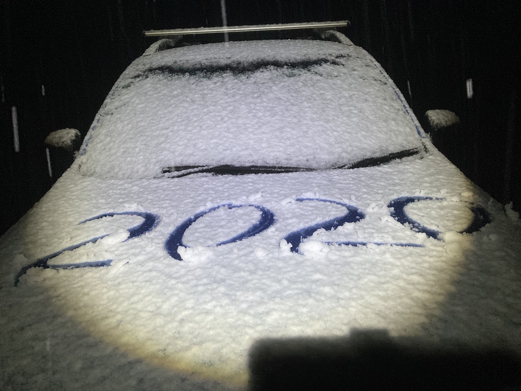
It's promising - now snowing properly here with big 20 cent flakes - and it's only early afternoon! Lots of cold air to come if we can keep the precipitation.

Edit: And settled... just a dusting but we're on the board :).
s
snowfall
Supercell
Reactions:
Posts: 1286
Joined: Mon Mar 20, 2017 7:39 pm
Location: Gisborne South (349m asl)

Re: Deep slow moving low with rain, snow, gales and storm surge: August 17-24

Post by snowfall »

Heavy shower just came through here. The temp dropped from 9c to 4c in about 15mins with sleet at the back end. 5mm here since midnight.
User avatar
Rivergirl
Memorial
Reactions:
Posts: 3674
Joined: Sun Nov 22, 2009 6:04 pm
Location: Ferny Creek VIC
Contact:

Re: Deep slow moving low with rain, snow, gales and storm surge: August 17-24

Post by Rivergirl »

Great to hear some snow coming down Macedonian and Gordon. Although by the sound of it no snow for Ferny Creek this time
S
Skywalker
Supercell
Reactions:
Posts: 1871
Joined: Sun Nov 29, 2009 10:03 am
Location: Burnside Heights/Cowes (Home) & Sunshine West (Work)

Re: Deep slow moving low with rain, snow, gales and storm surge: August 17-24

Post by Skywalker »

James wrote: Fri Aug 21, 2020 1:25 pm sunny and windy and cold here...no rain or anything really
Same here, nothing but bloody wind so far. Surprise surprise. :roll:

Hopefully that next incoming blob on the radar makes it here & we can get underway for the event.
Caroline Springs, Melbourne's meteorological boredom zone.
G
Gordon
Supercell
Reactions:
Posts: 2889
Joined: Thu Jun 17, 2010 10:01 am
Location: Near Gordon, Vic. 620 m asl

Re: Deep slow moving low with rain, snow, gales and storm surge: August 17-24

Post by Gordon »

Rivergirl wrote: Fri Aug 21, 2020 2:36 pm Great to hear some snow coming down Macedonian and Gordon. Although by the sound of it no snow for Ferny Creek this time
I think you'd be a fair chance if you end up under a big enough cell Robyn? Very cold when they come through.
B
Blackie
Reactions:

Re: Deep slow moving low with rain, snow, gales and storm surge: August 17-24

Post by Blackie »

Check these mammatus just north of Mt Buller right now
Attachments
66F0BD48-4285-432A-9154-2096806BFEAB.jpeg
66F0BD48-4285-432A-9154-2096806BFEAB.jpeg (69.36 KiB) Viewed 6846 times
61473F0B-1356-4582-A039-CFD84CED92BB.jpeg
61473F0B-1356-4582-A039-CFD84CED92BB.jpeg (82.58 KiB) Viewed 6846 times
G
Gordon
Supercell
Reactions:
Posts: 2889
Joined: Thu Jun 17, 2010 10:01 am
Location: Near Gordon, Vic. 620 m asl

Re: Deep slow moving low with rain, snow, gales and storm surge: August 17-24

Post by Gordon »

That is spectacular!
S
StratoBendigo
Supercell
Reactions:
Posts: 2809
Joined: Fri Jan 02, 2015 2:18 pm
Location: Kangaroo Flat

Re: Deep slow moving low with rain, snow, gales and storm surge: August 17-24

Post by StratoBendigo »

Just had graupel/hail from a coldie just now. Like the early 1990s.
M
Macedonian
Supercell
Reactions:
Posts: 2330
Joined: Mon Dec 21, 2009 10:44 pm
Location: Mount Macedon Vic at 870m above sea level

Re: Deep slow moving low with rain, snow, gales and storm surge: August 17-24

Post by Macedonian »

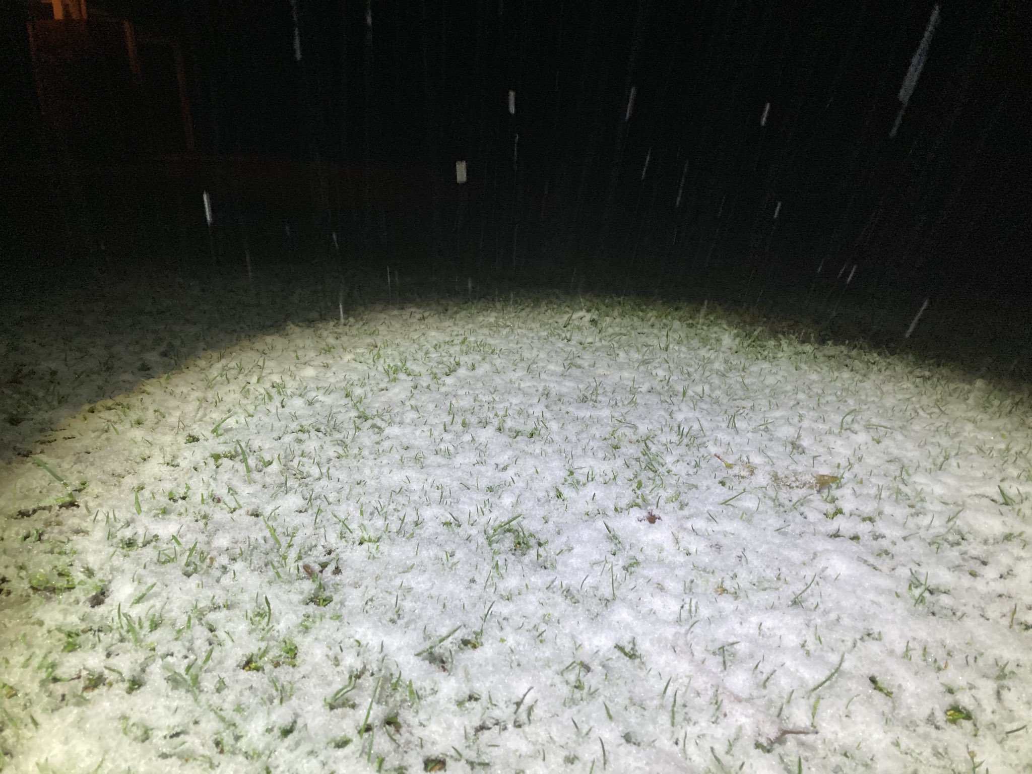
We ended up with a 1.5cm settled fall after that big front at 2pm. It was so sleety at work in macedon that my boss said to go home early. I could see Mt Macedon had a visible white snowline. It was settling well from just below 700m.
I am at 870m.
Home- "Shepherd's Bush" at Mt Macedon. 870m
Work- "Bolobek" at Macedon. 430m
Q
QldTwister
Cumulonimbus
Reactions:
Posts: 434
Joined: Tue May 22, 2012 7:56 pm
Location: Ashwood Vic

Re: Deep slow moving low with rain, snow, gales and storm surge: August 17-24

Post by QldTwister »

Nice pics of the coldie sweet

2mm yesterday takes me to 13mm for the week will double that over the next 48 hours, mostly tomorrow.

Windy, cool and mostly sunny day today, first shower just moving through now
Once flow goes SWly tomorrow its going to be wet

Nice to see widespread showers day after day across much of Vic today was like the 3rd or 4th day in a row
Hit and miss and only light falls for most, but better than nothing.

Wild 2 days ahead for the south enjoy

Dry 2 weeks or so after this I feel, hopefully change as we get further into Sept
Bring on the heat and stroms
User avatar
hillybilly
Site Admin/Moderator
Reactions:
Posts: 4984
Joined: Thu Nov 26, 2009 7:26 am
Location: Howden Tasmania, 25m above sea level
Contact:

Re: Deep slow moving low with rain, snow, gales and storm surge: August 17-24

Post by hillybilly »

3.4mm overnight and just in a mm today. Getting cold here now, with the last shower full of hail and temperature dropping to 3C. Not far off sleet or wet snow here now.

Will get cold enough here tonight for snow, but precip looks like lagging behind the cold air. Thinking flurries, but hoping for more :)
User avatar
Didjman
Supercell
Reactions:
Posts: 2099
Joined: Fri Sep 03, 2010 2:52 pm
Location: Wallan, Vic 328m ASL
Contact:

Re: Deep slow moving low with rain, snow, gales and storm surge: August 17-24

Post by Didjman »

That Occluded front curling away to the west and south of King Island looks a specy on the satpic atm!!
S
Sean
Supercell
Reactions:
Posts: 1000
Joined: Mon Feb 27, 2012 6:35 pm
Location: Patterson Lakes - SE Melb

Re: Deep slow moving low with rain, snow, gales and storm surge: August 17-24

Post by Sean »

EC showing a decent day of torrential showers and patchy rain tomorrow (best around midday-ish onwards), and it looks more widespread than the last couple of days. It isn't too keen on snow outside alpine areas though. GFS meanwhile showing lowish level snow around Ballarat and surrounds, but you'll need to be up early (4-8am window). Whether it happens or not, I don't know, but it picked the low level snow last time pretty well. It also has rain and showers for much of the day, focused around central/southern areas.

Winter will be order of the day tomorrow...
s
stevco123
Supercell
Reactions:
Posts: 2936
Joined: Sat Aug 07, 2010 7:42 pm
Location: Cranbourne 78m asl

Re: Deep slow moving low with rain, snow, gales and storm surge: August 17-24

Post by stevco123 »

Everything is drenched here. 52mm for the month but with the big yearly total, literally every millimetre adds to the puddles. The grass is squishy and the farms have huge area of water in them that haven't dried up since the start of the year.
https://www.weatherlink.com/bulletin/53 ... 76dd68e8bc: for current weather updated every 2 minutes
User avatar
Australis(Shell3155)
Supercell
Reactions:
Posts: 3146
Joined: Mon Nov 30, 2009 8:05 pm
Location: FTG
Contact:

Re: Deep slow moving low with rain, snow, gales and storm surge: August 17-24

Post by Australis(Shell3155) »

Good Day for testing out the plumbing,
Top of 10 low of 5
:o 90% 20 - 40mm
User avatar
hillybilly
Site Admin/Moderator
Reactions:
Posts: 4984
Joined: Thu Nov 26, 2009 7:26 am
Location: Howden Tasmania, 25m above sea level
Contact:

Re: Deep slow moving low with rain, snow, gales and storm surge: August 17-24

Post by hillybilly »

Woke up to heavy snow falling :D Was expecting the cold air to largely miss the precip, but they’ve managed to overlap :)

Perhaps an inch or so on cold surfaces atm. Is just in 0C so cold enough to settle nicely atm.

Couple of photos, waiting for first light.

Image

Image
D
Dane
Supercell
Reactions:
Posts: 1661
Joined: Thu Nov 26, 2009 9:51 am
Location: Sebastopol 420m ASL
Contact:

Re: Deep slow moving low with rain, snow, gales and storm surge: August 17-24

Post by Dane »

Just had a sleety shower pass through here, when I say sleety it was splattery rain - ice crystals
in the rain as it hit the windows. Temp is 3.0c so just a bit too warm for snow.
I notice looking at my PWS that there was a heavier shower about 3.30am and the temperature
at the end of that shower dropped to 2.1c so there may have been a few flakes then.
Cant confirm though as I was asleep then.
Nice pics HB.
S
StratoBendigo
Supercell
Reactions:
Posts: 2809
Joined: Fri Jan 02, 2015 2:18 pm
Location: Kangaroo Flat

Re: Deep slow moving low with rain, snow, gales and storm surge: August 17-24

Post by StratoBendigo »

A cold but sunny 5c here atm. Now up to 17mm for the week. Not a whole lot of runoff yet.

As for Mt Macedon:
s
snowfall
Supercell
Reactions:
Posts: 1286
Joined: Mon Mar 20, 2017 7:39 pm
Location: Gisborne South (349m asl)

Re: Deep slow moving low with rain, snow, gales and storm surge: August 17-24

Post by snowfall »

Beautiful shot of mount macedon. 3mm here this morning and currently 4c (and a wind chill of -1c). It was 3.1c when I woke up this morning, with a bit of sleet falling. Otherwise, too warm for snow, but wasn't really on the cards anyway! Many other areas in the central ranges will be getting snow.
M
Macedonian
Supercell
Reactions:
Posts: 2330
Joined: Mon Dec 21, 2009 10:44 pm
Location: Mount Macedon Vic at 870m above sea level

Re: Deep slow moving low with rain, snow, gales and storm surge: August 17-24

Post by Macedonian »

A few pics from this morning at Mt Macedon. Temp dropped to exactly zero.
Home- "Shepherd's Bush" at Mt Macedon. 870m
Work- "Bolobek" at Macedon. 430m
Locked