Had a couple of cracking thundery showers with 5mm in quick time. Now up to 14mm since it started. More inbound. A messy day with things not quite getting organised, but rain steadily adding up.

Welcome New Members! We want to hear from you. Register, stop lurking and start posting!
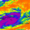
VIC - Warming trend with dangerous fire WX followed by rain - 27 Jan - 3 Feb 2020
-
hillybilly

- Site Admin/Moderator
- Reactions:
- Posts: 4979
- Joined: Thu Nov 26, 2009 7:26 am
- Location: Howden Tasmania, 25m above sea level
- Contact:
Re: VIC - Warming trend with dangerous fire WX - 27 - 31 Jan 2020
46.8C in western Sydney. Unbelievable. Canberra also set a February record which would be an all months record for the airport, if not for that scorcher a couple of weeks back. Fires looking bad again up there  Lucky to have missed that in central and western Vic.
Had a couple of cracking thundery showers with 5mm in quick time. Now up to 14mm since it started. More inbound. A messy day with things not quite getting organised, but rain steadily adding up.
Had a couple of cracking thundery showers with 5mm in quick time. Now up to 14mm since it started. More inbound. A messy day with things not quite getting organised, but rain steadily adding up.
-
Didjman

- Supercell
- Reactions:
- Posts: 2099
- Joined: Fri Sep 03, 2010 2:52 pm
- Location: Wallan, Vic 328m ASL
- Contact:
Re: VIC - Warming trend with dangerous fire WX - 27 - 31 Jan 2020
12mm here in quick time! Rain rate up to 131mm/hr. The Seymour cell has rotation on Doppler. Std radar appears to show a hook.
Last edited by Didjman on Sat Feb 01, 2020 4:12 pm, edited 1 time in total.
Re: VIC - Warming trend with dangerous fire WX - 27 - 31 Jan 2020
no thunder in any of it here...a letdown in that regard but the rain is nice and now the cooler air
-
Onetahuti

- Supercell
- Reactions:
- Posts: 2790
- Joined: Thu Mar 25, 2010 9:37 pm
- Location: Dandenong Nth.
Re: VIC - Warming trend with dangerous fire WX - 27 - 31 Jan 2020
Rain still steady from light to moderate, up to 23.4 mm. Tank overflowing.
Happy I have taken a break on Saturday afternoons vollie work at nursing home, with not driving I would have had to walk both ways in the rain.
Happy I have taken a break on Saturday afternoons vollie work at nursing home, with not driving I would have had to walk both ways in the rain.
- Dane
- Supercell
- Reactions:
- Posts: 1661
- Joined: Thu Nov 26, 2009 9:51 am
- Location: Sebastopol 420m ASL
- Contact:
Re: VIC - Warming trend with dangerous fire WX - 27 - 31 Jan 2020
During January was just to far West to get the best of things and ended up with just 52mm's less than half of what Melbourne (Olympic Park) Got.
Now with this system seems like I am too far East. Had 15.5mm's up to 9am - 14.0mm's at Ballarat Airport but further to the West and NW
falls of more than 3 times that.
Since 9am just 2.6mm's here and 3.0mm's at the Airport.
Its been humid mostly overcast but with just light showers and drizzle also low cloud and mist this afternoon with Vis down to about 3kms.
Ballarat Airport Dew Point Reached 24.4c earlier today which like many places is probably a record.
Is cooler now just 17.5c on my PWS but still humid 95%.
May get a bit more drizzle or light showers but its just about over for here I think.
Bit Disappointing.
-
hillybilly
- Site Admin/Moderator
- Reactions:
- Posts: 4979
- Joined: Thu Nov 26, 2009 7:26 am
- Location: Howden Tasmania, 25m above sea level
- Contact:
Re: VIC - Warming trend with dangerous fire WX - 27 - 31 Jan 2020
Just shy of 20mm here now. Nice way to start what is often our hottest and driest month  Strip around Lysterfield showing falls of 25-40mm. Bit patchy as expected.
It should be a wet night as the showers extend way back to the SA border.
It should be a wet night as the showers extend way back to the SA border.
- Macedonian
- Supercell
- Reactions:
- Posts: 2330
- Joined: Mon Dec 21, 2009 10:44 pm
- Location: Mount Macedon Vic at 870m above sea level
Re: VIC - Warming trend with dangerous fire WX - 27 - 31 Jan 2020
About 20mm at Mt Macedon and still raining. Nice heavy rain to assist me with brooming all that orange Mallee topdressing off my roof 
Home- "Shepherd's Bush" at Mt Macedon. 870m
Work- "Bolobek" at Macedon. 430m
Work- "Bolobek" at Macedon. 430m
-
Didjman
- Supercell
- Reactions:
- Posts: 2099
- Joined: Fri Sep 03, 2010 2:52 pm
- Location: Wallan, Vic 328m ASL
- Contact:
Re: VIC - Warming trend with dangerous fire WX - 27 - 31 Jan 2020
That storm now near Alexandra, looks like it is rotating clockwise!
-
Tempest
- Cumulonimbus
- Reactions:
- Posts: 148
- Joined: Sat Aug 14, 2010 8:34 pm
- Location: Warragul North, Vic... 140m asl
Re: VIC - Warming trend with dangerous fire WX - 27 - 31 Jan 2020
A nice heavy downpour here now with a few rumbles and much cooler air.
- Sean
- Supercell
- Reactions:
- Posts: 1000
- Joined: Mon Feb 27, 2012 6:35 pm
- Location: Patterson Lakes - SE Melb
Re: VIC - Warming trend with dangerous fire WX - 27 - 31 Jan 2020
Nudging 14mm here. A decent sum, but this was a bit of a fizzer in central areas in terms of what could've been. With a better trigger, there would've been widespread 50mm falls all through central (much like what happened on the SA/Vic border). Goes to show that a great reservoir of moisture is only part of the equation).
Attention turns to next Thur/Fri now. The infeed doesn't look anywhere near as good, but it might be better poised storm wise.
Attention turns to next Thur/Fri now. The infeed doesn't look anywhere near as good, but it might be better poised storm wise.
- snowfall
- Supercell
- Reactions:
- Posts: 1283
- Joined: Mon Mar 20, 2017 7:39 pm
- Location: Gisborne South (349m asl)
Re: VIC - Warming trend with dangerous fire WX - 27 - 31 Jan 2020
18.8mm since midnight, and just over 21mm for the event here. A reasonable drop, but not quite at the level of potential flash flooding. Still a bit more to come though. Nice and cool here now - 15.4c. Still shrouded in a thick fog, though it has stopped raining for the moment.
- Macedonian
- Supercell
- Reactions:
- Posts: 2330
- Joined: Mon Dec 21, 2009 10:44 pm
- Location: Mount Macedon Vic at 870m above sea level
Re: VIC - Warming trend with dangerous fire WX - 27 - 31 Jan 2020
Up to 25mm now and still raining.
Temp down to 14C. Nice and misty.
Temp down to 14C. Nice and misty.
Home- "Shepherd's Bush" at Mt Macedon. 870m
Work- "Bolobek" at Macedon. 430m
Work- "Bolobek" at Macedon. 430m
-
hillybilly
- Site Admin/Moderator
- Reactions:
- Posts: 4979
- Joined: Thu Nov 26, 2009 7:26 am
- Location: Howden Tasmania, 25m above sea level
- Contact:
Re: VIC - Warming trend with dangerous fire WX - 27 - 31 Jan 2020
Up to 24mm now a still ticking over with fog and drizzle. Pretty much in the middle of the models
Bit hit miss as expected. Few spots south of us have scored over 40mm, so models correct in showing some heavier falls. Shame it hasn’t made it much further east than the Yarra Valley.
Another 36 hours of showers in the south, so bit more to come.
Bit hit miss as expected. Few spots south of us have scored over 40mm, so models correct in showing some heavier falls. Shame it hasn’t made it much further east than the Yarra Valley.
Another 36 hours of showers in the south, so bit more to come.
- Gordon
- Supercell
- Reactions:
- Posts: 2888
- Joined: Thu Jun 17, 2010 10:01 am
- Location: Near Gordon, Vic. 620 m asl
Re: VIC - Warming trend with dangerous fire WX - 27 - 31 Jan 2020
Bit of a miss here with 17mm all up. Handy, but quite a bit less than model forecasts. As late as the wee hours yesterday, EC & GFS both had us down for around 50mm.
Off to Tassie for a few days and expecting snow tonight; quite a change from Friday!
Off to Tassie for a few days and expecting snow tonight; quite a change from Friday!
-
Didjman
- Supercell
- Reactions:
- Posts: 2099
- Joined: Fri Sep 03, 2010 2:52 pm
- Location: Wallan, Vic 328m ASL
- Contact:
Re: VIC - Warming trend with dangerous fire WX - 27 - 31 Jan 2020
17.6mm here so far. Not a lot, but it's good to see everything damp!
Re: VIC - Warming trend with dangerous fire WX - 27 - 31 Jan 2020
21.5mls for the Event. Pleased with this amount. The main thing for us is the reduced fire risk and minimal watering of the garden over the next week, time which can be spent on other activities
- snowfall
- Supercell
- Reactions:
- Posts: 1283
- Joined: Mon Mar 20, 2017 7:39 pm
- Location: Gisborne South (349m asl)
Re: VIC - Warming trend with dangerous fire WX - 27 - 31 Jan 2020
29mm all up here. Again, it’s a fair bit less than model forecasts, which had us around 50mm or more. But it’s a decent amount in any case and a great start to the month, plus a nice top up from the rain last week.
- Macedonian
- Supercell
- Reactions:
- Posts: 2330
- Joined: Mon Dec 21, 2009 10:44 pm
- Location: Mount Macedon Vic at 870m above sea level
Re: VIC - Warming trend with dangerous fire WX - 27 - 31 Jan 2020
25.5 mm and ytd is now 126.5mm.
It took longer than the first four months of last year to reach the same amount and this year we have done it in four weeks. So much better than 2019.
It took longer than the first four months of last year to reach the same amount and this year we have done it in four weeks. So much better than 2019.
Home- "Shepherd's Bush" at Mt Macedon. 870m
Work- "Bolobek" at Macedon. 430m
Work- "Bolobek" at Macedon. 430m
-
hillybilly
- Site Admin/Moderator
- Reactions:
- Posts: 4979
- Joined: Thu Nov 26, 2009 7:26 am
- Location: Howden Tasmania, 25m above sea level
- Contact:
Re: VIC - Warming trend with dangerous fire WX - 27 - 31 Jan 2020
Clicked over 3mm more through the night so on 27mm. Nearly half way to our February average which is a nice place to be on February 2. Season to date is around 240mm so only need about 10mm to reach average give or take which is quite a recovery after the awful December I’d have to check, but suspect the last three weeks which have delivered about 200mm in the Nongs is probably the wettest mid summer period since the 2010-2012 La Niña sequence and would rival the 2005 period. Very thankful to come out of the strongest IOD is years, to basically a non fire season locally  (pure dumb luck, as I realise so many people have had an awful time of it).
More showers to come in the south so could add another 5mm or so, give or take.
Tis funny that I’ve often found these incredibly moist systems are patchy. I guess when you have a tropical incursion the baroclinicity is pushed south, and you tend to rely on more subtle features for rain such as solar heating for convection. For most of Vic the timing wasn’t quite right with the trough peaking near the SA border, and central areas then reliant on diurnal activity on Saturday which struggle a bit because of the lack of clear air and the southerly which pushed through a bit early. No complaints on the total in FC, but a tweak could have seen us crack a ton In SA it was locally perhaps a once in ten year event, so where it peaked was certainly a cracker.
More showers to come in the south so could add another 5mm or so, give or take.
Tis funny that I’ve often found these incredibly moist systems are patchy. I guess when you have a tropical incursion the baroclinicity is pushed south, and you tend to rely on more subtle features for rain such as solar heating for convection. For most of Vic the timing wasn’t quite right with the trough peaking near the SA border, and central areas then reliant on diurnal activity on Saturday which struggle a bit because of the lack of clear air and the southerly which pushed through a bit early. No complaints on the total in FC, but a tweak could have seen us crack a ton
- StratoBendigo
- Supercell
- Reactions:
- Posts: 2809
- Joined: Fri Jan 02, 2015 2:18 pm
- Location: Kangaroo Flat
Re: VIC - Warming trend with dangerous fire WX - 27 - 31 Jan 2020
7mm in total for the event. YTD is 24mm.